Visualising the Conflict
Geographic Information Systems (GIS) Maps |
[Draft Page - This page will be split into separate Web pages]
This page contains a list, with details of the various formats, of the GIS maps that have been produced as part of the AHRC 'Visualising the Conflict' Project. The maps have been reproduced and made available with the permission of Land & Property Services under Delegated Authority from the Controller of HMSO, © Crown Copyright and database right 2010. Permit Number: 40209.
All maps were prepared by Luke Kelleher, then a Research Associate (GIS) working with CAIN. There are 20 categories of maps, numbering 163 different maps, listed below. All maps were sized A4 (approximately). GIS software was used to produce TIFF versions (A4 approx; 300dpi) which are available on request. Three versions of each map have been made available below:
- PDF versions (A4 approx; 300dpi) are based on original TIFF files.
- L-JPG versions (1000px700p approx; 72dpi) are low resolution JPEG images.
- H-JPG versions (A4 approx; 300dpi) are high resolution JPEG images.
In addition to the 'static' maps a number of animations have also been prepared. These animations are made up of a number of maps, which are shown sequentially with a short time delay, and are designed to highlight, for example, changes over time. The animations are based on GIFF (.gif) images and have been set to play once. They can be replayed on most Web browsers by either reloading the image or clicking on the link a second time.
Kelleher, Luke., and Melaugh, Martin. (2011). Visualising the Conflict: Immersion in the Landscape of Victims and Commemoration in Northern Ireland, (21 May 2011), Paper Presented at Conference: Urban Conflicts - Ethno-National Divisions, States and Cities, 1921 May 2011, Queens University Belfast. [PDF; 862KB]
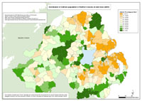
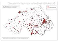
 Maps - Deaths and Killings (1969-2001), by area (Northern Ireland, Belfast, Derry), by status and organisation, at ward level (24 maps) Maps - Deaths and Killings (1969-2001), by area (Northern Ireland, Belfast, Derry), by status and organisation, at ward level (24 maps)
 Maps - Deaths and Killings (1969-2001), by area (Belfast, Derry), by status and organisation, with Multiple Deprivation Measure score, at ward level (16 maps) Maps - Deaths and Killings (1969-2001), by area (Belfast, Derry), by status and organisation, with Multiple Deprivation Measure score, at ward level (16 maps)
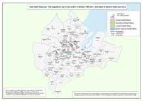
 Maps - Outline Maps, by area, of Ward Boundaries (1995) (8 maps) Maps - Outline Maps, by area, of Ward Boundaries (1995) (8 maps)
 Maps - Deaths, by area (Northern Ireland, Belfast, Derry), by 5 year groups, at 1km grid square level (24 maps) Maps - Deaths, by area (Northern Ireland, Belfast, Derry), by 5 year groups, at 1km grid square level (24 maps)
See also: Animations (3 animations)
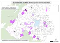
 Maps - Distribution of Catholic population at ward level in Northern Ireland, Belfast and Derry, with peacelines (3 maps) Maps - Distribution of Catholic population at ward level in Northern Ireland, Belfast and Derry, with peacelines (3 maps)
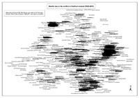 Text Maps - Deaths indicated by names, by area (Northern Ireland, Belfast, Derry) (3 maps) Text Maps - Deaths indicated by names, by area (Northern Ireland, Belfast, Derry) (3 maps)
See also: Animation (1 animation)
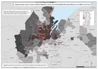 Spatial Intensity Maps - Death locations (1969-2001), by area (Belfast, Derry) and Northern Ireland Multiple Deprivation Measure score (2005), at ward level (2 maps) Spatial Intensity Maps - Death locations (1969-2001), by area (Belfast, Derry) and Northern Ireland Multiple Deprivation Measure score (2005), at ward level (2 maps)
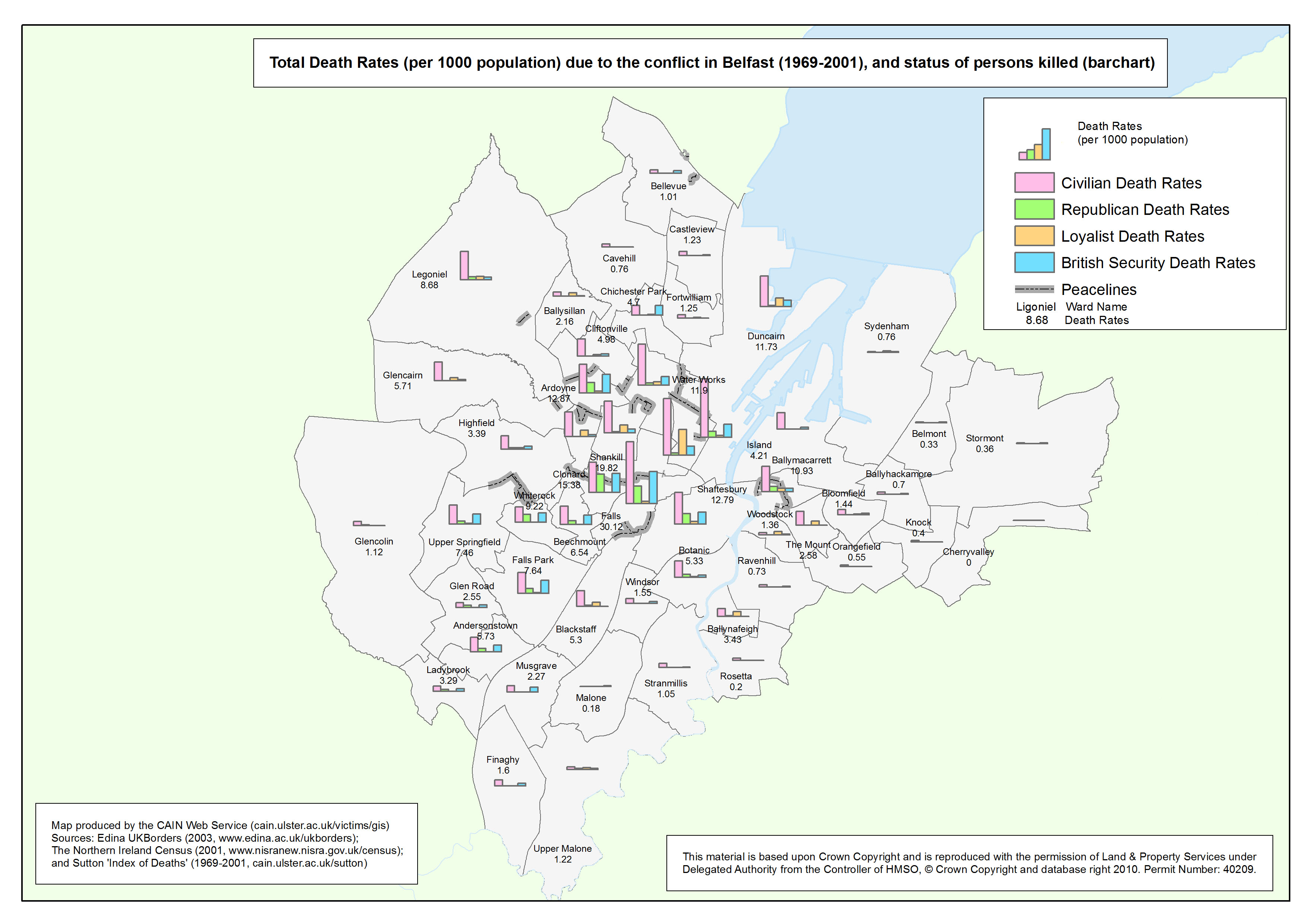
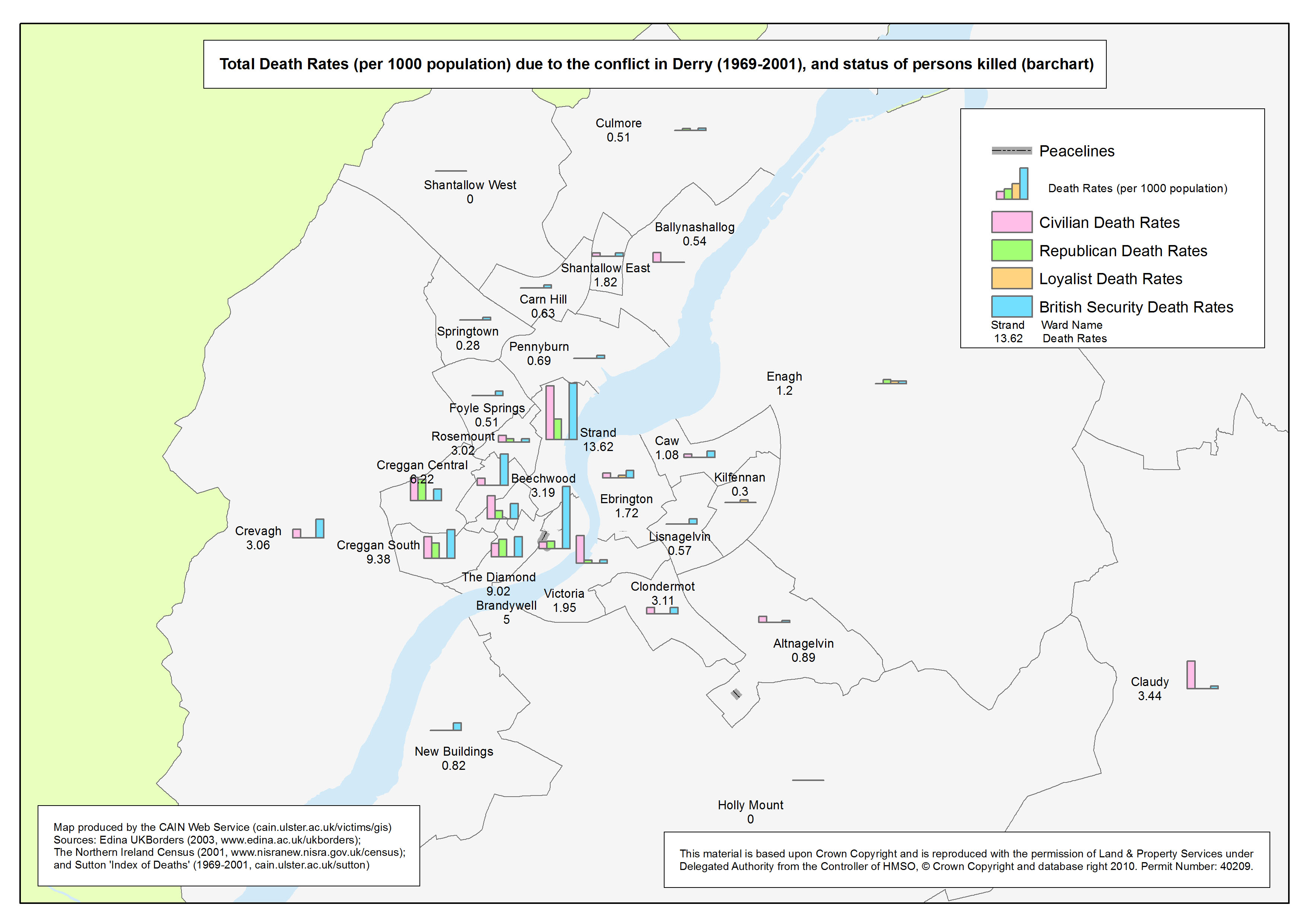
 Bar Chart Maps - Deaths (1969-2001), by area (Belfast, Derry), by status, at ward level (2 maps) Bar Chart Maps - Deaths (1969-2001), by area (Belfast, Derry), by status, at ward level (2 maps)
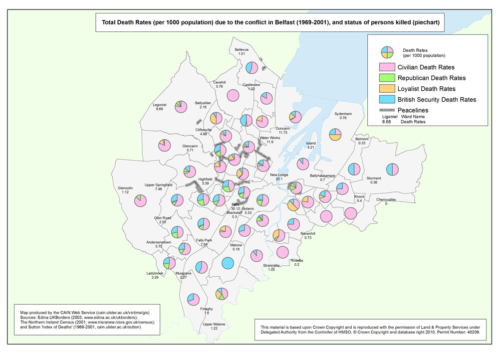
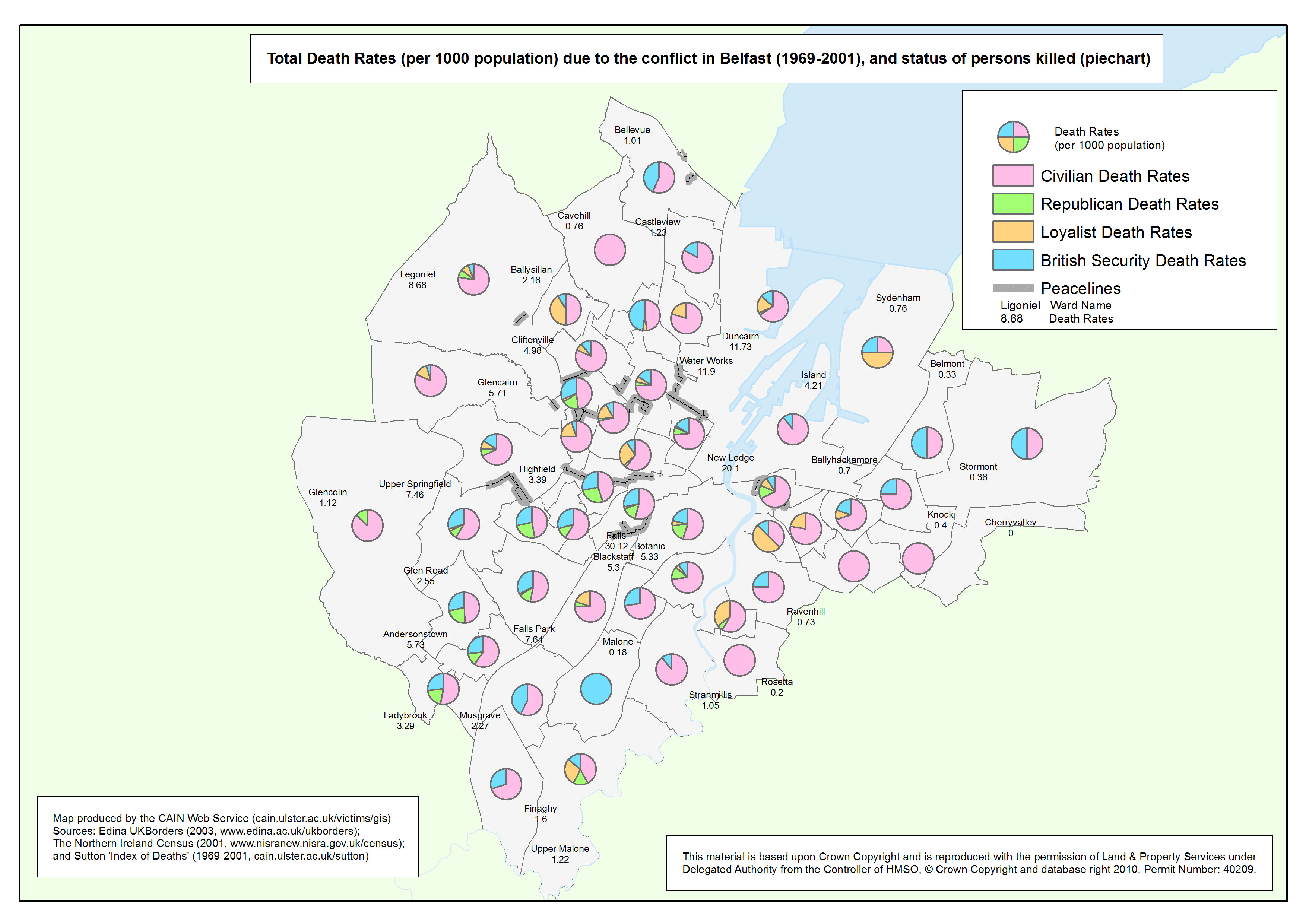
 Pie Chart Maps - Deaths (1969-2001), by area (Belfast, Derry), by status, at ward level (2 maps) Pie Chart Maps - Deaths (1969-2001), by area (Belfast, Derry), by status, at ward level (2 maps)
 Stacked Bar Chart Maps - Deaths (1969-2001), by area (Belfast, Derry), by status, at ward level (2 maps) Stacked Bar Chart Maps - Deaths (1969-2001), by area (Belfast, Derry), by status, at ward level (2 maps)
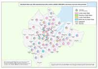
 Maps - Female Death Rates (per 1000 population) due to the conflict (1969-2001), by area (Northern Ireland, Belfast, Derry), at ward level (3 maps) Maps - Female Death Rates (per 1000 population) due to the conflict (1969-2001), by area (Northern Ireland, Belfast, Derry), at ward level (3 maps)
 Maps - Female Death Rates (per 1000 population) due to the conflict (1969-2001), by area (Belfast, Derry), and Multiple Deprivation Measure score, at ward level (2 maps) Maps - Female Death Rates (per 1000 population) due to the conflict (1969-2001), by area (Belfast, Derry), and Multiple Deprivation Measure score, at ward level (2 maps)
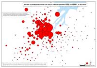 Maps - Number of people killed due to the conflict in Belfast, by year (1969-2001), at SOA (Small Output Area) (34 maps) Maps - Number of people killed due to the conflict in Belfast, by year (1969-2001), at SOA (Small Output Area) (34 maps)
See also: Animation (1 animation)
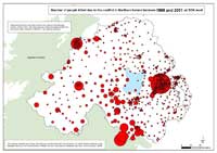 Maps - Number of people killed due to the conflict in Northern Ireland, by year (1969-2001), at SOA (Small Output Area) (34 maps) Maps - Number of people killed due to the conflict in Northern Ireland, by year (1969-2001), at SOA (Small Output Area) (34 maps)
See also: Animation (1 animation)
 Maps - Number of people killed due to the conflict in Northern Ireland, Belfast and Derry, between 1969 and 2001, at SOA (Small Output Area) (barchart, 3D) (3 maps) Maps - Number of people killed due to the conflict in Northern Ireland, Belfast and Derry, between 1969 and 2001, at SOA (Small Output Area) (barchart, 3D) (3 maps)
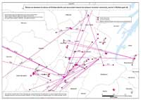 Maps - Distances between locations of deaths and associated memorials (closest recorded memorial), Belfast, Derry, and Northern Ireland (8 maps) Maps - Distances between locations of deaths and associated memorials (closest recorded memorial), Belfast, Derry, and Northern Ireland (8 maps)
 Maps - Locations of deaths as a result of paramilitary feuds, and location of deaths of alleged informers, Belfast and Northern Ireland (5 maps) Maps - Locations of deaths as a result of paramilitary feuds, and location of deaths of alleged informers, Belfast and Northern Ireland (5 maps)
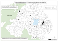 Maps - Child victims of the conflict, Belfast, Derry and Northern Ireland (3 maps) Maps - Child victims of the conflict, Belfast, Derry and Northern Ireland (3 maps)
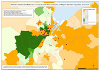
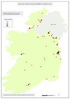 Maps - Location of deaths related to the Northern Ireland conflict, in England, Europe, and the Republic of Ireland (4 maps) Maps - Location of deaths related to the Northern Ireland conflict, in England, Europe, and the Republic of Ireland (4 maps)
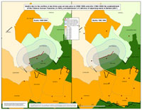 Maps - Deaths due to the conflict, close to selected peacelines in Belfast, and distribution of Catholics of adjoining wards (6 maps) Maps - Deaths due to the conflict, close to selected peacelines in Belfast, and distribution of Catholics of adjoining wards (6 maps)
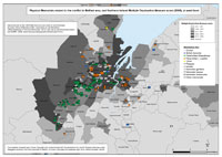 Maps - Physical memorials related to the conflict, in Belfast, Derry, and Northern Ireland (7 maps) Maps - Physical memorials related to the conflict, in Belfast, Derry, and Northern Ireland (7 maps)
| Maps - Deaths and Killings (1969-2001), by area (Northern Ireland, Belfast, Derry), by status and organisation, at ward level (24 maps) |
| Title of Map |
File Version |
| PDF
| L-JPG
| H-JPG
|
| Northern Ireland |
Deaths - NI - Ward
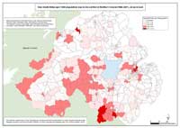
Total Death Rates (per 1000 population) due to the conflict in Northern Ireland (1969-2001), at ward level |
.pdf
578kb |
.jpg
84kb |
.jpg
879kb |
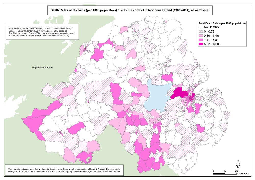
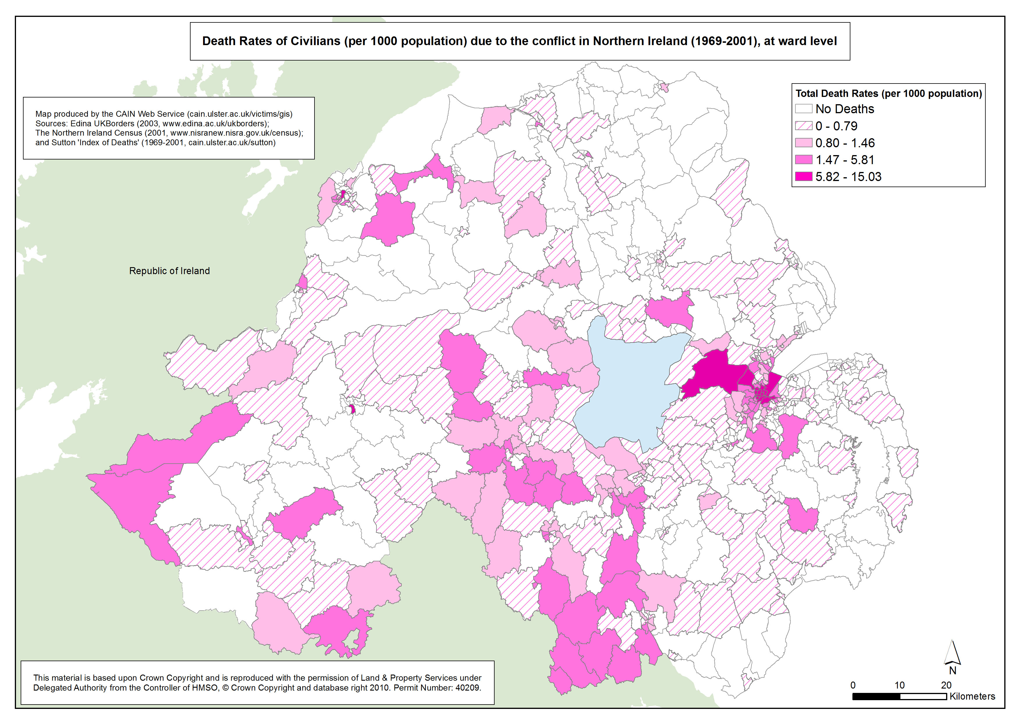
Deaths - NI - Civilians - Ward
Death Rates of Civilians (per 1000 population) due to the conflict in Northern Ireland (1969-2001), at ward level |
.pdf
637kb |
.jpg
183kb |
.jpg
1173kb |
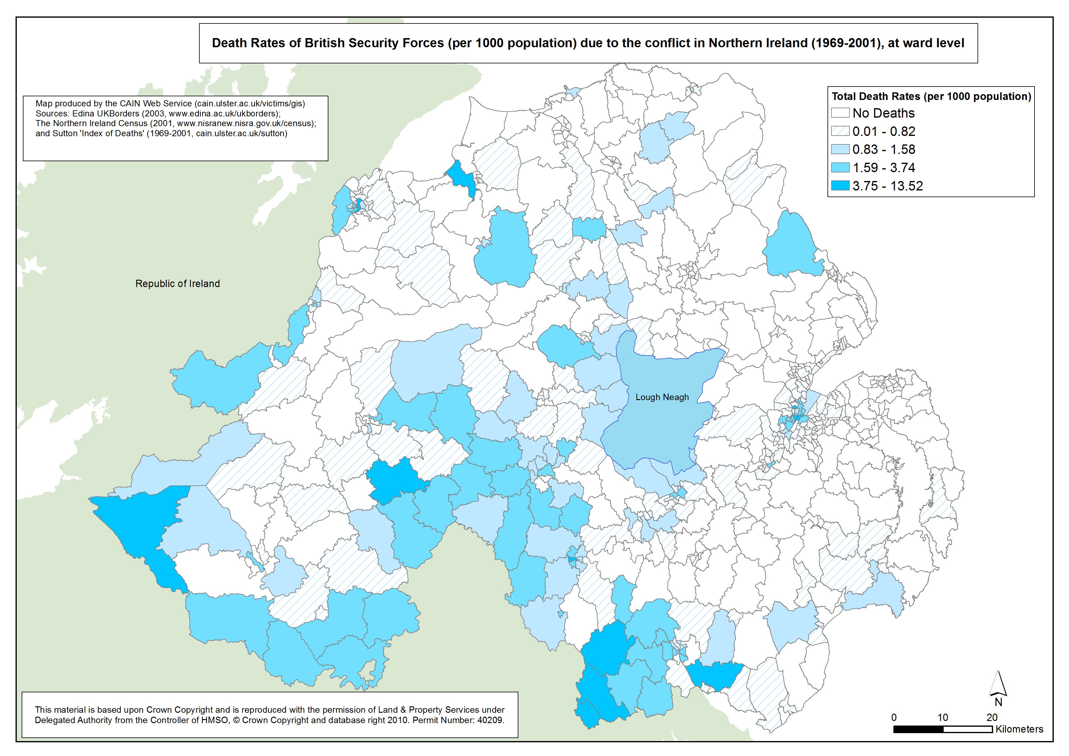
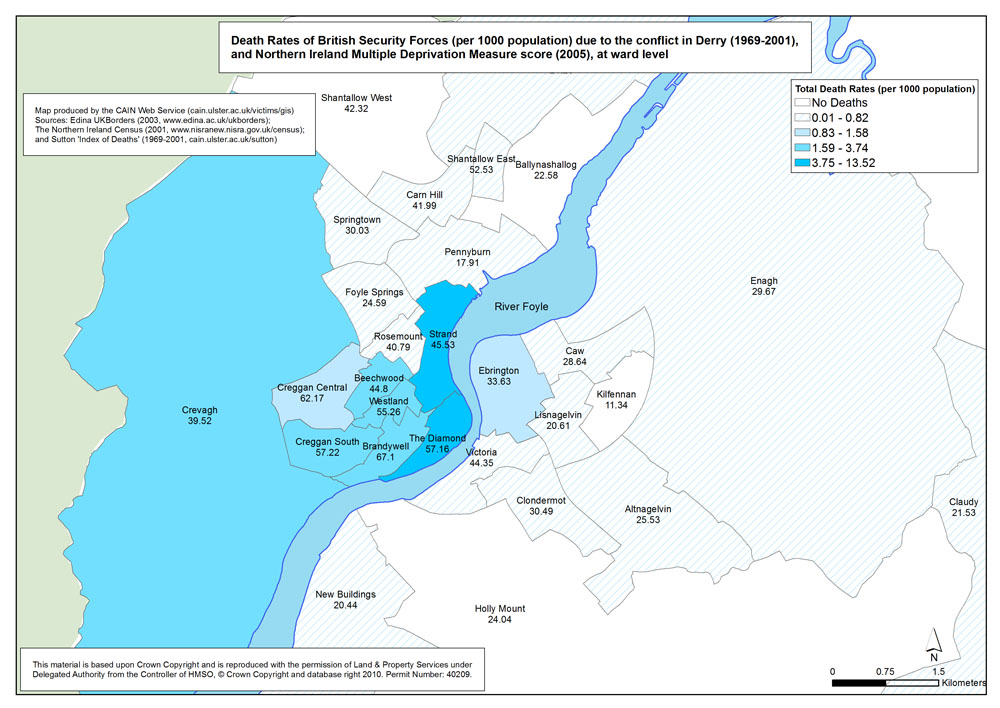
Deaths - NI - British Security Forces - Ward
Death Rates of British Security Forces (per 1000 population) due to the conflict in Northern Ireland (1969-2001), at ward level |
.pdf
583kb |
.jpg
119kb |
.jpg
863kb |
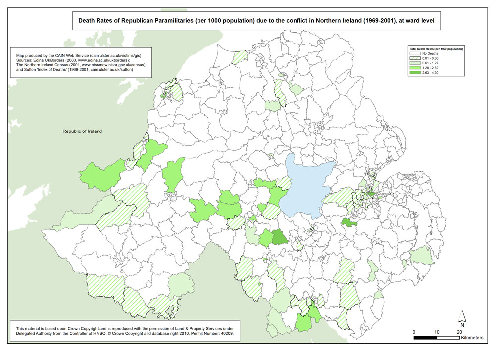
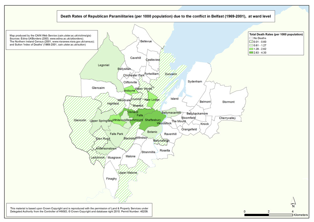
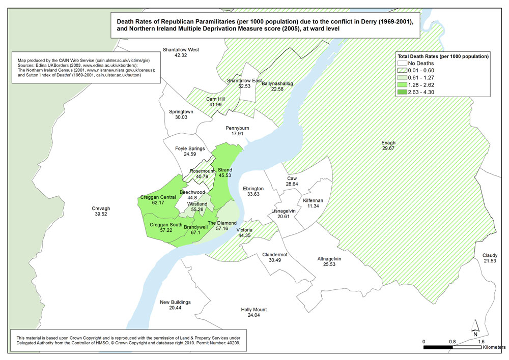
Deaths - NI - Republicans - Ward
Death Rates of Republican Paramilitaries (per 1000 population) due to the conflict in Northern Ireland (1969-2001), at ward level |
.pdf
613kb |
.jpg
187kb |
.jpg
1223kb |
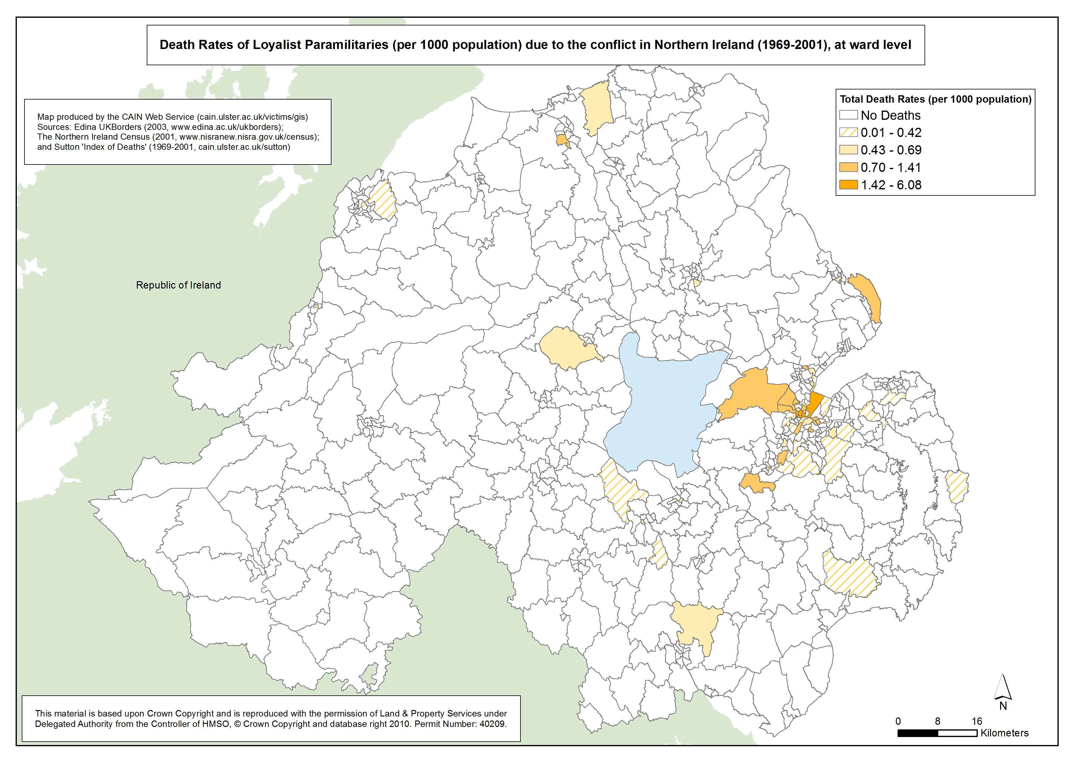
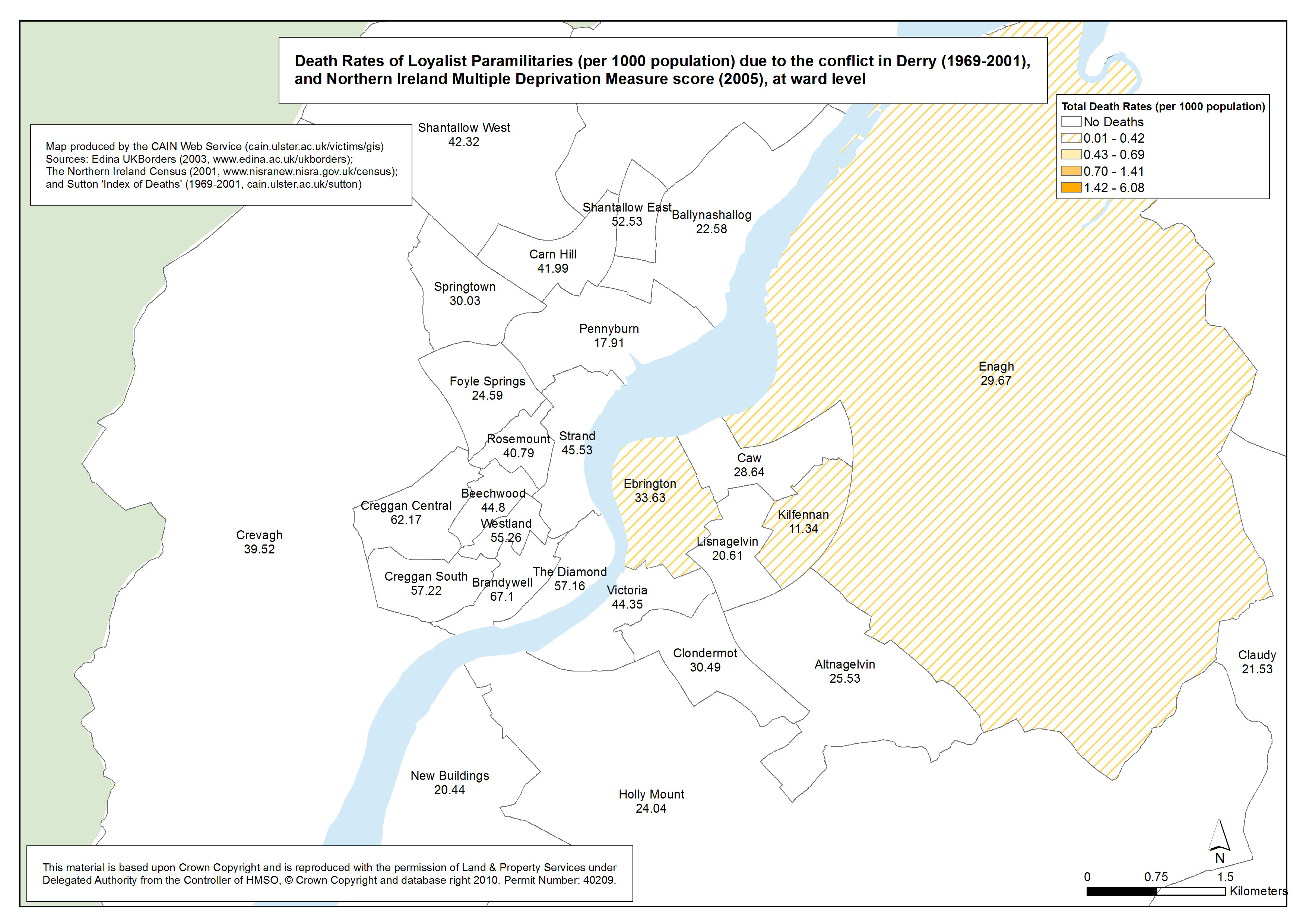
Deaths - NI - Loyalists - Ward
Death Rates of Loyalist Paramilitaries (per 1000 population) due to the conflict in Northern Ireland (1969-2001), at ward level |
.pdf
581kb |
.jpg
119kb |
.jpg
801kb |
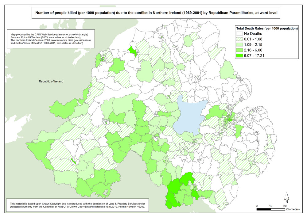
Killings - NI - Republican Killings - Ward
Number of people killed (per 1000 population) due to the conflict in Northern Ireland (1969-2001) by Republican Paramilitaries, at ward level |
.pdf
614kb |
.jpg
202kb |
.jpg
1331kb |
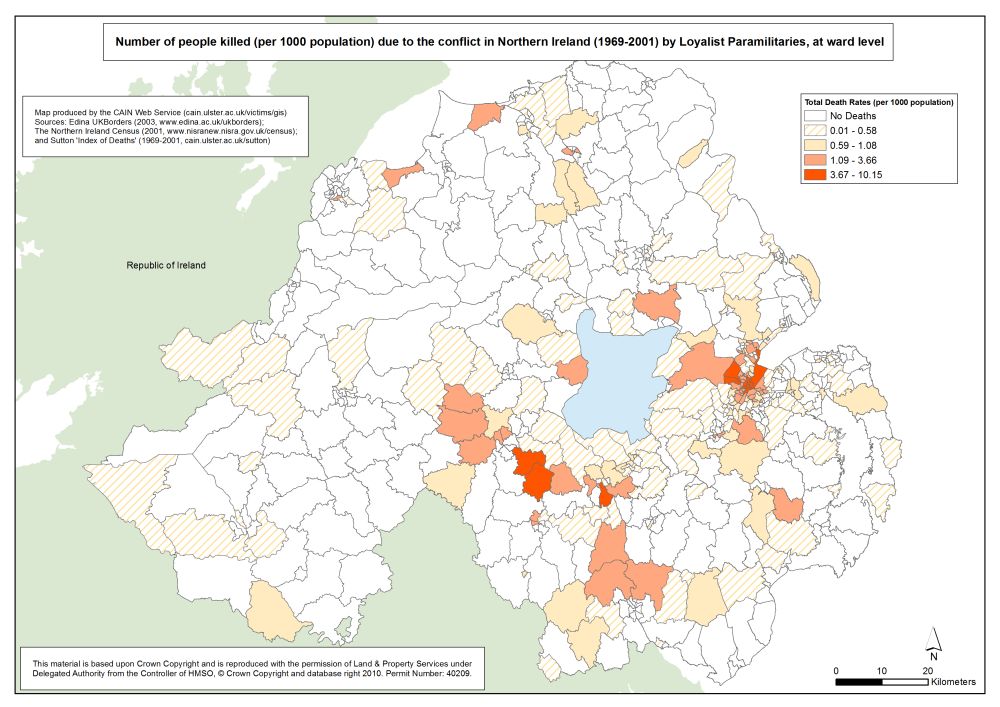
Killings - NI - Loyalist Killings - Ward
Number of people killed (per 1000 population) due to the conflict in Northern Ireland (1969-2001) by Loyalist Paramilitaries, at ward level |
.pdf
518kb |
.jpg
126kb |
.jpg
898kb |
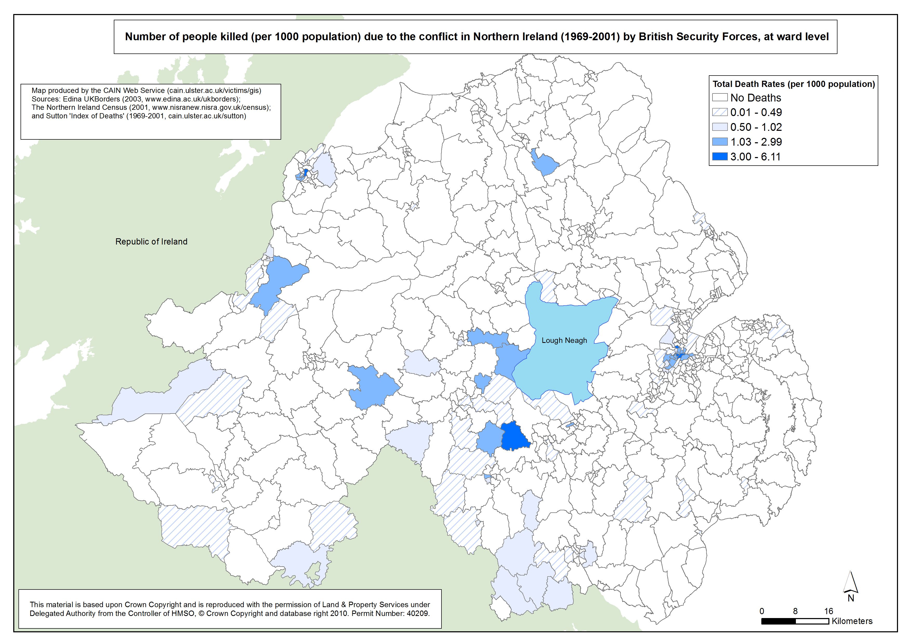
Killings - NI - British Security Forces - Ward
Number of people killed (per 1000 population) due to the conflict in Northern Ireland (1969-2001) by British Security Forces, at ward level |
.pdf
597kb |
.jpg
121kb |
.jpg
840kb |
| Belfast |
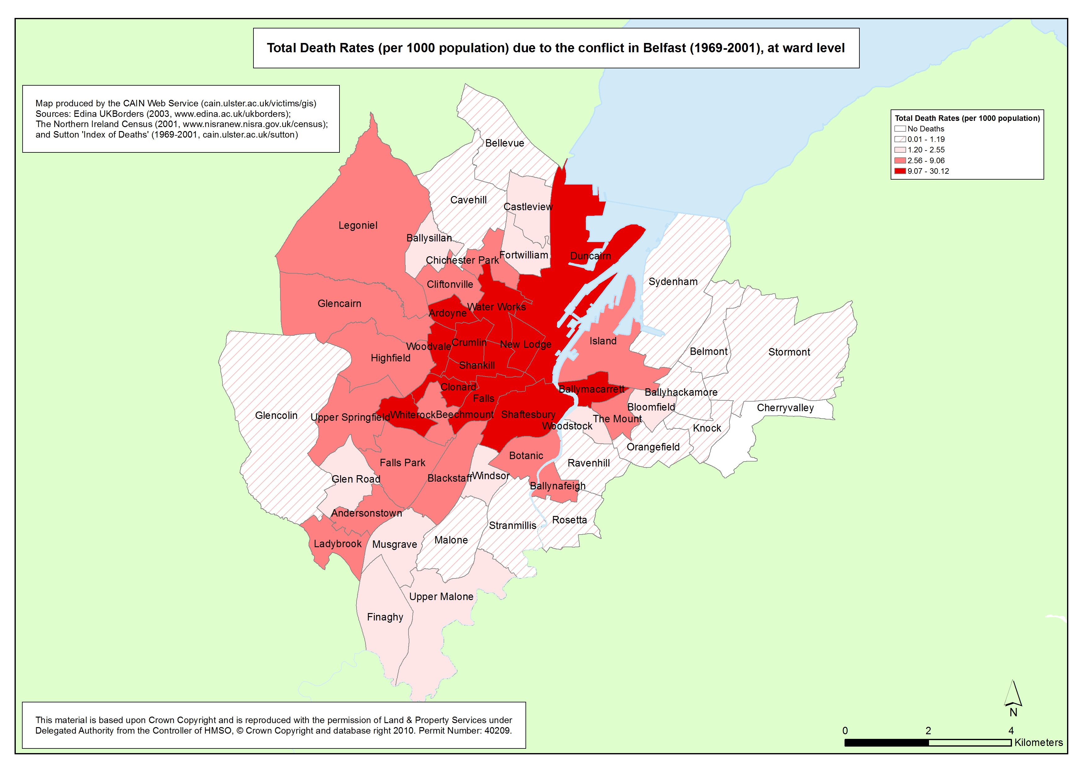
Deaths - Belfast - Ward
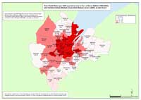
Total Death Rates (per 1000 population) due to the conflict in Belfast (1969-2001), at ward level |
.pdf
452kb |
.jpg
82kb |
.jpg
621kb |
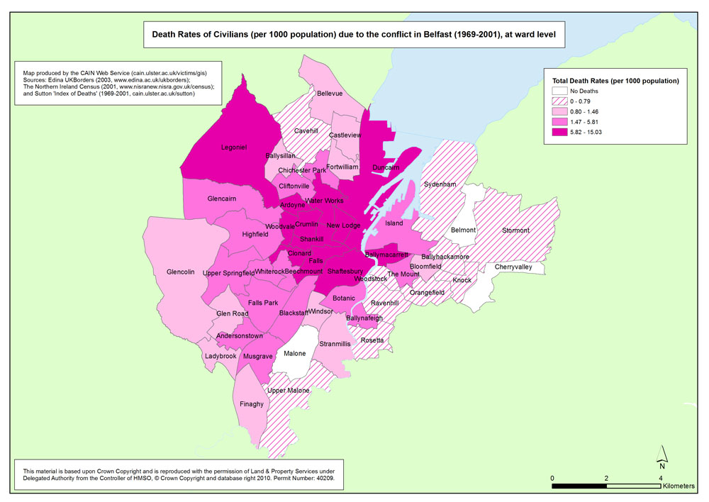
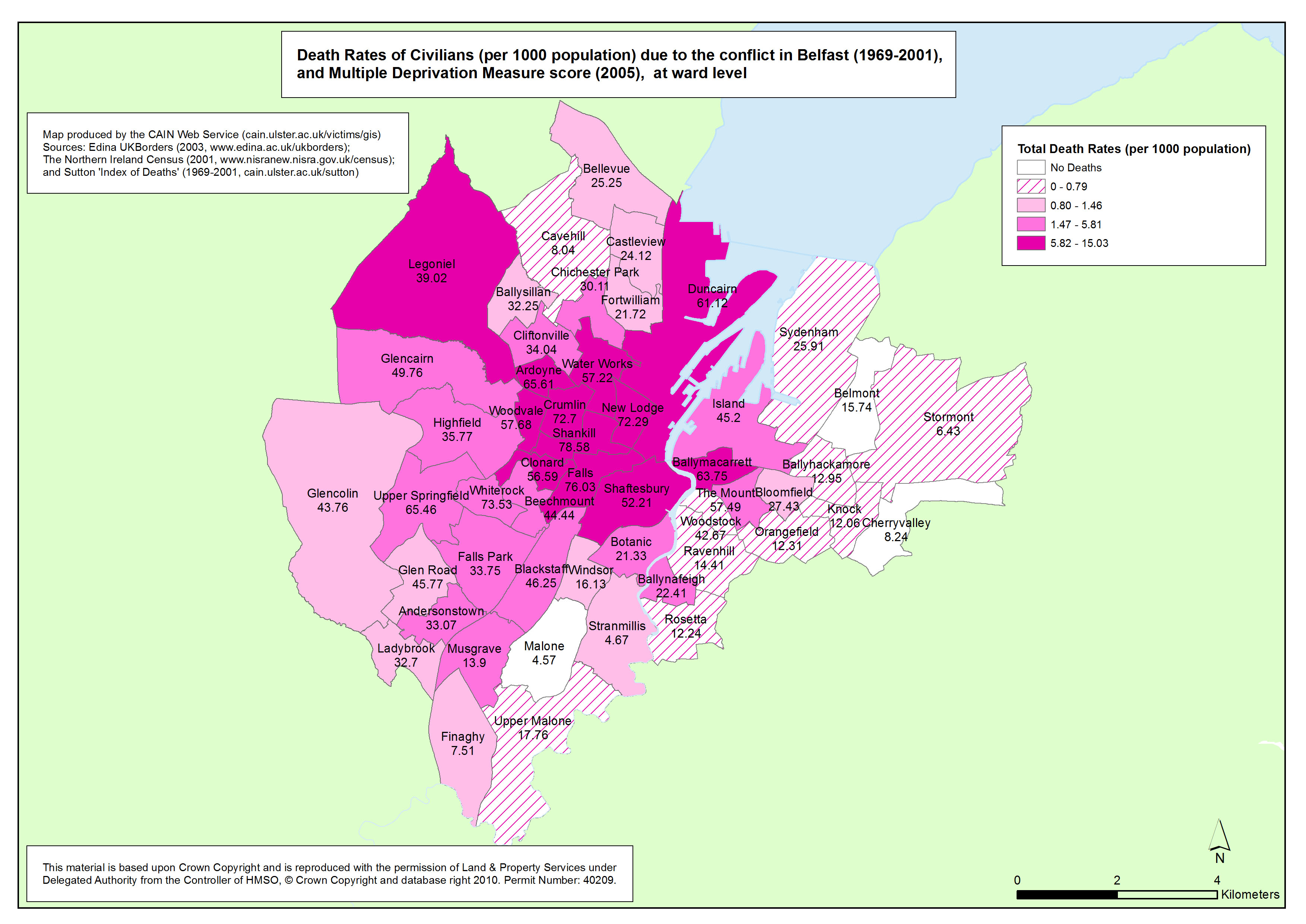
Deaths - Belfast - Civilians - Ward
Death Rates of Civilians (per 1000 population) due to the conflict in Belfast (1969-2001), at ward level |
.pdf
503kb |
.jpg
147kb |
.jpg
905kb |
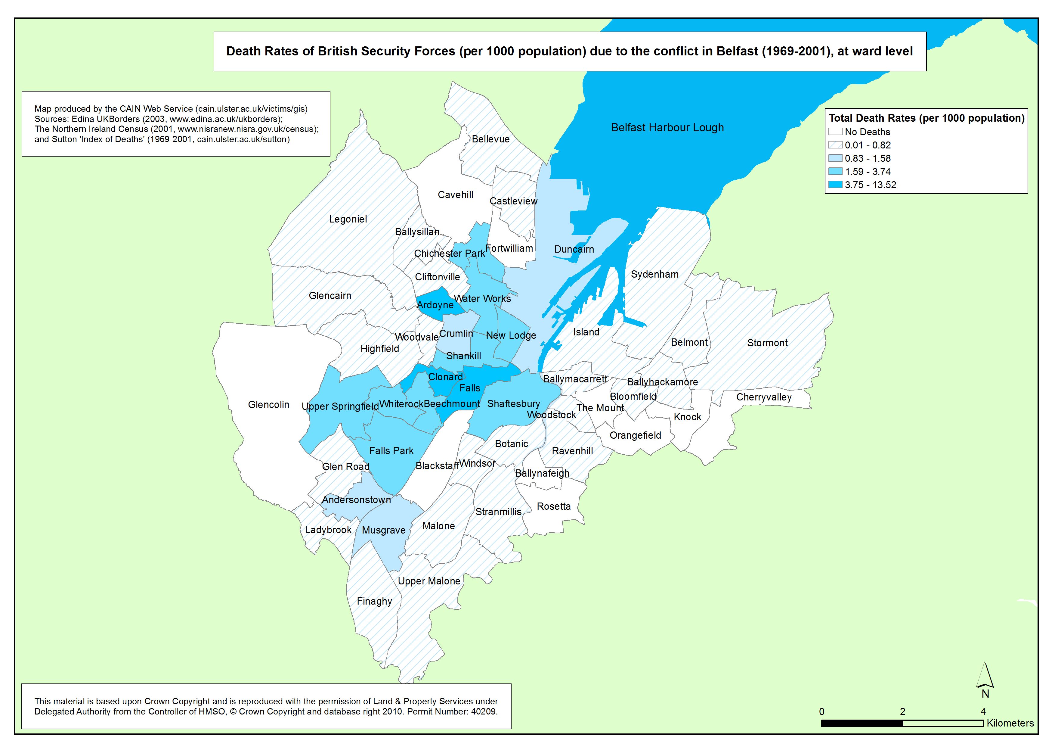
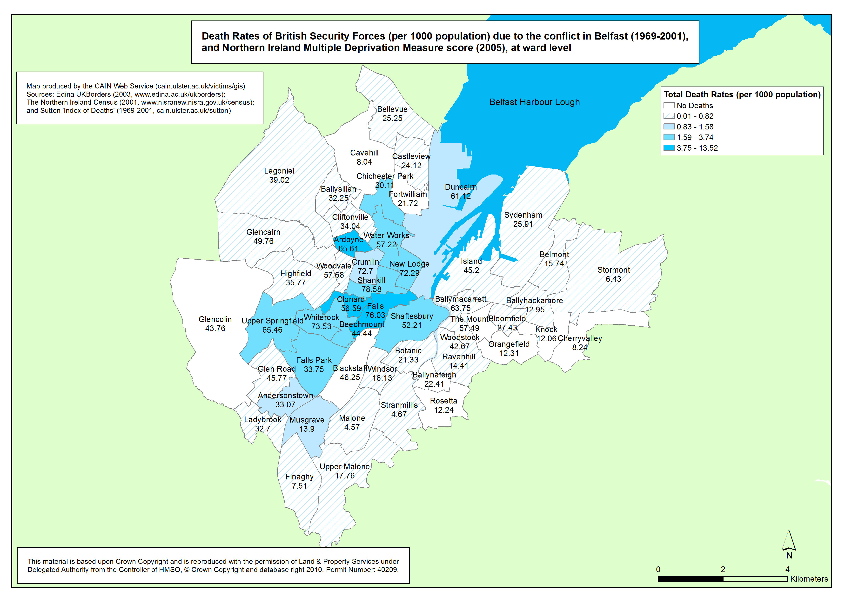
Deaths - Belfast - British Security Forces - Ward
Death Rates of British Security Forces (per 1000 population) due to the conflict in Belfast (1969-2001), at ward level |
.pdf
488kb |
.jpg
91kb |
.jpg
681kb |
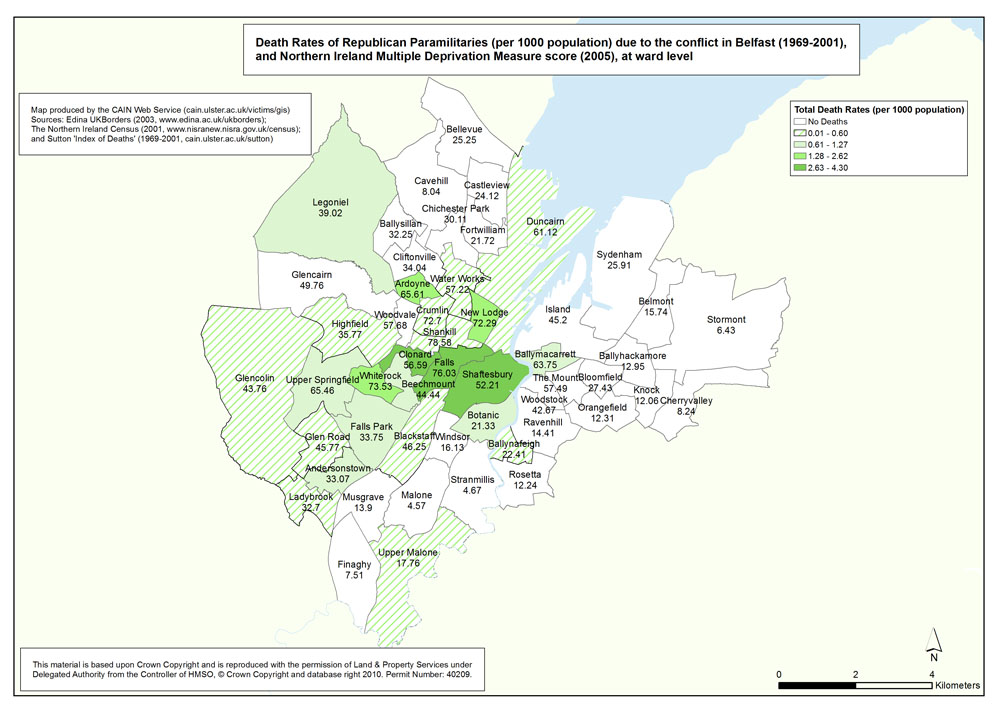
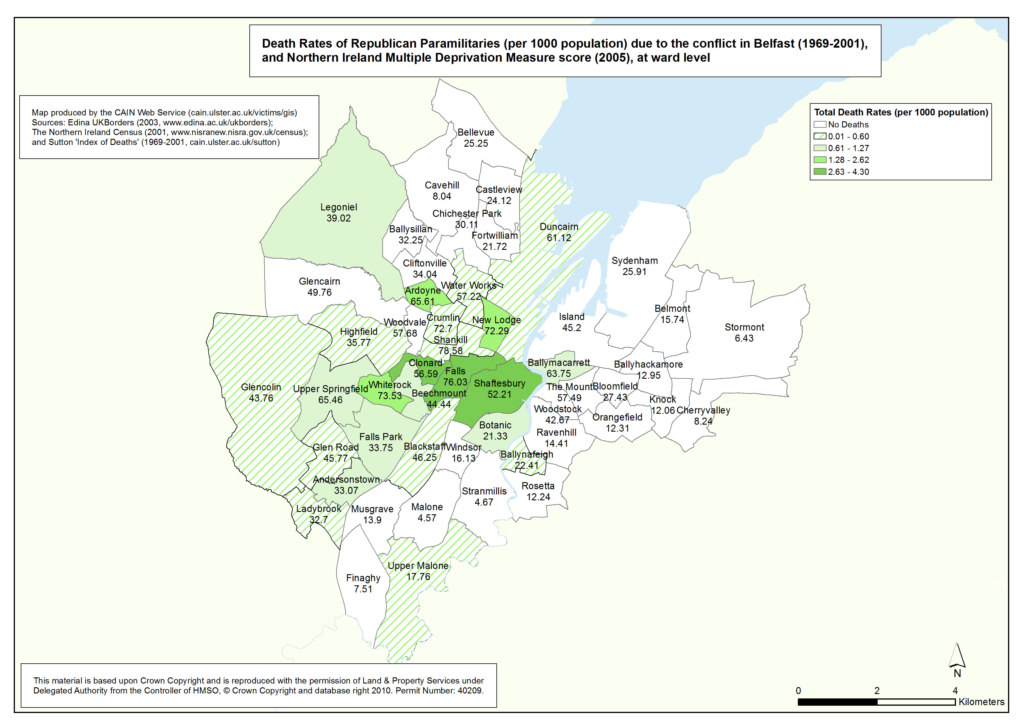
Deaths - Belfast - Republicans - Ward
Death Rates of Republican Paramilitaries (per 1000 population) due to the conflict in Belfast (1969-2001), at ward level |
.pdf
480kb |
.jpg
149kb |
.jpg
1053kb |
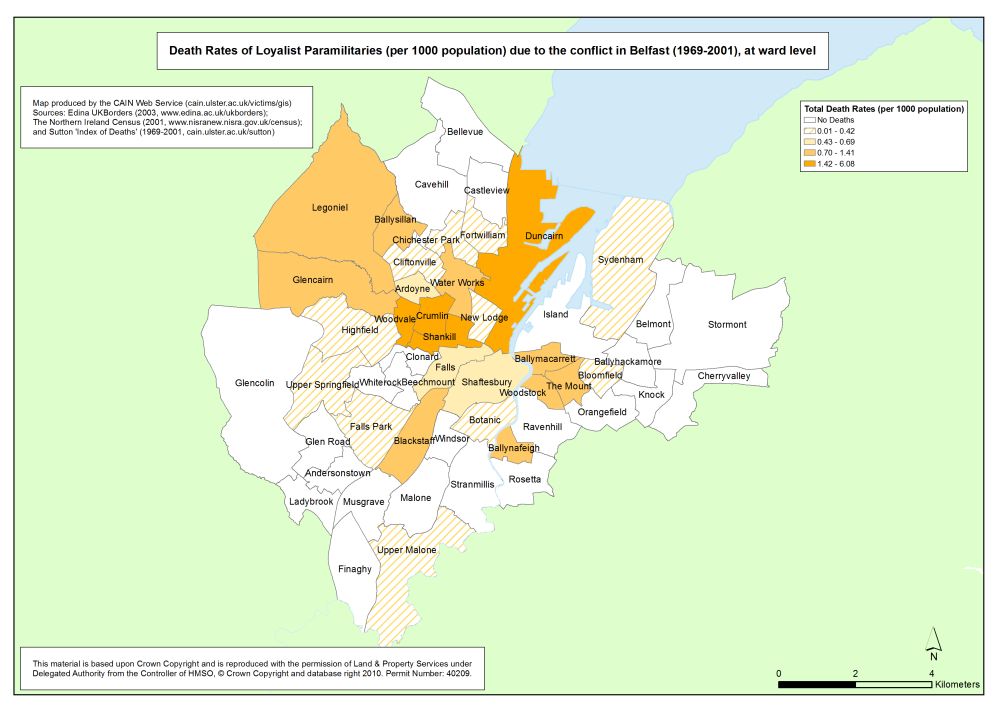
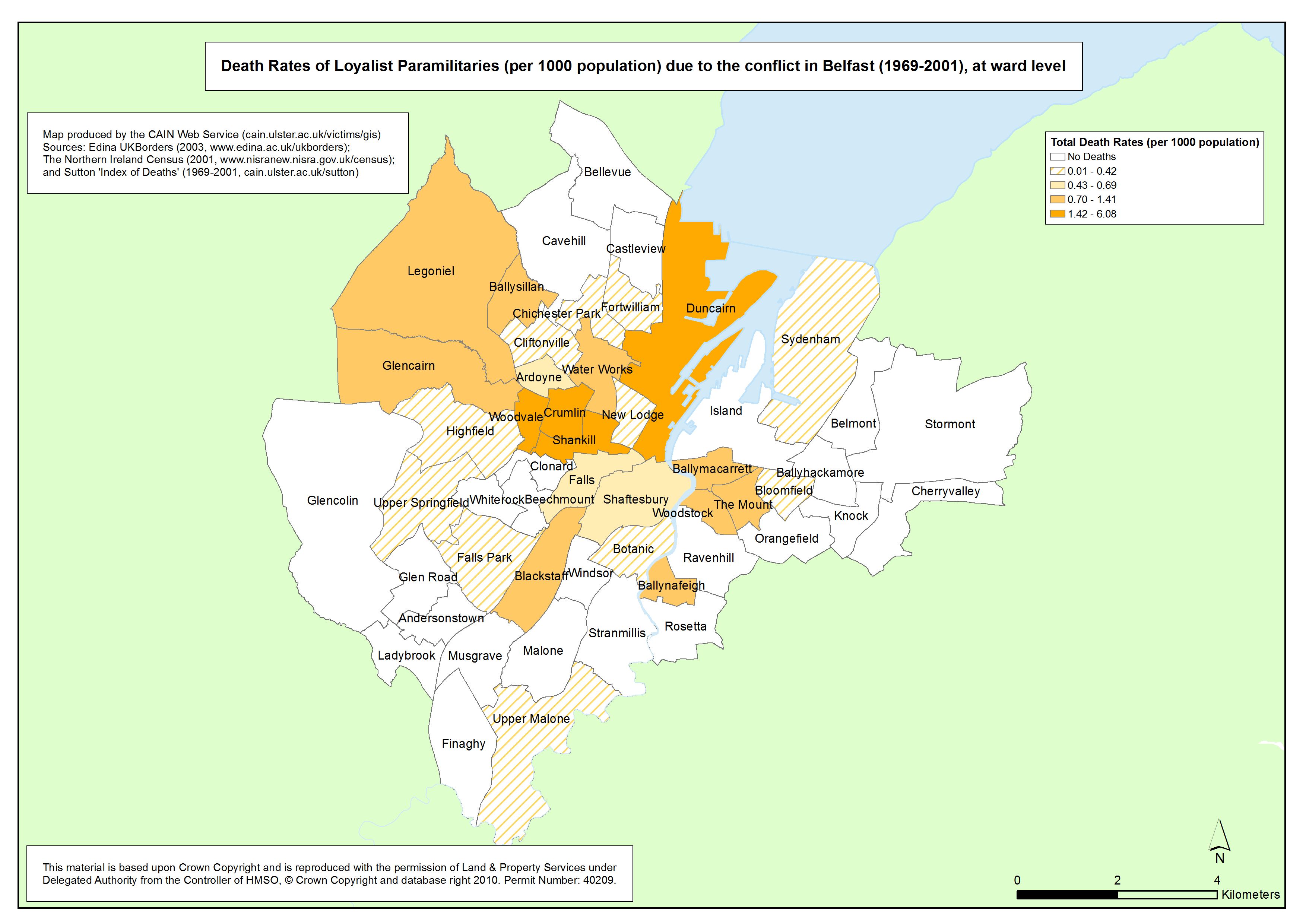
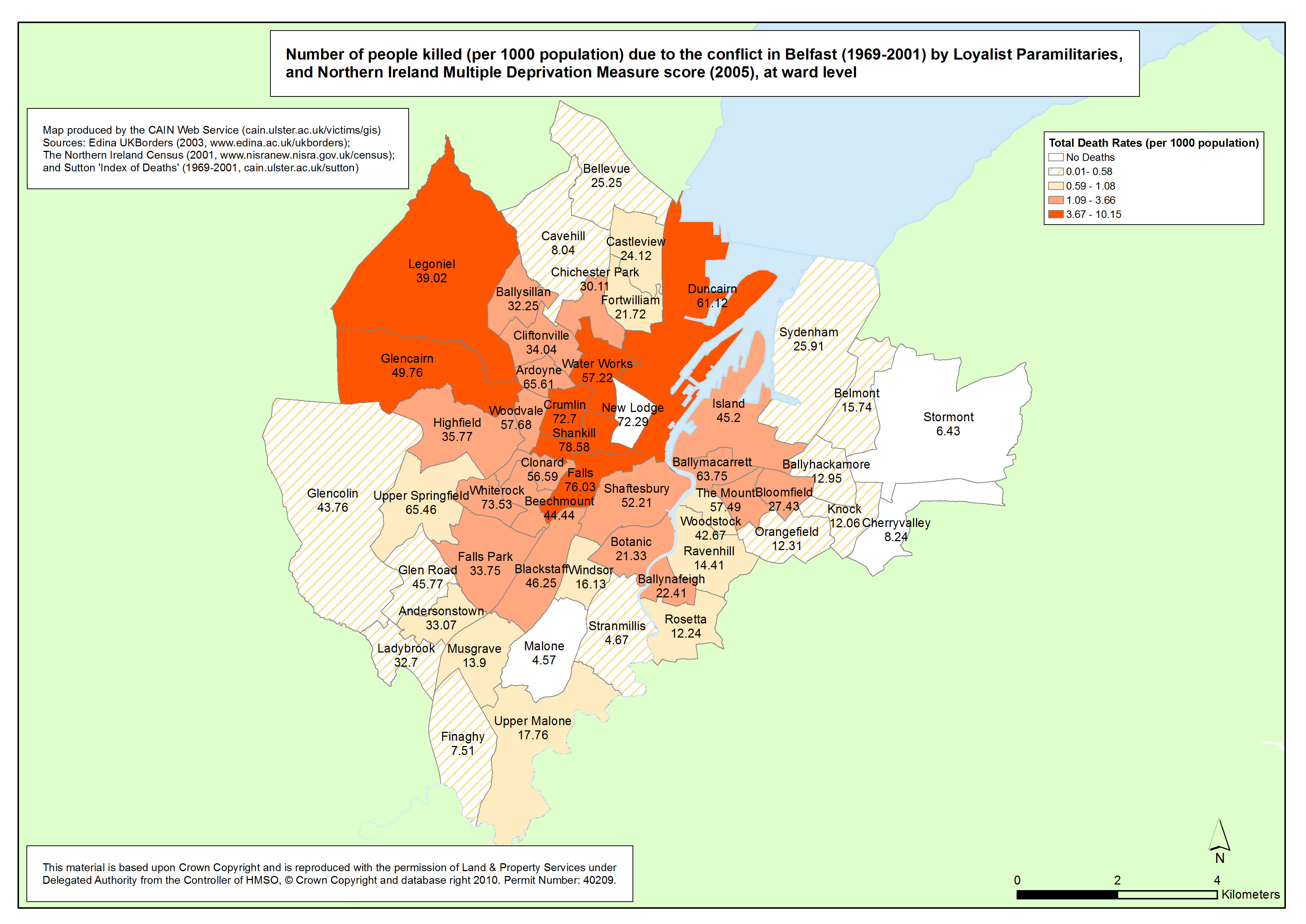
Deaths - Belfast - Loyalists - Ward
Death Rates of Loyalist Paramilitaries (per 1000 population) due to the conflict in Belfast (1969-2001), at ward level |
.pdf
459kb |
.jpg
85kb |
.jpg
610kb |
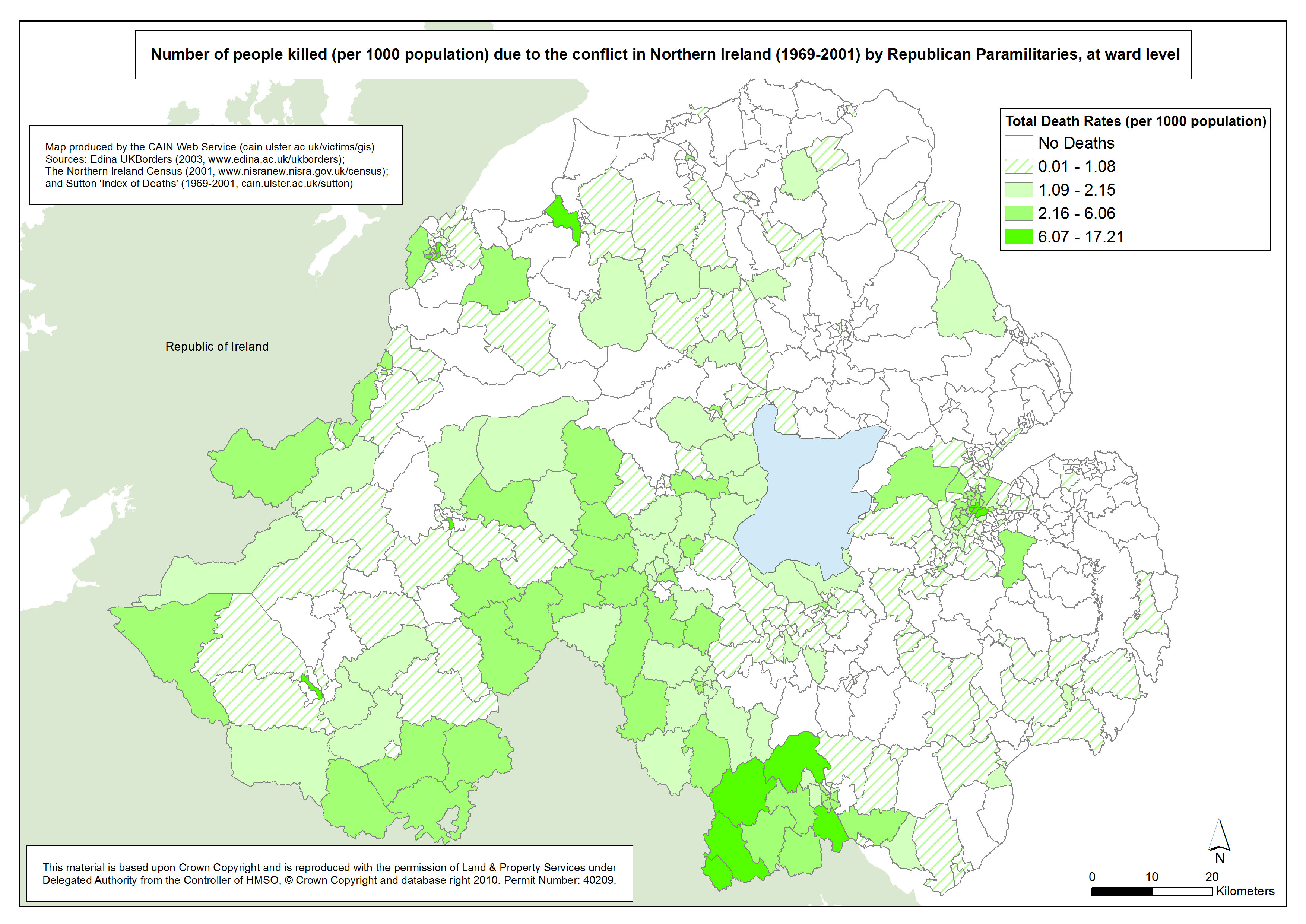
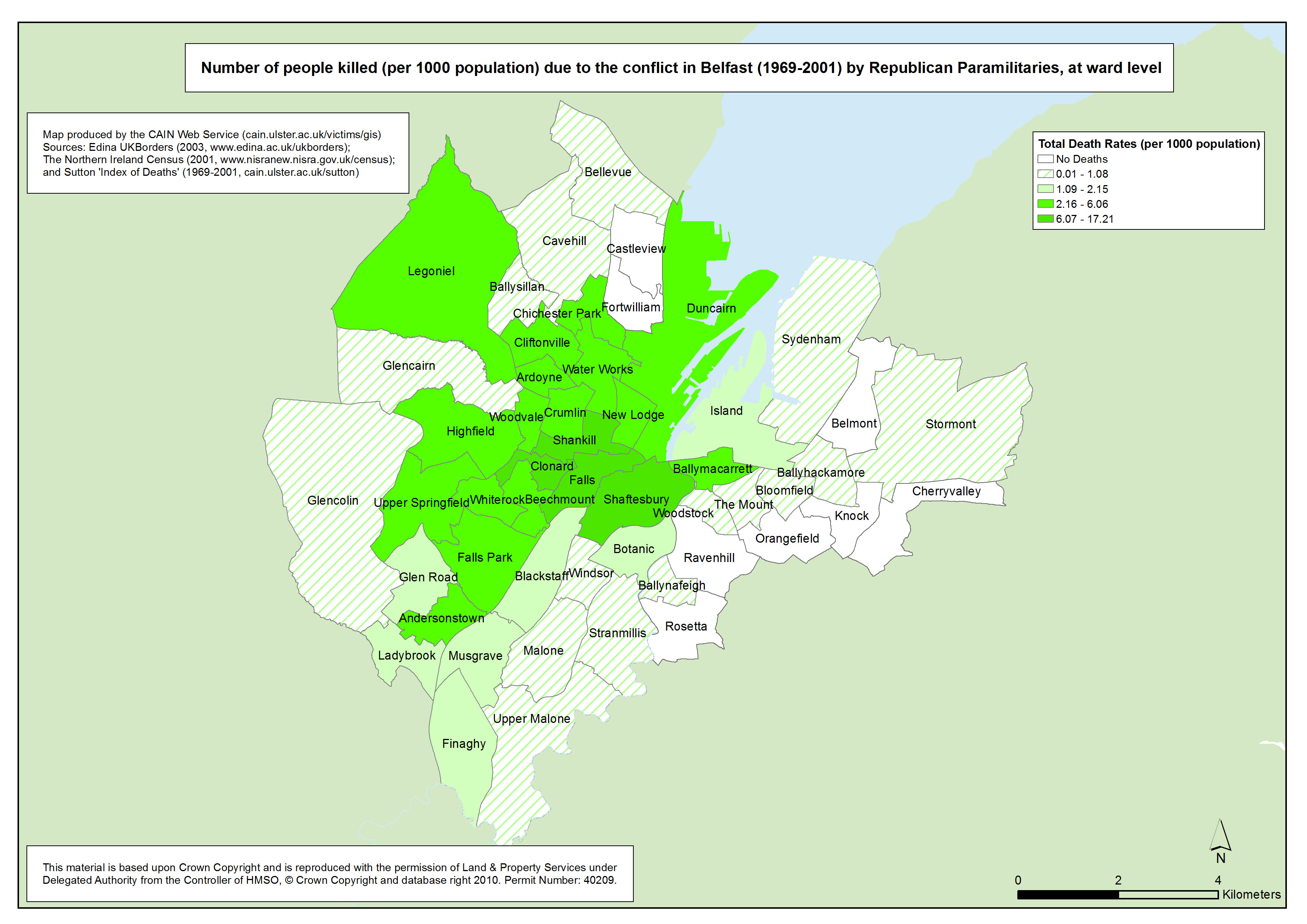
Killings - Belfast - Republican Killings - Ward
Number of people killed (per 1000 population) due to the conflict in Belfast (1969-2001) by Republican Paramilitaries, at ward level |
.pdf
485kb |
.jpg
163kb |
.jpg
1124kb |
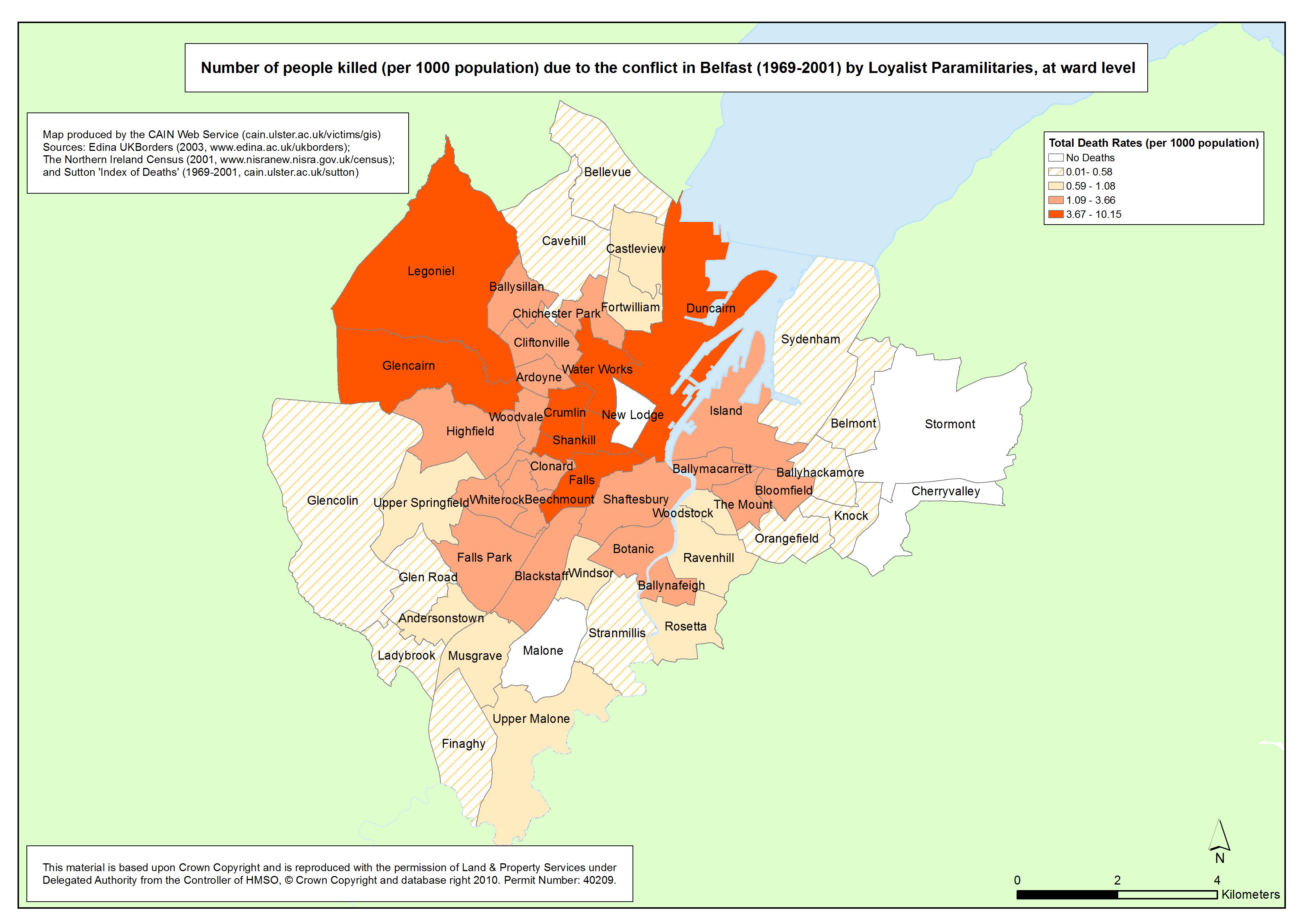
Killings - Belfast - Loyalist Killings - Ward
Number of people killed (per 1000 population) due to the conflict in Belfast (1969-2001) by Loyalist Paramilitaries, at ward level |
.pdf
464kb |
.jpg
85kb |
.jpg
628kb |
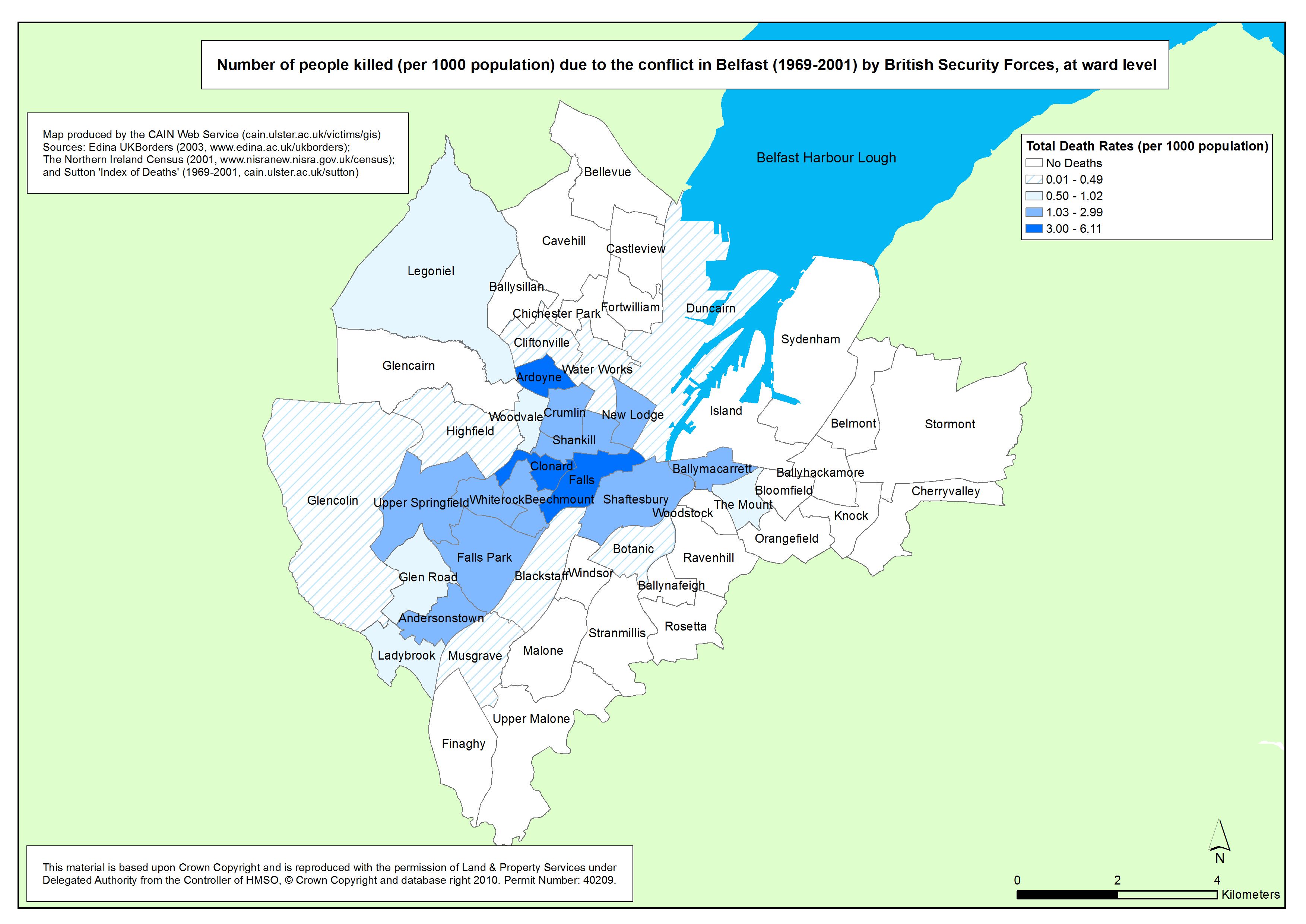
Killings - Belfast - British Security Forces - Ward
Number of people killed (per 1000 population) due to the conflict in Belfast (1969-2001) by British Security Forces, at ward level |
.pdf
472kb |
.jpg
89kb |
.jpg
623kb |
| Derry |
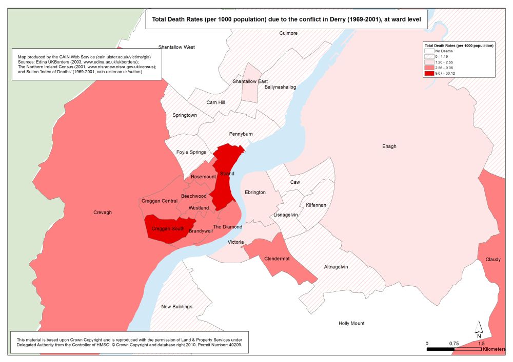
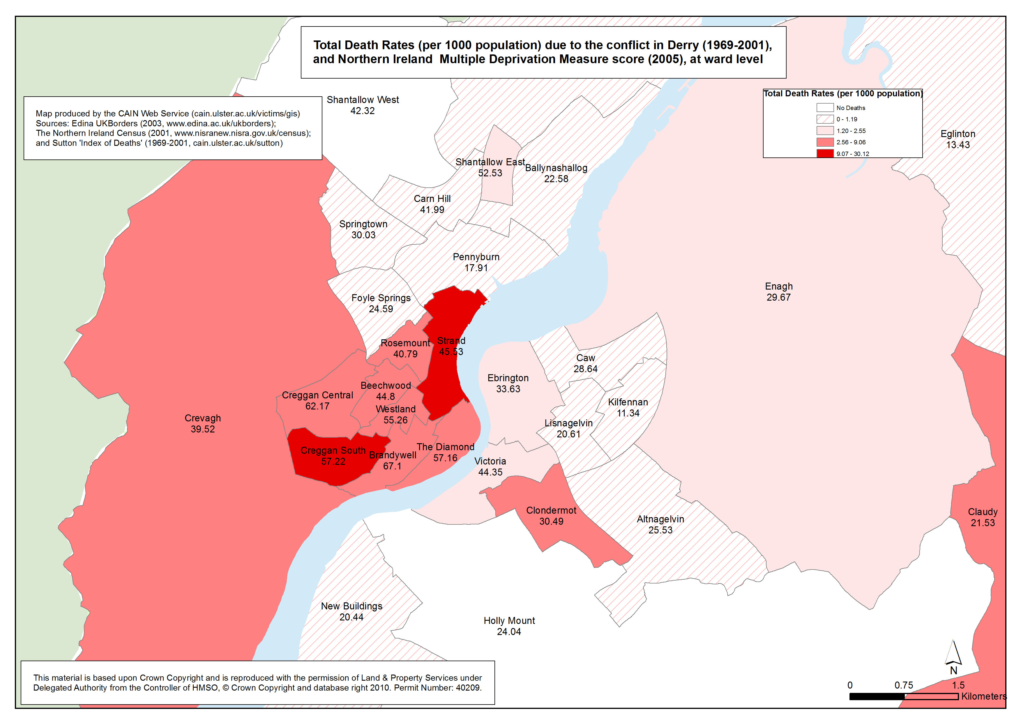
Deaths - Derry - Ward
Total Death Rates (per 1000 population) due to the conflict in Derry (1969-2001), at ward level |
.pdf
459kb |
.jpg
82kb |
.jpg
650kb |
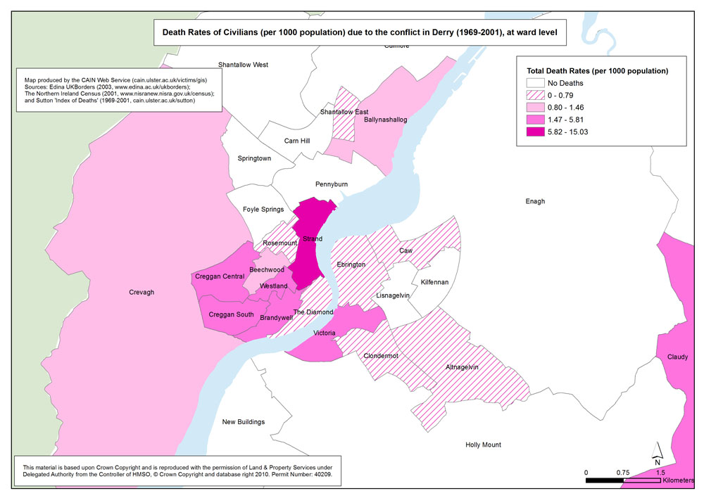
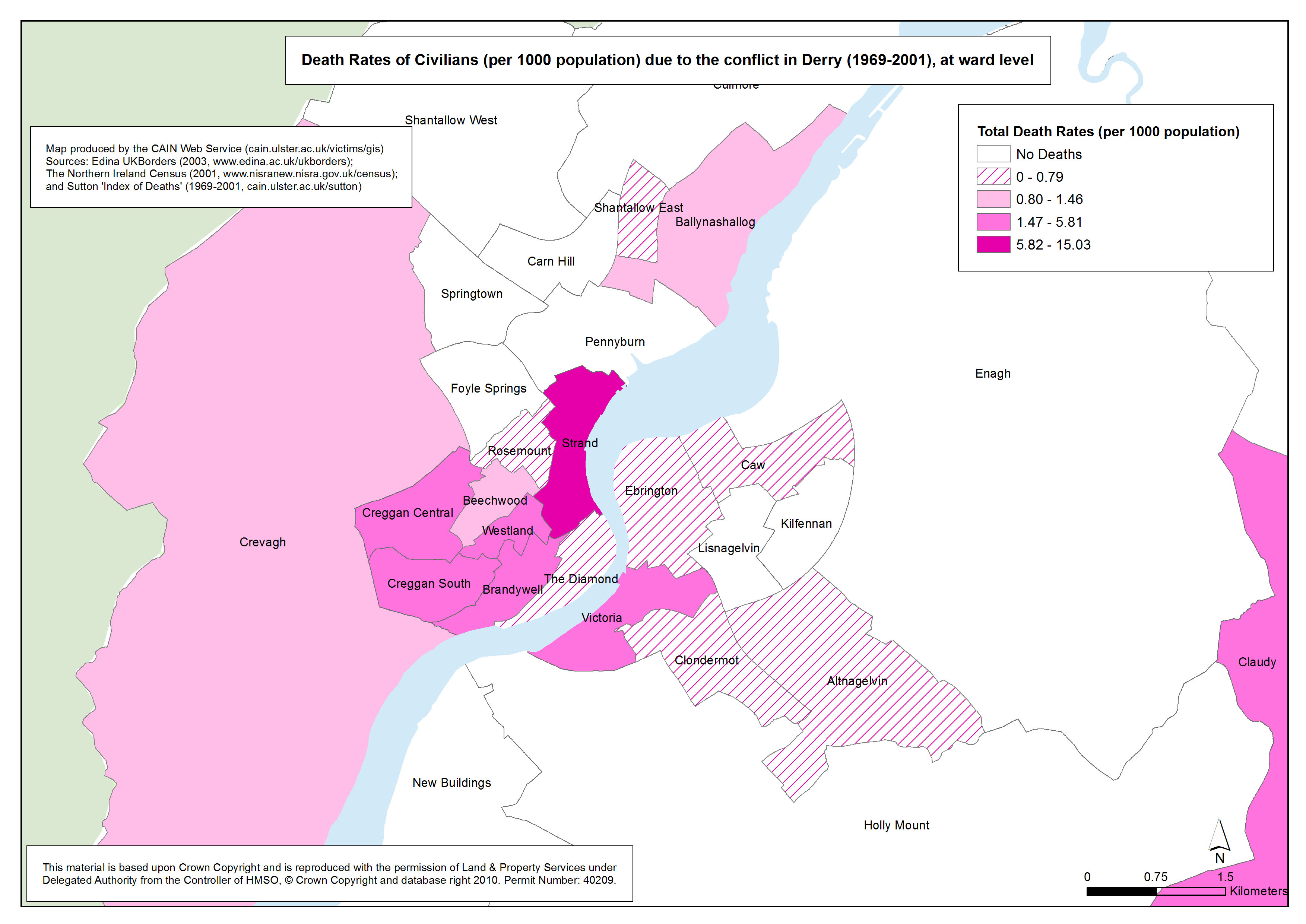
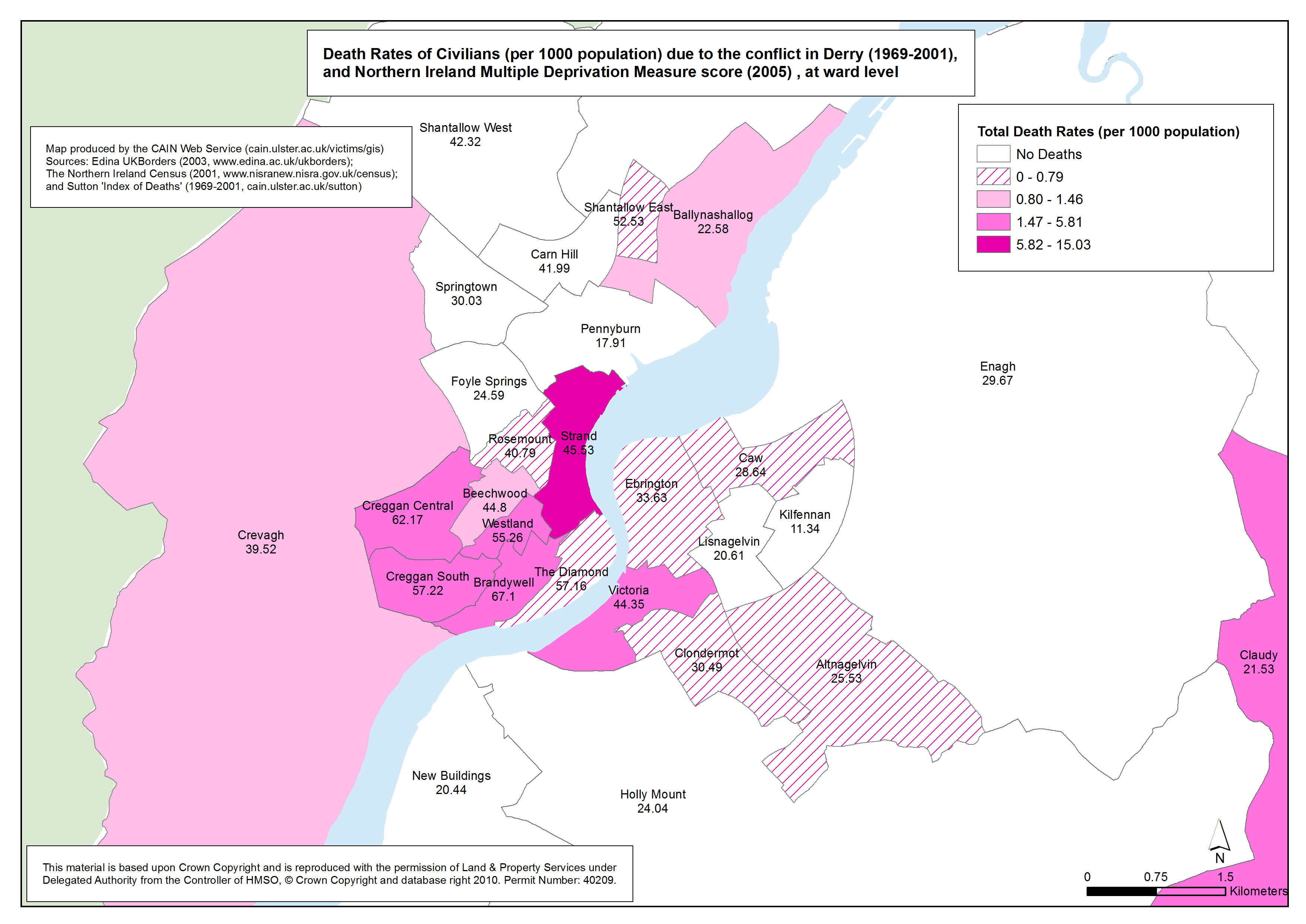
Deaths - Derry - Civilians - Ward
Death Rates of Civilians (per 1000 population) due to the conflict in Derry (1969-2001), at ward level |
.pdf
489kb |
.jpg
134kb |
.jpg
818kb |
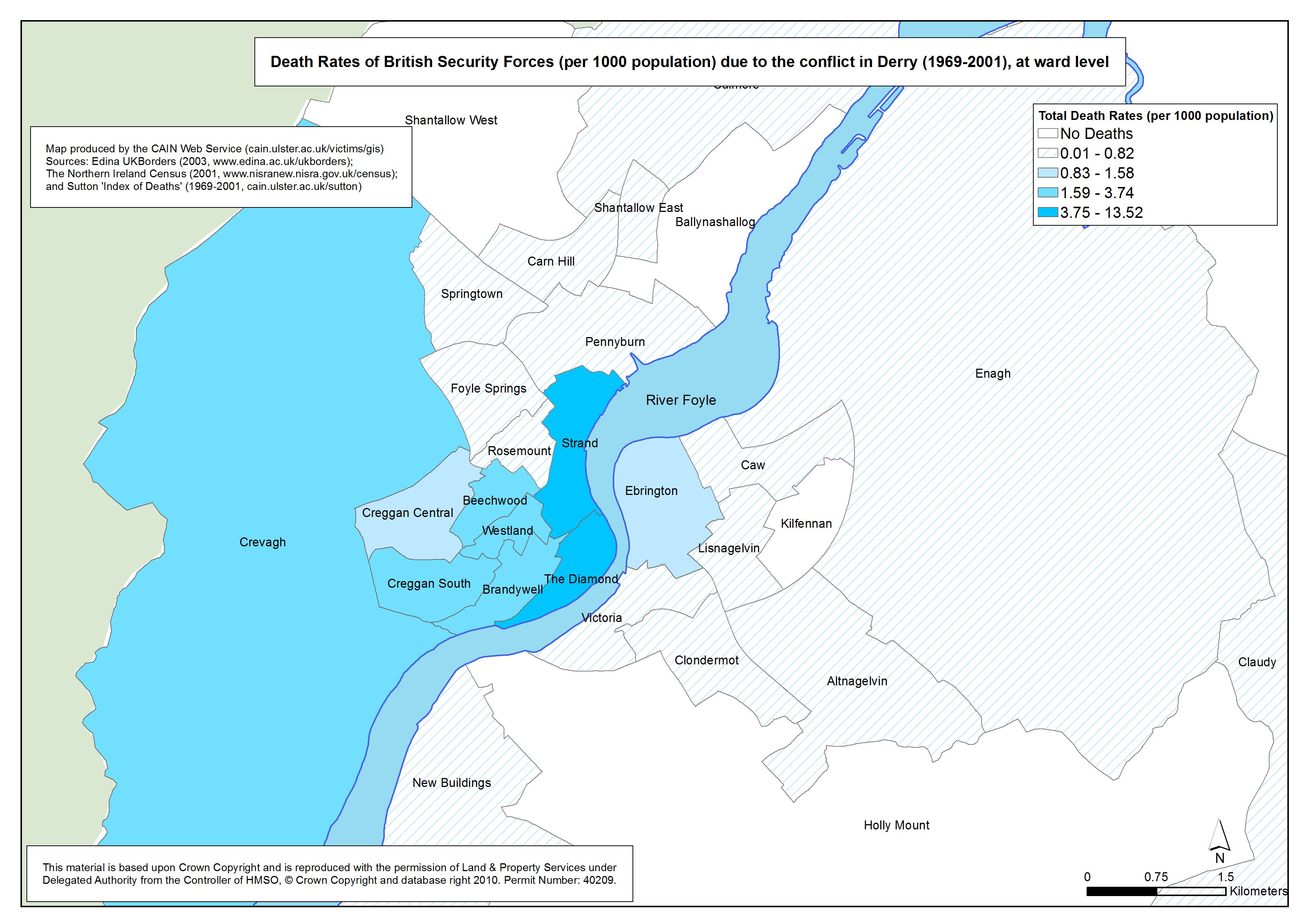
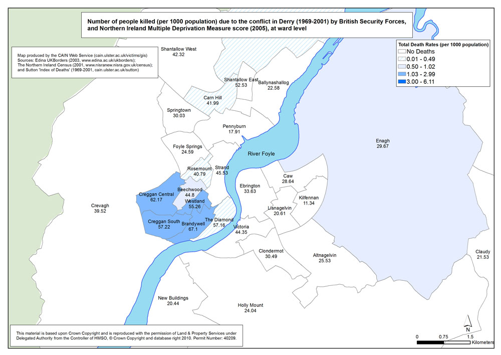
Deaths - Derry - British Security Forces - Ward
Death Rates of British Security Forces (per 1000 population) due to the conflict in Derry (1969-2001), at ward level |
.pdf
567kb |
.jpg
103kb |
.jpg
890kb |
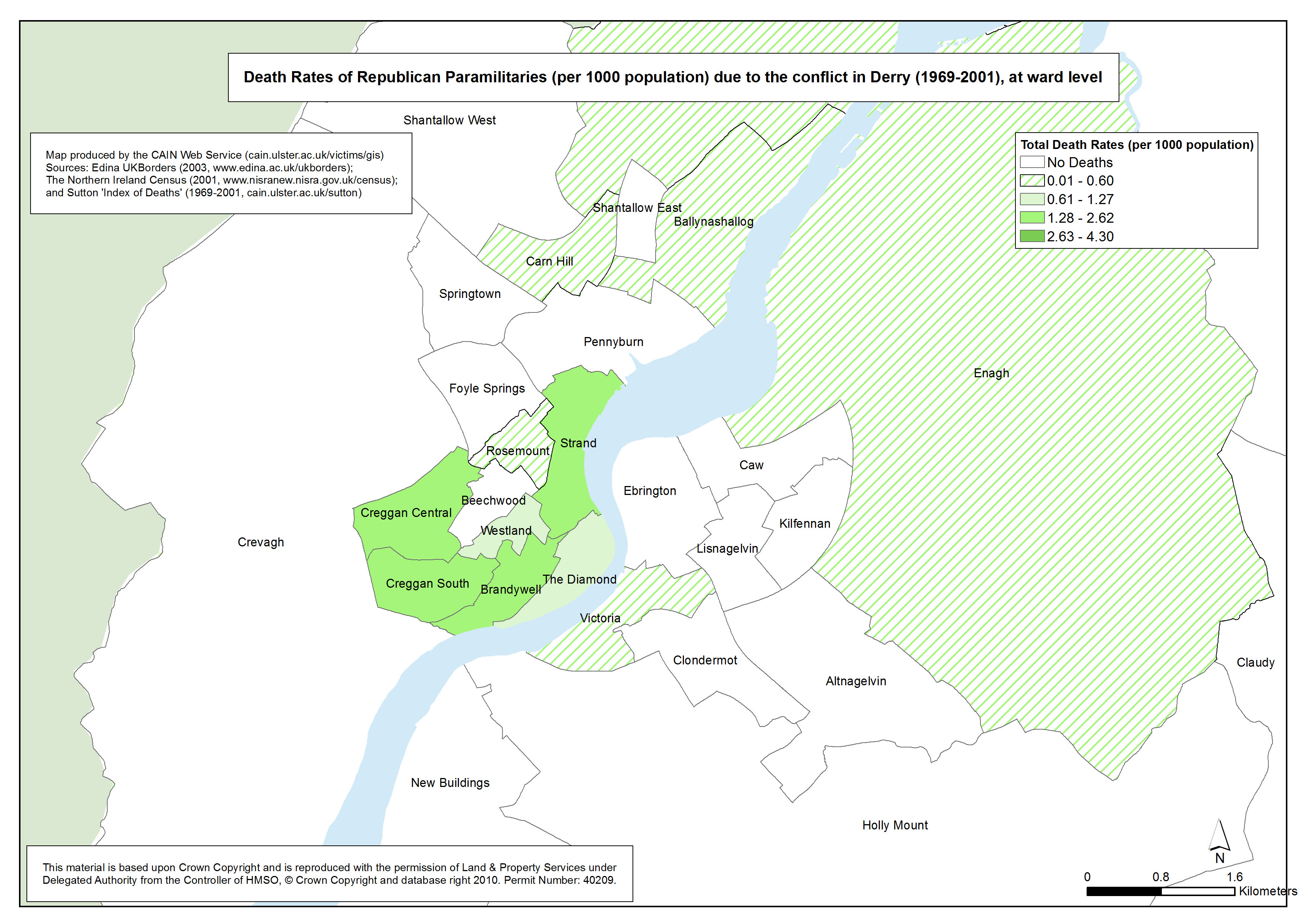
Deaths - Derry - Republicans - Ward
Death Rates of Republican Paramilitaries (per 1000 population) due to the conflict in Derry (1969-2001), at ward level |
.pdf
591kb |
.jpg
218kb |
.jpg
1489kb |
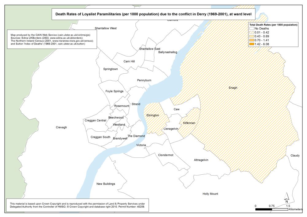
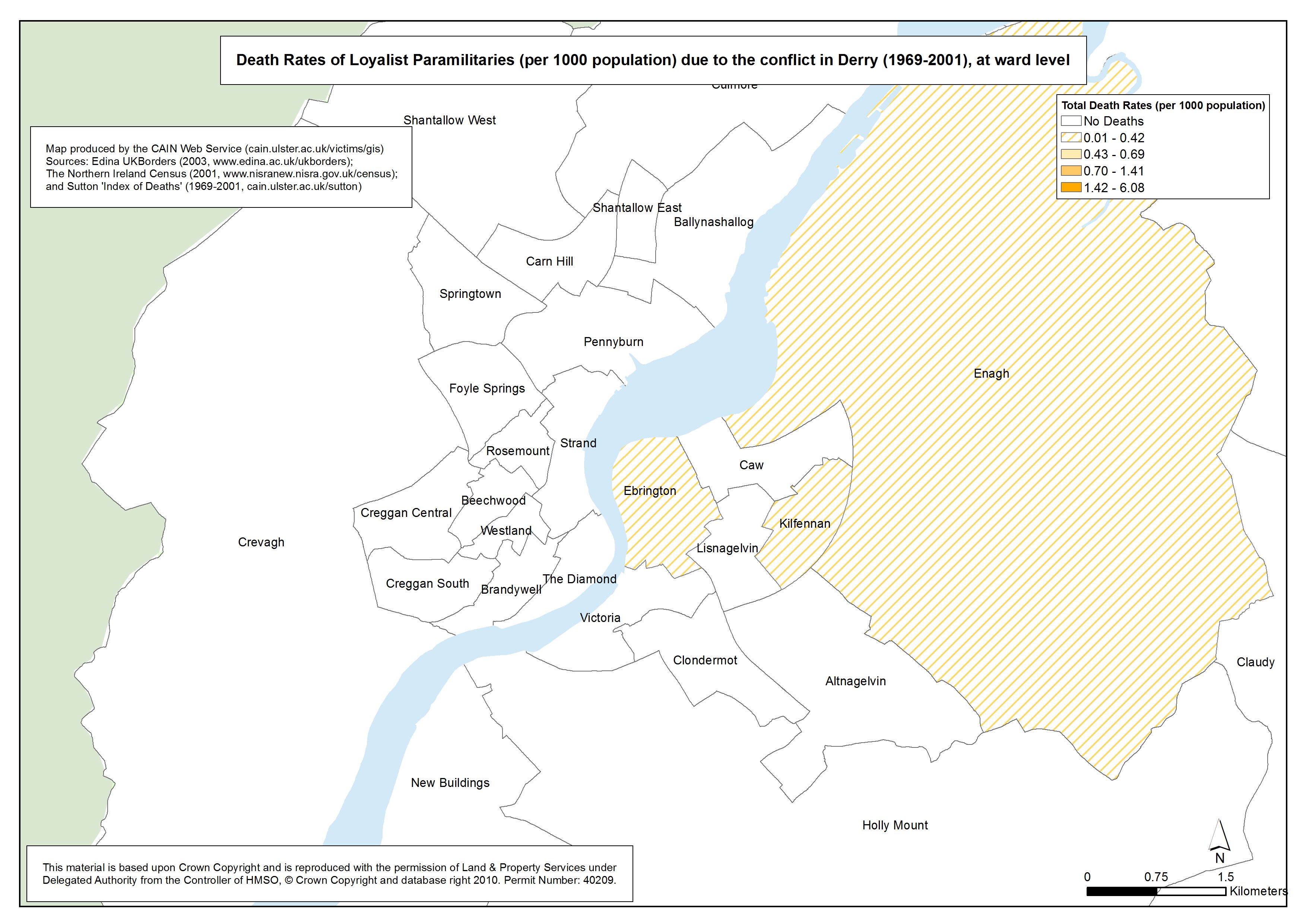
Deaths - Derry - Loyalists - Ward
Death Rates of Loyalist Paramilitaries (per 1000 population) due to the conflict in Derry (1969-2001), at ward level |
.pdf
558kb |
.jpg
104kb |
.jpg
852kb |
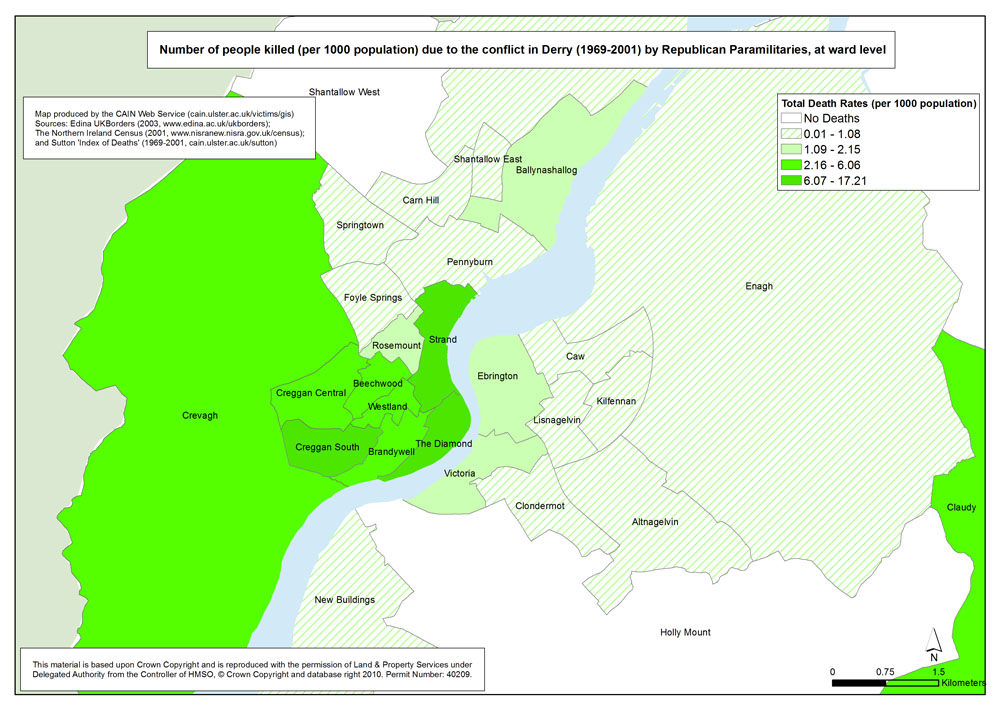
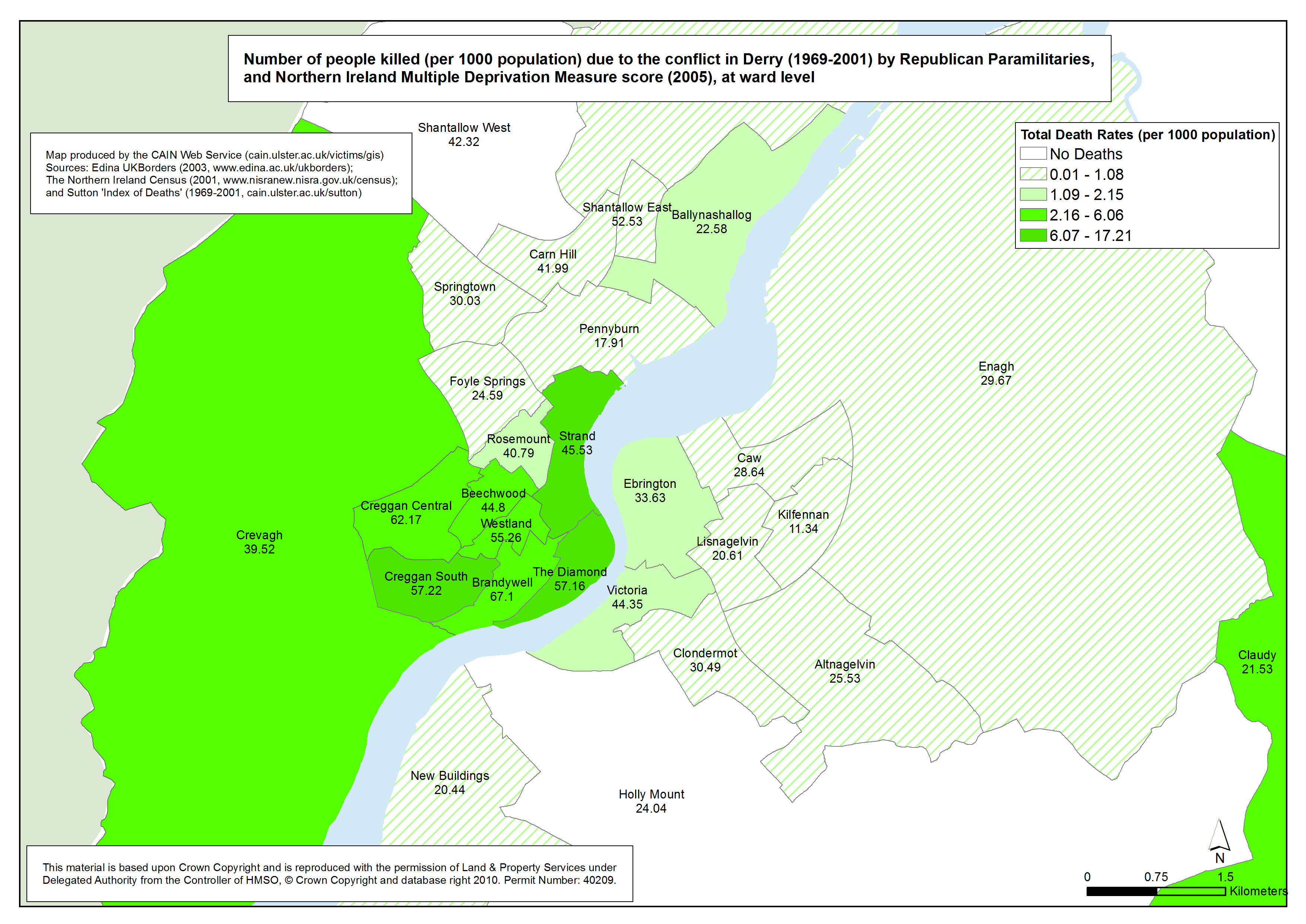
Killings - Derry - Republican Killings - Ward
Number of people killed (per 1000 population) due to the conflict in Derry (1969-2001) by Republican Paramilitaries, at ward level |
.pdf
600kb |
.jpg
226kb |
.jpg
1511kb |
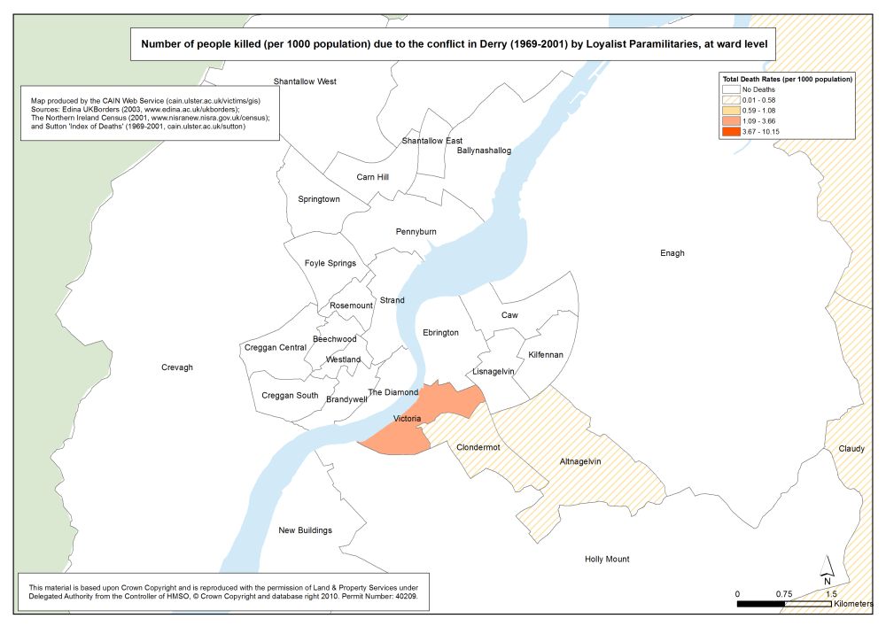
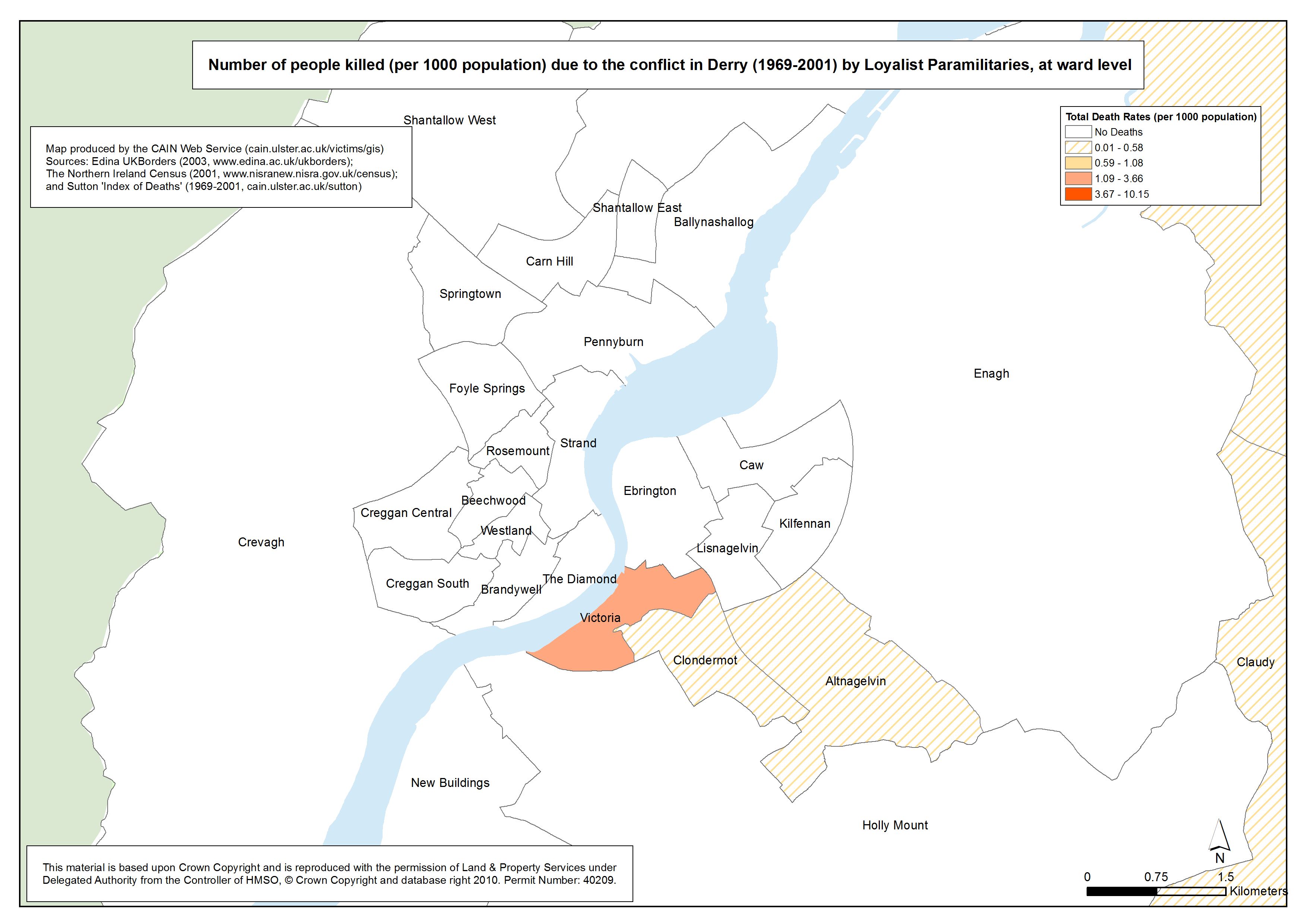
Killings - Derry - Loyalist Killings - Ward
Number of people killed (per 1000 population) due to the conflict in Derry (1969-2001) by Loyalist Paramilitaries, at ward level |
.pdf
444kb |
.jpg
80kb |
.jpg
582kb |
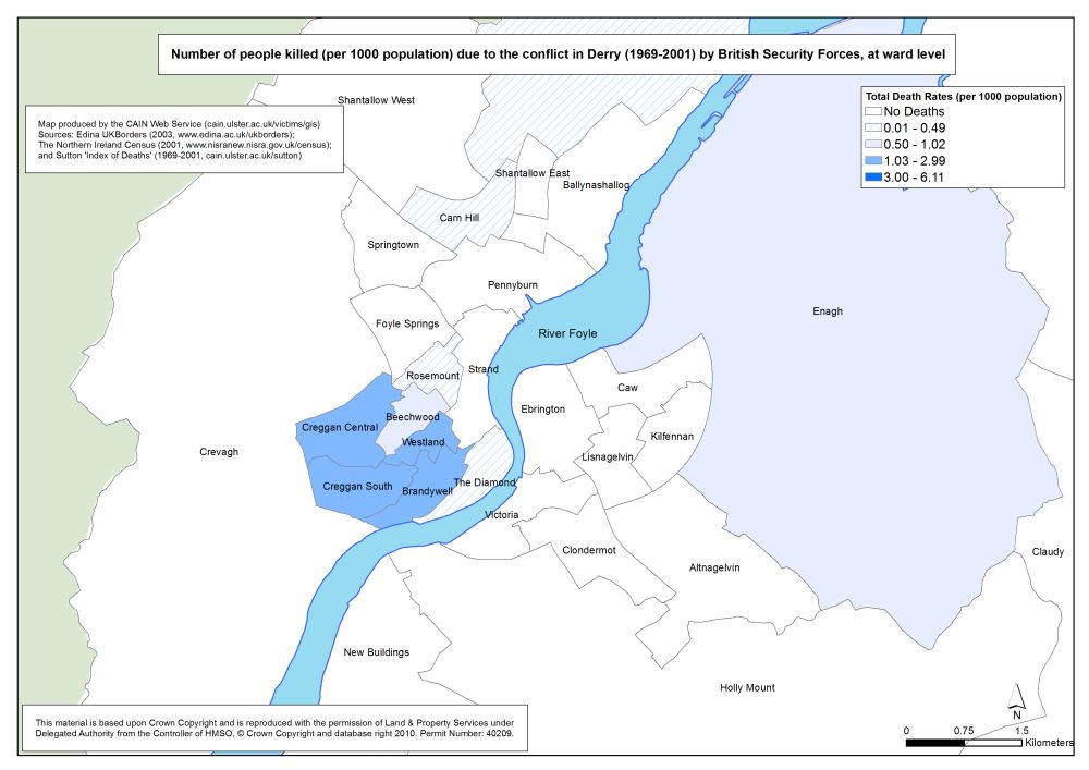
Killings - Derry - British Security Forces - Ward
Number of people killed (per 1000 population) due to the conflict in Derry (1969-2001) by British Security Forces, at ward level |
.pdf
444kb |
.jpg
82kb |
.jpg
559kb |
| Maps - Deaths and Killings (1969-2001), by area (Belfast, Derry), by status and organisation, with Multiple Deprivation Measure score, at ward level (16 maps) |
| Title of Map |
File Version |
| PDF |
L-JPG |
H-JPG |
| Belfast |
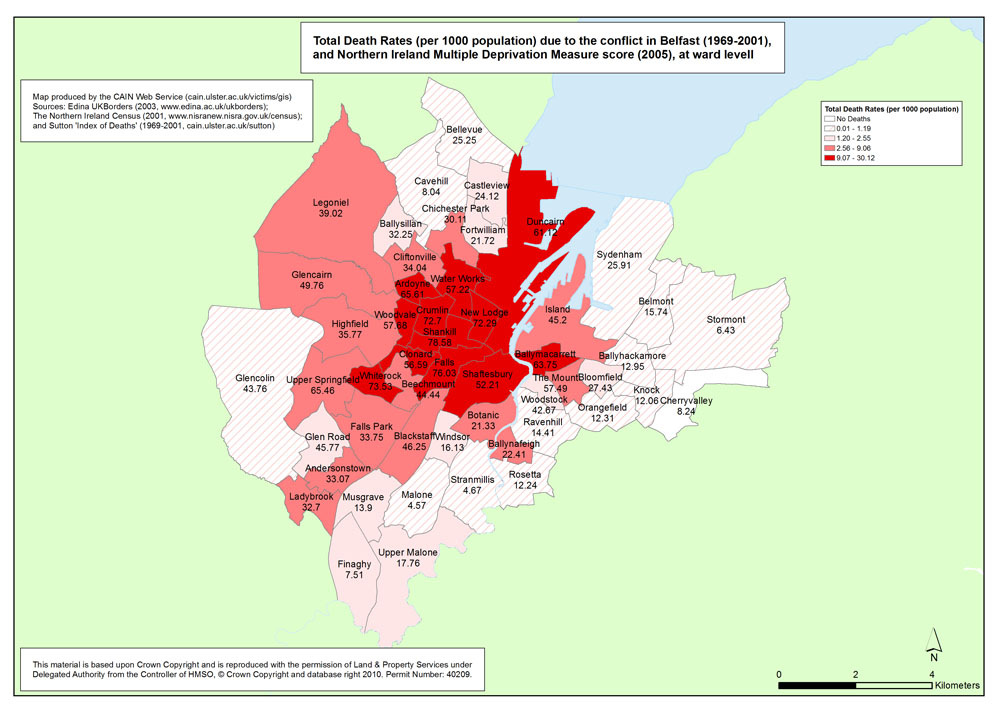
Deaths - Belfast - Ward - MDM
Total Death Rates (per 1000 population) due to the conflict in Belfast (1969-2001), with Multiple Deprivation Measure score, at ward level |
.pdf
496kb |
.jpg
157kb |
.jpg
1143kb |
Deaths - Belfast - Civilians - Ward - MDM
Death Rates of Civilians (per 1000 population) due to the conflict in Belfast (1969-2001), with Multiple Deprivation Measure score, at ward level |
.pdf
541kb |
.jpg
157kb |
.jpg
1001kb |
Deaths - Belfast - British Security Forces - Ward - MDM
Death Rates of British Security Forces (per 1000 population) due to the conflict in Belfast (1969-2001), with Multiple Deprivation Measure score, at ward level |
.pdf
539kb |
.jpg
165kb |
.jpg
1235kb |
Deaths - Belfast - Republicans - Ward - MDM
Death Rates of Republican Paramilitaries (per 1000 population) due to the conflict in Belfast (1969-2001), with Multiple Deprivation Measure score, at ward level |
.pdf
523kb |
.jpg
160kb |
.jpg
1167kb |
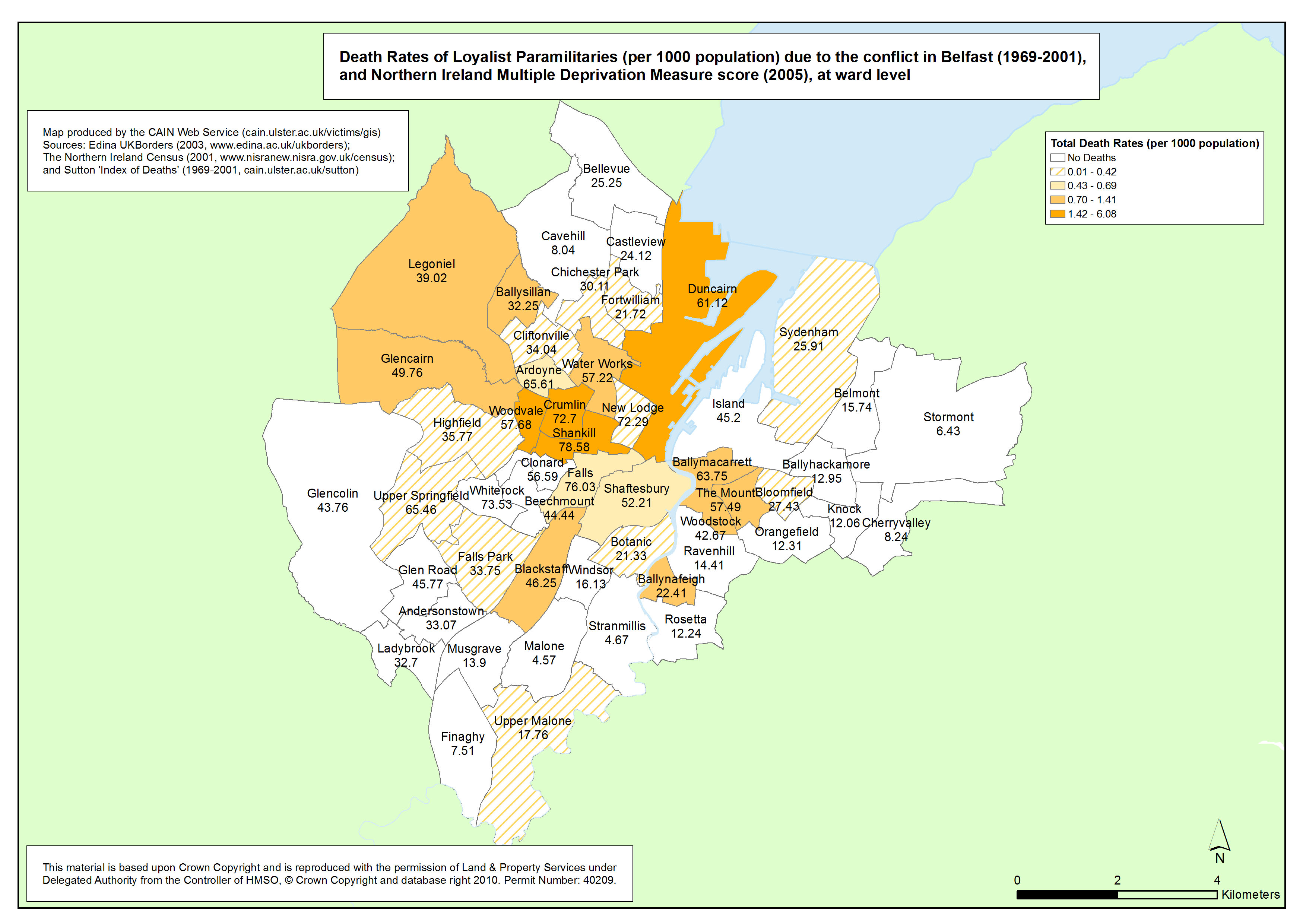
Deaths - Belfast - Loyalists - Ward - MDM
Death Rates of Loyalist Paramilitaries (per 1000 population) due to the conflict in Belfast (1969-2001), with Multiple Deprivation Measure score, at ward level |
.pdf
502kb |
.jpg
163kb |
.jpg
1146kb |
Killings - Belfast - Republican Killings - Ward - MDM
Number of people killed (per 1000 population) due to the conflict in Belfast (1969-2001) by Republican Paramilitaries, with Multiple Deprivation Measure score, at ward level |
.pdf
529kb |
.jpg
176kb |
.jpg
1241kb |
Killings - Belfast - Loyalist Killings - Ward - MDM
Number of people killed (per 1000 population) due to the conflict in Belfast (1969-2001) by Loyalist Paramilitaries, with Multiple Deprivation Measure score, at ward level |
.pdf
500kb |
.jpg
166kb |
.jpg
1151kb |
Killings - Belfast - British Security Forces - Ward - MDM
Number of people killed (per 1000 population) due to the conflict in Belfast (1969-2001) by British Security Forces, with Multiple Deprivation Measure score, at ward level |
.pdf
516kb |
.jpg
162kb |
.jpg
1137kb |
| Derry |
Deaths - Derry - Ward - MDM
Total Death Rates (per 1000 population) due to the conflict in Derry (1969-2001), at ward level |
.pdf
491kb |
.jpg
149kb |
.jpg
1137kb |
Deaths - Derry - Civilians - Ward - MDM
Death Rates of Civilians (per 1000 population) due to the conflict in Derry (1969-2001), at ward level |
.pdf
515kb |
.jpg
142kb |
.jpg
882kb |
Deaths - Derry - British Security Forces - Ward - MDM
Death Rates of British Security Forces (per 1000 population) due to the conflict in Derry (1969-2001), at ward level |
.pdf
595kb |
.jpg
182kb |
.jpg
1441kb |
Deaths - Derry - Republicans - Ward - MDM
Death Rates of Republican Paramilitaries (per 1000 population) due to the conflict in Derry (1969-2001), at ward level |
.pdf
619kb |
.jpg
225kb |
.jpg
1556kb |
Deaths - Derry - Loyalists - Ward - MDM
Death Rates of Loyalist Paramilitaries (per 1000 population) due to the conflict in Derry (1969-2001), at ward level |
.pdf
588kb |
.jpg
214kb |
.jpg
1508kb |
Killings - Derry - Republican Killings - Ward - MDM
Number of people killed (per 1000 population) due to the conflict in Derry (1969-2001) by Republican Paramilitaries, at ward level |
.pdf
624kb |
.jpg
231kb |
.jpg
1571kb |
Killings - Derry - Loyalist Killings - Ward - MDM
Number of people killed (per 1000 population) due to the conflict in Derry (1969-2001) by Loyalist Paramilitaries, at ward level |
.pdf
479kb |
.jpg
145kb |
.jpg
1032kb |
Killings - Derry - British Security Forces - Ward - MDM
Number of people killed (per 1000 population) due to the conflict in Derry (1969-2001) by British Security Forces, at ward level |
.pdf
473kb |
.jpg
142kb |
.jpg
994kb |
| Maps - Outline Maps, by area, of Ward Boundaries (1995) (8 maps) |
| Title of Map |
File Version |
| PDF |
L-JPG |
H-JPG |
| Belfast |
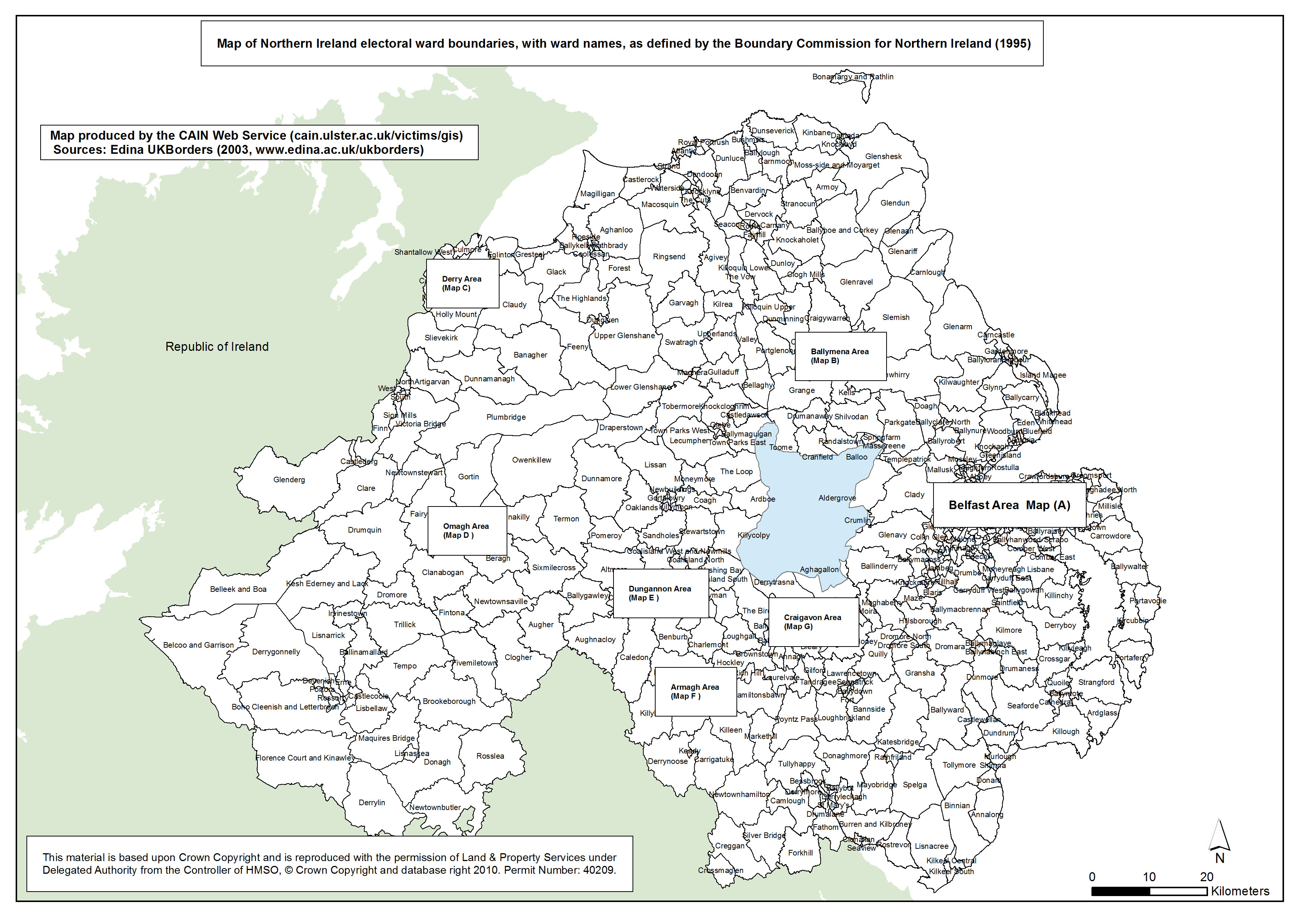
Ward Boundaries - Northern Ireland
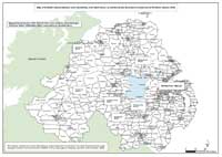
Map of Northern Ireland electoral ward boundaries, with ward names, as defined by the Boundary Commission for Northern Ireland (1995) |
.pdf
818kb |
.jpg
208kb |
.jpg
1673kb |
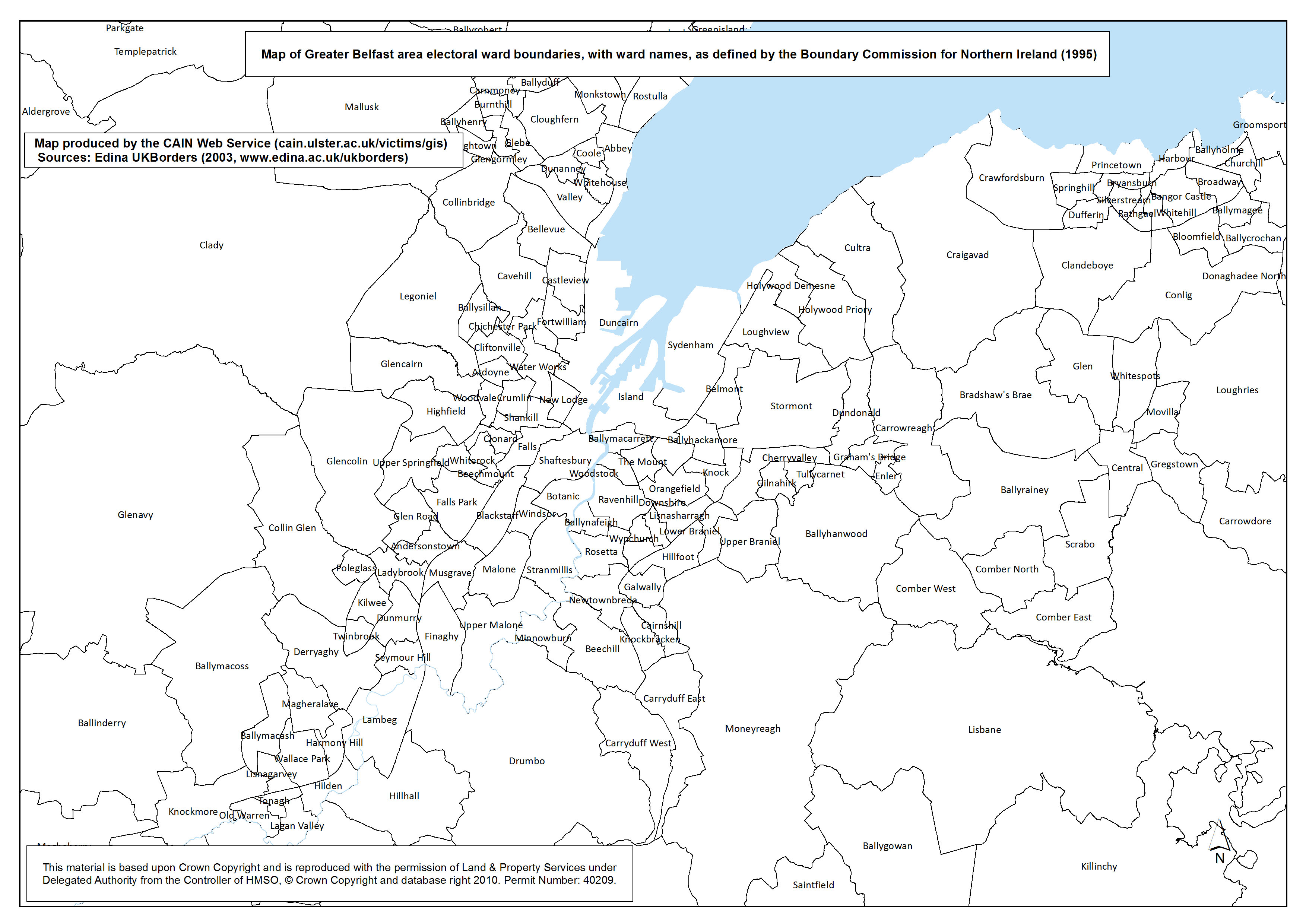
Ward Boundaries - Belfast
Map A. Map of Greater Belfast area electoral ward boundaries, with ward names, as defined by the Boundary Commission for Northern Ireland (1995) |
.pdf
674kb |
.jpg
189kb |
.jpg
1336kb |
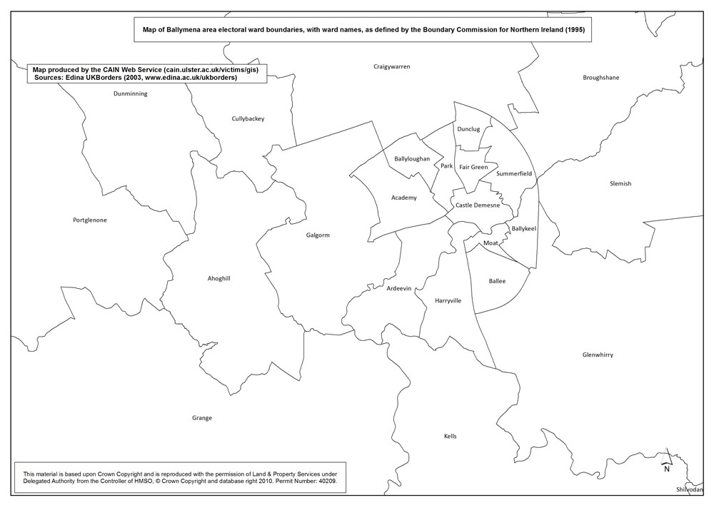
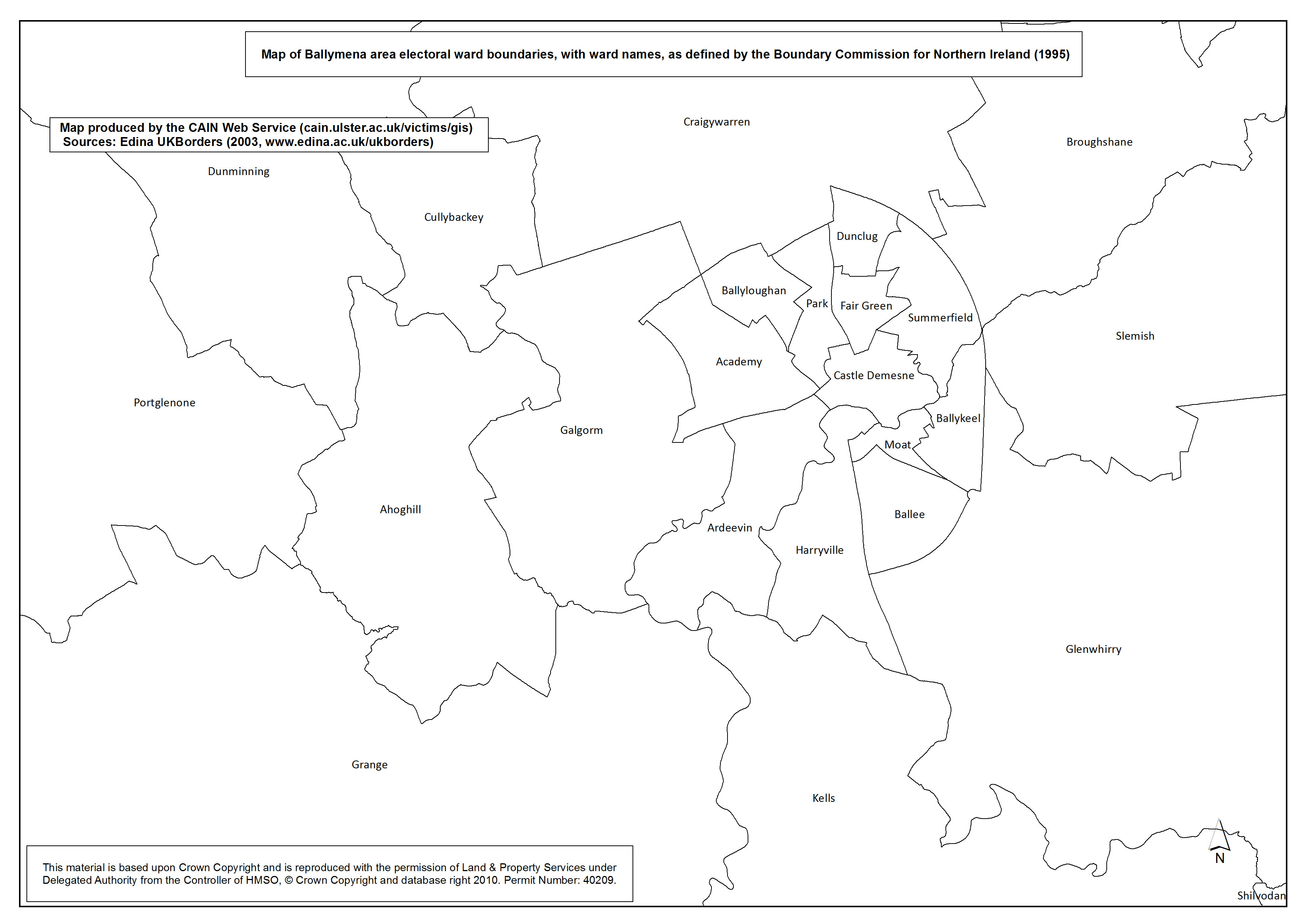
Ward Boundaries - Ballymena
Map B. Map of Ballymena area electoral ward boundaries, with ward names, as defined by the Boundary Commission for Northern Ireland (1995) |
.pdf
387kb |
.jpg
108kb |
.jpg
719kb |
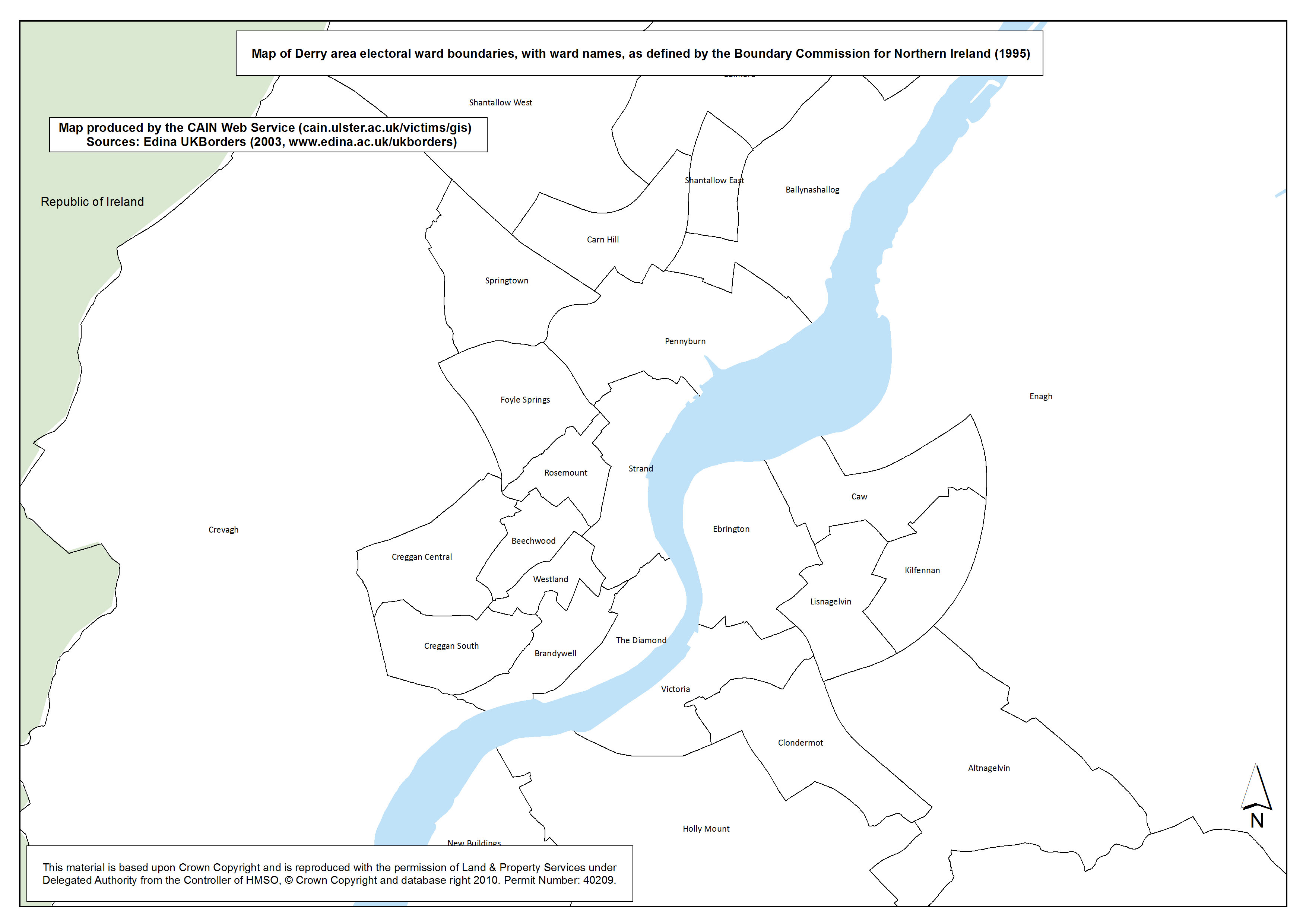
Ward Boundaries - Derry
Map C. Map of Derry area electoral ward boundaries, with ward names, as defined by the Boundary Commission for Northern Ireland (1995) |
.pdf
381kb |
.jpg
109kb |
.jpg
717kb |
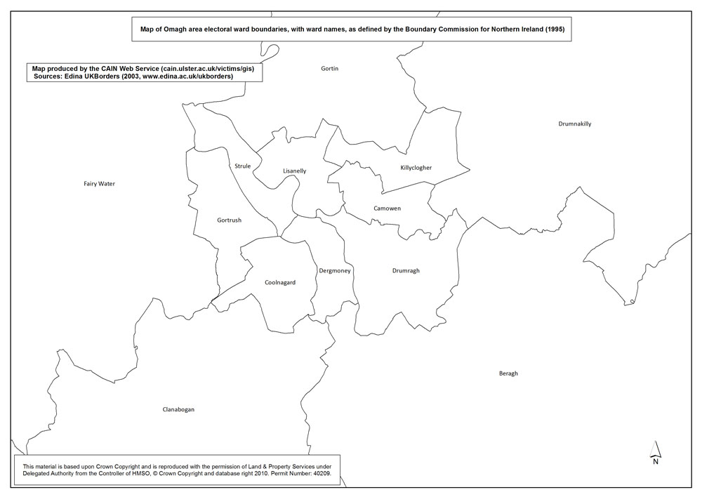
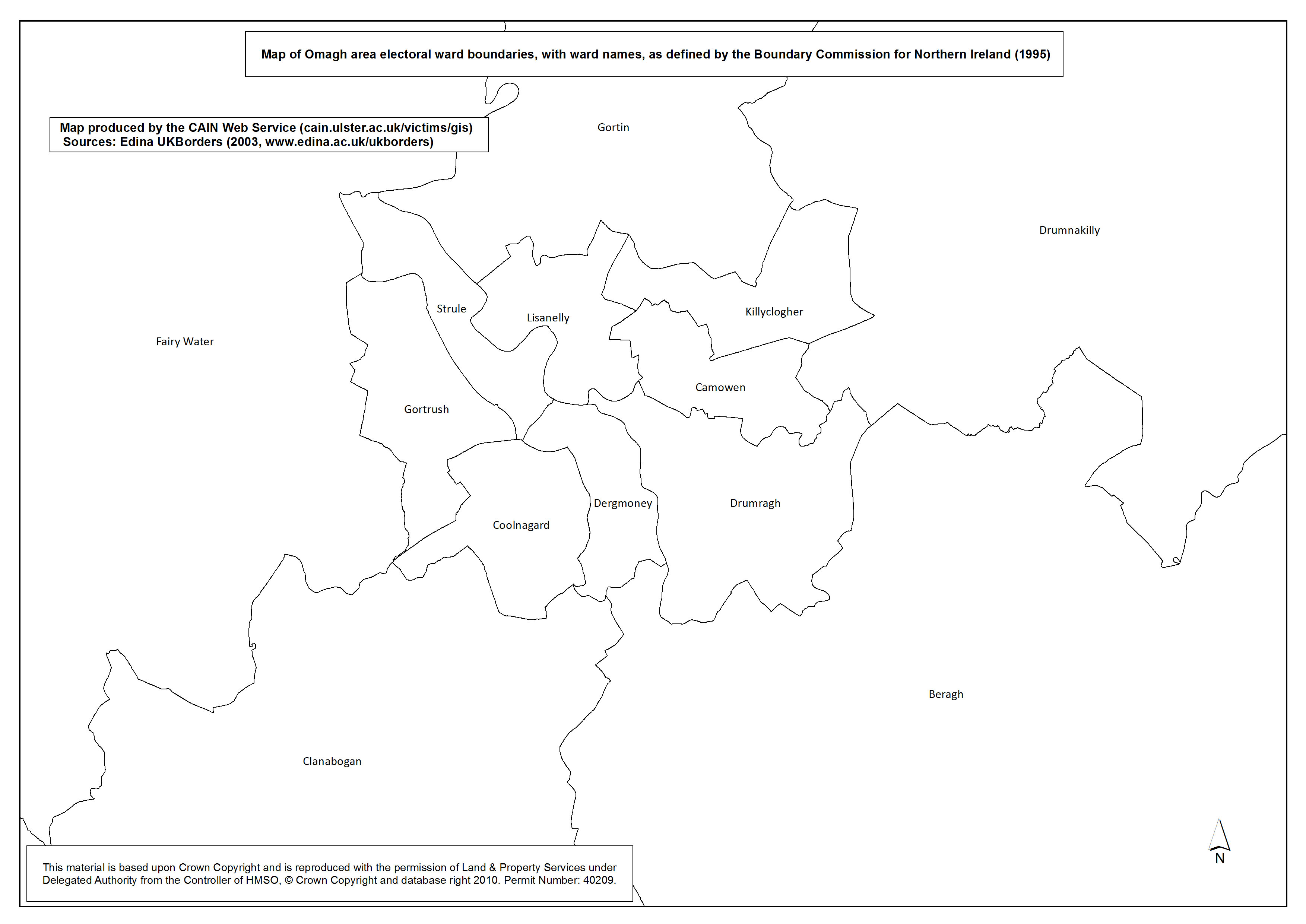
Ward Boundaries - Omagh
Map D. Map of Omagh area electoral ward boundaries, with ward names, as defined by the Boundary Commission for Northern Ireland (1995) |
.pdf
343kb |
.jpg
94kb |
.jpg
634kb |
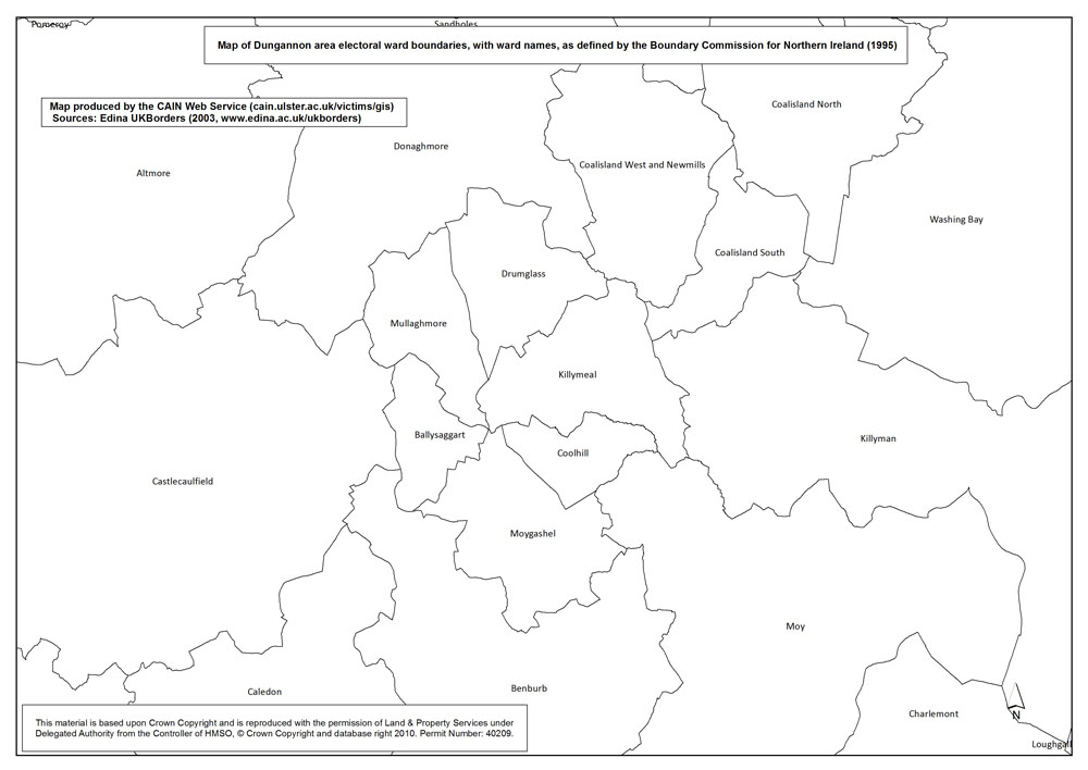
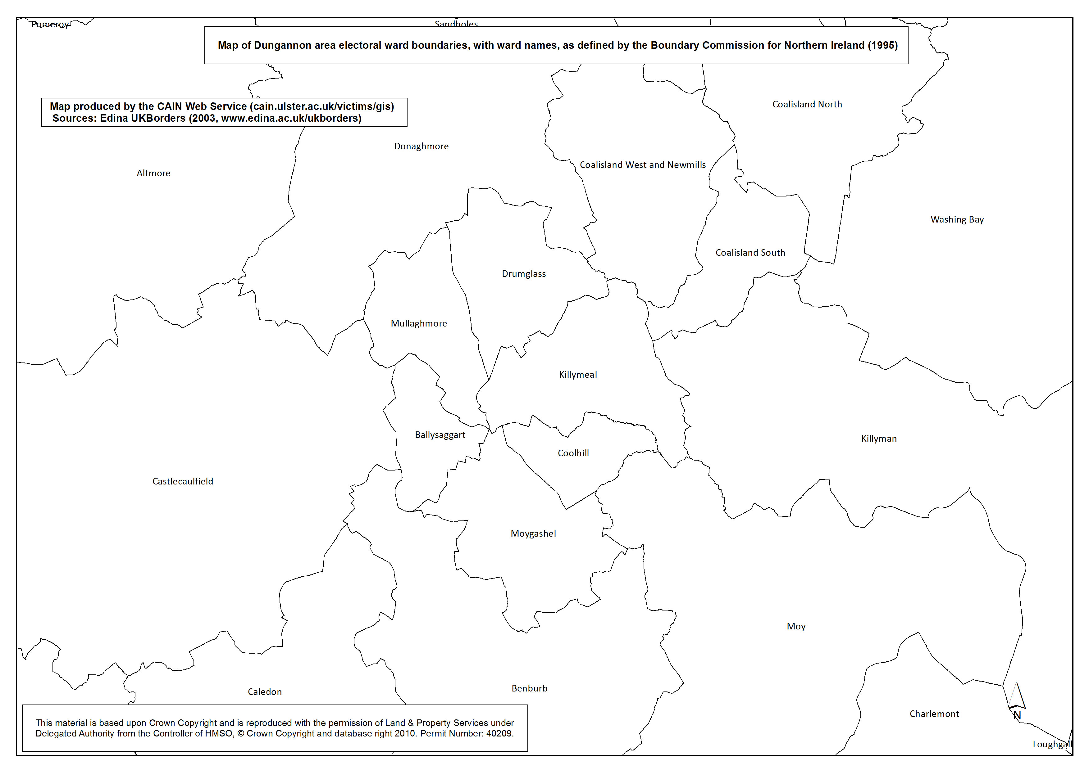
Ward Boundaries - Dungannon
Map E. Map of Dungannon area electoral ward boundaries, with ward names, as defined by the Boundary Commission for Northern Ireland (1995) |
.pdf
387kb |
.jpg
108kb |
.jpg
721kb |
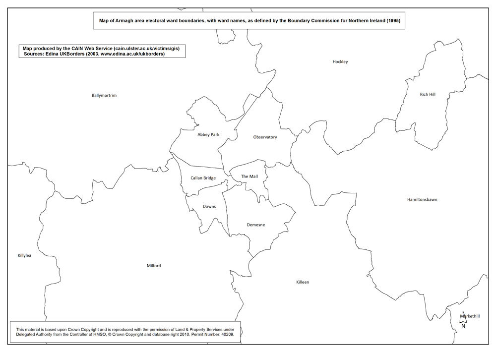
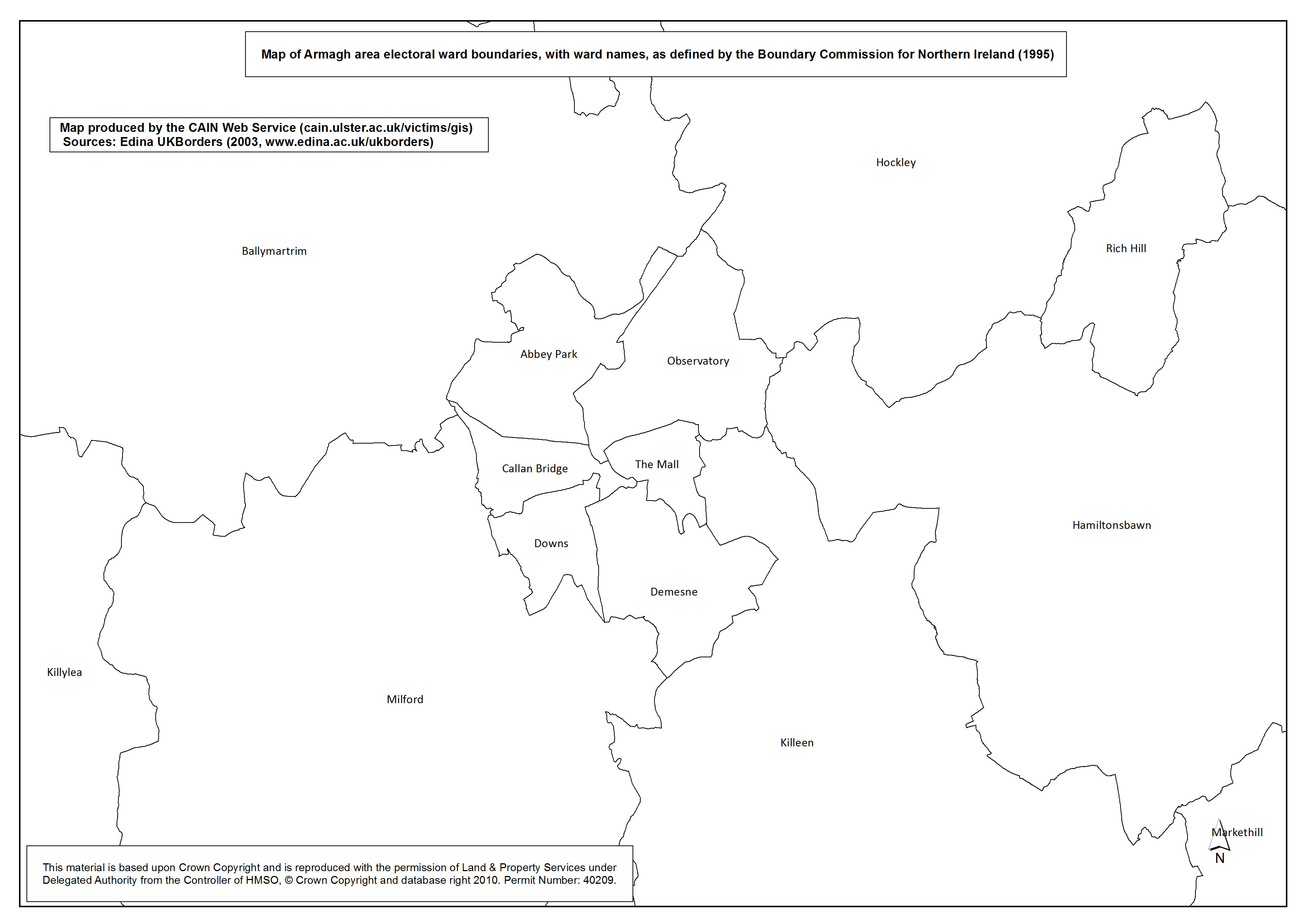
Ward Boundaries - Armagh
Map F. Map of Armagh area electoral ward boundaries, with ward names, as defined by the Boundary Commission for Northern Ireland (1995) |
.pdf
348kb |
.jpg
96kb |
.jpg
644kb |
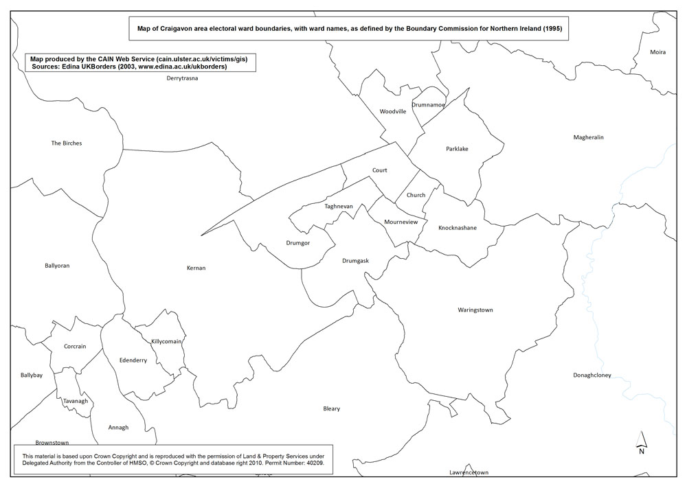
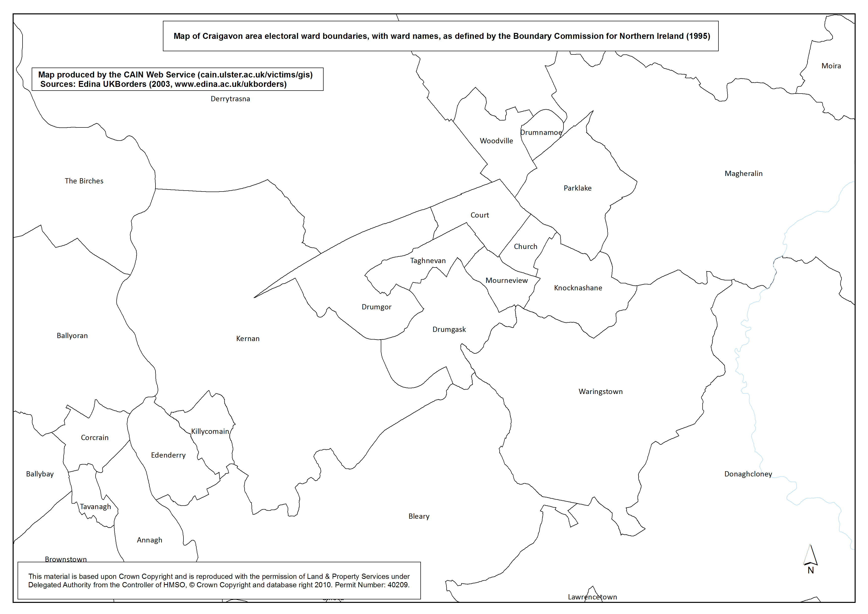
Ward Boundaries - Craigavon
Map G. Map of Craigavon area electoral ward boundaries, with ward names, as defined by the Boundary Commission for Northern Ireland (1995) |
.pdf
403kb |
.jpg
114kb |
.jpg
753kb |
| Maps - Deaths, by area (Northern Ireland, Belfast, Derry), by 5 year groups, at 1km grid square level (24 maps) |
| Title of Map |
File Version |
| PDF |
L-JPG |
H-JPG |
| Northern Ireland |
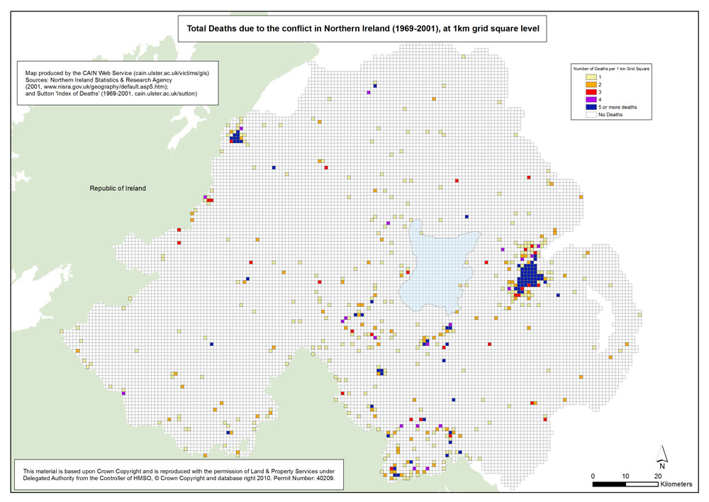
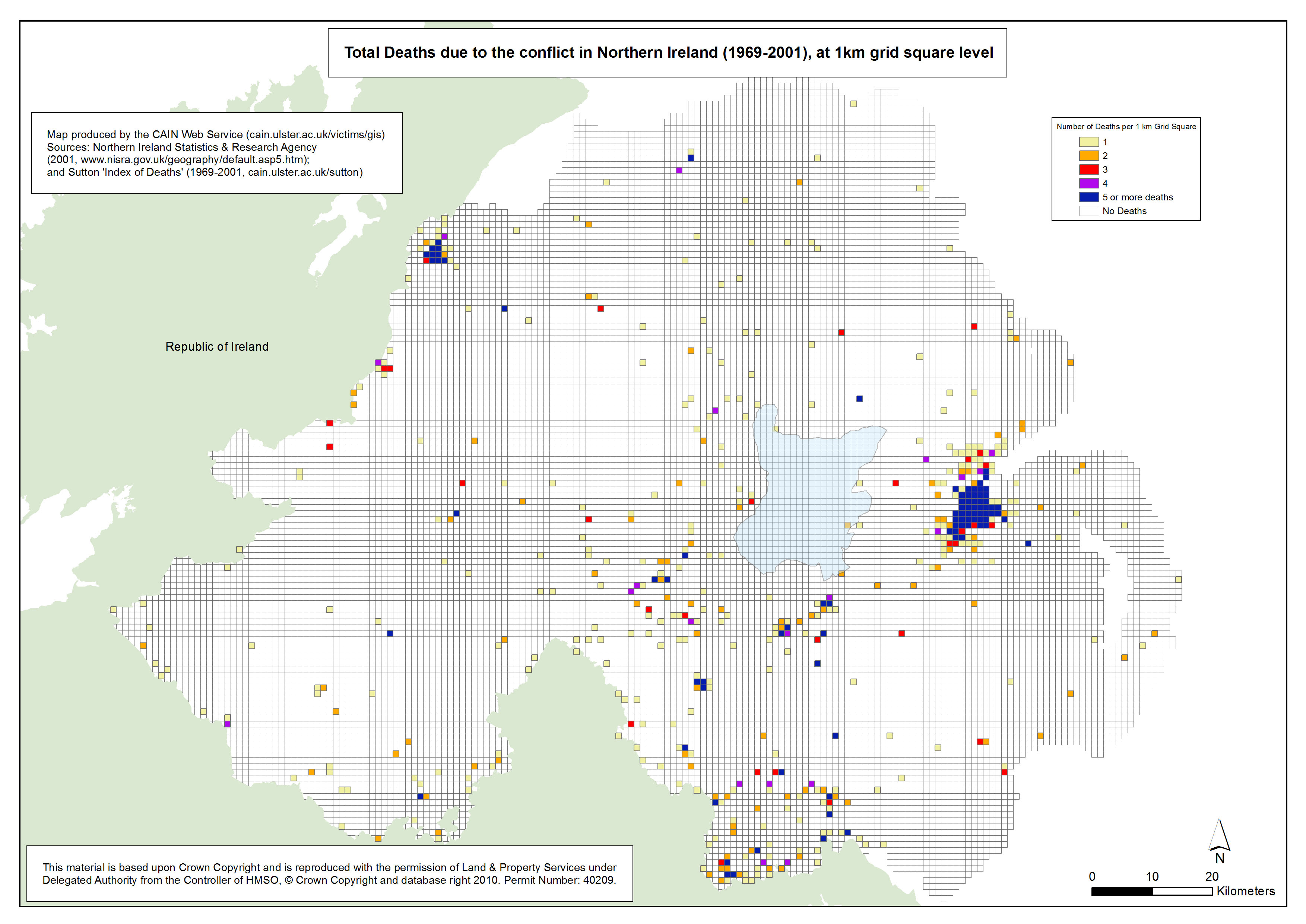
Deaths - NI - 1969-2001 - 1km Grid Square
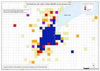
Total Deaths due to the conflict in Northern Ireland (1969-2001), at 1km grid square level |
.pdf
825kb |
.jpg
167kb |
.jpg
1452kb |
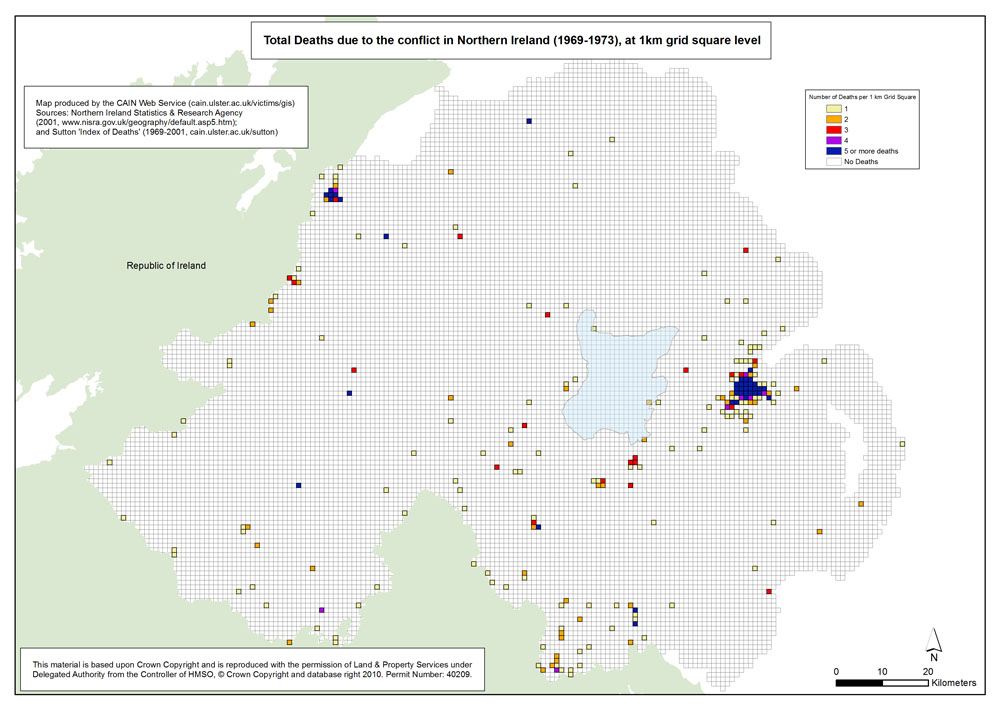
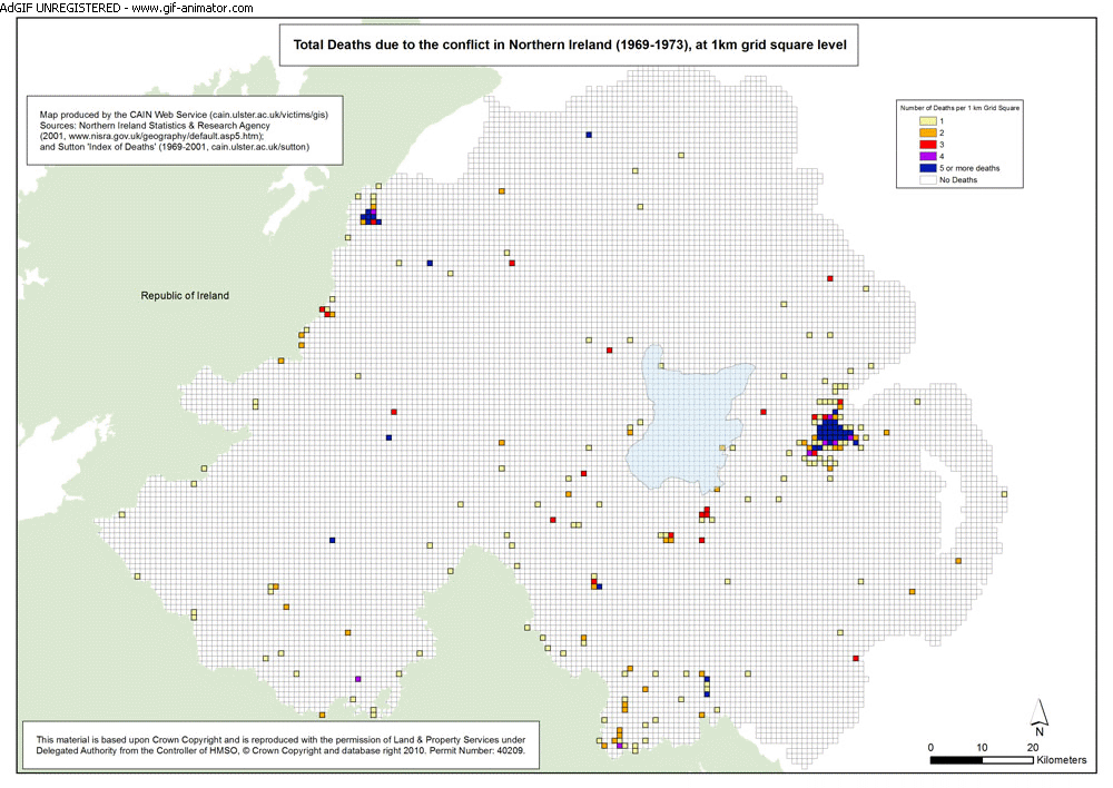
Deaths - NI - 1969-1973 - 1km Grid Square
Total Deaths due to the conflict in Northern Ireland (1969-1973), at 1km grid square level |
.pdf
820kb |
.jpg
160kb |
.jpg
1433kb |
Deaths - NI - 1974-1978 - 1km Grid Square
Total Deaths due to the conflict in Northern Ireland (1974-1978), at 1km grid square level |
.pdf
819kb |
.jpg
161kb |
.jpg
1436kb |
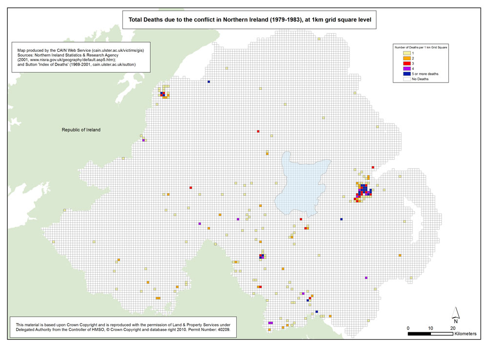
Deaths - NI - 1979-1983 - 1km Grid Square
Total Deaths due to the conflict in Northern Ireland (1979-1983), at 1km grid square level |
.pdf
814kb |
.jpg
156kb |
.jpg
1424kb |
Deaths - NI - 1984-1988 - 1km Grid Square
Total Deaths due to the conflict in Northern Ireland (1984-1988), at 1km grid square level |
.pdf
814kb |
.jpg
155kb |
.jpg
1423kb |
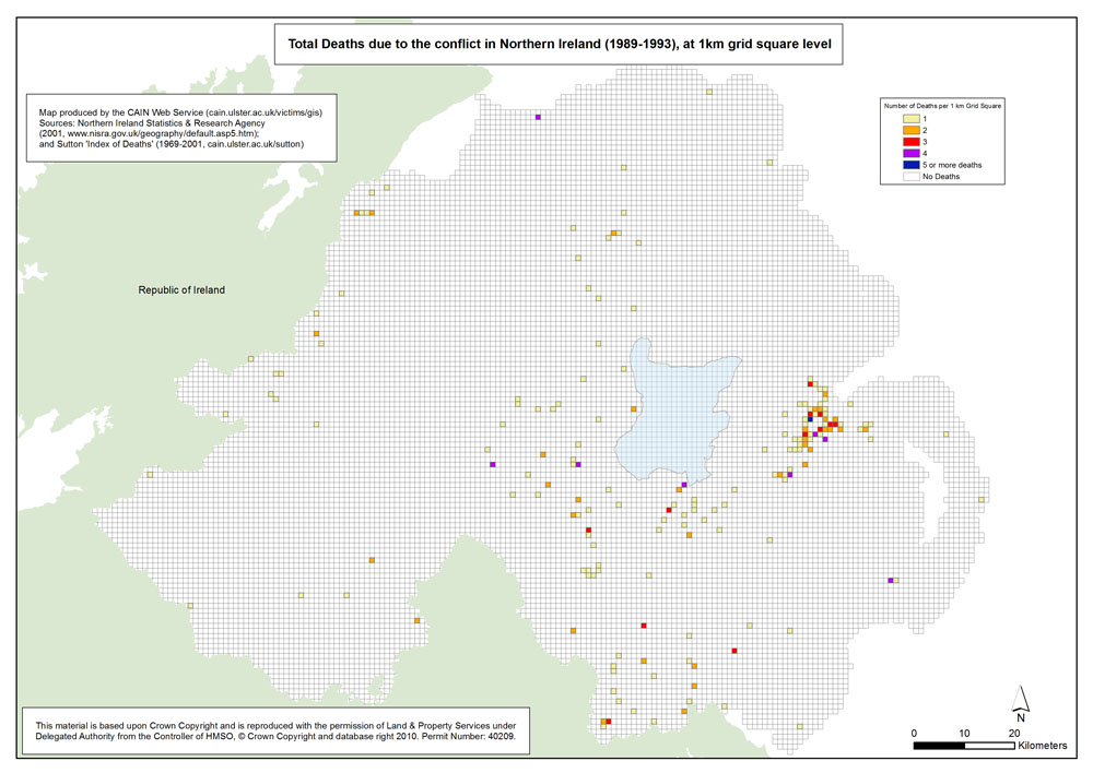
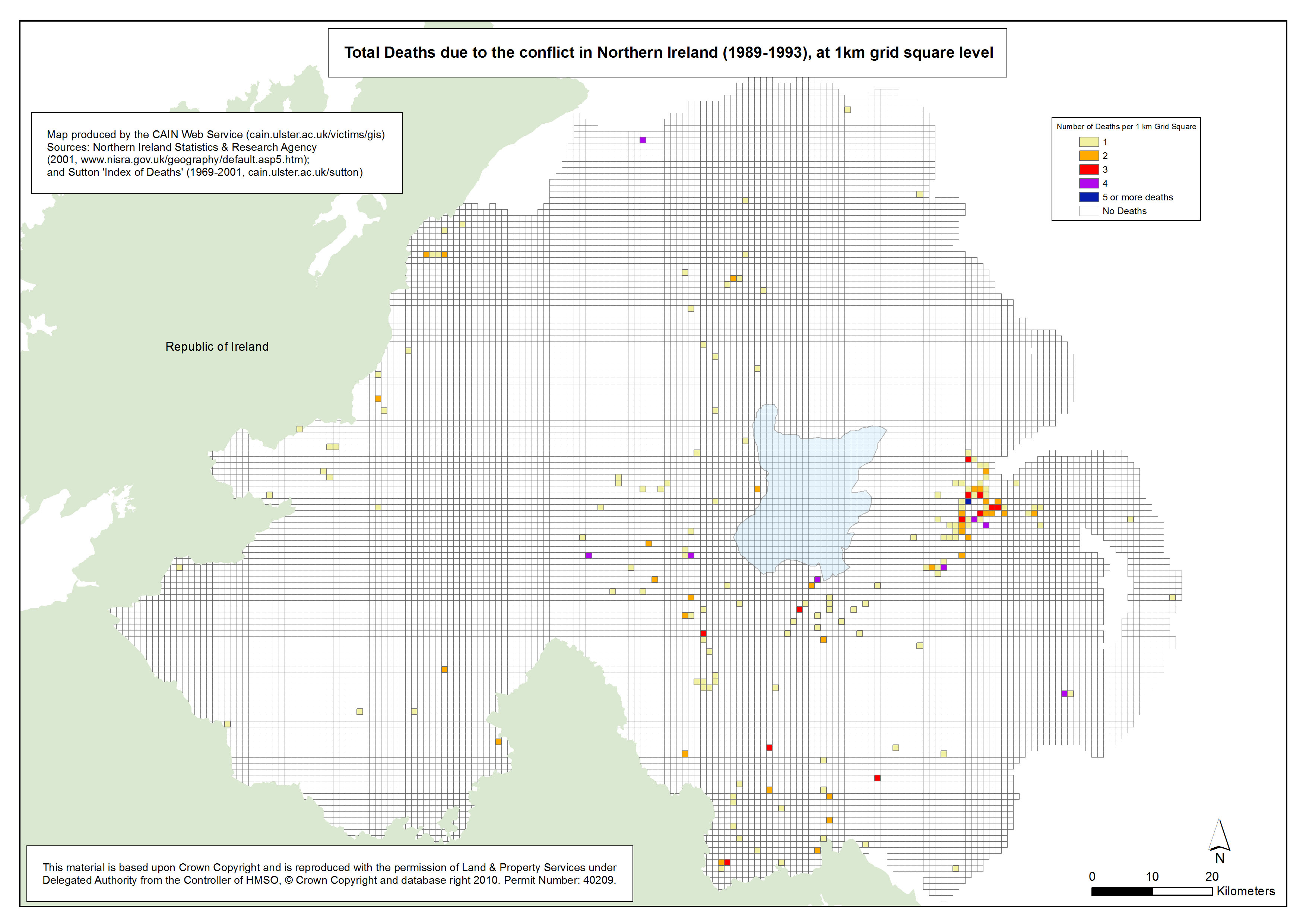
Deaths - NI - 1989-1993 - 1km Grid Square
Total Deaths due to the conflict in Northern Ireland (1989-1993), at 1km grid square level |
.pdf
814kb |
.jpg
155kb |
.jpg
1422kb |
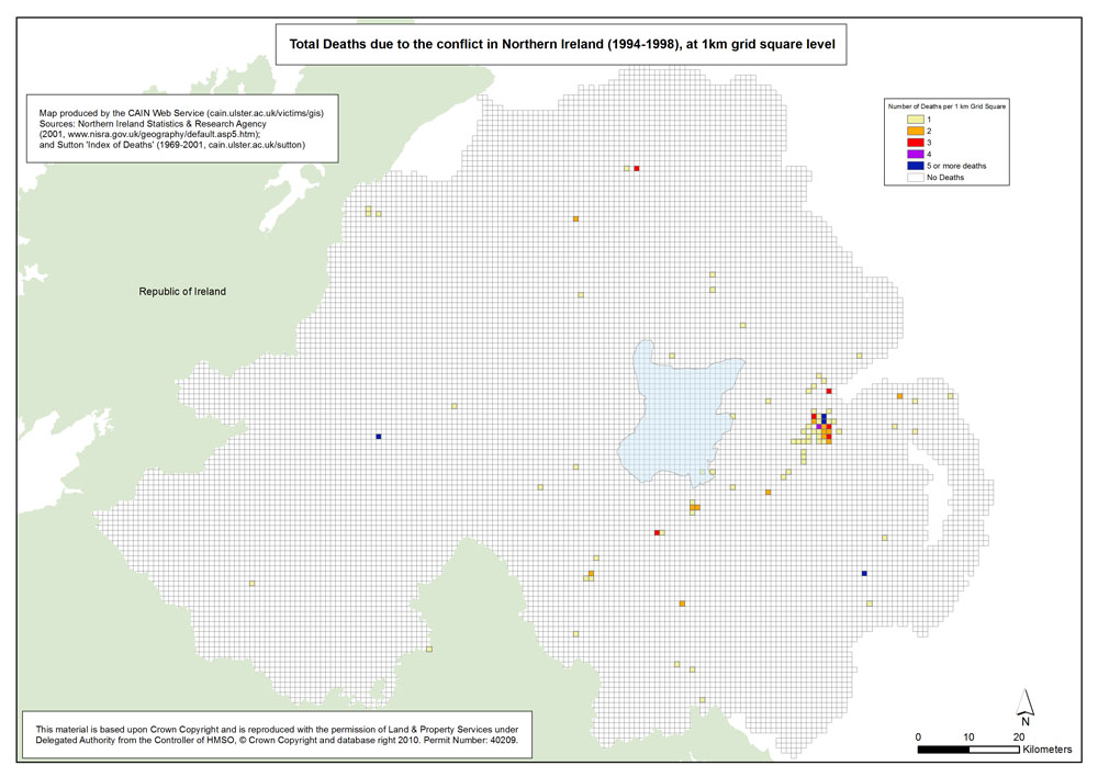
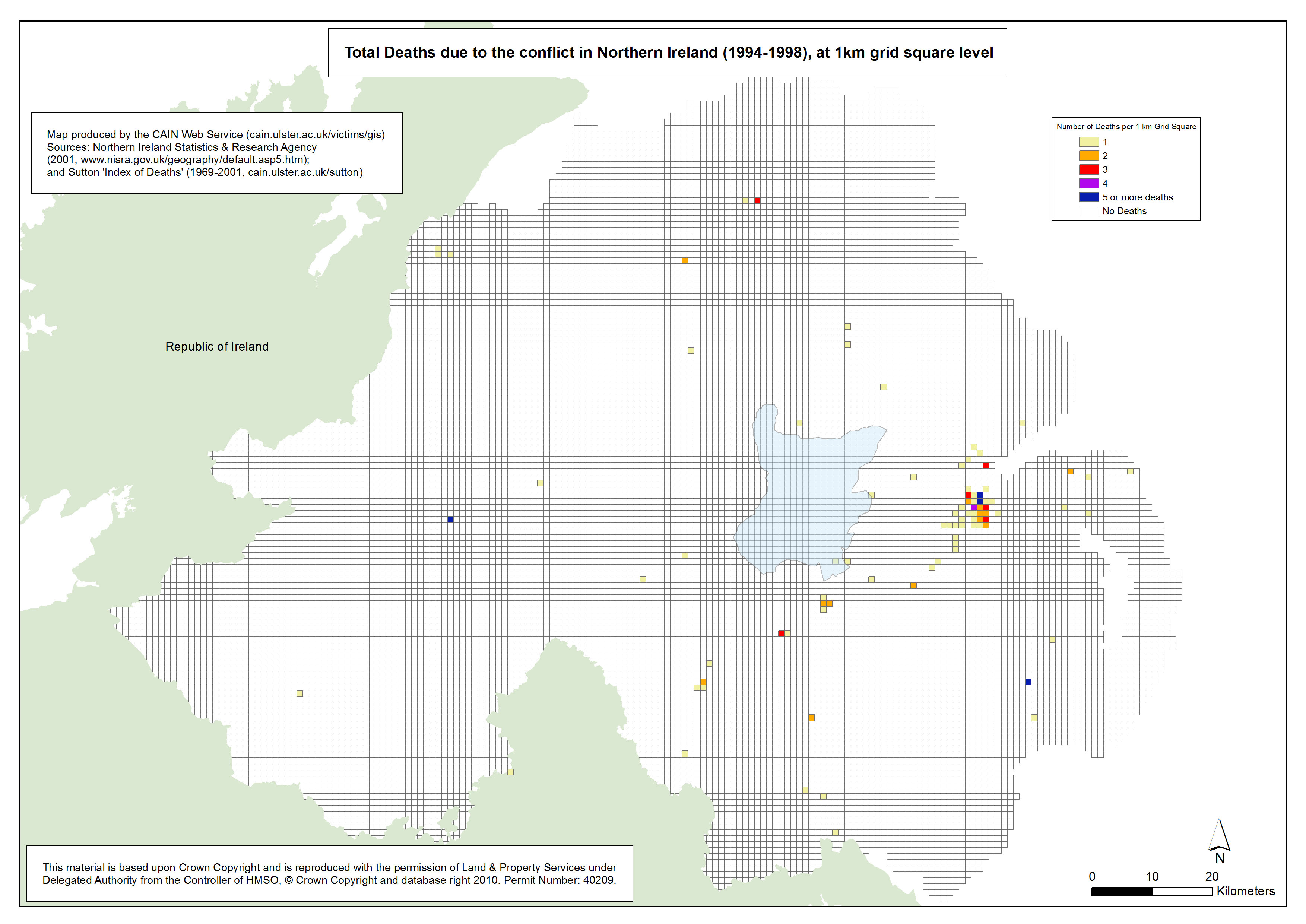
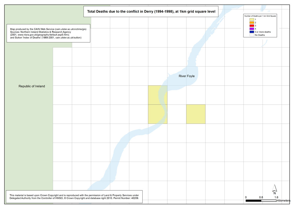
Deaths - NI - 1994-1998 - 1km Grid Square
Total Deaths due to the conflict in Northern Ireland (1994-1998), at 1km grid square level |
.pdf
810kb |
.jpg
152kb |
.jpg
1412kb |
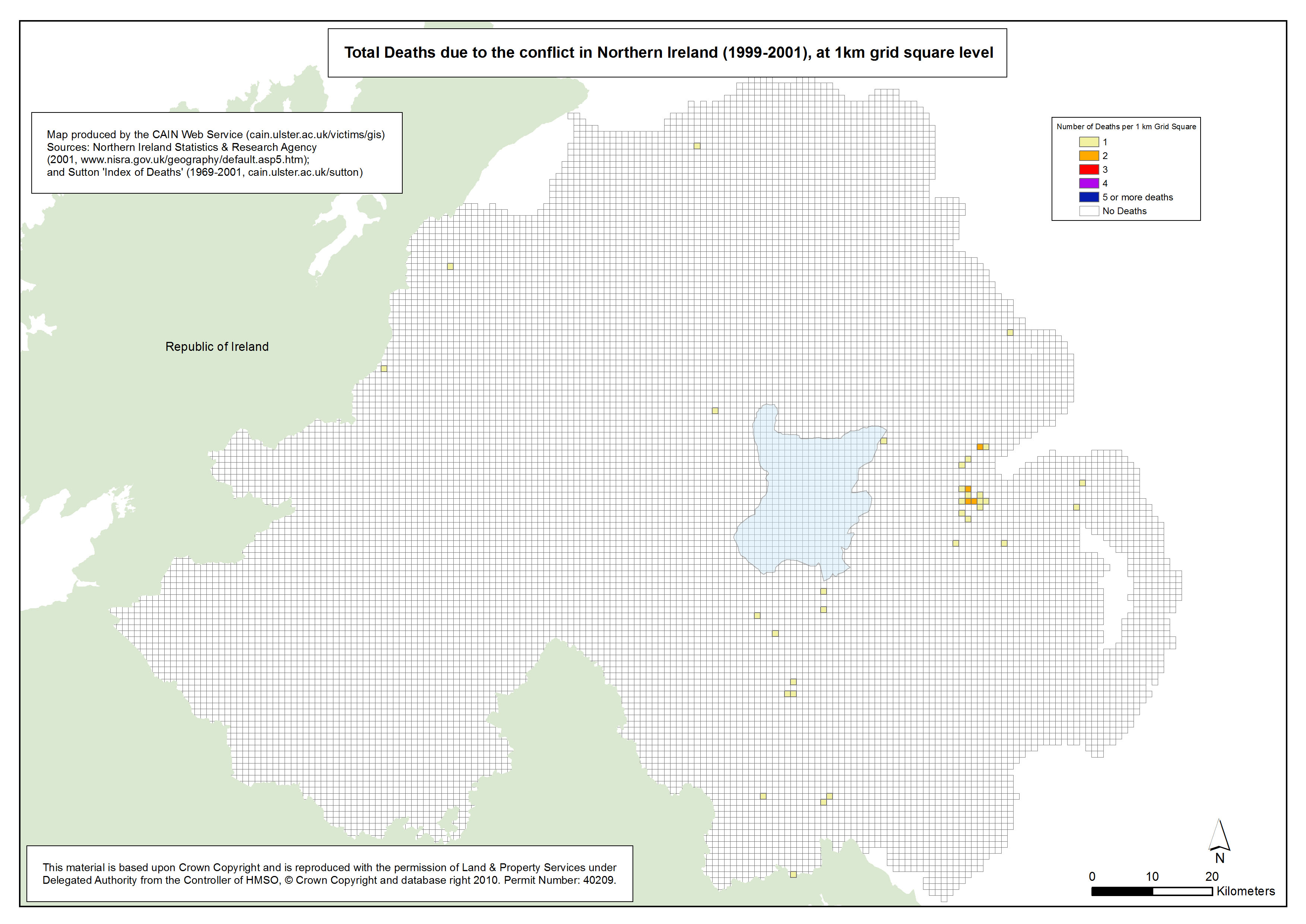
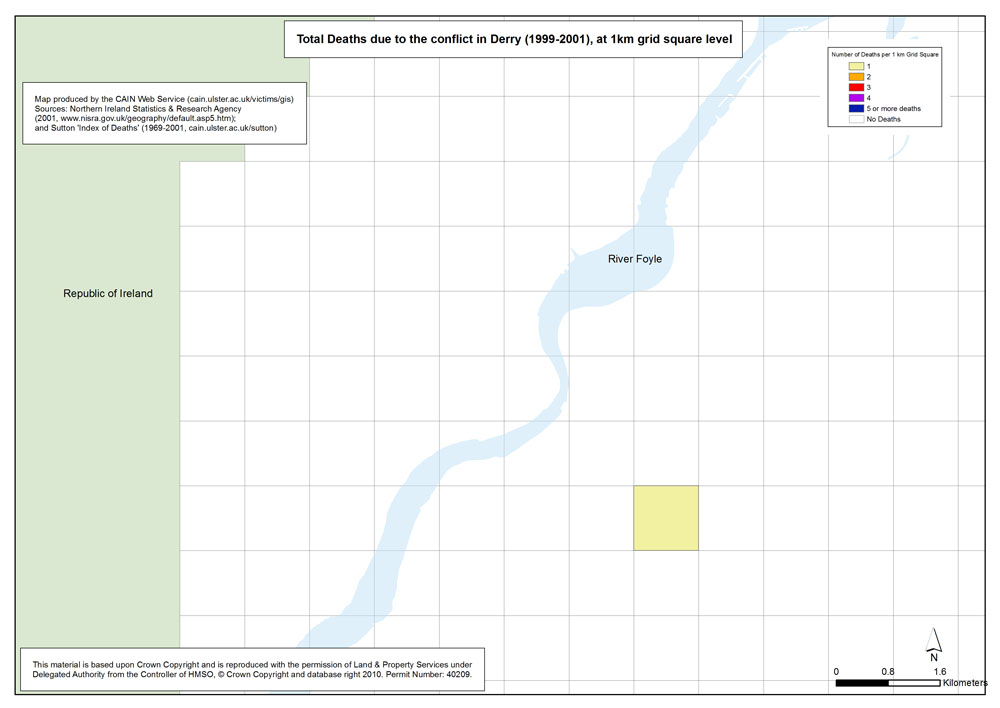
Deaths - NI - 1999-2001 - 1km Grid Square
Total Deaths due to the conflict in Northern Ireland (1999-2001), at 1km grid square level |
.pdf
809kb |
.jpg
150kb |
.jpg
1408kb |
| Belfast |
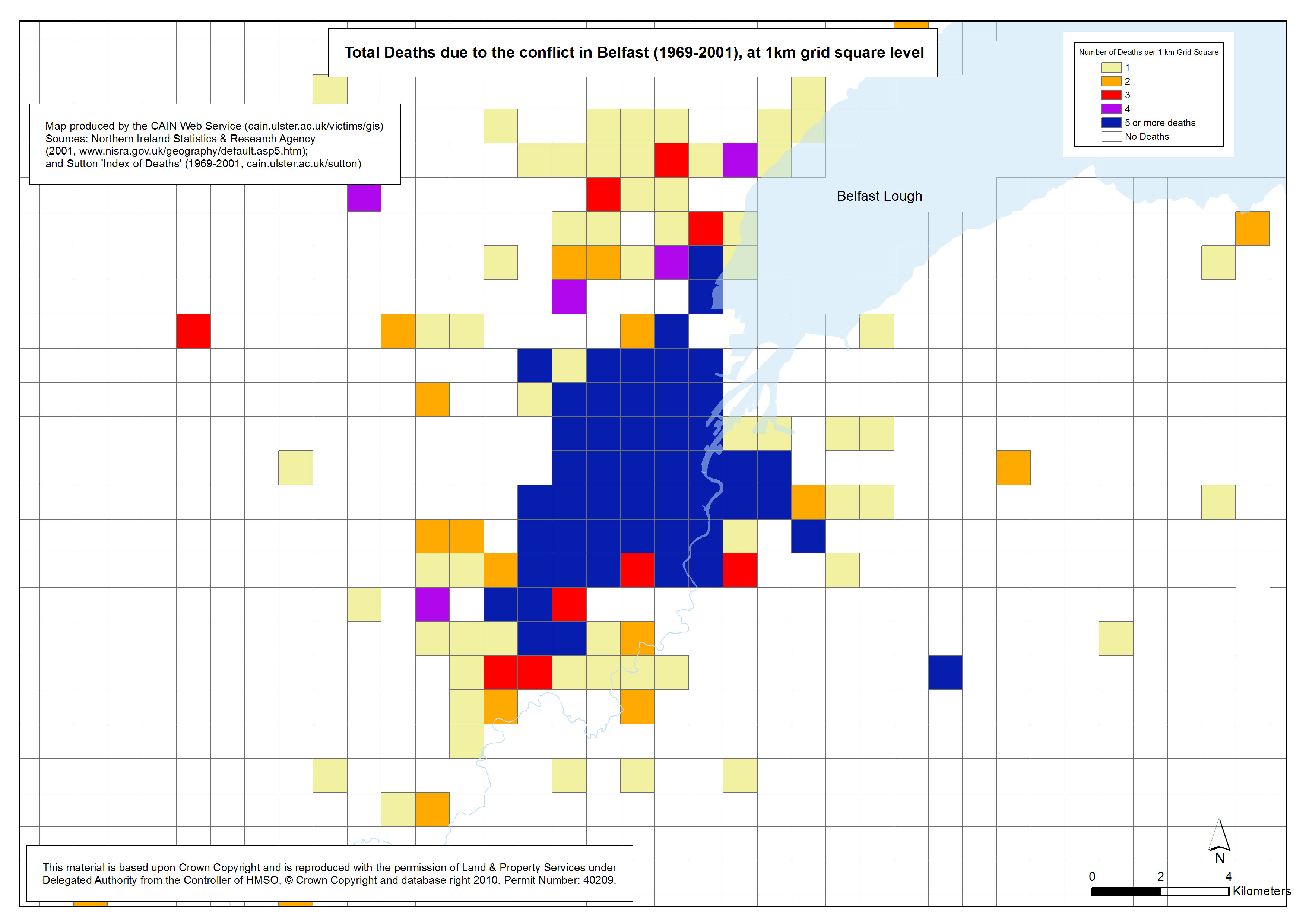
Deaths - Belfast - 1969-2001 - 1km Grid Square
Total Deaths due to the conflict in Belfast (1969-2001), at 1km grid square level |
.pdf
476kb |
.jpg
143kb |
.jpg
847kb |
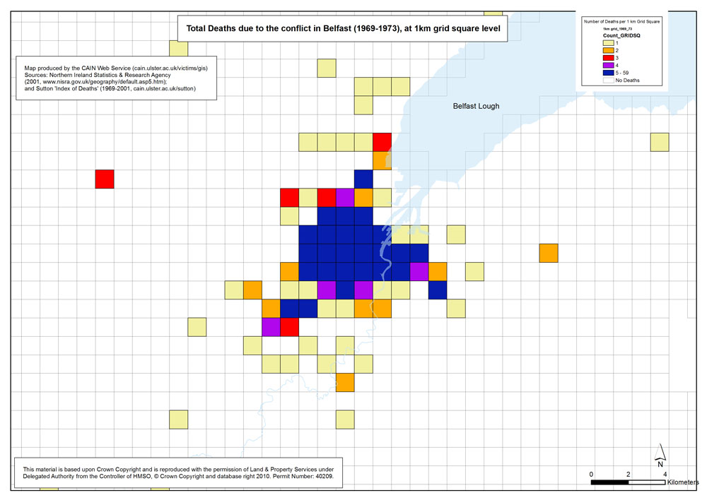
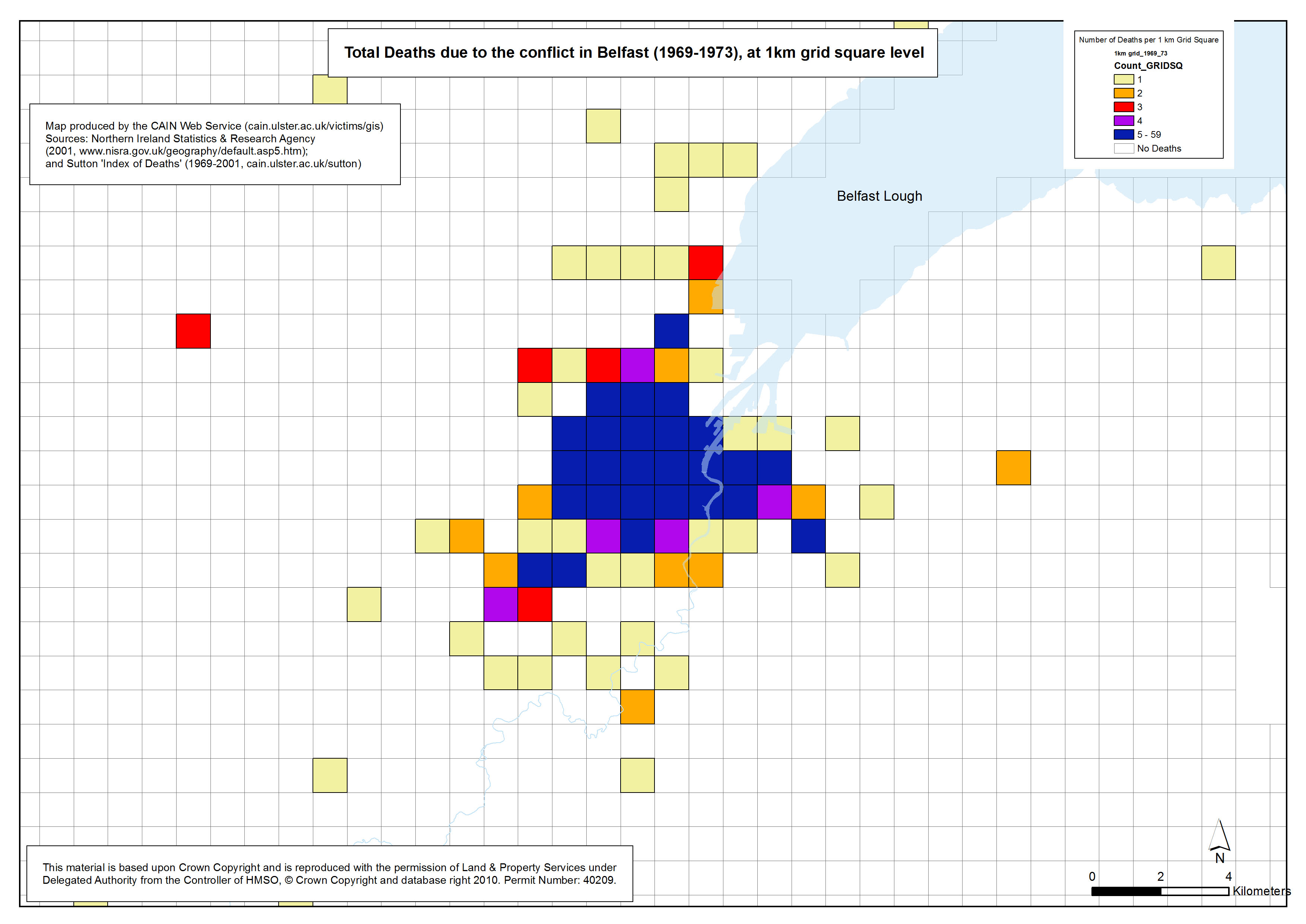
Deaths - Belfast - 1969-1973 - 1km Grid Square
Total Deaths due to the conflict in Belfast (1969-1973), at 1km grid square level |
.pdf
475kb |
.jpg
137kb |
.jpg
828kb |
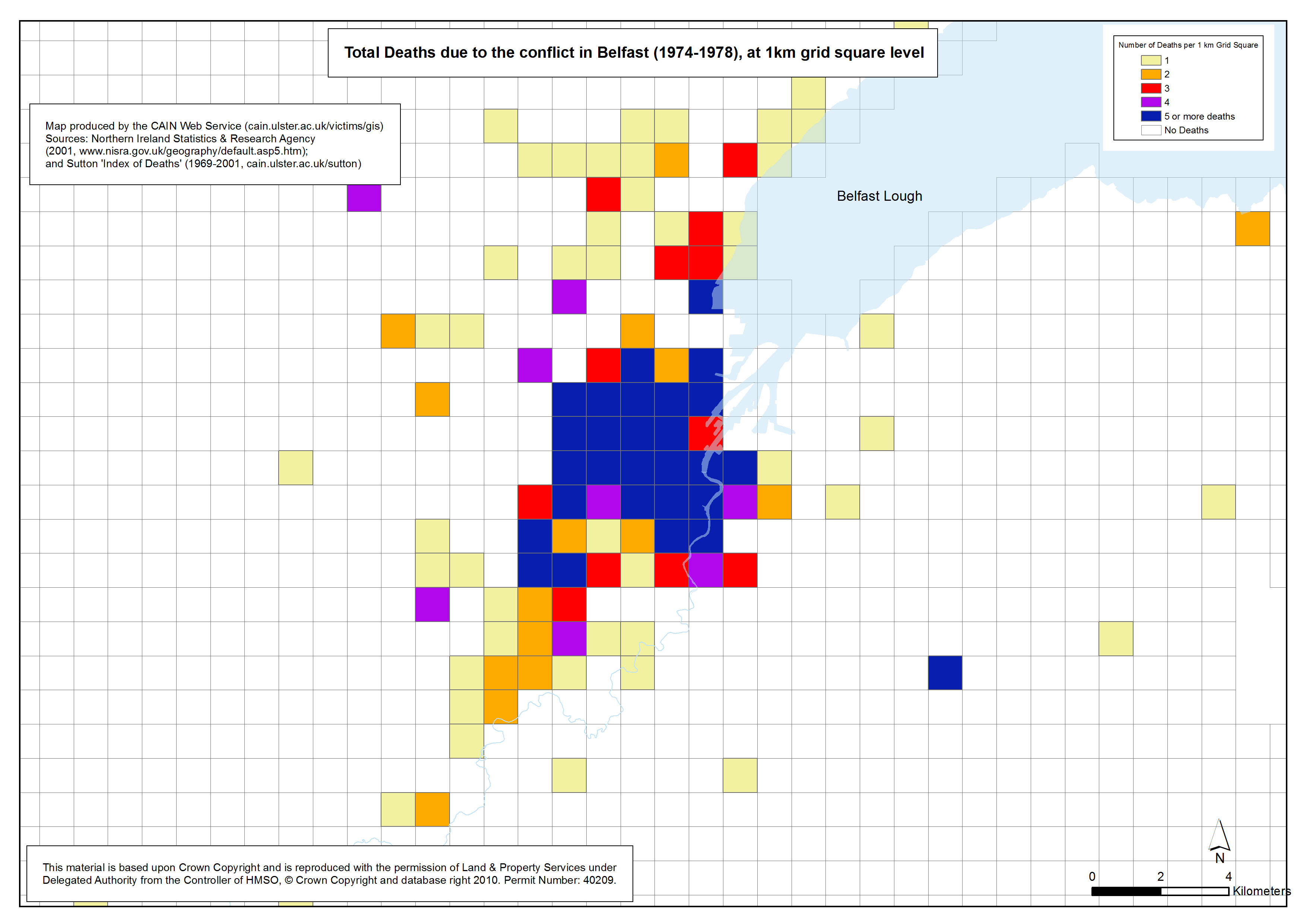
Deaths - Belfast - 1974-1978 - 1km Grid Square
Total Deaths due to the conflict in Belfast (1974-1978), at 1km grid square level |
.pdf
474kb |
.jpg
140kb |
.jpg
837kb |
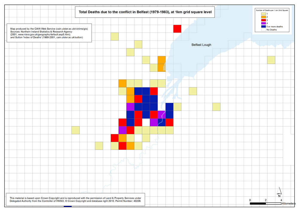
Deaths - Belfast - 1979-1983 - 1km Grid Square
Total Deaths due to the conflict in Belfast (1979-1983), at 1km grid square level |
.pdf
467kb |
.jpg
132kb |
.jpg
811kb |
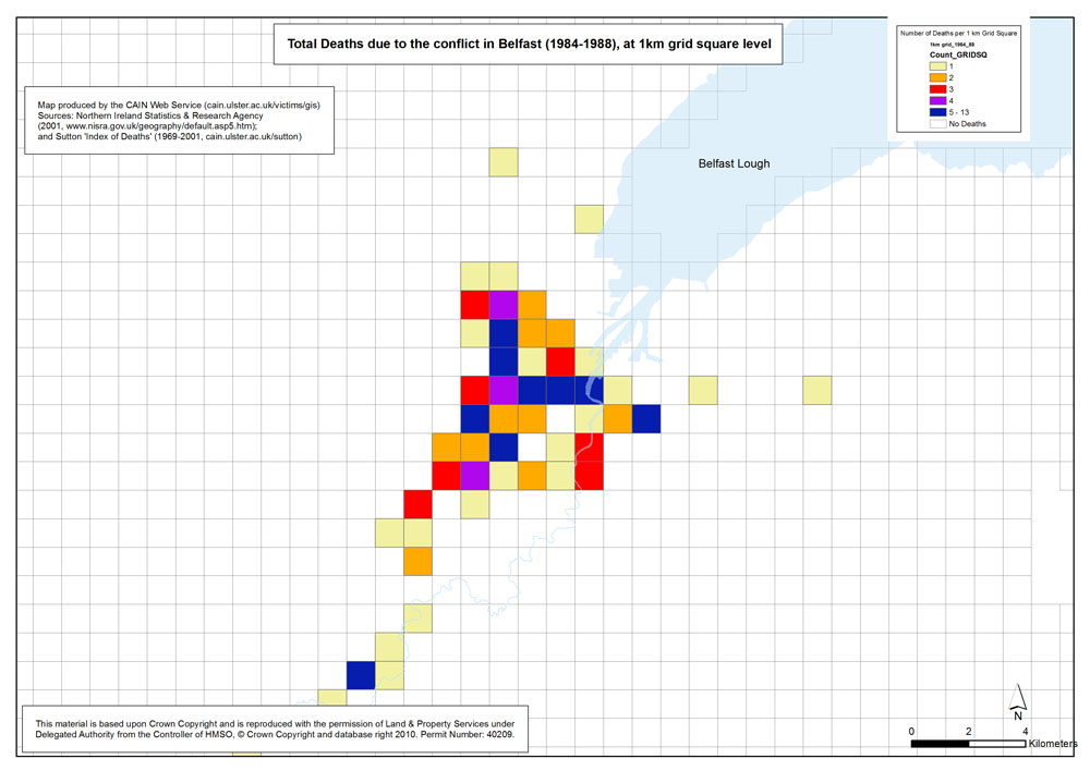
Deaths - Belfast - 1984-1988 - 1km Grid Square
Total Deaths due to the conflict in Belfast (1984-1988), at 1km grid square level |
.pdf
466kb |
.jpg
131kb |
.jpg
810kb |
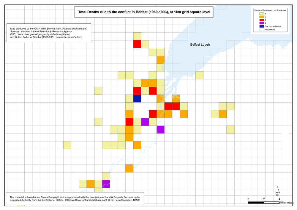
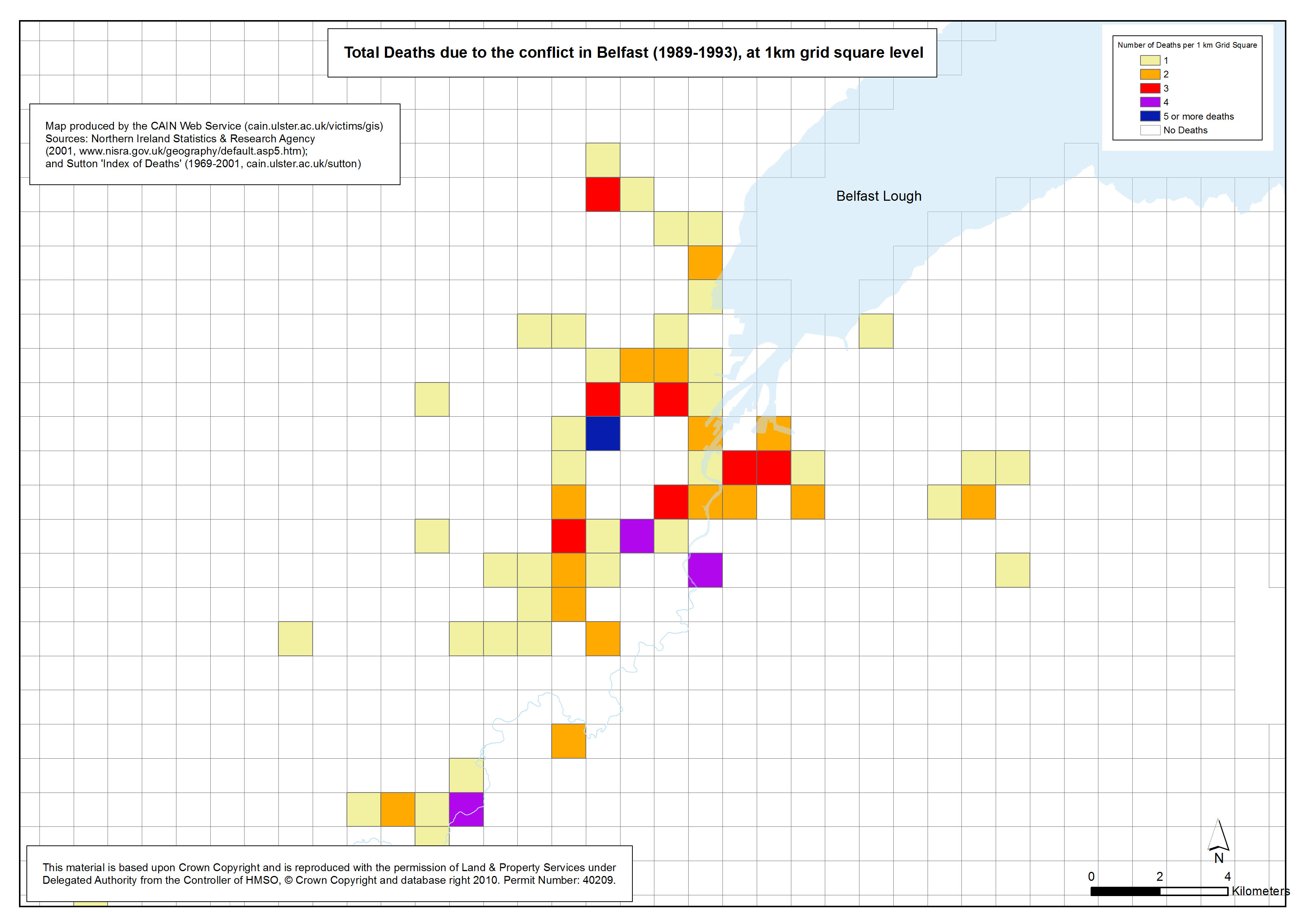
Deaths - Belfast - 1989-1993 - 1km Grid Square
Total Deaths due to the conflict in Belfast (1989-1993), at 1km grid square level |
.pdf
470kb |
.jpg
133kb |
.jpg
818kb |
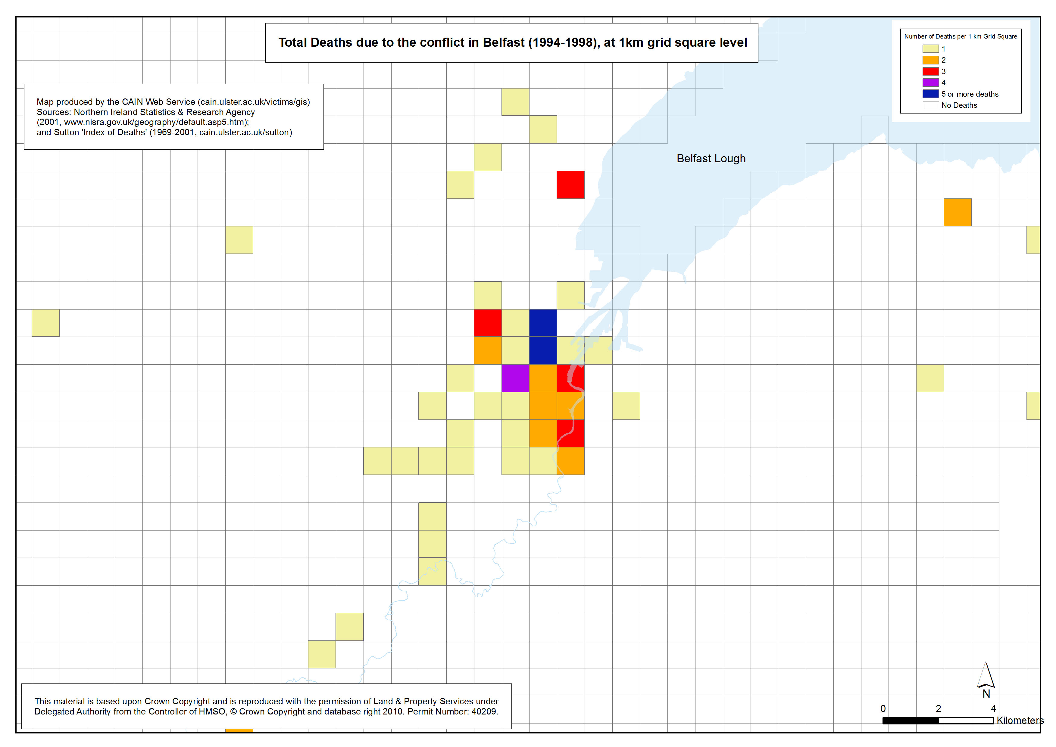
Deaths - Belfast - 1994-1998 - 1km Grid Square
Total Deaths due to the conflict in Belfast (1994-1998), at 1km grid square level |
.pdf
466kb |
.jpg
129kb |
.jpg
806kb |
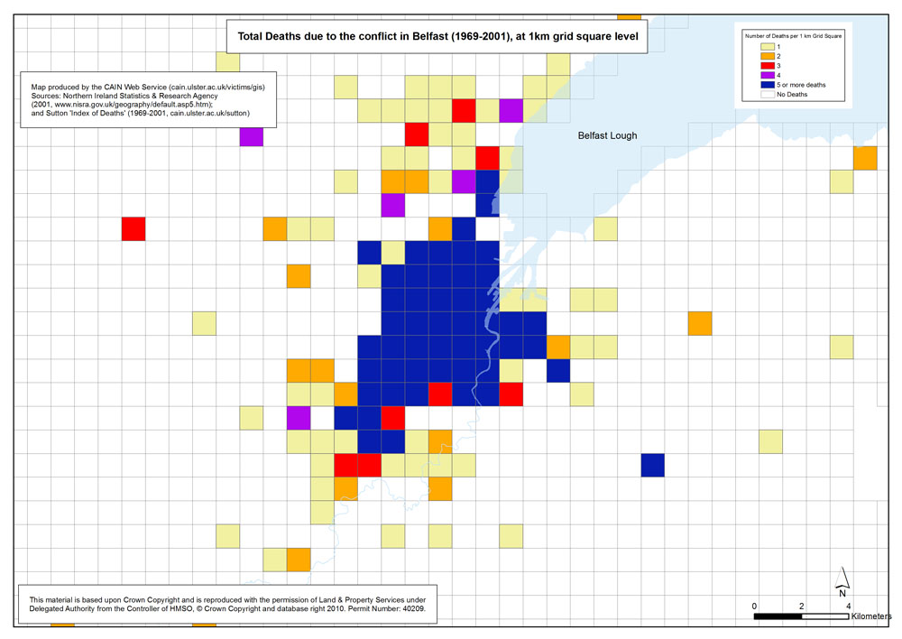
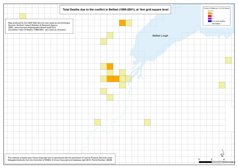
Deaths - Belfast - 1999-2001 - 1km Grid Square
Total Deaths due to the conflict in Belfast (1999-2001), at 1km grid square level |
.pdf
462kb |
.jpg
125kb |
.jpg
793kb |
| Derry |
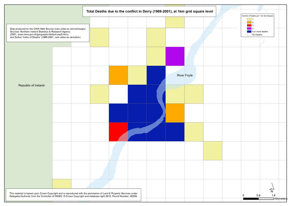
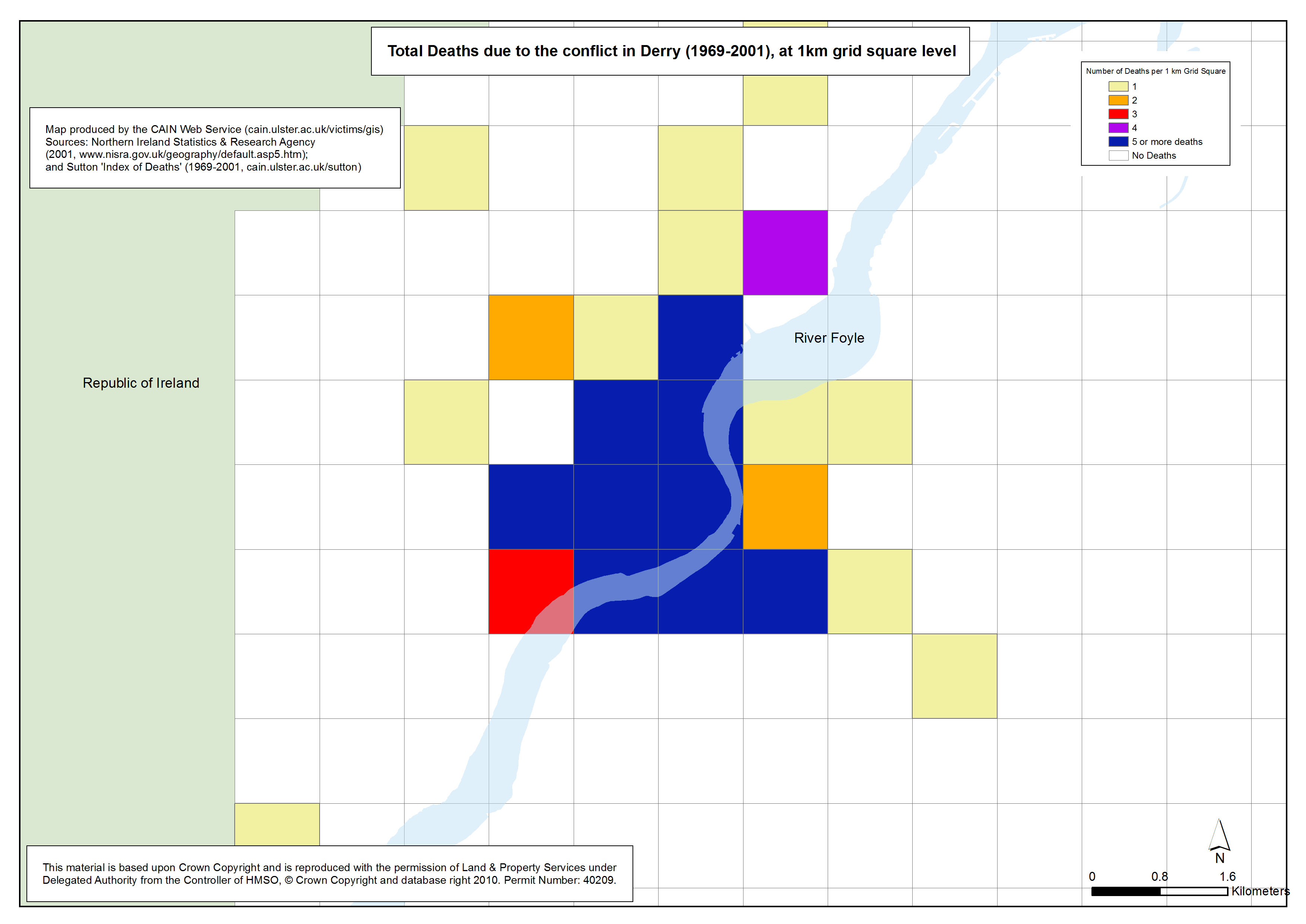
Deaths - Derry - 1969-2001 - 1km Grid Square
Total Deaths due to the conflict in Derry (1969-2001), at 1km grid square level |
.pdf
352kb |
.jpg
104kb |
.jpg
652kb |
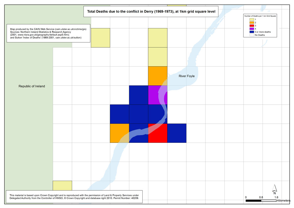
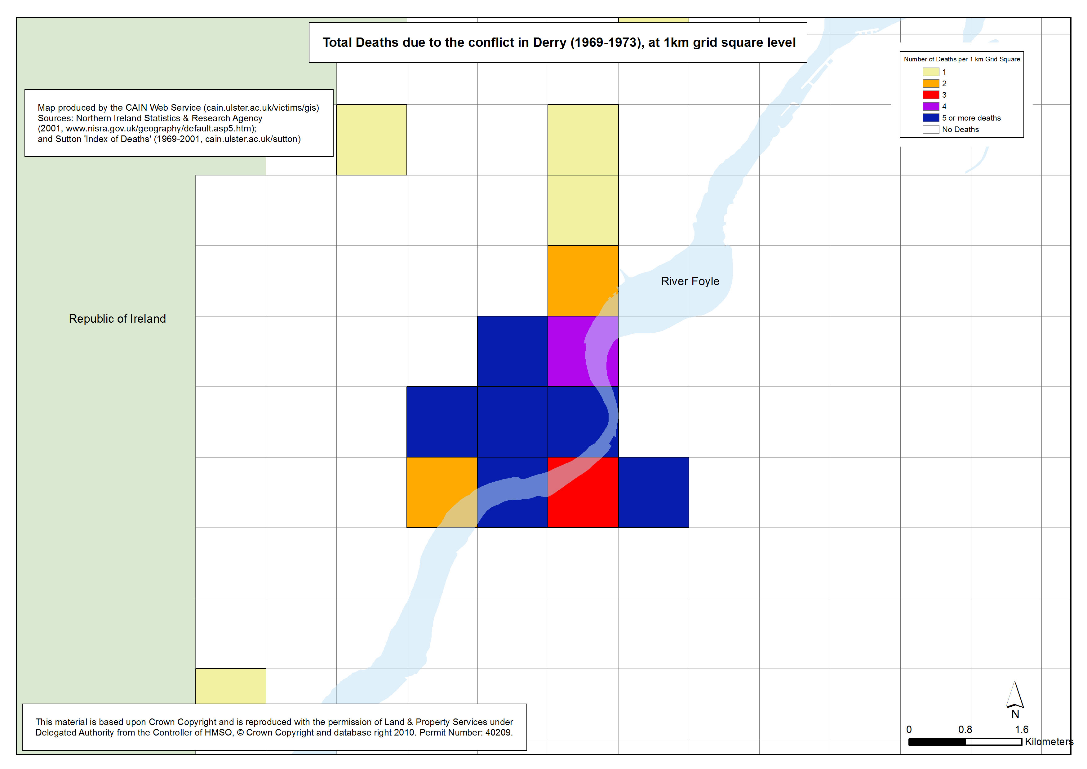
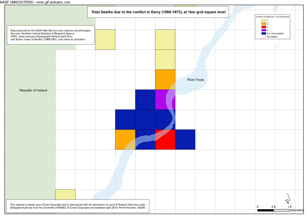
Deaths - Derry - 1969-1973 - 1km Grid Square
Total Deaths due to the conflict in Derry (1969-1973), at 1km grid square level |
.pdf
351kb |
.jpg
101kb |
.jpg
644kb |
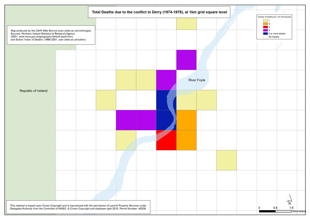
Deaths - Derry - 1974-1978 - 1km Grid Square
Total Deaths due to the conflict in Derry (1974-1978), at 1km grid square level |
.pdf
349kb |
.jpg
101kb |
.jpg
644kb |
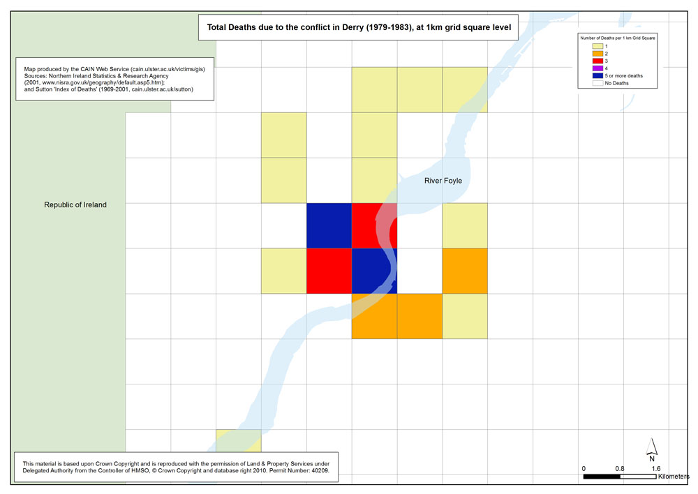
Deaths - Derry - 1979-1983 - 1km Grid Square
Total Deaths due to the conflict in Derry (1979-1983), at 1km grid square level |
.pdf
348kb |
.jpg
100kb |
.jpg
642kb |
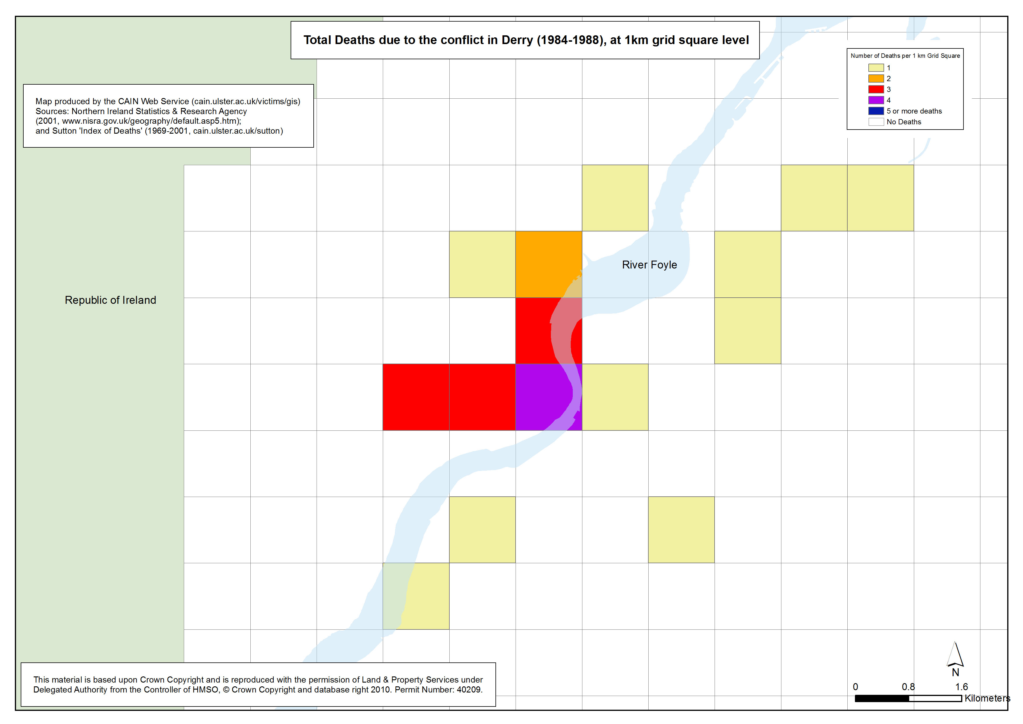
Deaths - Derry - 1984-1988 - 1km Grid Square
Total Deaths due to the conflict in Derry (1984-1988), at 1km grid square level |
.pdf
349kb |
.jpg
100kb |
.jpg
641kb |
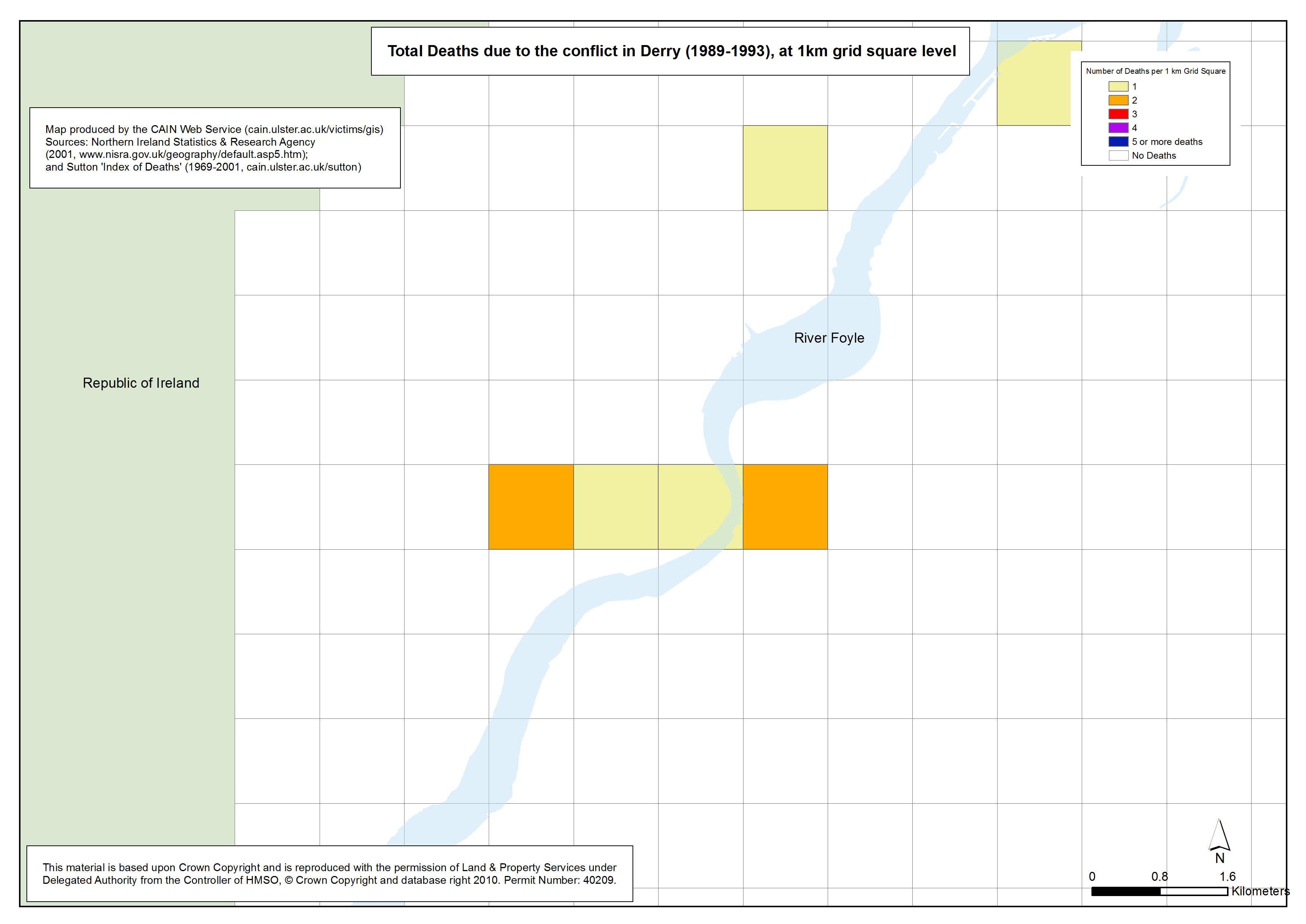
Deaths - Derry - 1989-1993 - 1km Grid Square
Total Deaths due to the conflict in Derry (1989-1993), at 1km grid square level |
.pdf
344kb |
.jpg
96kb |
.jpg
627kb |
Deaths - Derry - 1994-1998 - 1km Grid Square
Total Deaths due to the conflict in Derry (1994-1998), at 1km grid square level |
.pdf
342kb |
.jpg
94kb |
.jpg
622kb |
Deaths - Derry - 1999-2001 - 1km Grid Square
Total Deaths due to the conflict in Derry (1999-2001), at 1km grid square level |
.pdf
342kb |
.jpg
94kb |
.jpg
620kb |
| Animations - Deaths, by area (Northern Ireland, Belfast, Derry), by 5 year groups, at 1km grid square level (3 animations based on 21 maps) |
| Title of Animation |
File Version |
| GIF |
|
|
Animation - Deaths - NI - 1969-2001 - 1km Grid Square
Animated Gif of the above maps showing Total Deaths due to the conflict in Northern Ireland (1969-2001), at 1km grid square level |
.gif
1392kb |
|
|
Animation - Deaths - Belfast - 1969-2001 - 1km Grid Square
Animated Gif of the above maps showing Total Deaths due to the conflict in Belfast (1969-2001), at 1km grid square level |
.gif
926kb |
|
|
Animation - Deaths - Derry - 1969-2001 - 1km Grid Square
Animated Gif of the above maps showing Total Deaths due to the conflict in Derry (1969-2001), at 1km grid square level |
.gif
604kb |
|
|
| Maps - Distribution of Catholic population (3 maps) |
| Title of Map |
File Version |
| PDF |
L-JPG |
H-JPG |
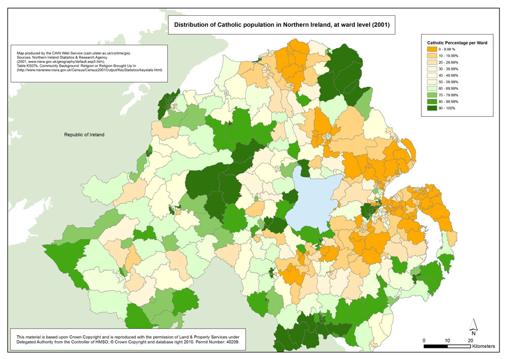
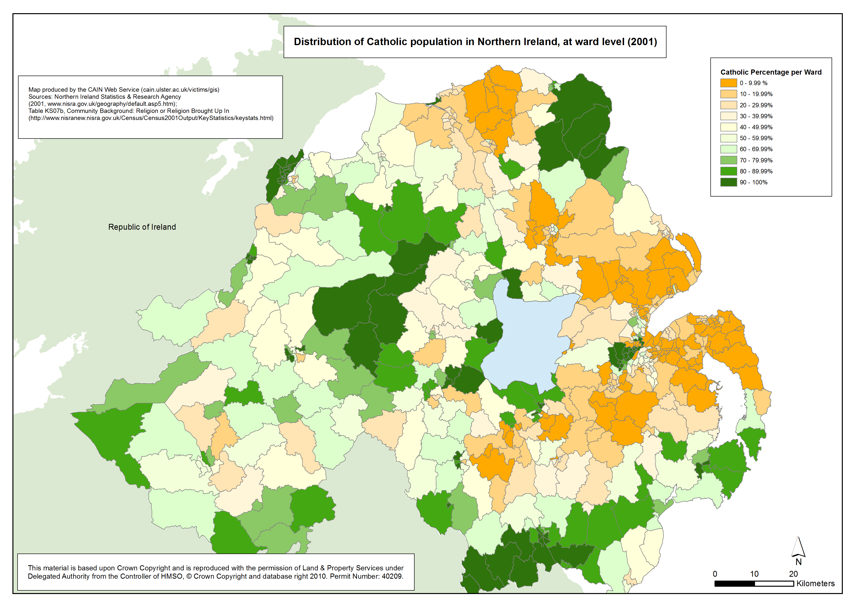
Catholics - Northern Ireland - Ward
Map showing distribution of Catholic population in Northern Ireland, at ward level (2001) |
.pdf
513kb |
.jpg
170kb |
.jpg
2572kb |
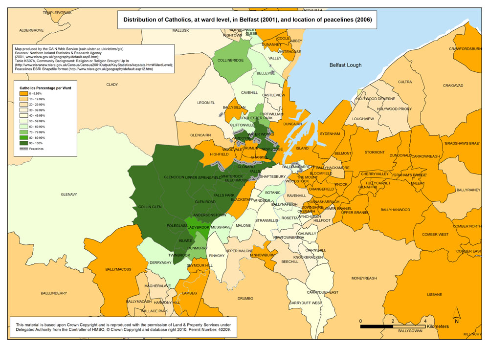
Catholics - Belfast - Ward
Map showing distribution of Catholic population in Belfast, at ward level (2001), and location of peacelines (2006) |
.pdf
633kb |
.jpg
196kb |
.jpg
1165kb |
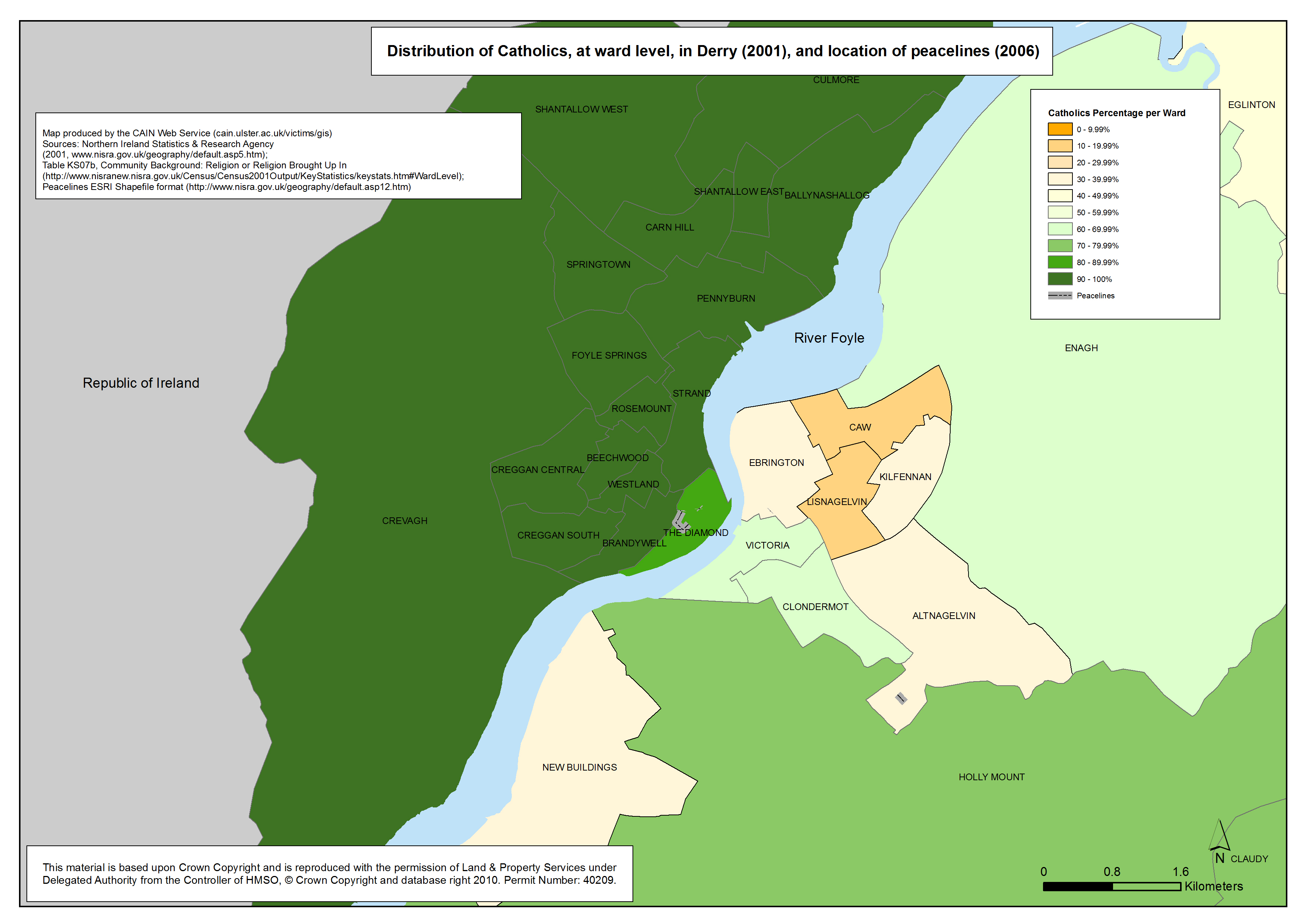
Catholics - Derry - Ward
Map showing distribution of Catholic population in Derry, at ward level (2001), and location of peacelines (2006) |
.pdf
382kb |
.jpg
104kb |
.jpg
1429kb |
| Text Maps - Deaths indicated by names (3 maps) |
| Title of Map |
File Version |
| PDF |
L-JPG |
H-JPG |
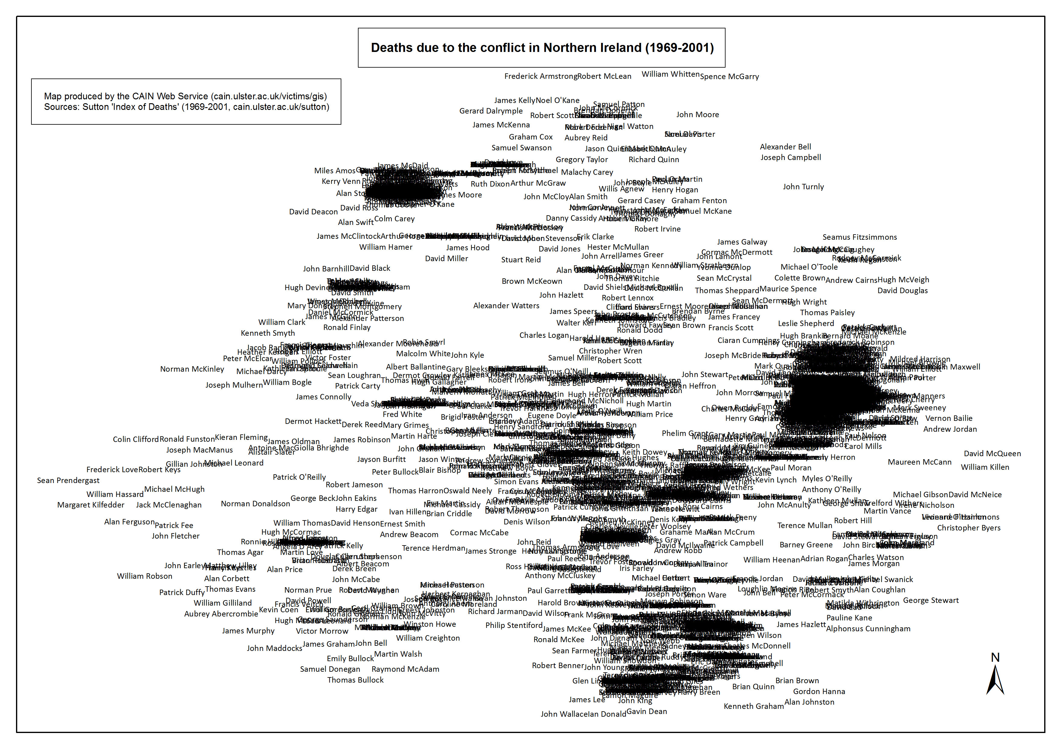
Text Map - Names - Northern Ireland
Text Map showing names of those killed (overlaid) as a result of the conflict in Northern Ireland (1969-2001) |
.pdf
941kb |
.jpg
195kb |
.jpg
1936kb |
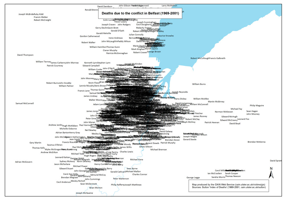
Text Map - Names - Belfast area
Text Map showing names of those killed (overlaid) as a result of the conflict in Belfast (1969-2001) |
.pdf
736kb |
.jpg
151kb |
.jpg
1477kb |
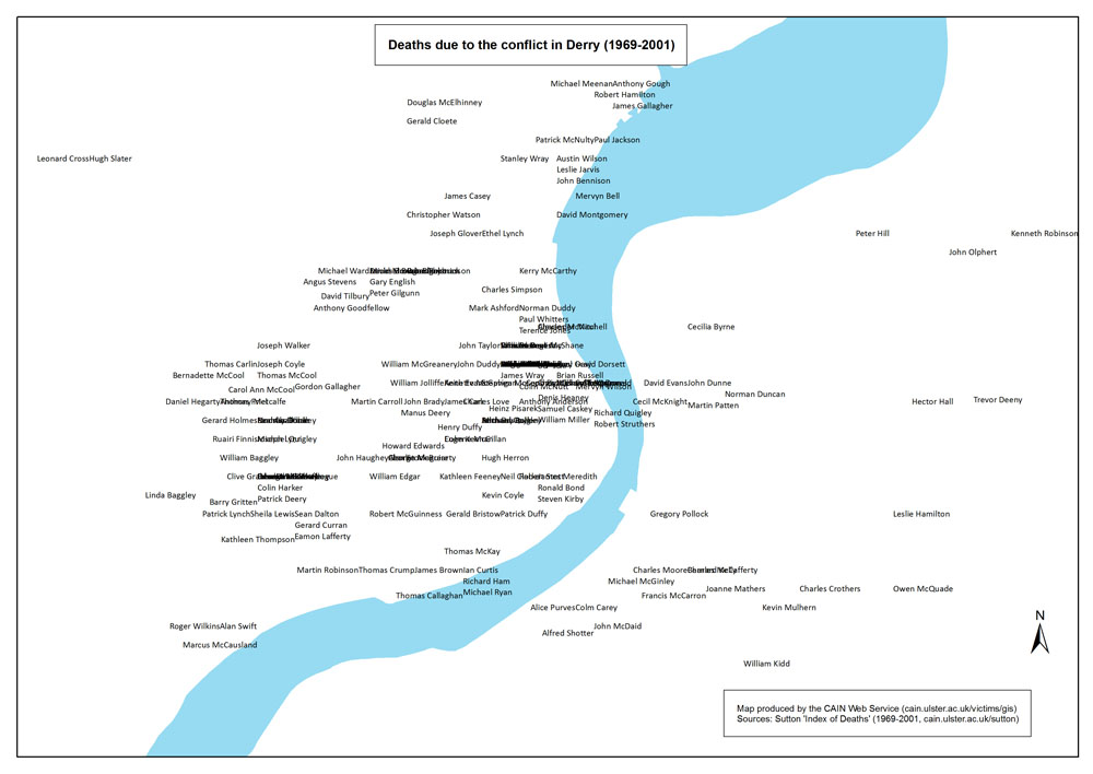
Text Map - Names - Derry area
Text Map showing names of those killed (overlaid) as a result of the conflict in Derry (1969-2001) |
.pdf
393kb |
.jpg
92kb |
.jpg
613kb |
| Animation of Text Map - Deaths indicated by names (1 animation based on 21 text maps) |
| Title of Animation |
File Version |
| GIF |
|
|
Animation - Text Map - Names - Northern Ireland
Animated GIF of Text Map showing names of those killed (overlaid) as a result of the conflict in Northern Ireland (1969-2001) |
.gif
4415kb |
|
|
| Spatial Intensity Maps - Death locations (1969-2001), by area (Belfast, Derry) and Northern Ireland Multiple Deprivation Measure score (2005), at ward level (2 maps) |
| Title of Map |
File Version |
| PDF |
L-JPG |
H-JPG |
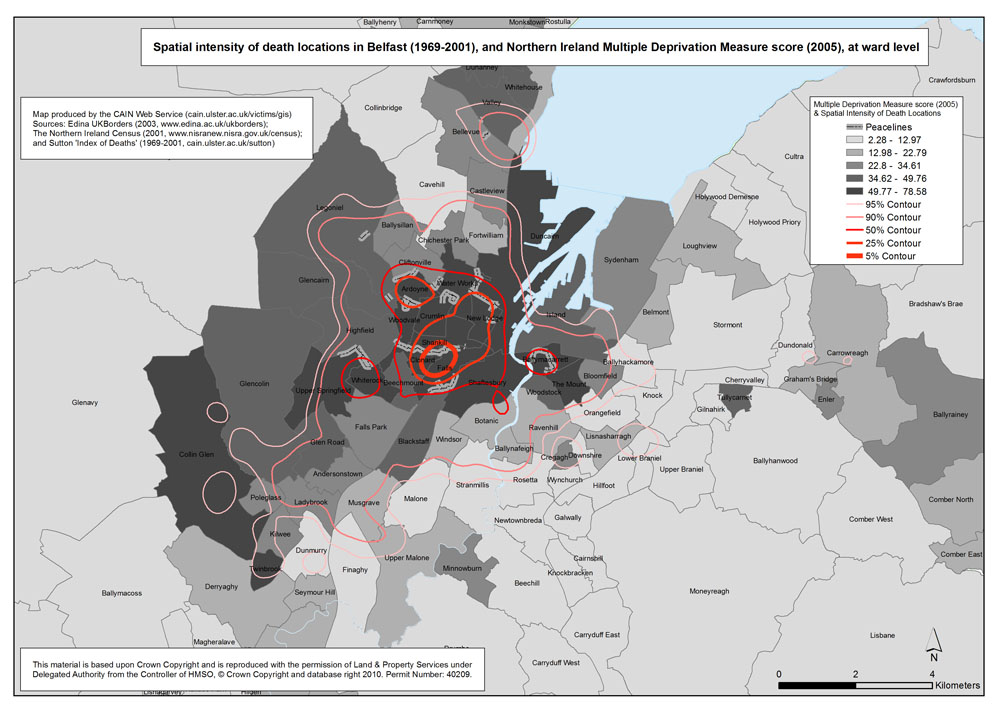
Spatial Intensity Map - Belfast - Ward - MDM
Spatial intensity of death locations in Belfast (1969-2001), and Northern Ireland Multiple Deprivation Measure score 92005), at ward level |
.pdf
514kb |
.jpg
158kb |
.jpg
961kb |
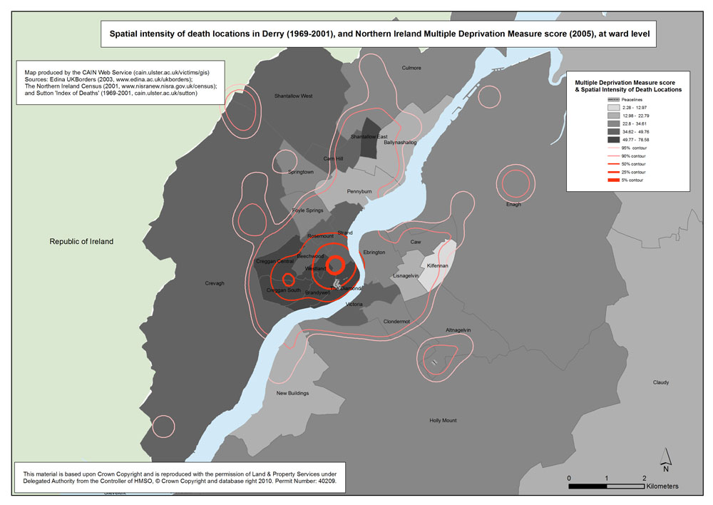
Spatial Intensity Map - Derry - Ward - MDM
Spatial intensity of death locations in Derry (1969-2001), and Northern Ireland Multiple Deprivation Measure score 92005), at ward level |
.pdf
395kb |
.jpg
114kb |
.jpg
665kb |
| Bar Chart Maps - Deaths (1969-2001), by area (Belfast, Derry), by status, at ward level (2 maps) |
| Title of Map |
File Version |
| PDF |
L-JPG |
H-JPG |
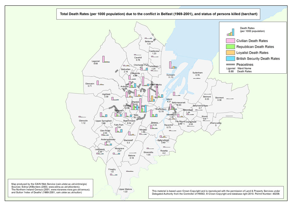
Bar Chart Map - Belfast
Total Death Rates (per 1000 population) due to the conflict in Belfast (1969-2001), by status, at ward level (Bar Chart) |
.pdf
467kb |
.jpg
126kb |
.jpg
791kb |
Bar Chart Map - Derry
Total Death Rates (per 1000 population) due to the conflict in Belfast (1969-2001), by status, at ward level (Bar Chart) |
.pdf
431kb |
.jpg
115kb |
.jpg
712kb |
| Pie Chart Maps - Deaths (1969-2001), by area (Belfast, Derry), by status, at ward level (2 maps) |
| Title of Map |
File Version |
| PDF |
L-JPG |
H-JPG |
Pie Chart Map - Belfast
Total Death Rates (per 1000 population) due to the conflict in Belfast (1969-2001), by status, at ward level (Pie Chart) |
.pdf
480kb |
.jpg
136kb |
.jpg
830kb |
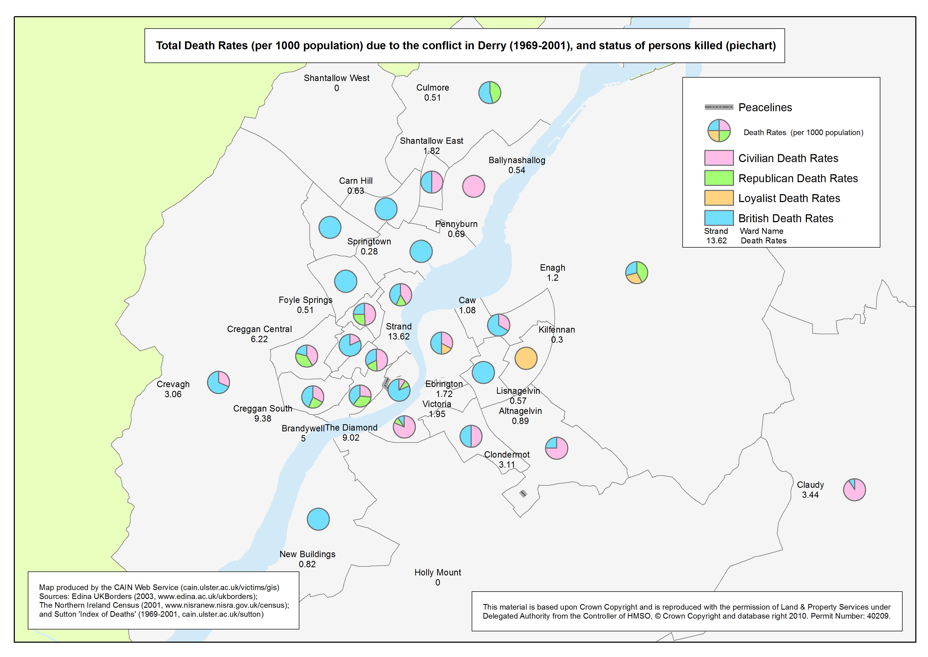
Pie Chart Map - Derry
Total Death Rates (per 1000 population) due to the conflict in Belfast (1969-2001), by status, at ward level (Pie Chart) |
.pdf
437kb |
.jpg
121kb |
.jpg
731kb |
| Stacked Bar Chart Maps - Deaths (1969-2001), by area (Belfast, Derry), by status, at ward level (2 maps) |
| Title of Map |
File Version |
| PDF |
L-JPG |
H-JPG |
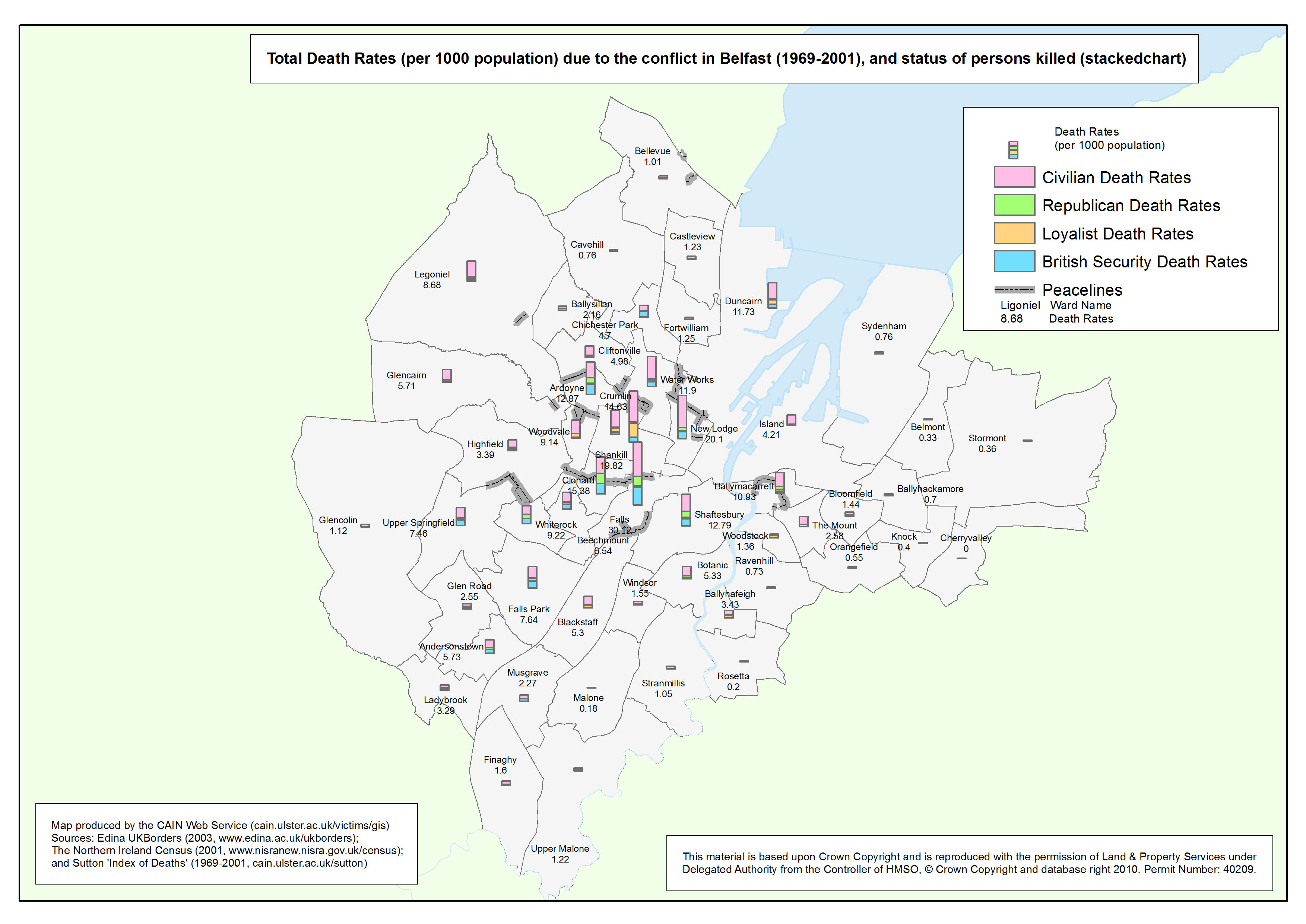
Stacked Bar Chart Map - Belfast
Total Death Rates (per 1000 population) due to the conflict in Belfast (1969-2001), by status, at ward level (Pie Chart) |
.pdf
469kb |
.jpg
124kb |
.jpg
800kb |
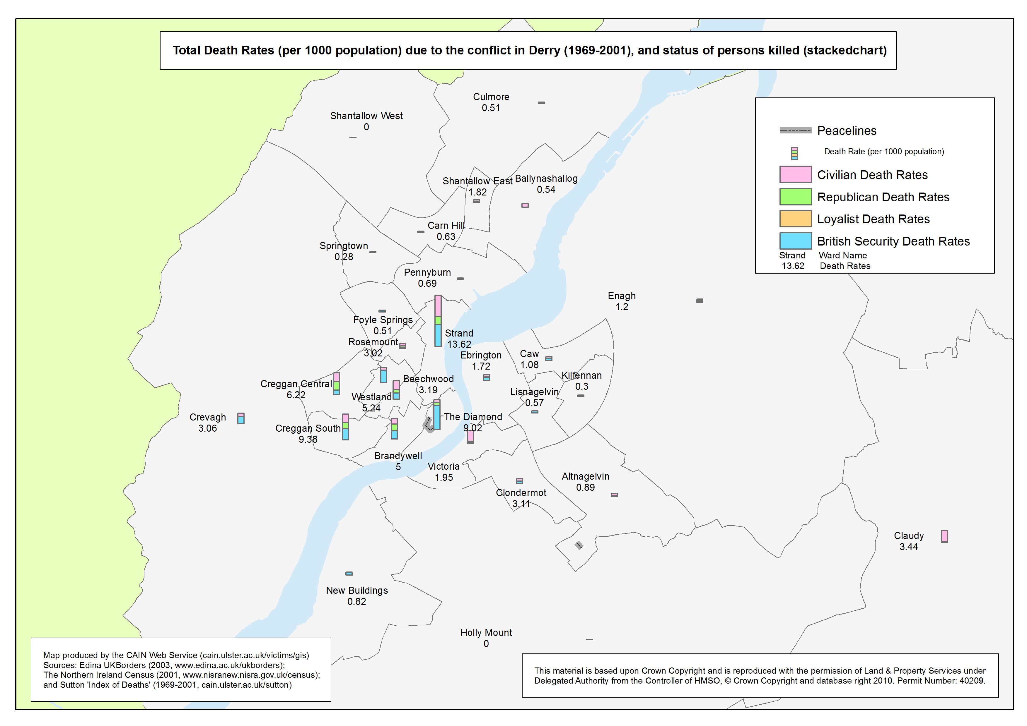
Stacked Bar Chart Map - Derry
Total Death Rates (per 1000 population) due to the conflict in Belfast (1969-2001), by status, at ward level (Pie Chart) |
.pdf
426kb |
.jpg
113kb |
.jpg
707kb |
| Maps - Female Death Rates (per 1000 population) due to the conflict (1969-2001), by area (Northern Ireland, Belfast, Derry), at ward level (3 maps) |
| Title of Map |
File Version |
| PDF
| L-JPG
| H-JPG
|
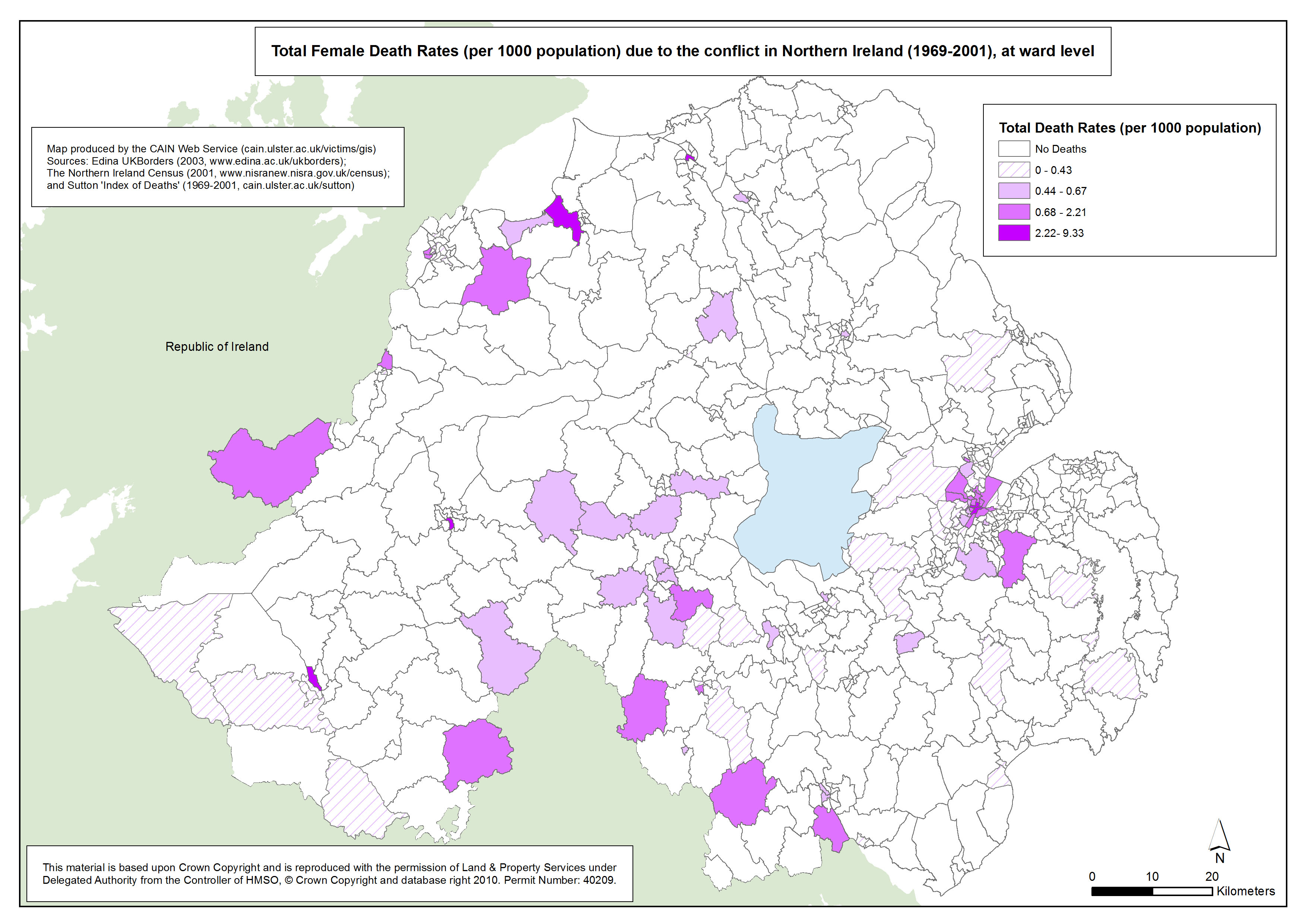
Female Death Rates - NI - Ward
Total Female Death Rates (per 1000 population) due to the conflict in Northern Ireland (1969-2001), at ward level |
.pdf
590kb |
.jpg
167kb |
.jpg
1004kb |
Female Death Rates - Belfast - Ward
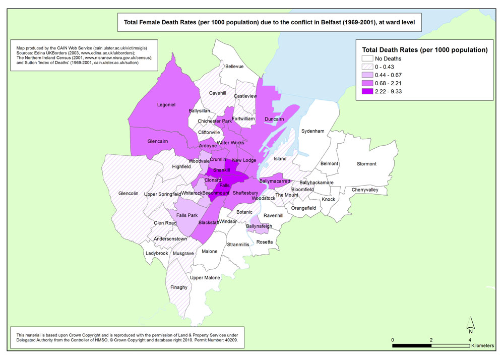
Total Female Death Rates (per 1000 population) due to the conflict in Belfast (1969-2001), at ward level |
.pdf
465kb |
.jpg
131kb |
.jpg
870kb |
Female Death Rates - Derry - Ward
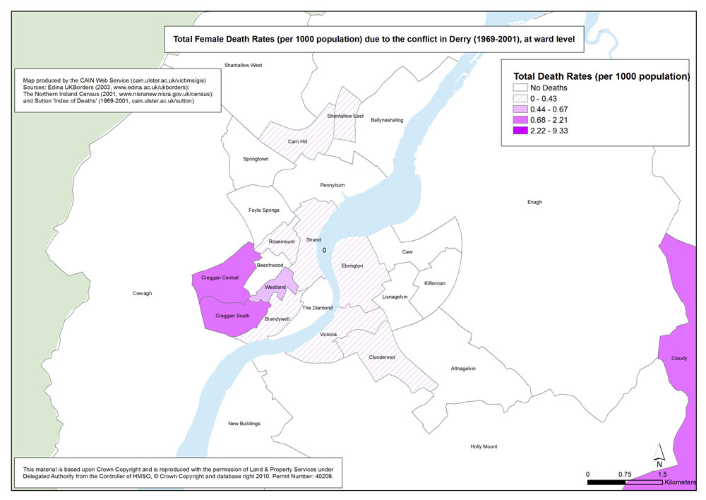
Total Female Death Rates (per 1000 population) due to the conflict in Derry (1969-2001), at ward level |
.pdf
409kb |
.jpg
111kb |
.jpg
694kb |
| Maps - Female Death Rates (per 1000 population) due to the conflict (1969-2001), by area (Belfast, Derry), and Multiple Deprivation Measure score, at ward level (2 maps) |
| Title of Map |
File Version |
| PDF |
L-JPG |
H-JPG |
Female Death Rates - Belfast - Ward - MDM
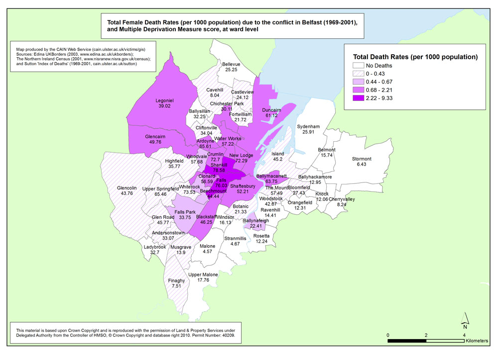
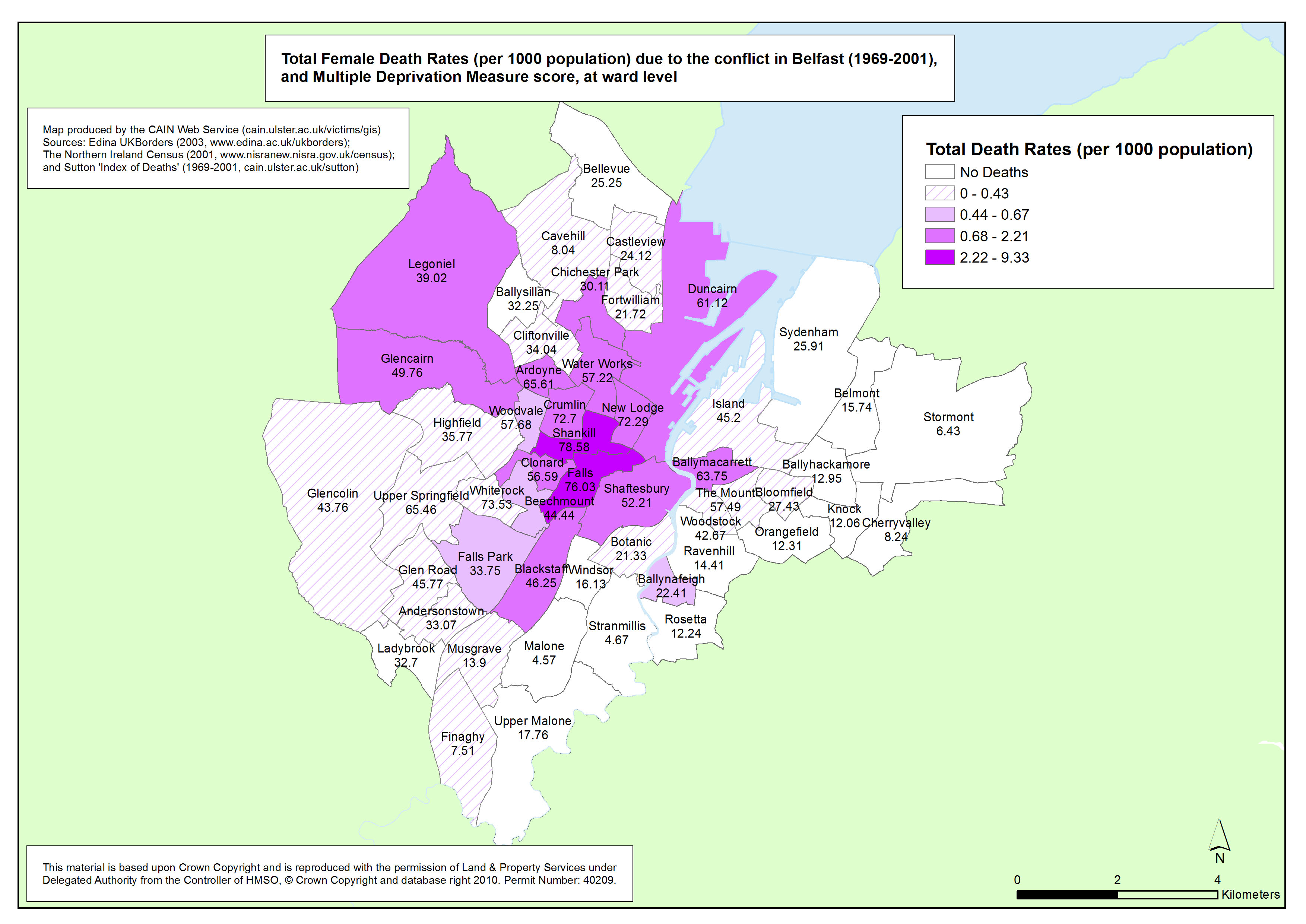
Total Female Death Rates (per 1000 population) due to the conflict in Belfast (1969-2001), and Multiple Deprivation Measure score, at ward level |
.pdf
508kb |
.jpg
142kb |
.jpg
973kb |
Female Death Rates - Derry - Ward - MDM
Total Female Death Rates (per 1000 population) due to the conflict in Derry (1969-2001), and Multiple Deprivation Measure score, at ward level |
.pdf
426kb |
.jpg
114kb |
.jpg
740kb |
| Maps - Number of people killed due to the conflict in Belfast, by year (1969-2001), at SOA (Small Output Area) (34 maps) |
| Title of Map |
File Version |
| PDF |
L-JPG |
H-JPG |
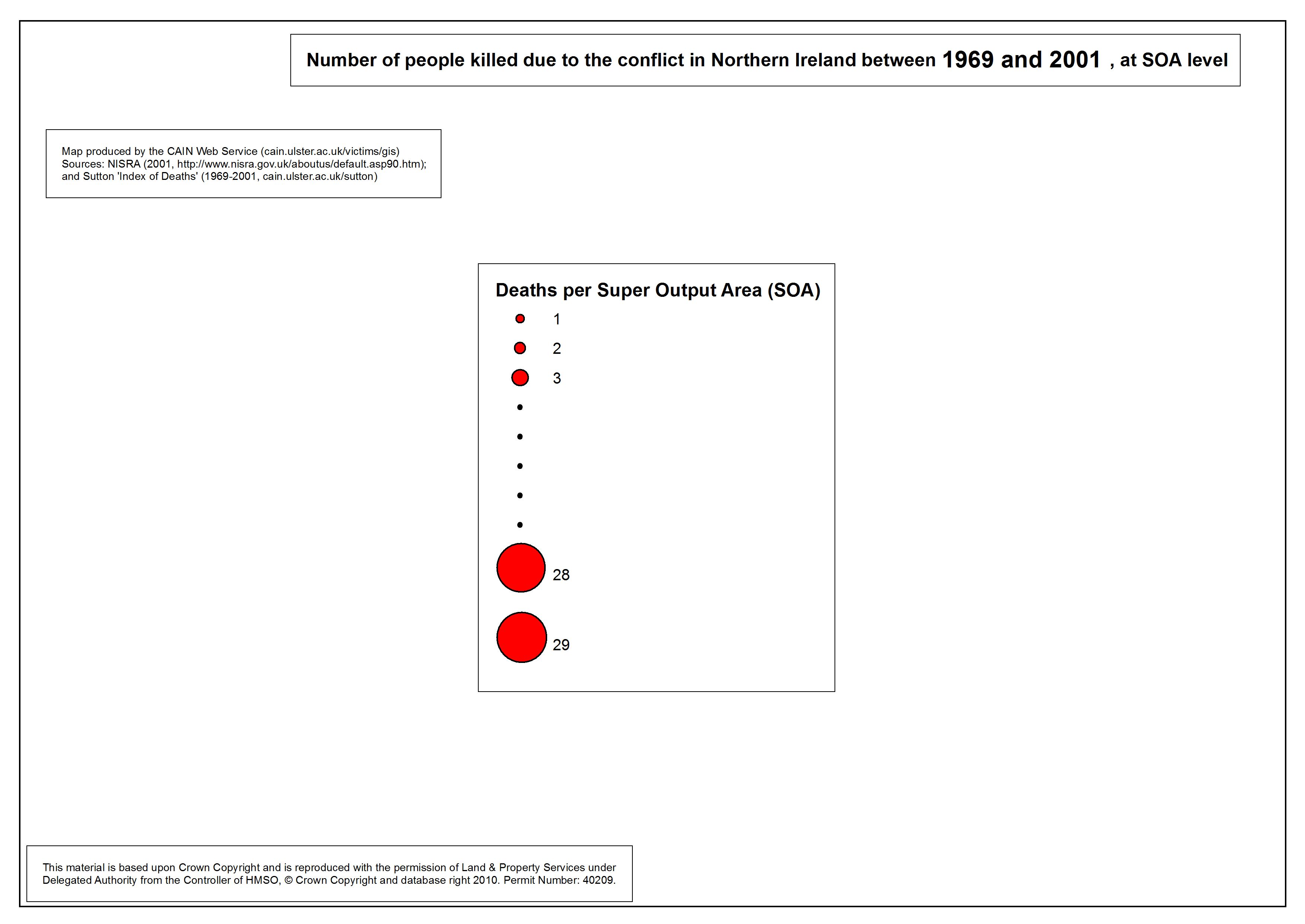
Legend
Legend for following maps |
.pdf
282kb |
.jpg
38kb |
.jpg
245kb |
Number killed - Belfast - SOA - 1969
Number of people killed due to the conflict in Belfast, 1969, at SOA |
.pdf
247kb |
.jpg
32kb |
.jpg
202kb |
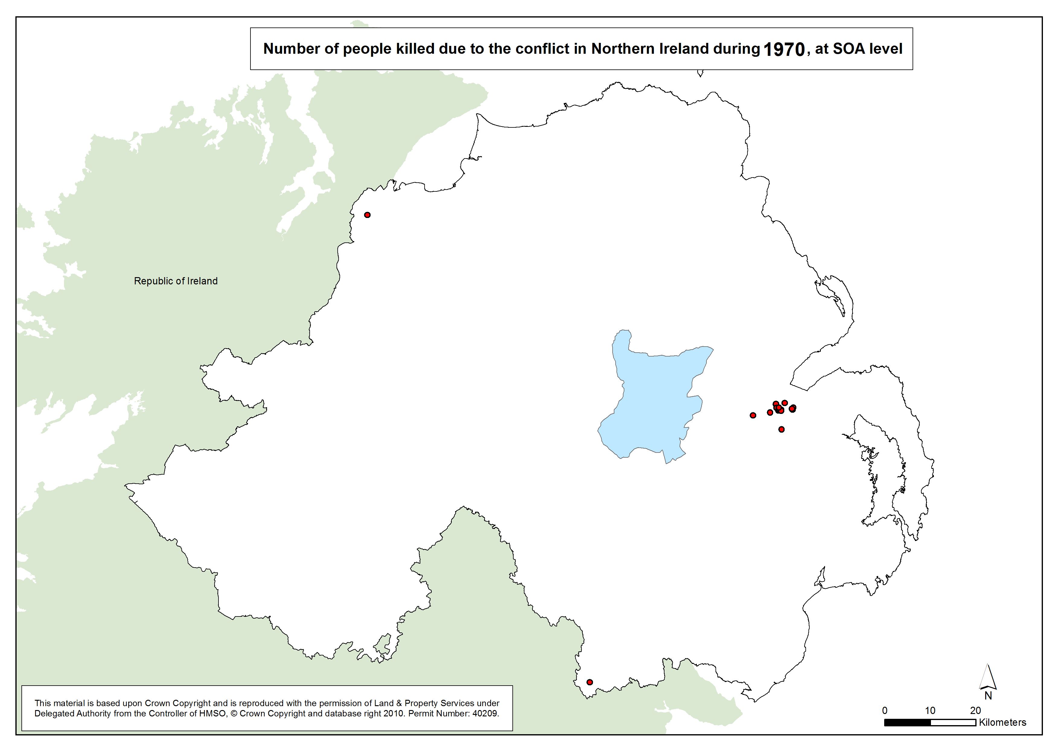
Number killed - Belfast - SOA - 1970
Number of people killed due to the conflict in Belfast, 1970, at SOA |
.pdf
248kb |
.jpg
33kb |
.jpg
204kb |
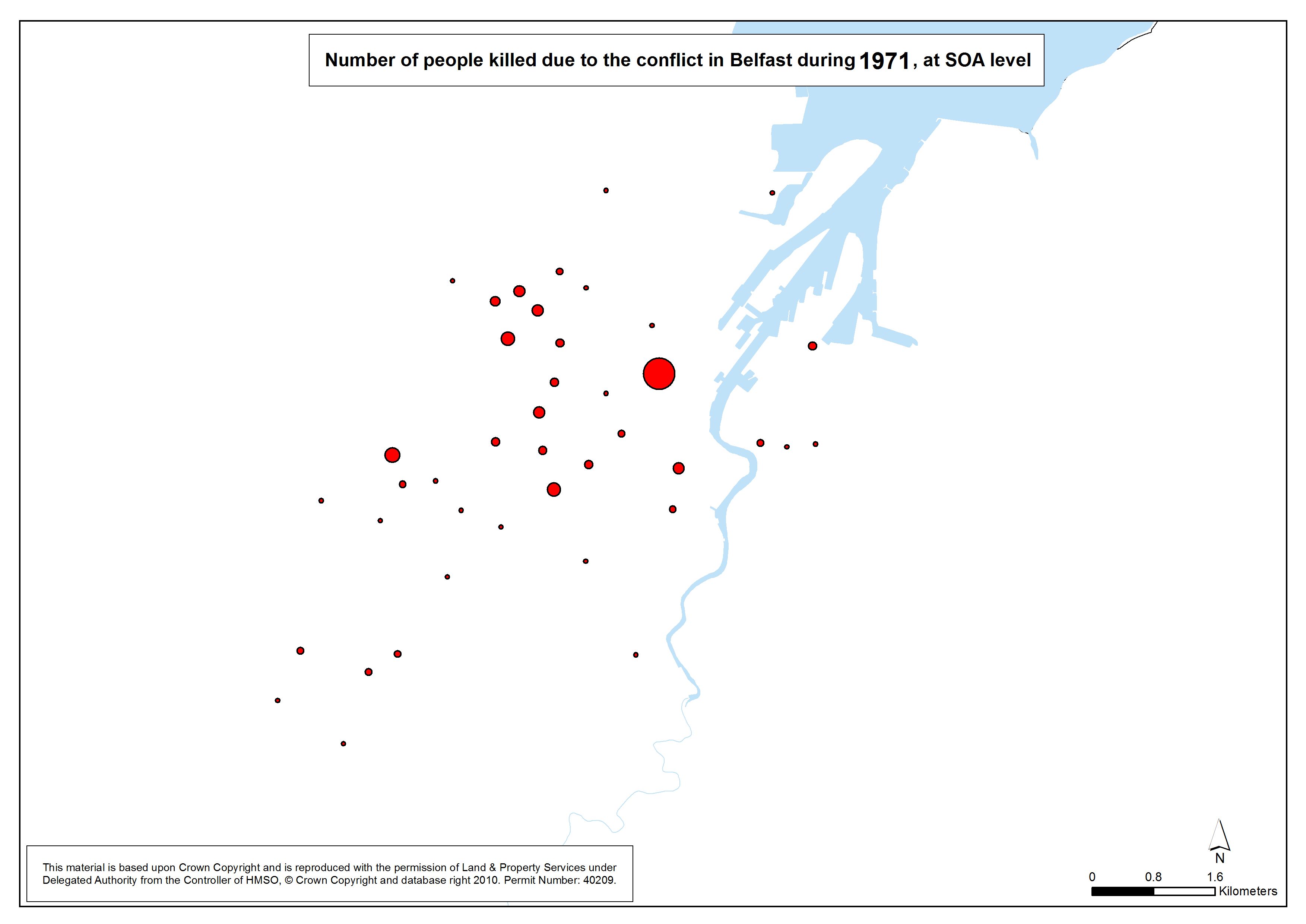
Number killed - Belfast - SOA - 1971
Number of people killed due to the conflict in Belfast, 1971, at SOA |
.pdf
256kb |
.jpg
36kb |
257.jpg
219kb |
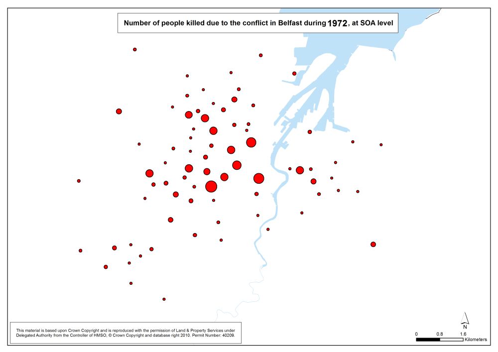
Number killed - Belfast - SOA - 1972
Number of people killed due to the conflict in Belfast, 1972, at SOA |
.pdf
277kb |
.jpg
44kb |
229.jpg
257kb |
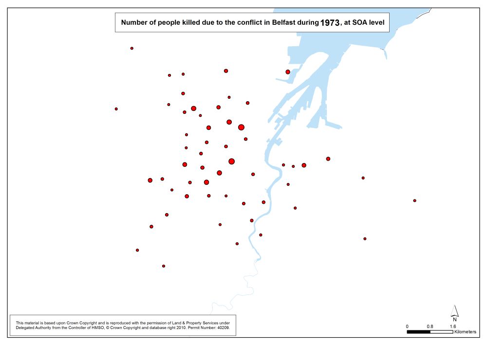
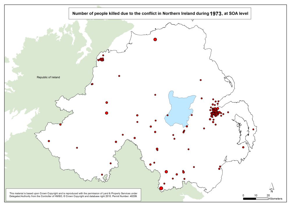
Number killed - Belfast - SOA - 1973
Number of people killed due to the conflict in Belfast, 1973, at SOA |
.pdf
263kb |
.jpg
39kb |
208.jpg
231kb |
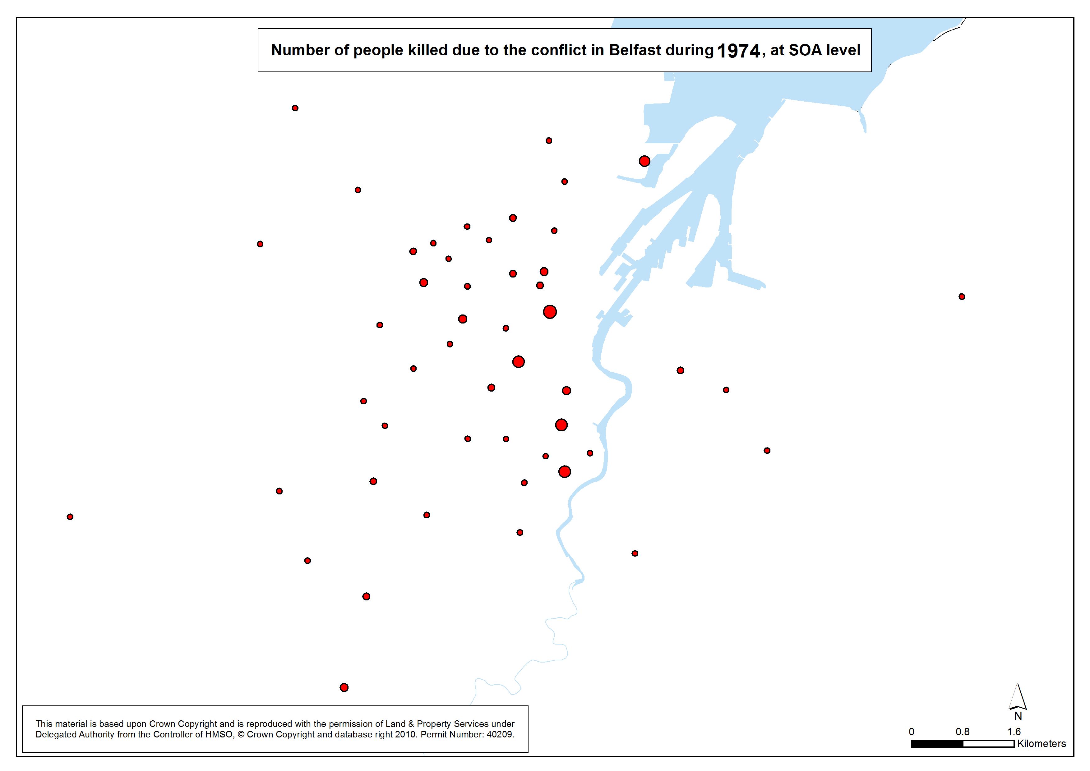
Number killed - Belfast - SOA - 1974
Number of people killed due to the conflict in Belfast, 1974, at SOA |
.pdf
259kb |
.jpg
38kb |
.jpg
225kb |
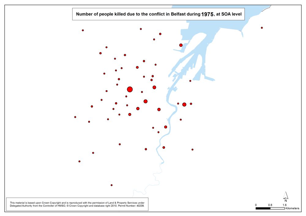
Number killed - Belfast - SOA - 1975
Number of people killed due to the conflict in Belfast, 1975, at SOA |
.pdf
262kb |
.jpg
38kb |
.jpg
229kb |
Number killed - Belfast - SOA - 1976
Number of people killed due to the conflict in Belfast, 1976, at SOA |
.pdf
266kb |
.jpg
40kb |
.jpg
237kb |
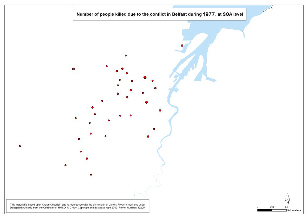
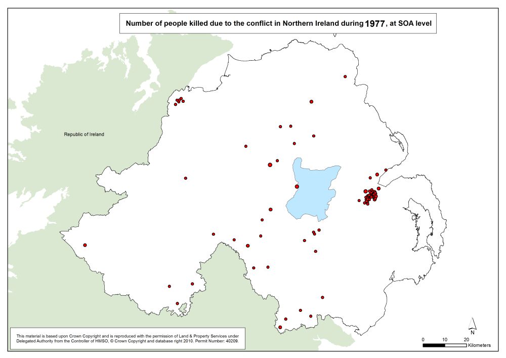
Number killed - Belfast - SOA - 1977
Number of people killed due to the conflict in Belfast, 1977, at SOA |
.pdf
255kb |
.jpg
36kb |
.jpg
217kb |
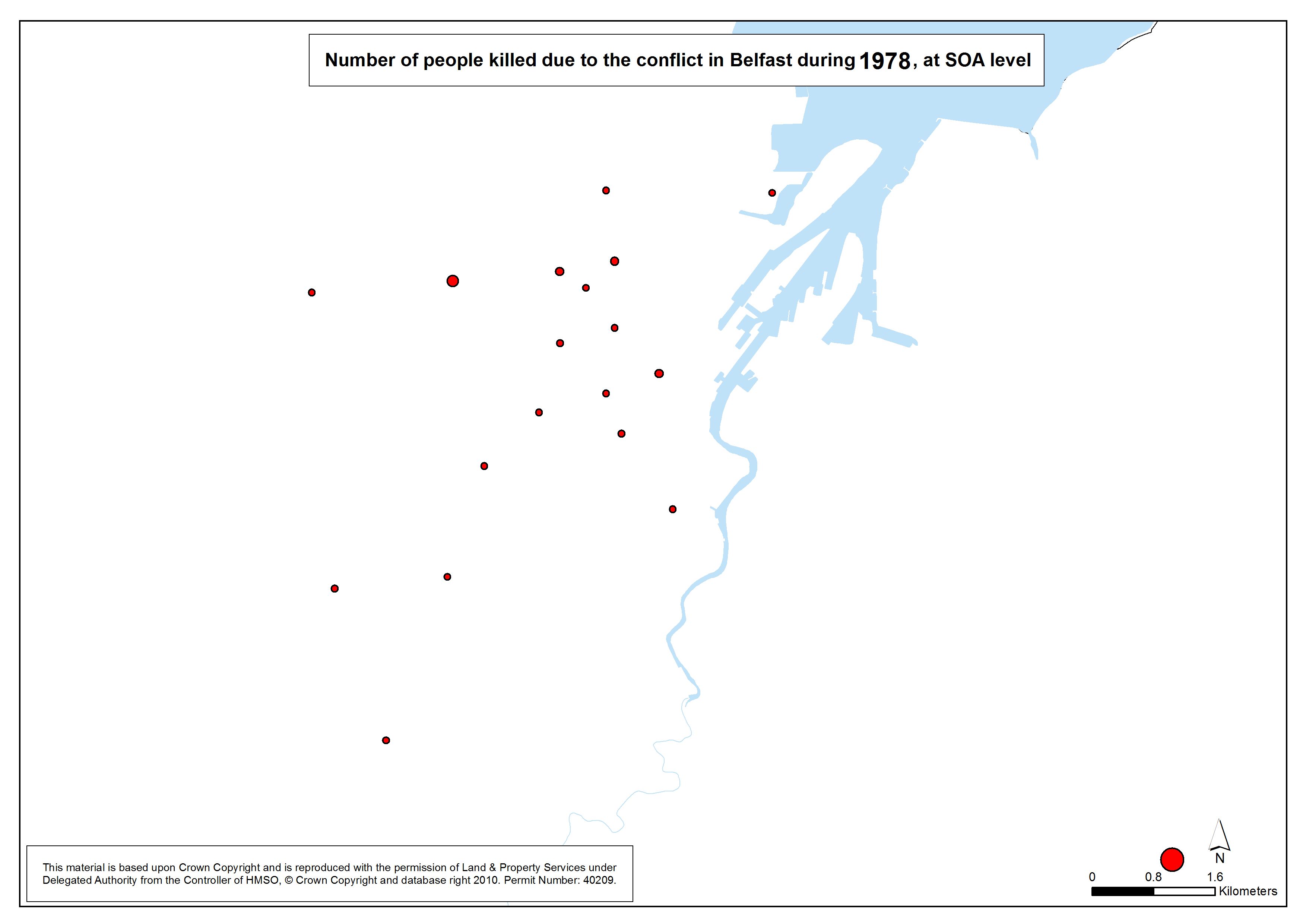
Number killed - Belfast - SOA - 1978
Number of people killed due to the conflict in Belfast, 1978, at SOA |
.pdf
250kb |
.jpg
34kb |
.jpg
208kb |
Number killed - Belfast - SOA - 1979
Number of people killed due to the conflict in Belfast, 1979, at SOA |
.pdf
251kb |
.jpg
34kb |
.jpg
210kb |
Number killed - Belfast - SOA - 1980
Number of people killed due to the conflict in Belfast, 1980, at SOA |
.pdf
253kb |
.jpg
35kb |
.jpg
214kb |
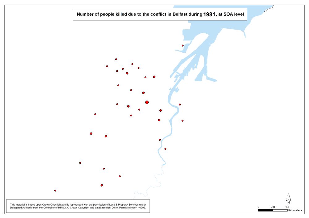
Number killed - Belfast - SOA - 1981
Number of people killed due to the conflict in Belfast, 1981, at SOA |
.pdf
254kb |
.jpg
35kb |
.jpg
215kb |
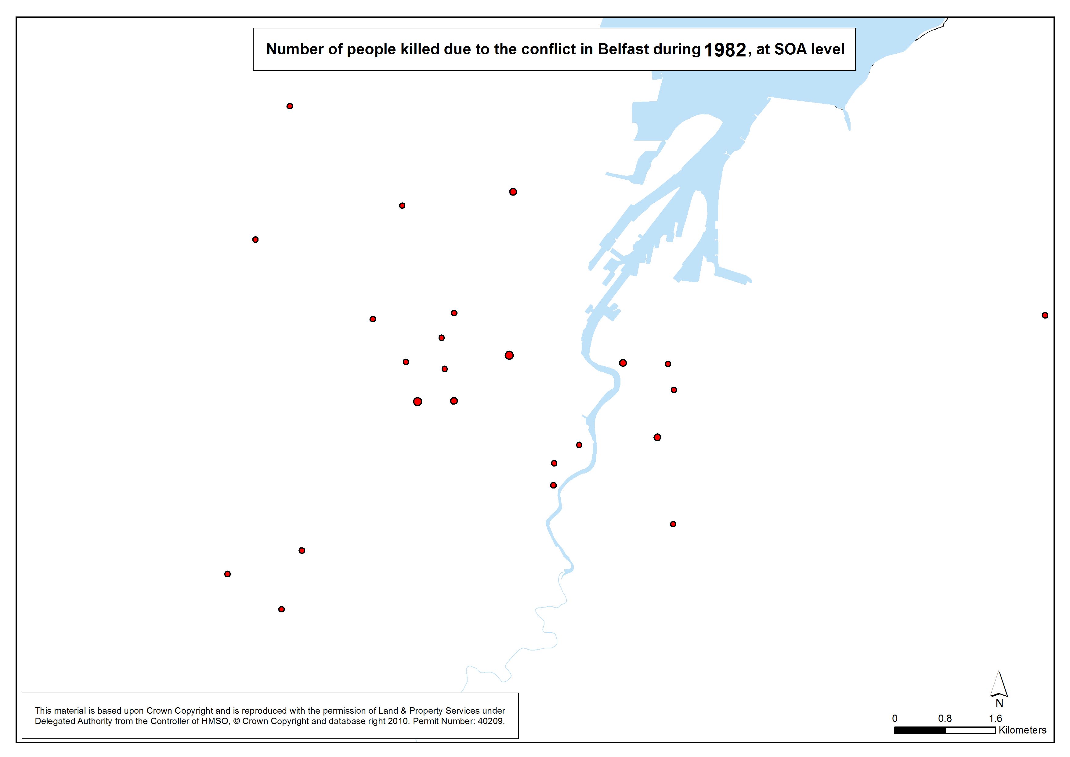
Number killed - Belfast - SOA - 1982
Number of people killed due to the conflict in Belfast, 1982, at SOA |
.pdf
251kb |
.jpg
34kb |
.jpg
210kb |
Number killed - Belfast - SOA - 1983
Number of people killed due to the conflict in Belfast, 1983, at SOA |
.pdf
248kb |
.jpg
33kb |
.jpg
205kb |
Number killed - Belfast - SOA - 1984
Number of people killed due to the conflict in Belfast, 1984, at SOA |
.pdf
247kb |
.jpg
32kb |
.jpg
202kb |
Number killed - Belfast - SOA - 1985
Number of people killed due to the conflict in Belfast, 1985, at SOA |
.pdf
246kb |
.jpg
32kb |
.jpg
201kb |
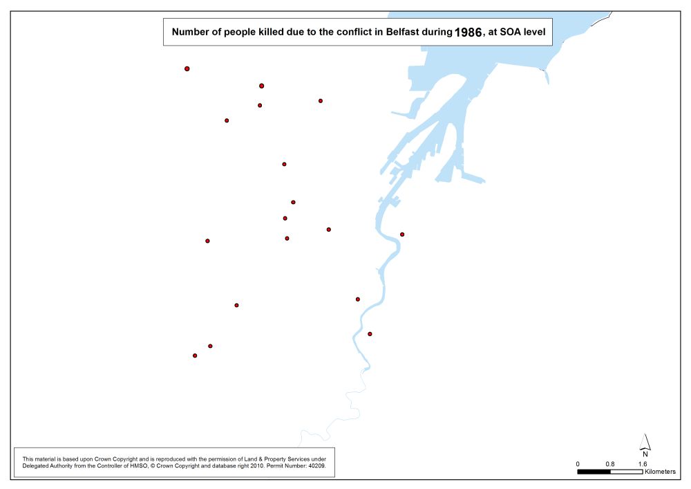
Number killed - Belfast - SOA - 1986
Number of people killed due to the conflict in Belfast, 1986, at SOA |
.pdf
249kb |
.jpg
33kb |
.jpg
206kb |
Number killed - Belfast - SOA - 1987
Number of people killed due to the conflict in Belfast, 1987, at SOA |
.pdf
251kb |
.jpg
34kb |
.jpg
210kb |
Number killed - Belfast - SOA - 1988
Number of people killed due to the conflict in Belfast, 1988, at SOA |
.pdf
253kb |
.jpg
35kb |
.jpg
214kb |
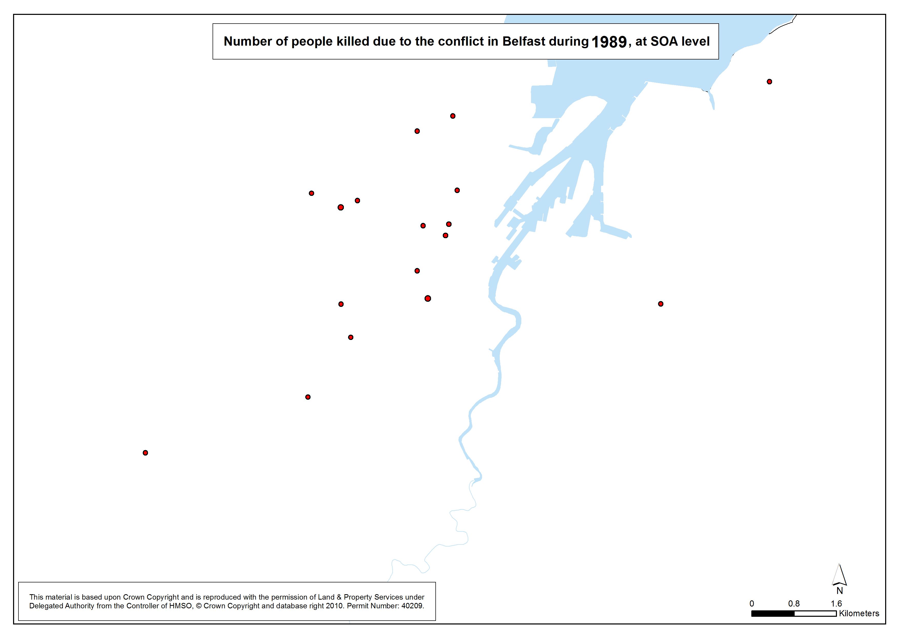
Number killed - Belfast - SOA - 1989
Number of people killed due to the conflict in Belfast, 1989, at SOA |
.pdf
249kb |
.jpg
33kb |
.jpg
206kb |
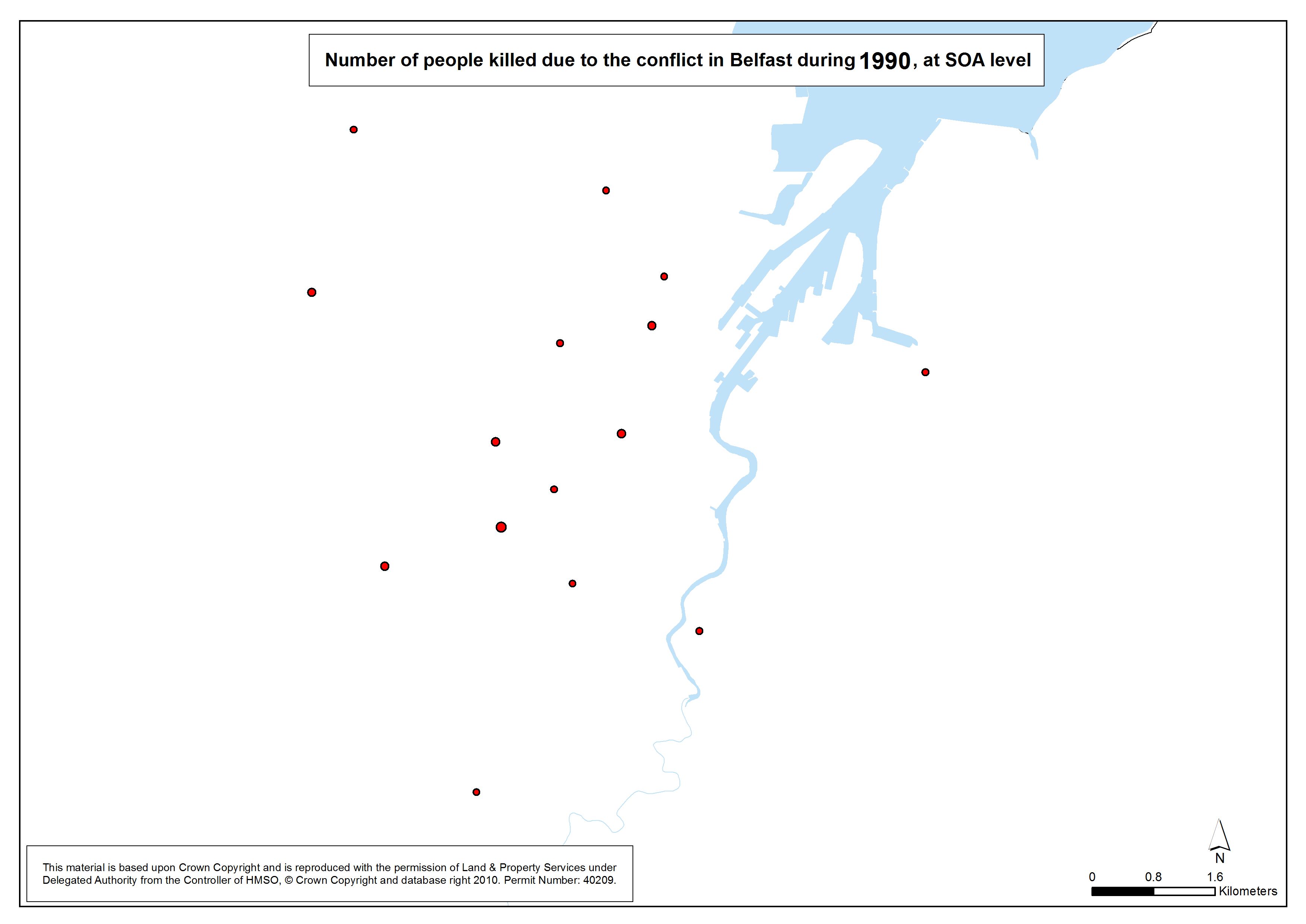
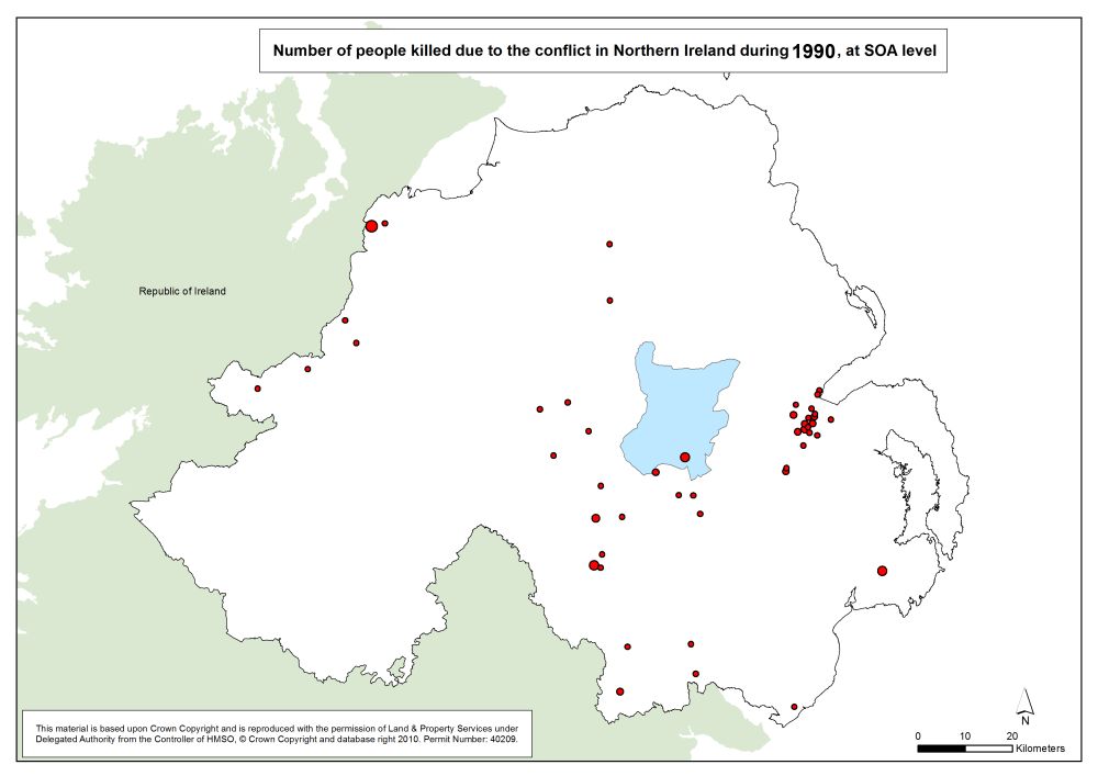
Number killed - Belfast - SOA - 1990
Number of people killed due to the conflict in Belfast, 1990, at SOA |
.pdf
249kb |
.jpg
33kb |
.jpg
206kb |
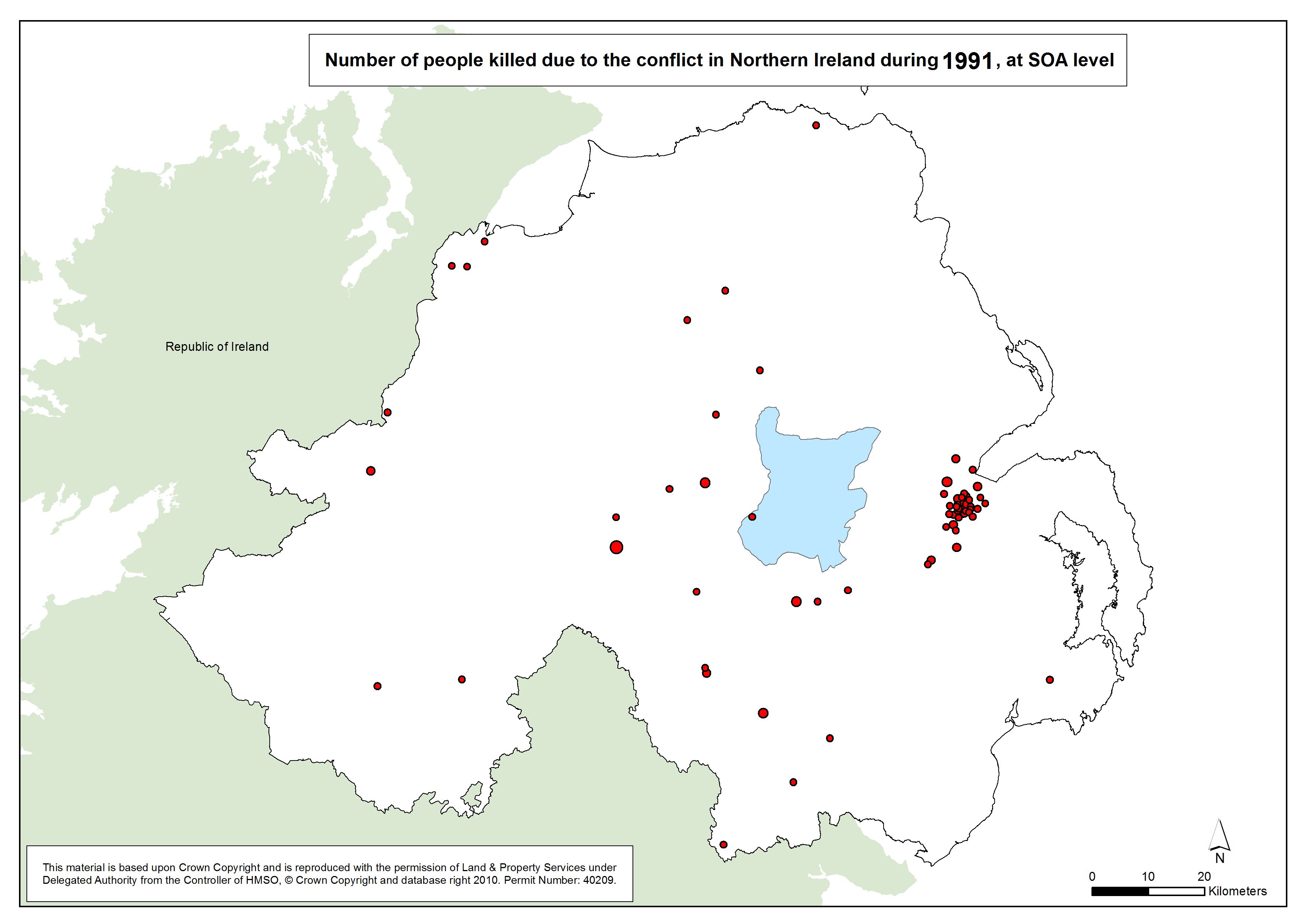
Number killed - Belfast - SOA - 1991
Number of people killed due to the conflict in Belfast, 1991, at SOA |
.pdf
253kb |
.jpg
35kb |
.jpg
213kb |
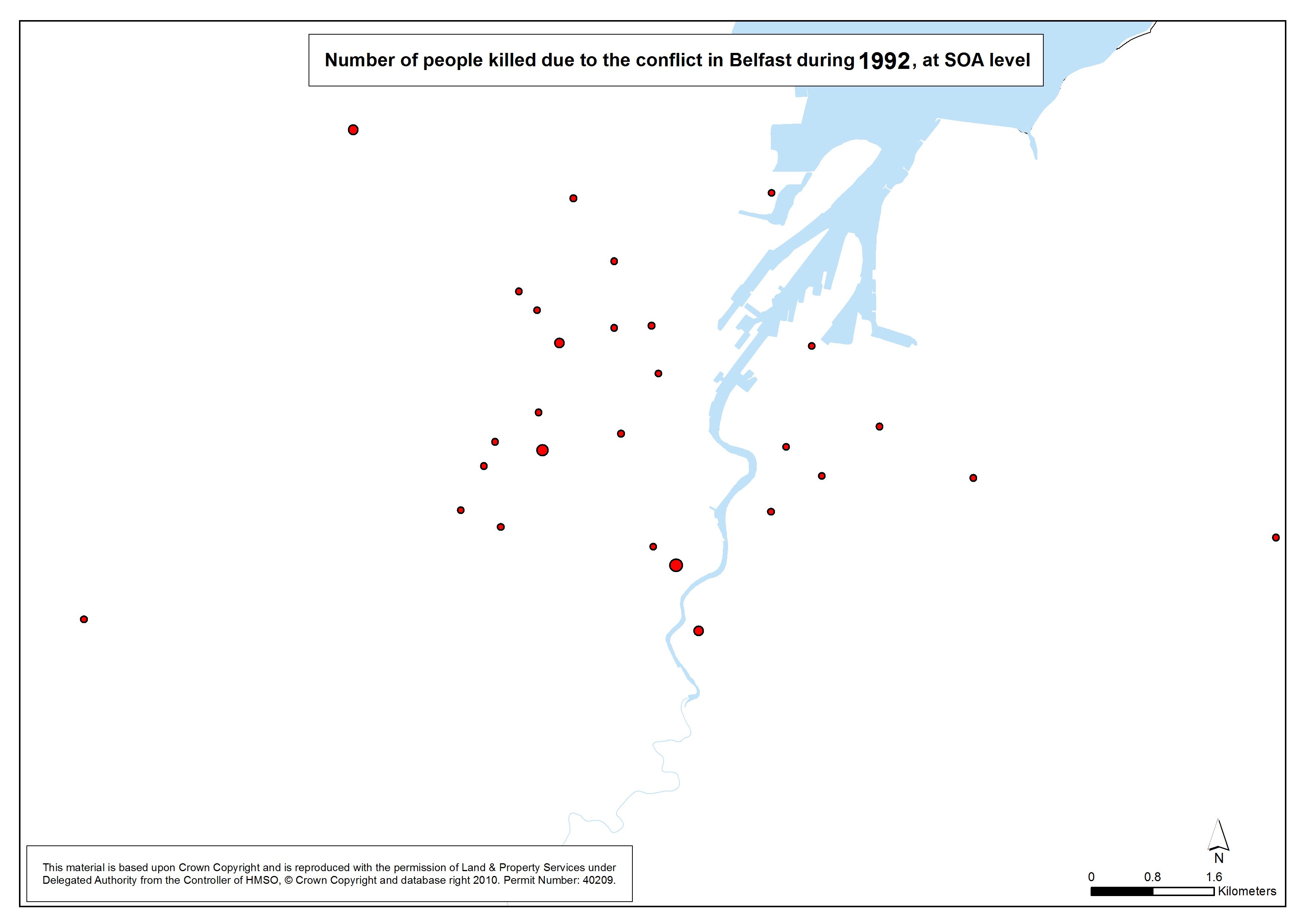
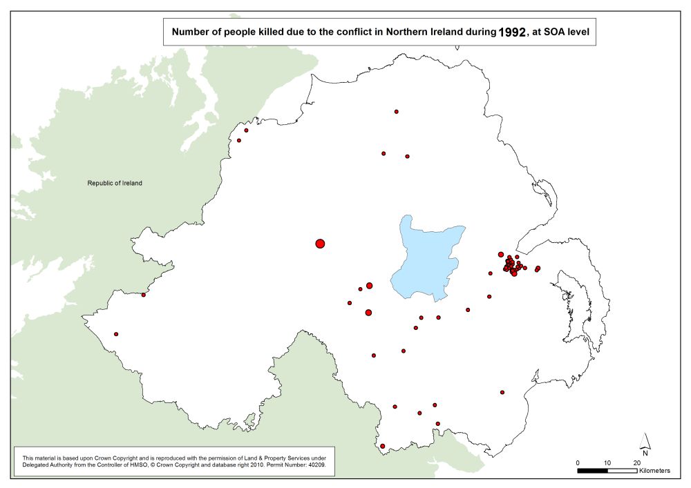
Number killed - Belfast - SOA - 1992
Number of people killed due to the conflict in Belfast, 1992, at SOA |
.pdf
253kb |
.jpg
35kb |
.jpg
212kb |
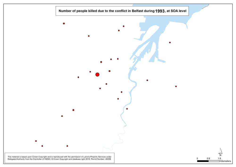
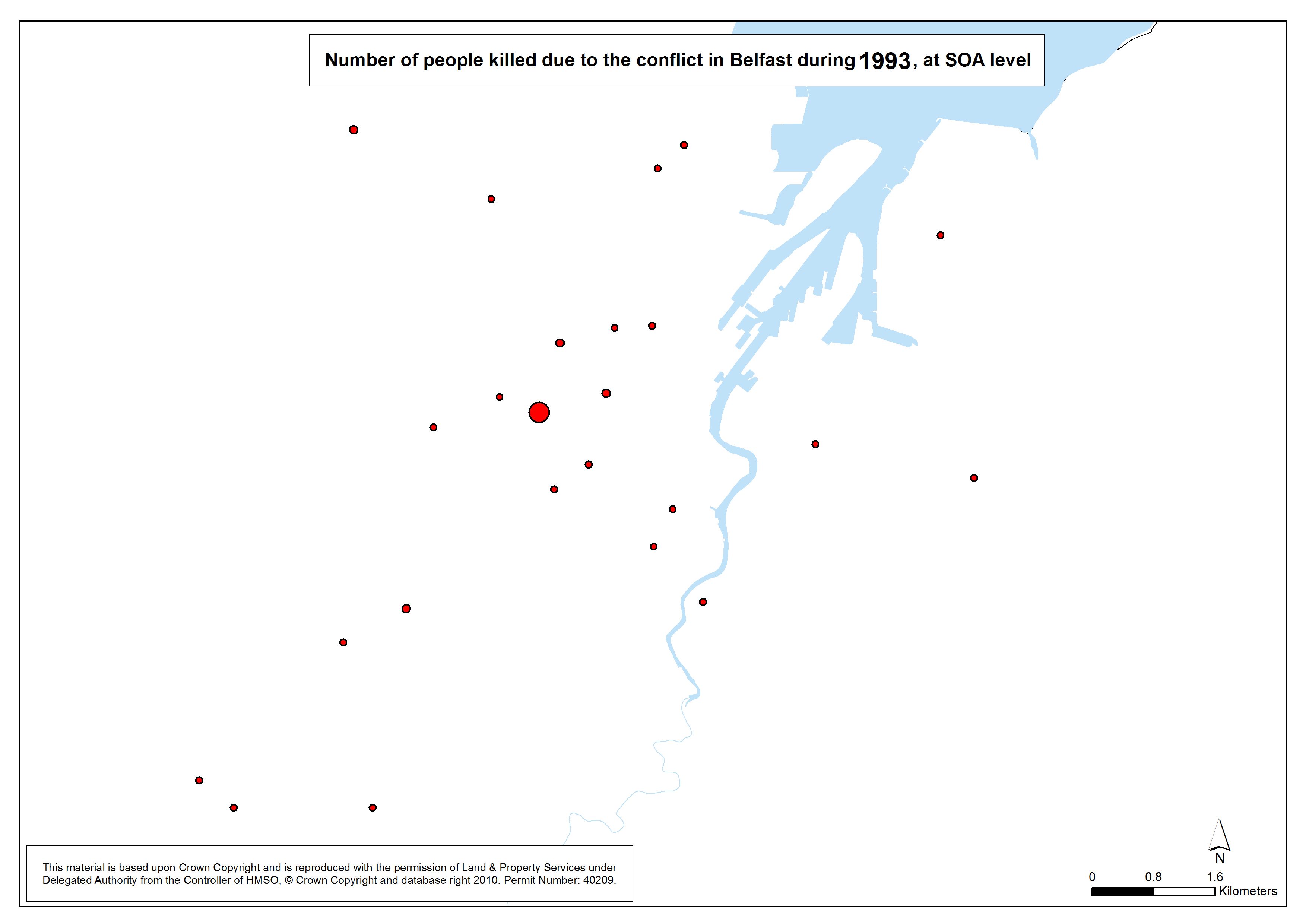
Number killed - Belfast - SOA - 1993
Number of people killed due to the conflict in Belfast, 1993, at SOA |
.pdf
252kb |
.jpg
34kb |
.jpg
210kb |
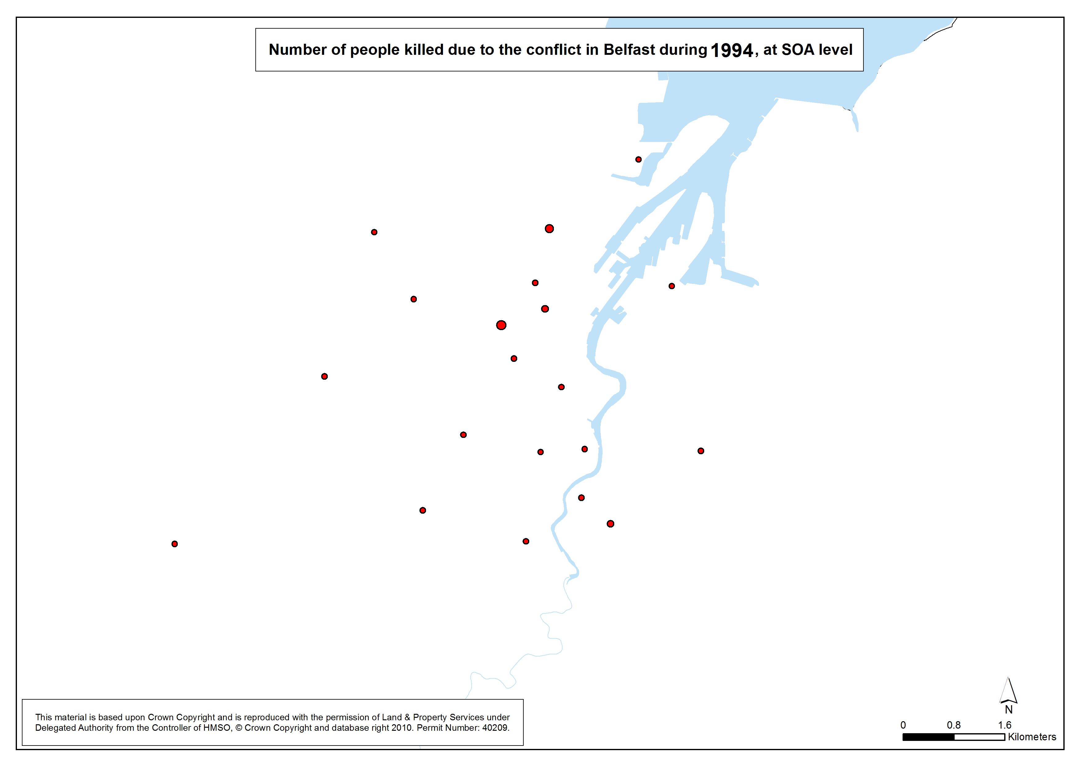
Number killed - Belfast - SOA - 1994
Number of people killed due to the conflict in Belfast, 1994, at SOA |
.pdf
250kb |
.jpg
33kb |
.jpg
207kb |
Number killed - Belfast - SOA - 1995
Number of people killed due to the conflict in Belfast, 1995, at SOA |
.pdf
246kb |
.jpg
32kb |
.jpg
201kb |
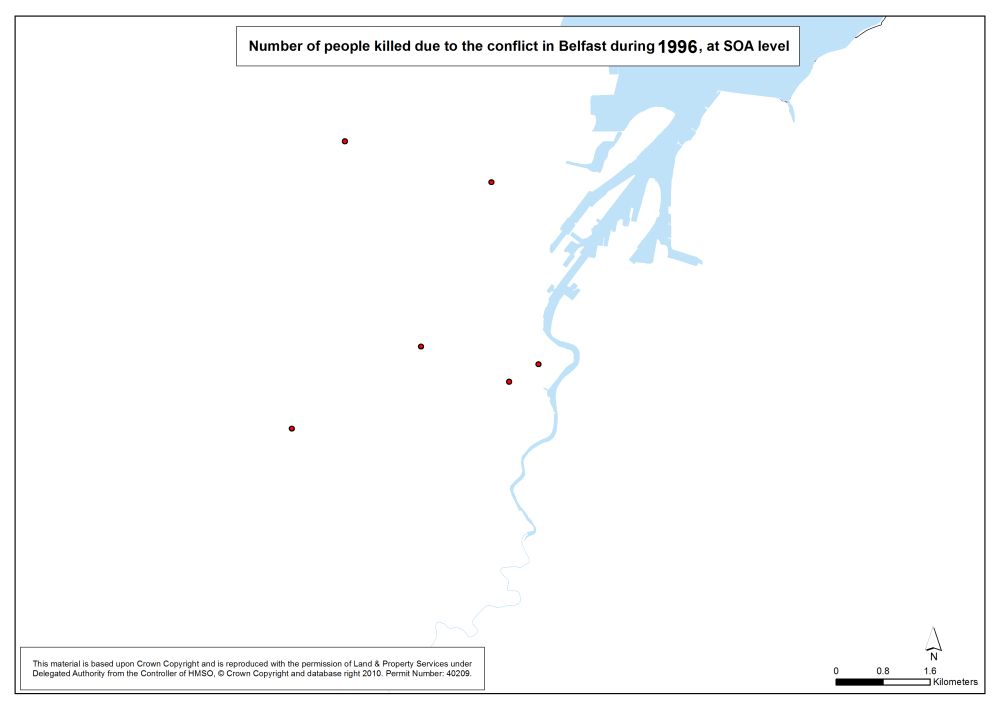
Number killed - Belfast - SOA - 1996
Number of people killed due to the conflict in Belfast, 1996, at SOA |
.pdf
246kb |
.jpg
32kb |
.jpg
200kb |
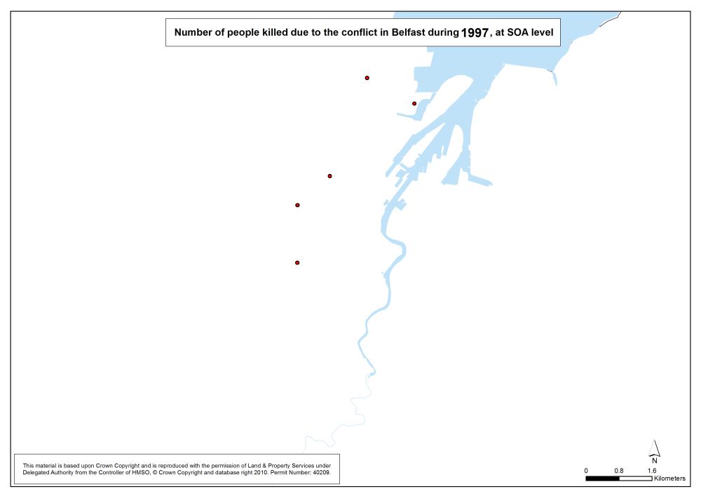
Number killed - Belfast - SOA - 1997
Number of people killed due to the conflict in Belfast, 1997, at SOA |
.pdf
246kb |
.jpg
32kb |
.jpg
199kb |
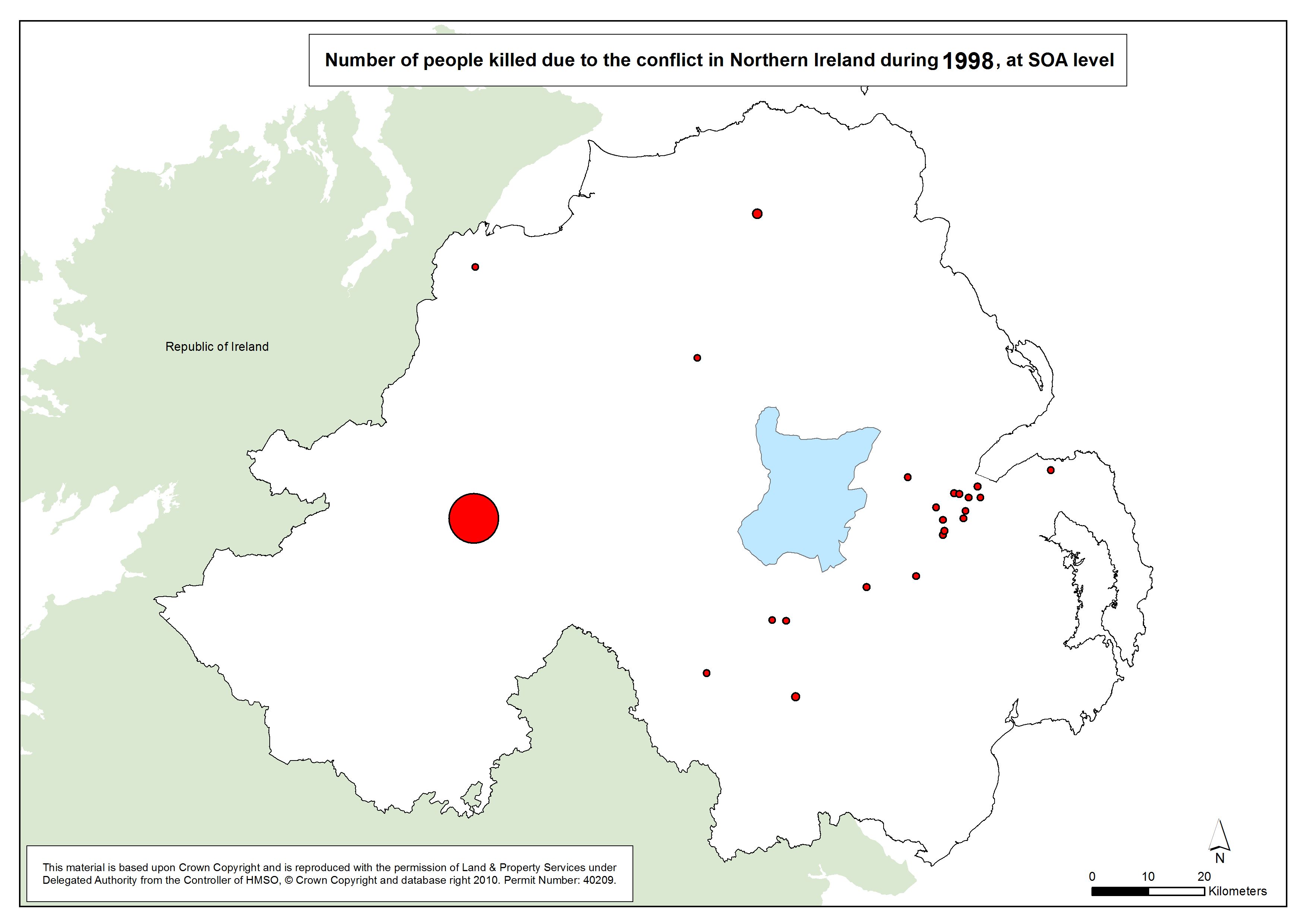
Number killed - Belfast - SOA - 1998
Number of people killed due to the conflict in Belfast, 1998, at SOA |
.pdf
247kb |
.jpg
32kb |
.jpg
202kb |
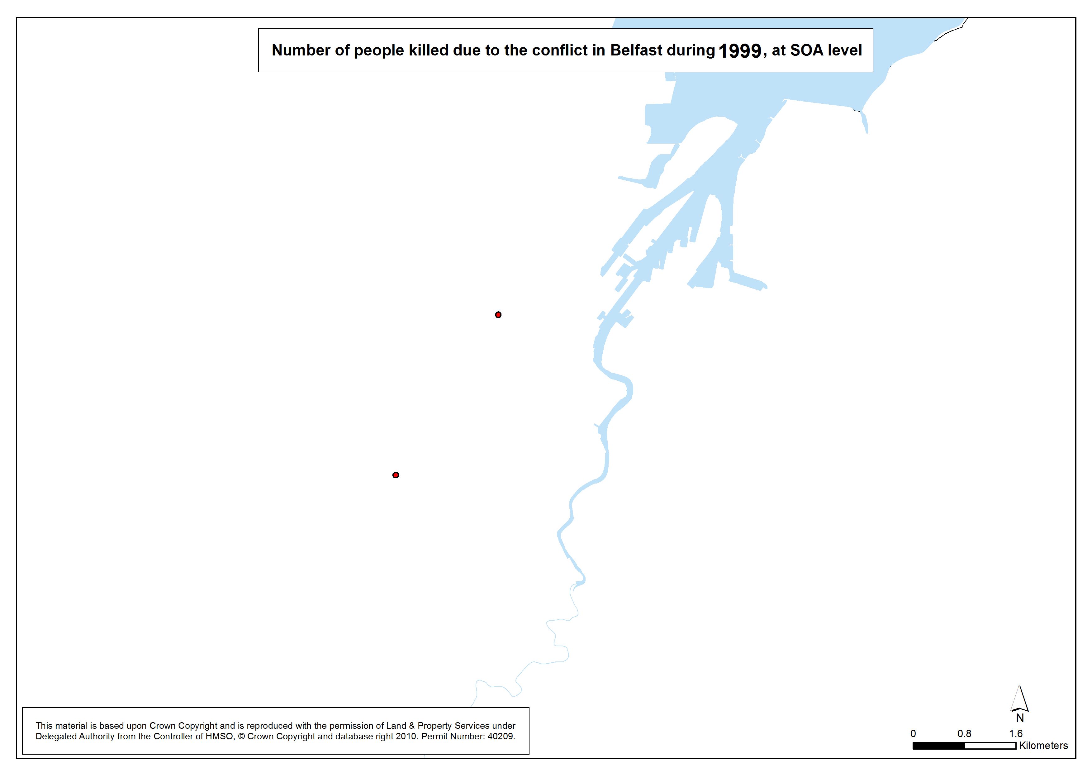
Number killed - Belfast - SOA - 1999
Number of people killed due to the conflict in Belfast, 1999, at SOA |
.pdf
245kb |
.jpg
31kb |
.jpg
198kb |
Number killed - Belfast - SOA - 2000
Number of people killed due to the conflict in Belfast, 2000, at SOA |
.pdf
247kb |
.jpg
32kb |
.jpg
201kb |
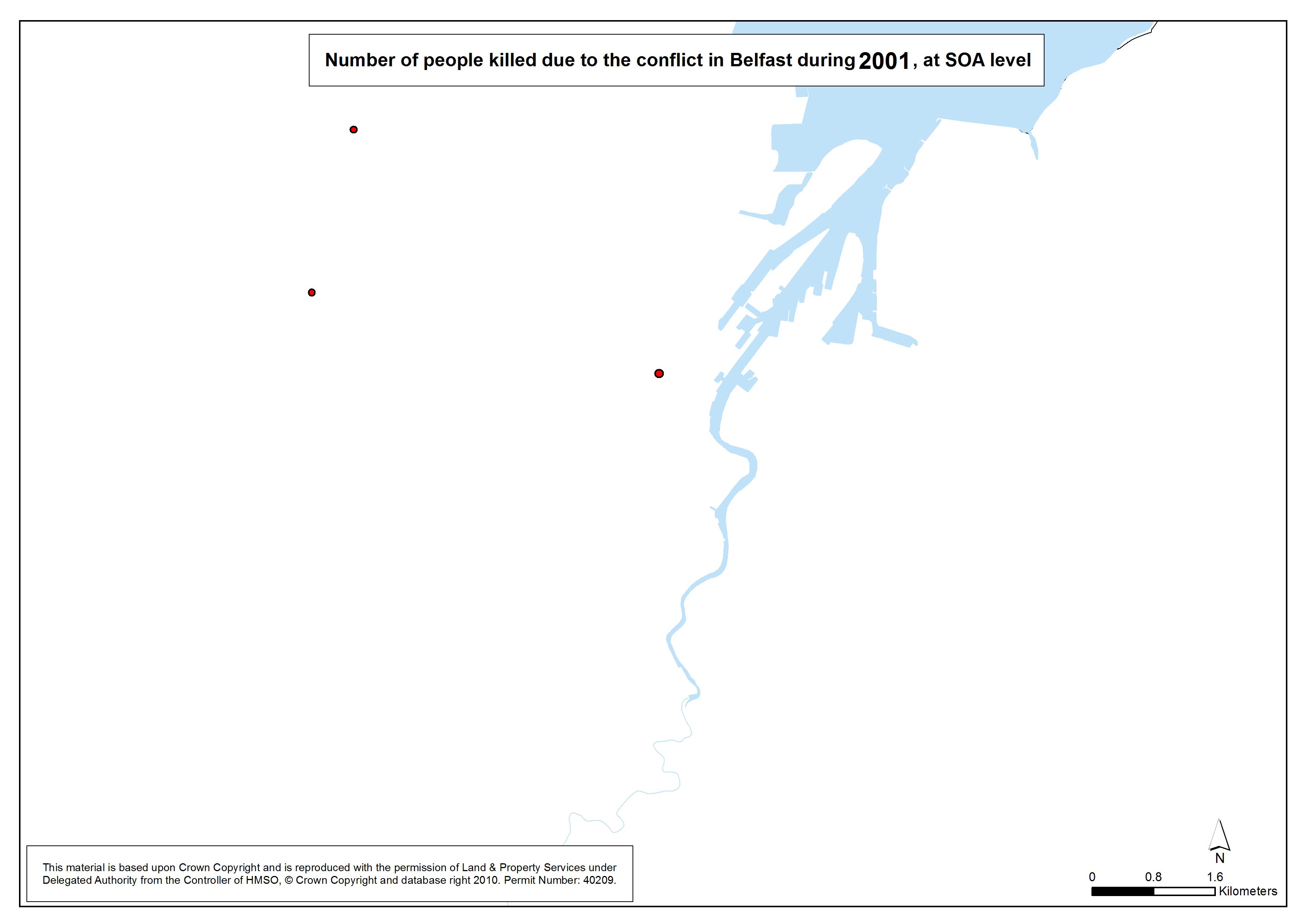
Number killed - Belfast - SOA - 2001
Number of people killed due to the conflict in Belfast, 2001, at SOA |
.pdf
245kb |
.jpg
31kb |
.jpg
198kb |
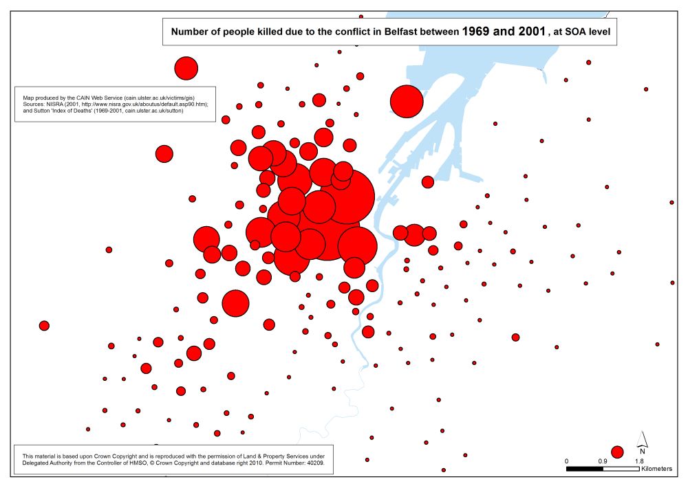
Number killed - Belfast - SOA - 1969-2001
Number of people killed due to the conflict in Belfast, 1969-2001, at SOA |
.pdf
379kb |
.jpg
76kb |
.jpg
625kb |
| Animation - Number of people killed due to the conflict in Belfast, by year (1969-2001), at SOA (Small Output Area) (1 animation based on 34 maps) |
| Title of Animation |
File Version |
| GIF |
|
|
Animation - Number killed - Belfast - SOA - 1969-2001
Animation Gif of Number of people killed due to the conflict in Belfast, 1969-2001, at SOA |
.gif
1784kb |
|
|
| Maps - Number of people killed due to the conflict in Northern Ireland, by year (1969-2001), at SOA (Small Output Area) (34 maps) |
| Title of Map |
File Version |
| PDF |
L-JPG |
H-JPG |
Legend
Legend for following maps |
.pdf
285kb |
.jpg
39kb |
.jpg
250kb |
Number killed - NI - SOA - 1969
Number of people killed due to the conflict in Northern Ireland, 1969, at SOA |
.pdf
320kb |
.jpg
53kb |
.jpg
327kb |
Number killed - NI - SOA - 1970
Number of people killed due to the conflict in Northern Ireland, 1970, at SOA |
.pdf
320kb |
.jpg
53kb |
.jpg
328kb |
Number killed - NI - SOA - 1971
Number of people killed due to the conflict in Northern Ireland, 1971, at SOA |
.pdf
327kb |
.jpg
55kb |
.jpg
339kb |
Number killed - NI - SOA - 1972
Number of people killed due to the conflict in Northern Ireland, 1972, at SOA |
.pdf
345kb |
.jpg
61kb |
.jpg
372kb |
Number killed - NI - SOA - 1973
Number of people killed due to the conflict in Northern Ireland, 1973, at SOA |
.pdf
341kb |
.jpg
60kb |
.jpg
363kb |
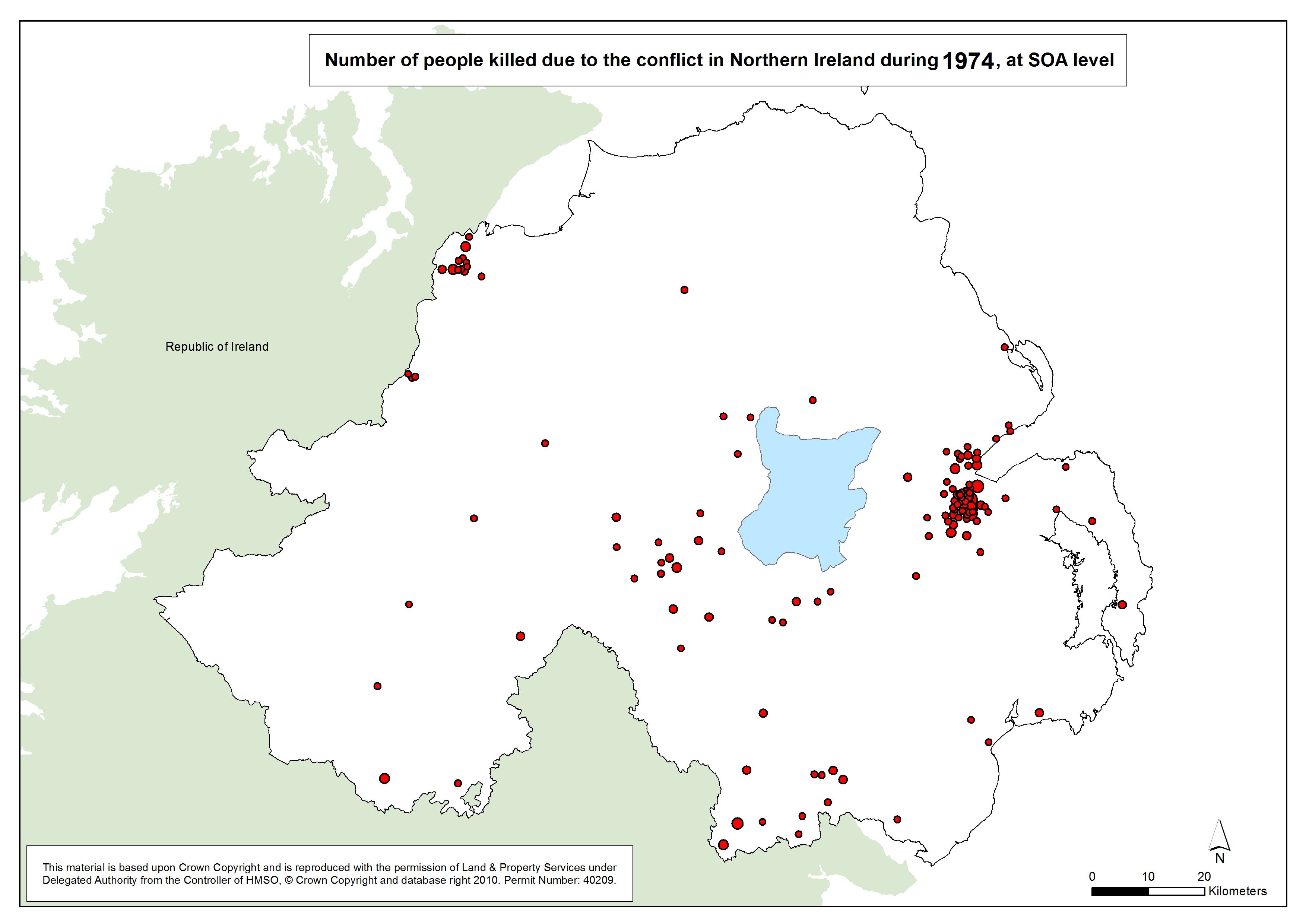
Number killed - NI - SOA - 1974
Number of people killed due to the conflict in Northern Ireland, 1974, at SOA |
.pdf
345kb |
.jpg
61kb |
.jpg
370kb |
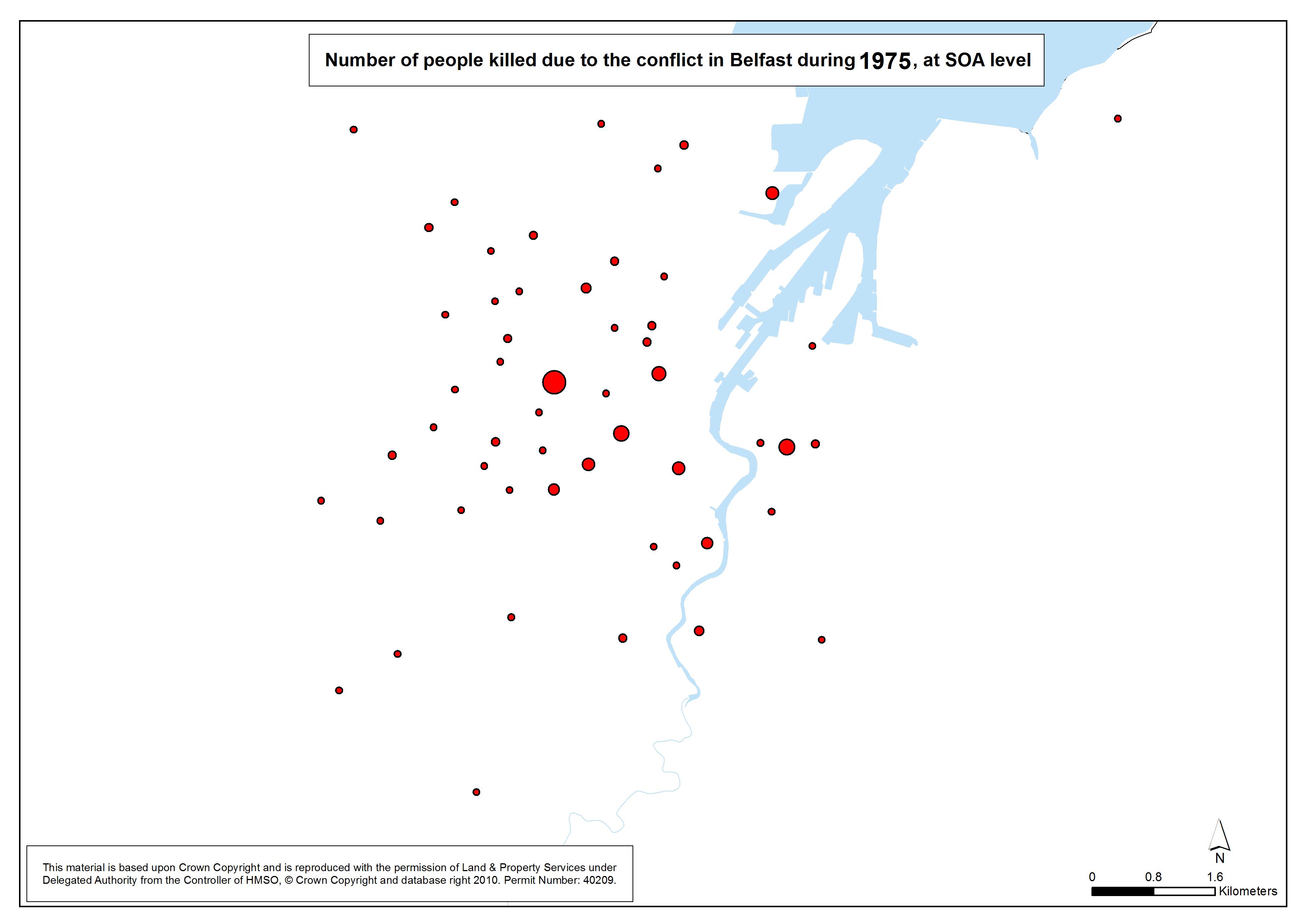
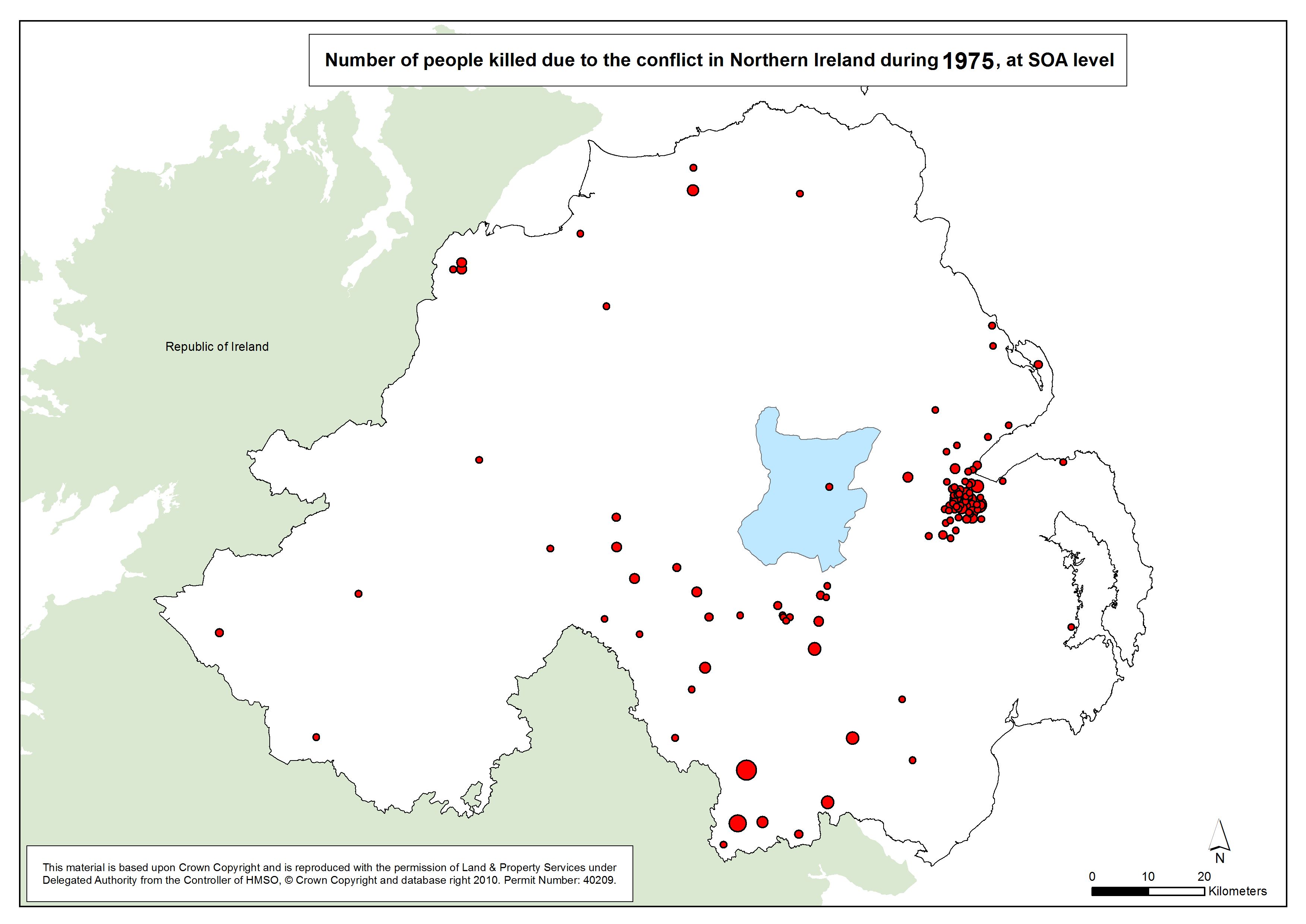
Number killed - NI - SOA - 1975
Number of people killed due to the conflict in Northern Ireland, 1975, at SOA |
.pdf
341kb |
.jpg
60kb |
.jpg
363kb |
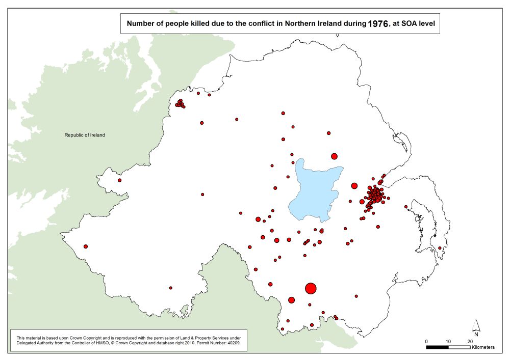
Number killed - NI - SOA - 1976
Number of people killed due to the conflict in Northern Ireland, 1976, at SOA |
.pdf
347kb |
.jpg
62kb |
.jpg
373kb |
Number killed - NI - SOA - 1977
Number of people killed due to the conflict in Northern Ireland, 1977, at SOA |
.pdf
332kb |
.jpg
57kb |
.jpg
348kb |
Number killed - NI - SOA - 1978
Number of people killed due to the conflict in Northern Ireland, 1978, at SOA |
.pdf
330kb |
.jpg
56kb |
.jpg
345kb |
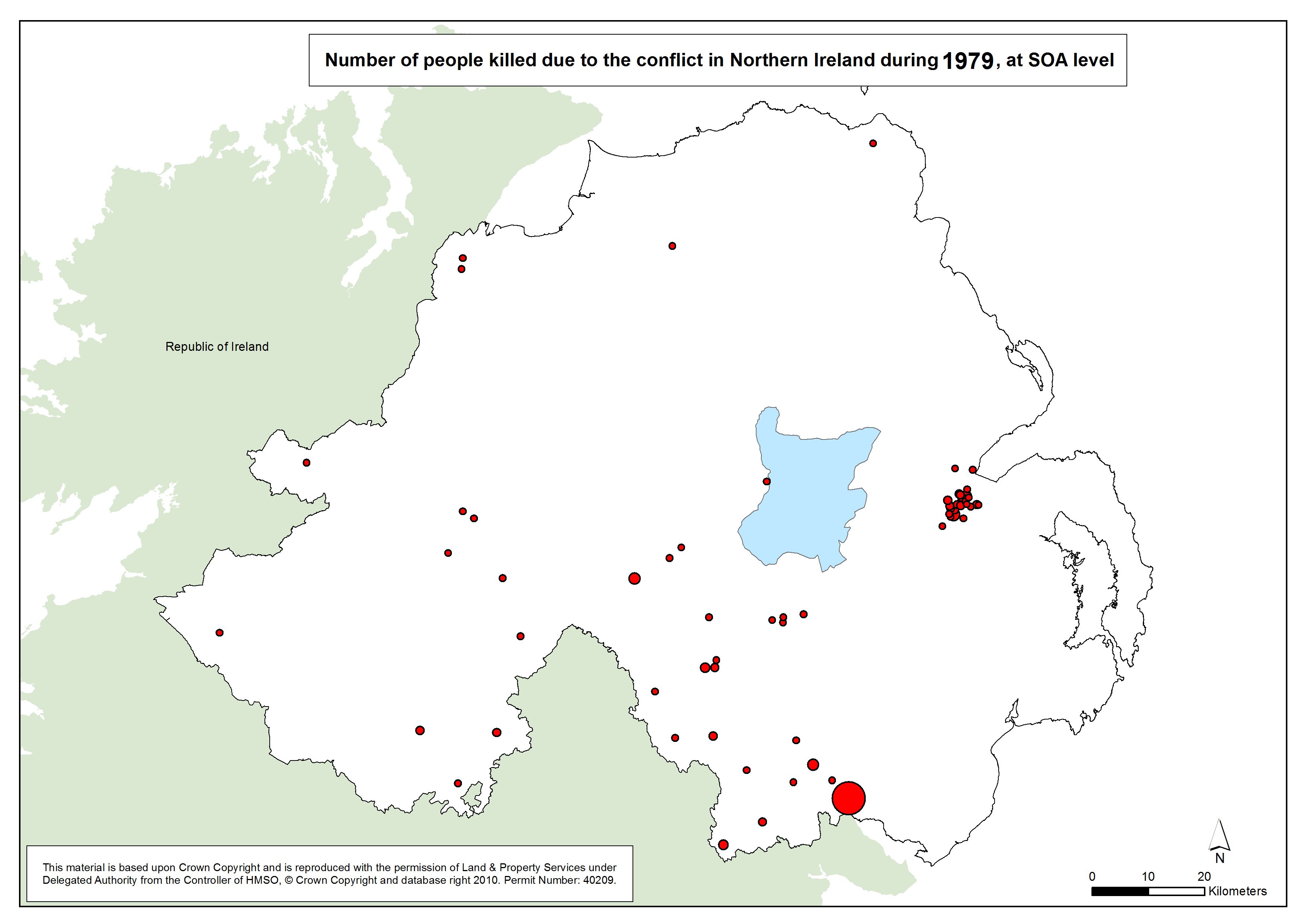
Number killed - NI - SOA - 1979
Number of people killed due to the conflict in Northern Ireland, 1979, at SOA |
.pdf
332kb |
.jpg
57kb |
.jpg
348kb |
Number killed - NI - SOA - 1980
Number of people killed due to the conflict in Northern Ireland, 1980, at SOA |
.pdf
330kb |
.jpg
56kb |
.jpg
345kb |
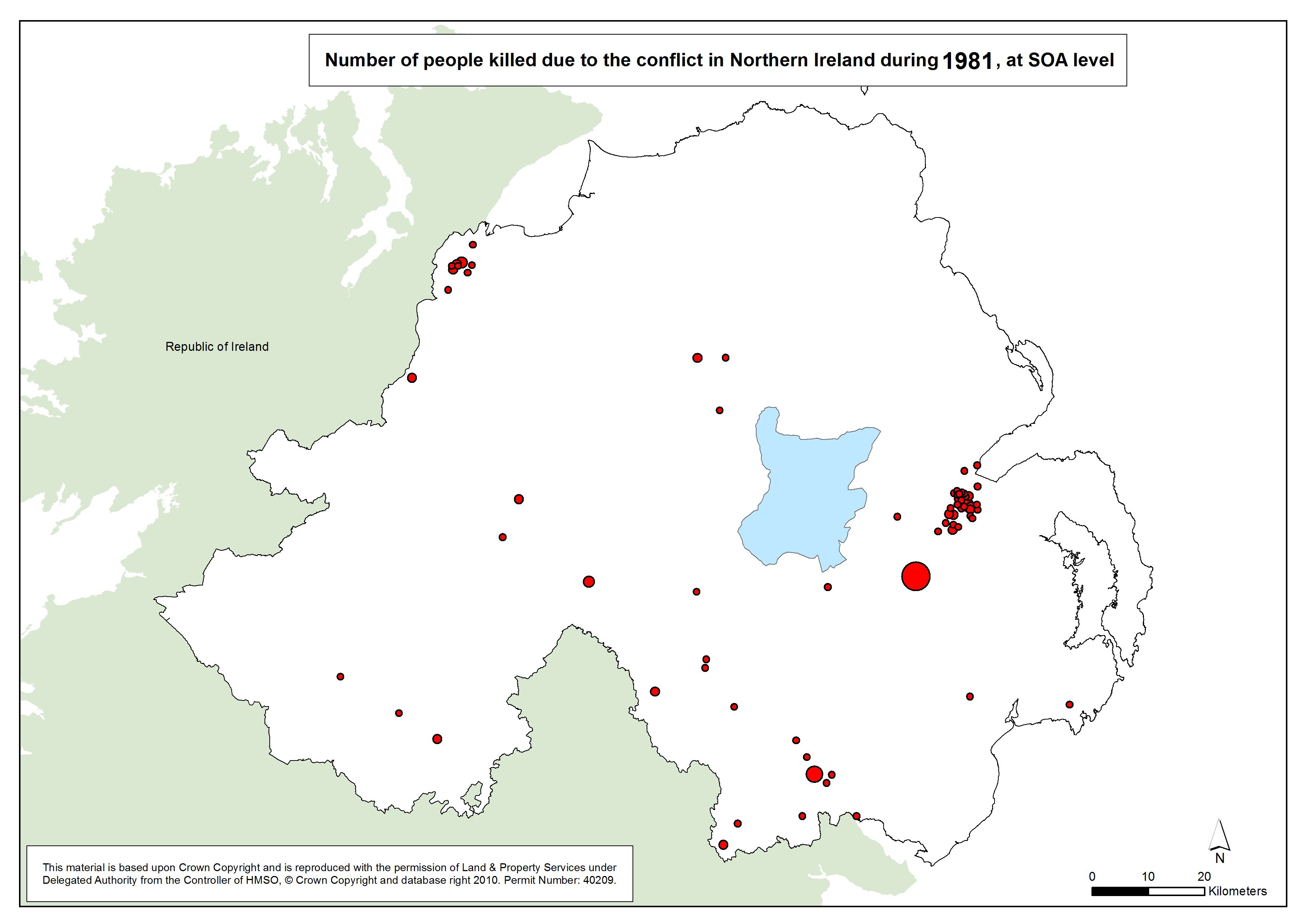
Number killed - NI - SOA - 1981
Number of people killed due to the conflict in Northern Ireland, 1981, at SOA |
.pdf
333kb |
.jpg
57kb |
.jpg
350kb |
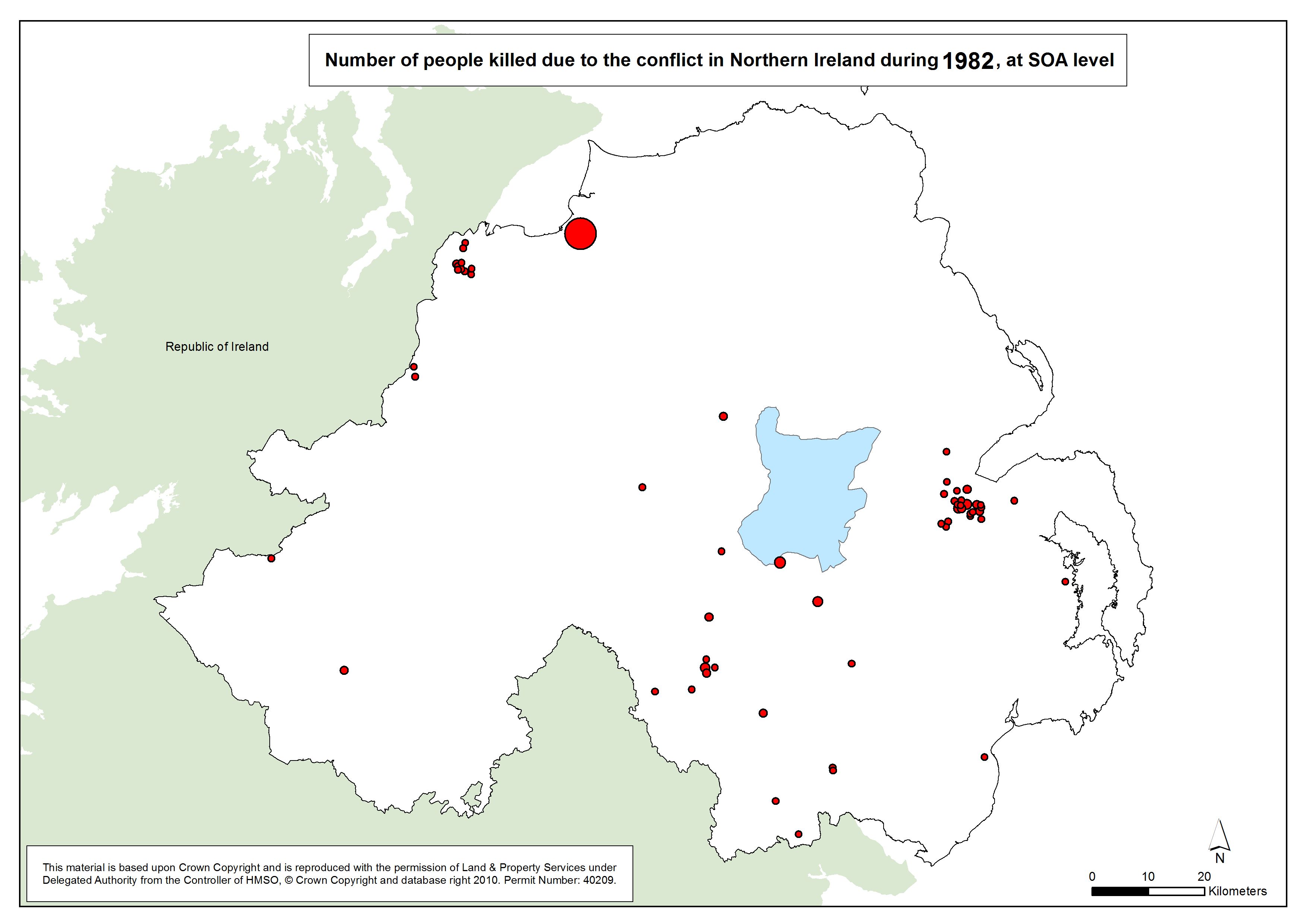
Number killed - NI - SOA - 1982
Number of people killed due to the conflict in Northern Ireland, 1982, at SOA |
.pdf
331kb |
.jpg
56kb |
.jpg
346kb |
Number killed - NI - SOA - 1983
Number of people killed due to the conflict in Northern Ireland, 1983, at SOA |
.pdf
333kb |
.jpg
57kb |
.jpg
349kb |
Number killed - NI - SOA - 1984
Number of people killed due to the conflict in Northern Ireland, 1984, at SOA |
.pdf
330kb |
.jpg
56kb |
.jpg
344kb |
Number killed - NI - SOA - 1985
Number of people killed due to the conflict in Northern Ireland, 1985, at SOA |
.pdf
327kb |
.jpg
55kb |
.jpg
339kb |
Number killed - NI - SOA - 1986
Number of people killed due to the conflict in Northern Ireland, 1986, at SOA |
.pdf
329kb |
.jpg
56kb |
.jpg
342kb |
Number killed - NI - SOA - 1987
Number of people killed due to the conflict in Northern Ireland, 1987, at SOA |
.pdf
330kb |
.jpg
56kb |
.jpg
344kb |
Number killed - NI - SOA - 1988
Number of people killed due to the conflict in Northern Ireland, 1988, at SOA |
.pdf
330kb |
.jpg
56kb |
.jpg
345kb |
Number killed - NI - SOA - 1989
Number of people killed due to the conflict in Northern Ireland, 1989, at SOA |
.pdf
329kb |
.jpg
56kb |
.jpg
343kb |
Number killed - NI - SOA - 1990
Number of people killed due to the conflict in Northern Ireland, 1990, at SOA |
.pdf
330kb |
.jpg
56kb |
.jpg
345kb |
Number killed - NI - SOA - 1991
Number of people killed due to the conflict in Northern Ireland, 1991, at SOA |
.pdf
331kb |
.jpg
56kb |
.jpg
346kb |
Number killed - NI - SOA - 1992
Number of people killed due to the conflict in Northern Ireland, 1992, at SOA |
.pdf
329kb |
.jpg
56kb |
.jpg
343kb |
Number killed - NI - SOA - 1993
Number of people killed due to the conflict in Northern Ireland, 1993, at SOA |
.pdf
331kb |
.jpg
56kb |
.jpg
345kb |
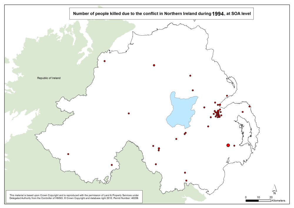
Number killed - NI - SOA - 1994
Number of people killed due to the conflict in Northern Ireland, 1994, at SOA |
.pdf
328kb |
.jpg
55kb |
.jpg
341kb |
Number killed - NI - SOA - 1995
Number of people killed due to the conflict in Northern Ireland, 1995, at SOA |
.pdf
320kb |
.jpg
53kb |
.jpg
327kb |
Number killed - NI - SOA - 1996
Number of people killed due to the conflict in Northern Ireland, 1996, at SOA |
.pdf
321kb |
.jpg
53kb |
.jpg
328kb |
Number killed - NI - SOA - 1997
Number of people killed due to the conflict in Northern Ireland, 1997, at SOA |
.pdf
323kb |
.jpg
54kb |
.jpg
332kb |
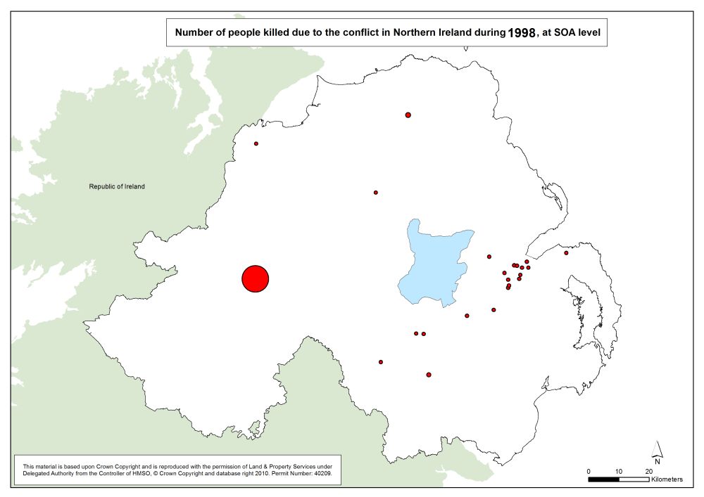
Number killed - NI - SOA - 1998
Number of people killed due to the conflict in Northern Ireland, 1998, at SOA |
.pdf
326kb |
.jpg
55kb |
.jpg
337kb |
Number killed - NI - SOA - 1999
Number of people killed due to the conflict in Northern Ireland, 1999, at SOA |
.pdf
320kb |
.jpg
53kb |
.jpg
327kb |
Number killed - NI - SOA - 2000
Number of people killed due to the conflict in Northern Ireland, 2000, at SOA |
.pdf
321kb |
.jpg
53kb |
.jpg
330kb |
Number killed - NI - SOA - 2001
Number of people killed due to the conflict in Northern Ireland, 2001, at SOA |
.pdf
322kb |
.jpg
53kb |
.jpg
330kb |
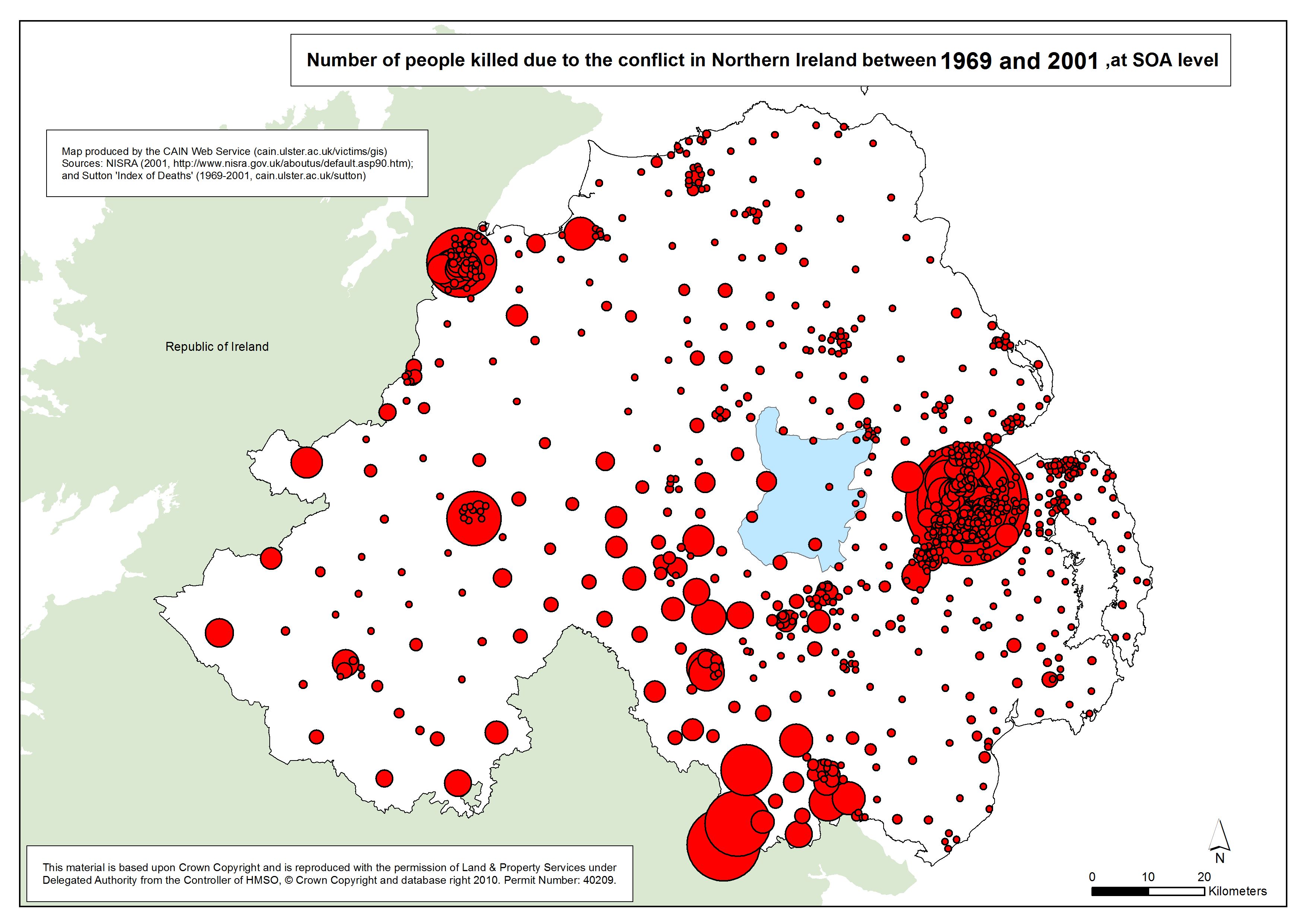
Number killed - NI - SOA - 1969-2001
Number of people killed due to the conflict in Northern Ireland, 1969-2001, at SOA |
.pdf
525kb |
.jpg
112kb |
.jpg
679kb |
| Animation - Number of people killed due to the conflict in Northern Ireland, by year (1969-2001), at SOA (Small Output Area) (1 animation based on 34 maps) |
| Title of Animation |
File Version |
| GIF |
|
|
Animation - Number killed - NI - SOA - 1969-2001
Animation Gif of Number of people killed due to the conflict in Northern Ireland, 1969-2001, at SOA |
.gif
3785kb |
|
|
| Maps - Number of people killed due to the conflict in Northern Ireland, Belfast and Derry, between 1969 and 2001, at SOA (Small Output Area) (barchart, 3D) (3 maps) |
| Title of Map |
File Version |
| PDF |
L-JPG |
H-JPG |
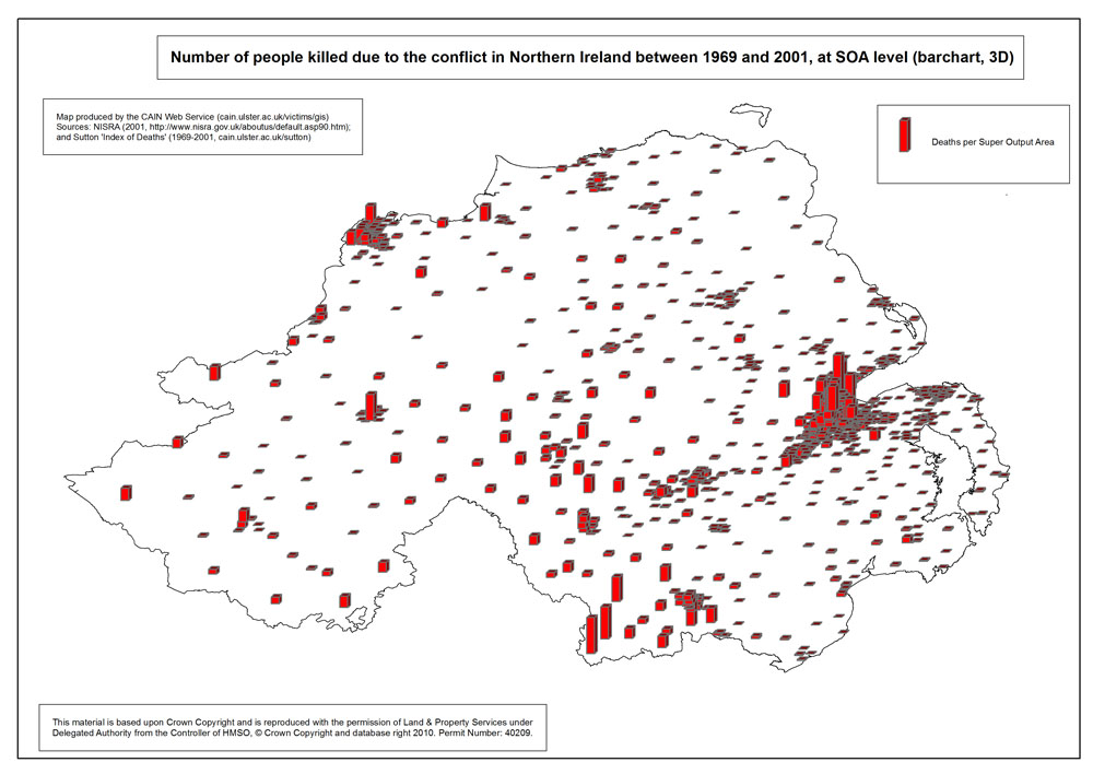
Number killed - NI - SOA - 3D
Number of people killed due to the conflict in Northern Ireland between 1969 and 2001, at SOA (Small Output Area) (barchart, 3D; map in projection / tilted) |
.pdf
453kb |
.jpg
138kb |
.jpg
712kb |
Number killed - Belfast - SOA - 3D
Number of people killed due to the conflict in Belfast between 1969 and 2001, at SOA (Small Output Area) (barchart, 3D) |
.pdf
348kb |
.jpg
102kb |
.jpg
522kb |
Number killed - Derry - SOA - 3D
Number of people killed due to the conflict in Derry between 1969 and 2001, at SOA (Small Output Area) (barchart, 3D) |
.pdf
302kb |
.jpg
73kb |
.jpg
417kb |
| Maps - Distances between locations of deaths and associated memorials (closest recorded memorial), Belfast, Derry, and Northern Ireland (8 maps) |
| Title of Map |
File Version |
| PDF |
L-JPG |
H-JPG |
Distances - Civilian - Belfast
Distances between locations of civilian deaths and associated memorials (closest recorded memorial), wards in Belfast |
.pdf
500kb |
.jpg
70kb |
.jpg
882kb |
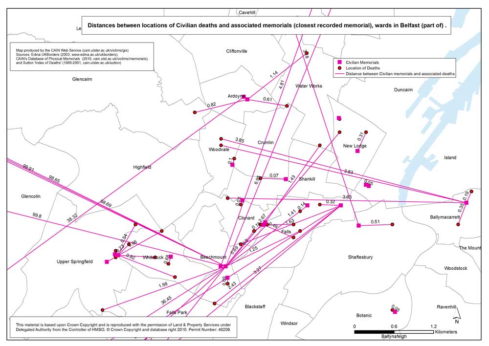
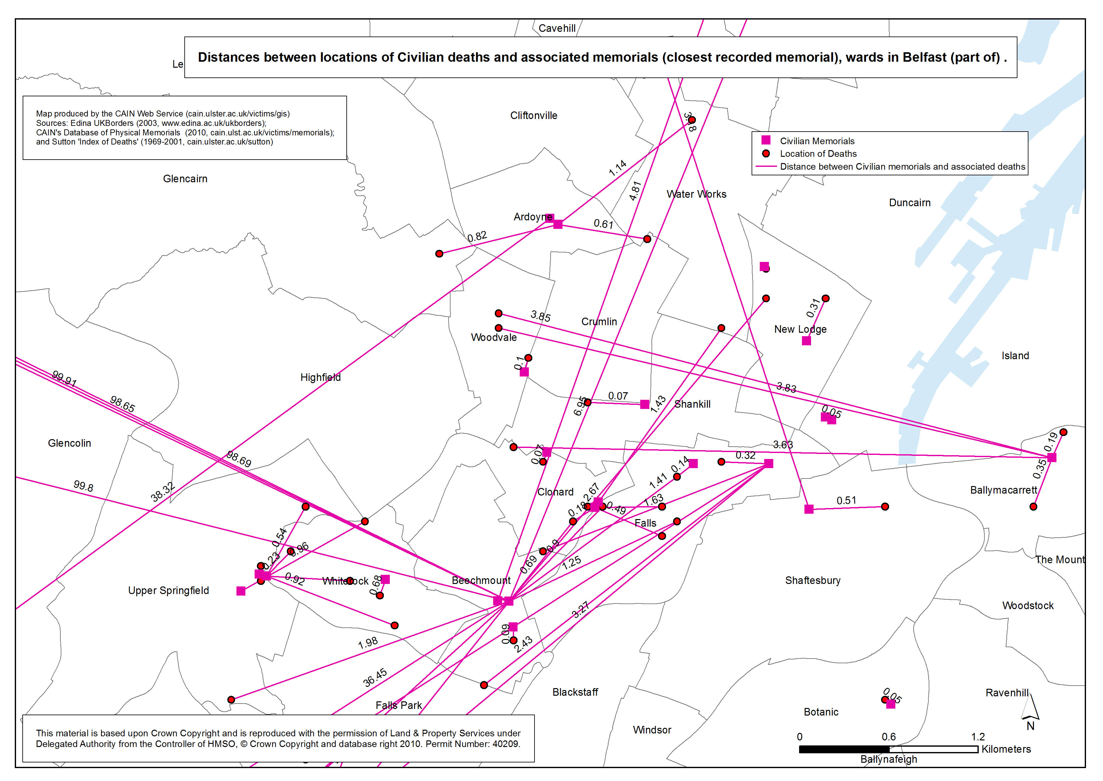
Distances - Civilian - Belfast (part of)
Distances between locations of civilian deaths and associated memorials (closest recorded memorial), wards in Belfast (part of) |
.pdf
579kb |
.jpg
87kb |
.jpg
1031kb |
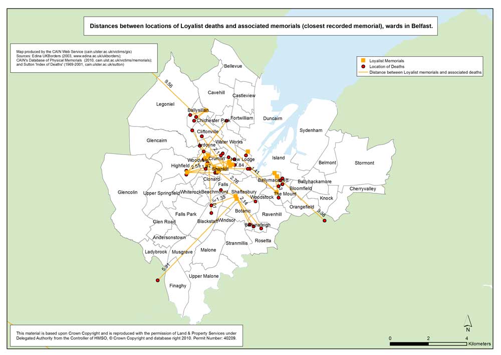
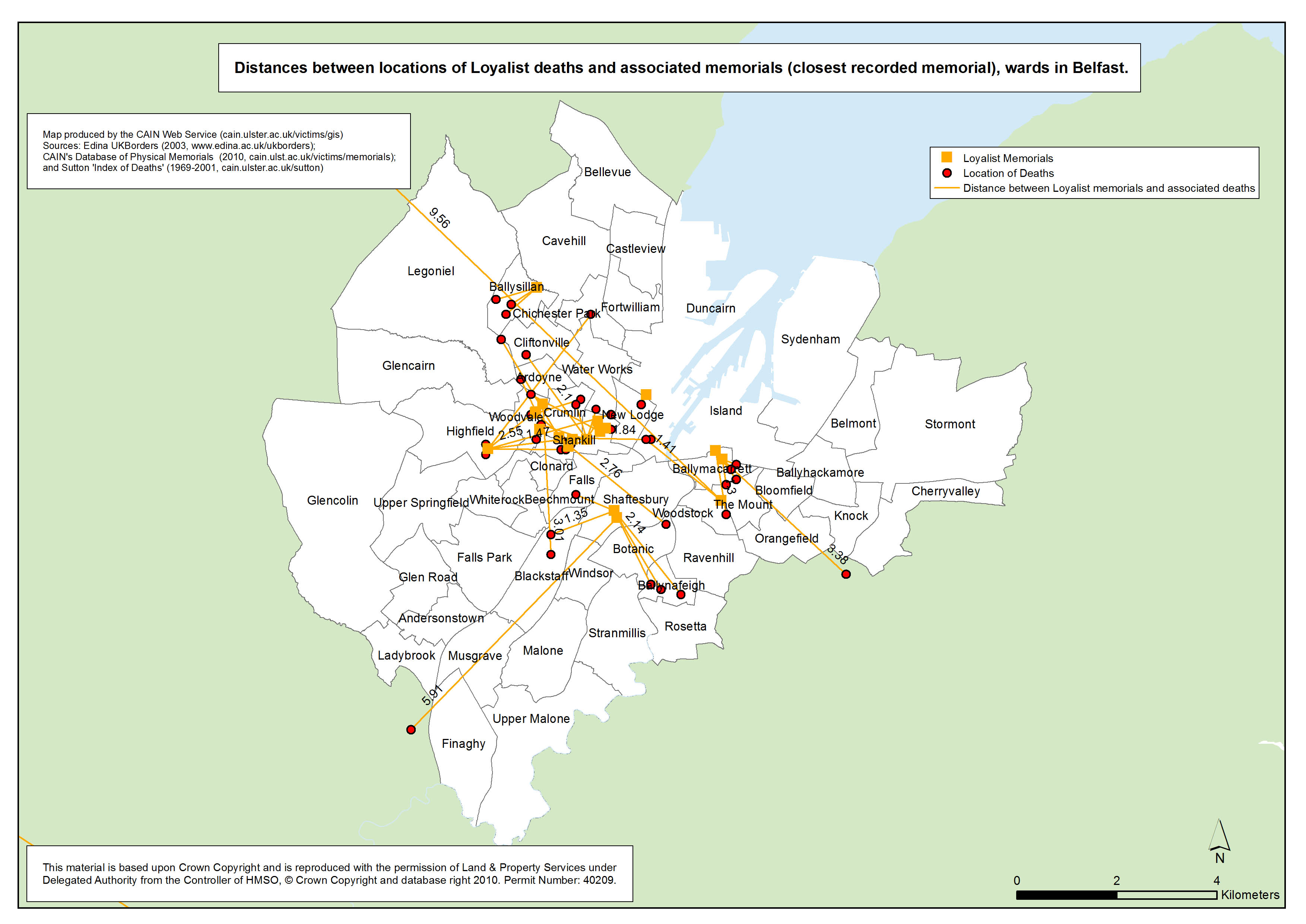
Distances - Loyalist - Belfast
Distances between locations of Loyalist paramilitary deaths and associated memorials (closest recorded memorial), wards in Belfast |
.pdf
458kb |
.jpg
64kb |
.jpg
792kb |
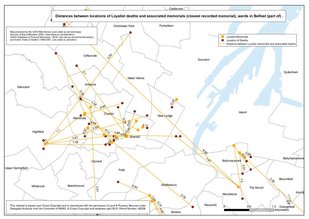
Distances - Loyalist - Belfast (part of)
Distances between locations of Loyalist paramilitary deaths and associated memorials (closest recorded memorial), wards in Belfast (part of) |
.pdf
504kb |
.jpg
76kb |
.jpg
891kb |
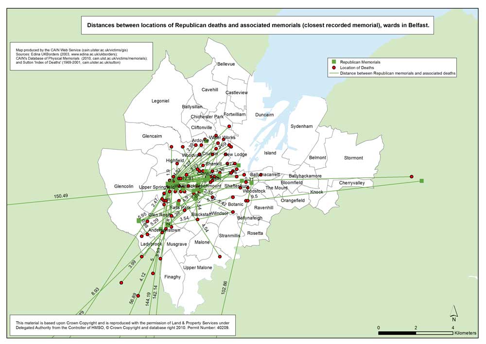
Distances - Republican - Belfast
Distances between locations of Republican paramilitary deaths and associated memorials (closest recorded memorial), wards in Belfast |
.pdf
506kb |
.jpg
70kb |
.jpg
868kb |
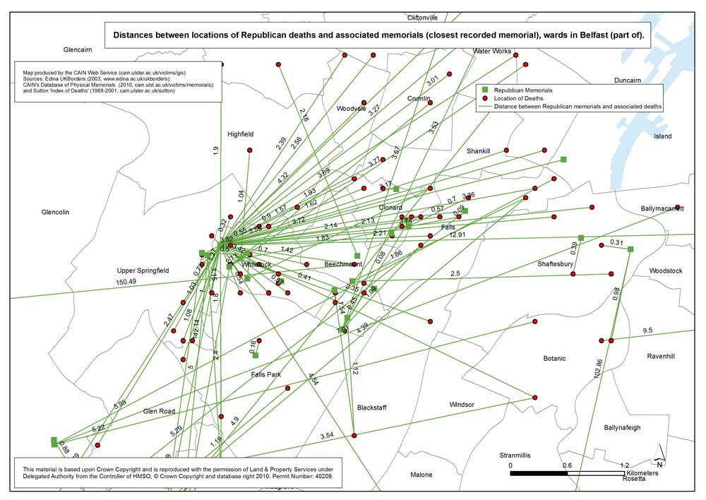
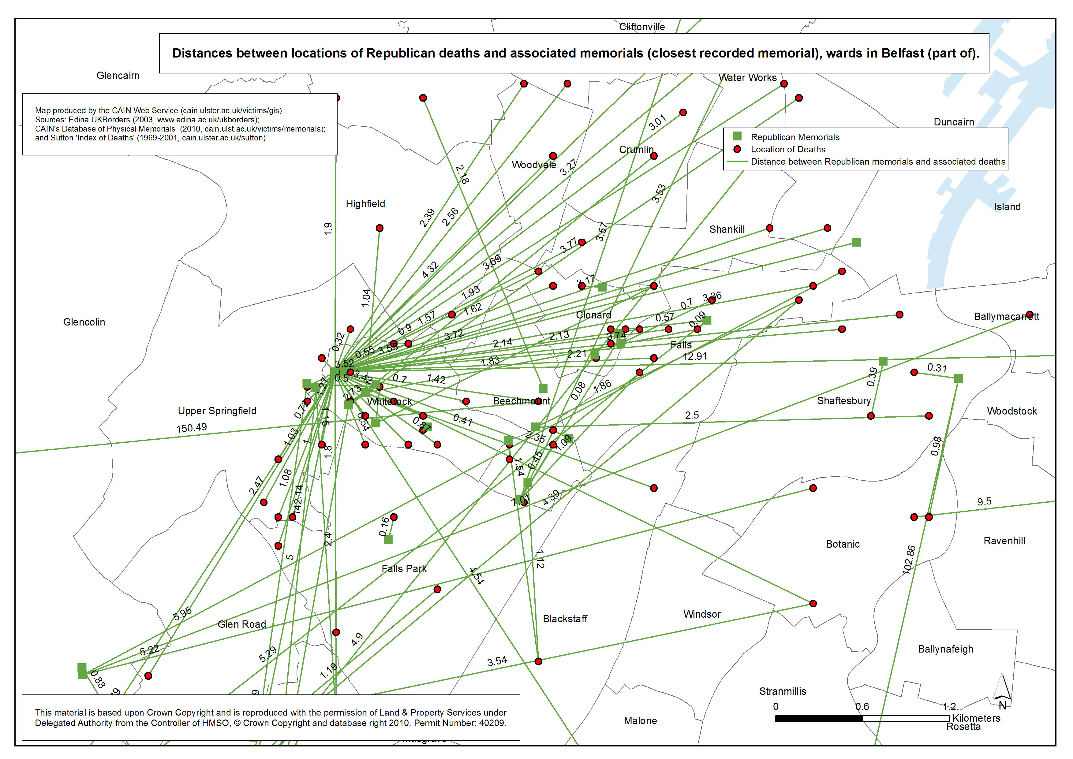
Distances - Republican - Belfast (part of)
Distances between locations of Republican paramilitary deaths and associated memorials (closest recorded memorial), wards in Belfast (part of) |
.pdf
670kb |
.jpg
102kb |
.jpg
1145kb |
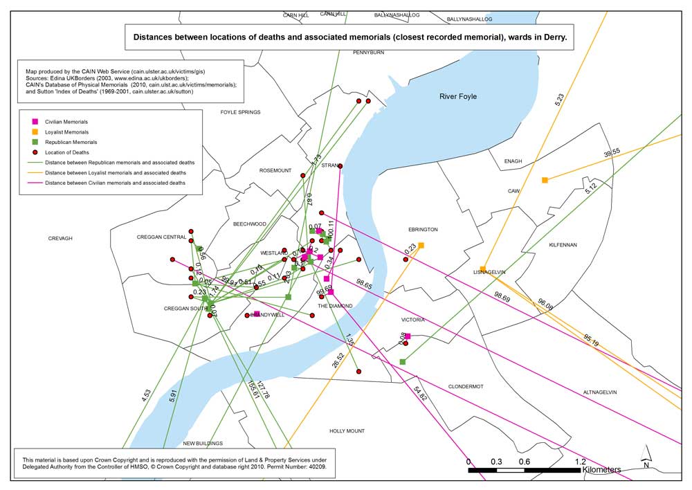
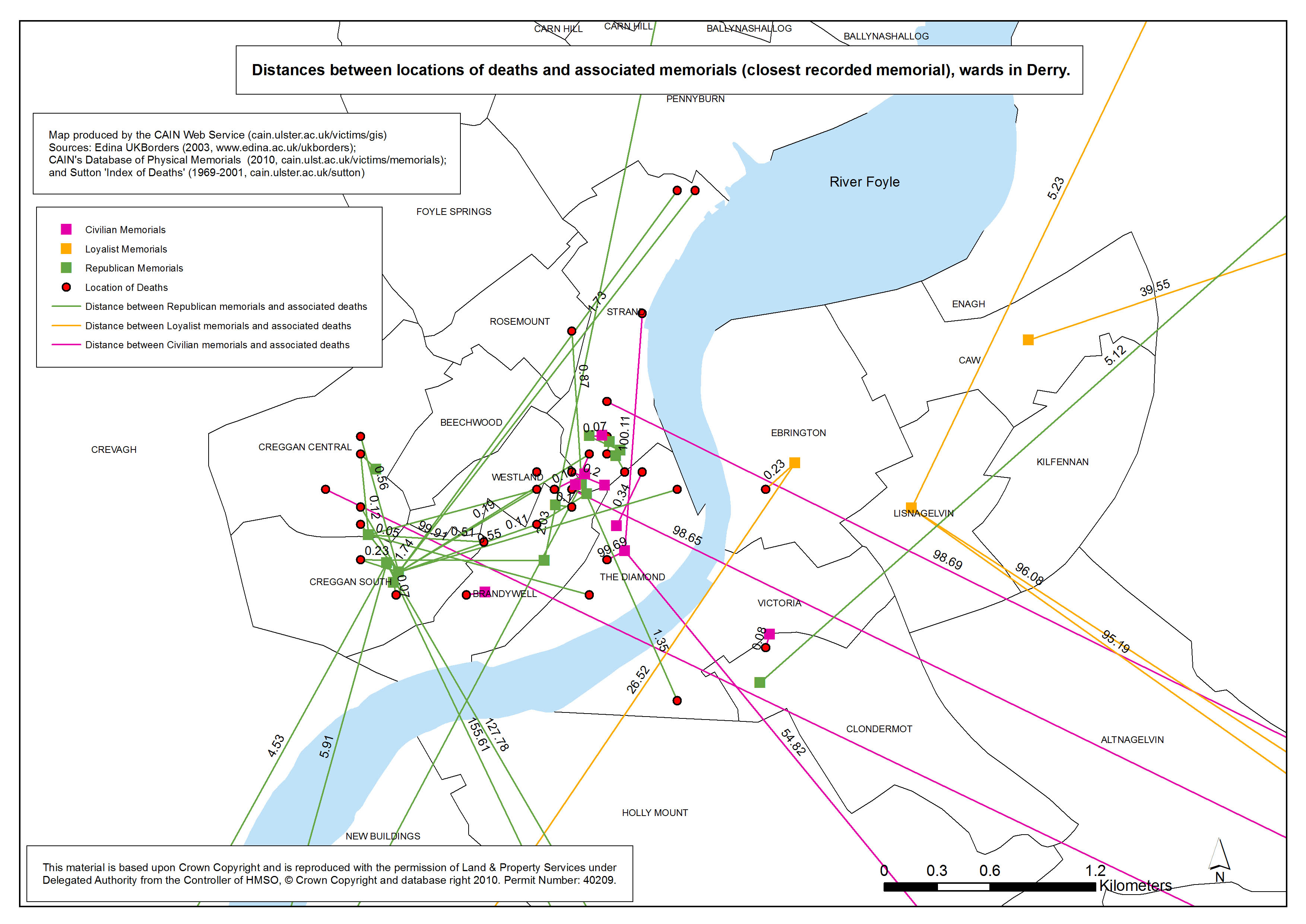
Distances - Civilian - Derry
Distances between locations of deaths and associated memorials (closest recorded memorial), wards in Derry |
.pdf
567kb |
.jpg
86kb |
.jpg
986kb |
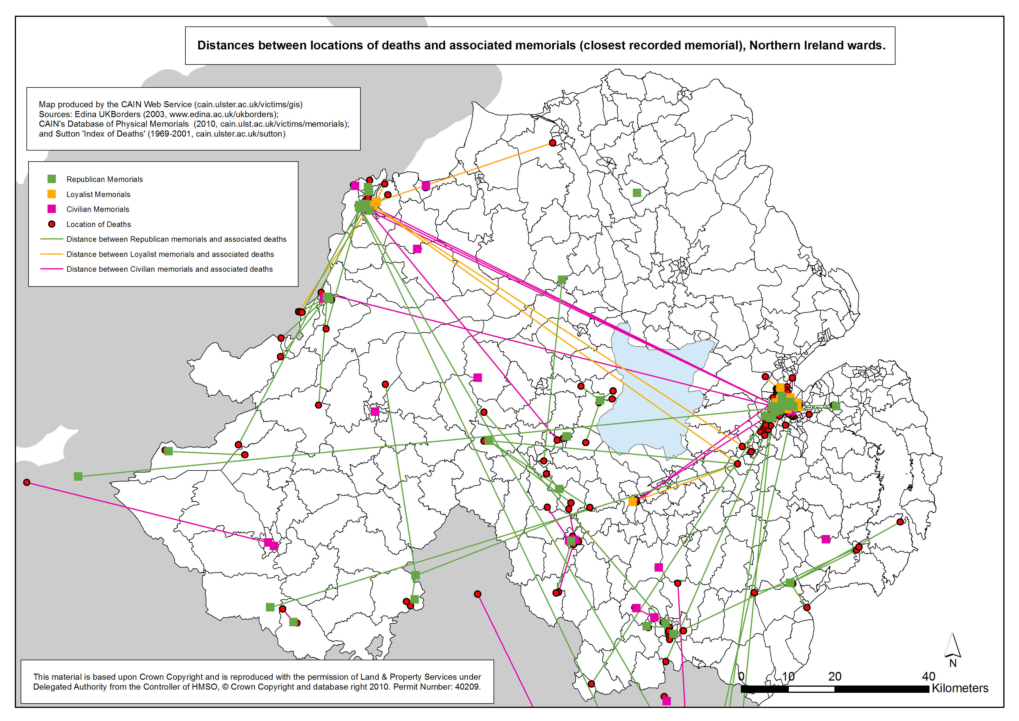
Distances - Civilian - Northern Ireland
Distances between locations of deaths and associated memorials (closest recorded memorial), wards in Northern Ireland |
.pdf
798kb |
.jpg
118kb |
.jpg
1293kb |
| Maps - Locations of deaths as a result of paramilitary feuds, and location of deaths of alleged informers, Belfast and Northern Ireland (5 maps) |
| Title of Map |
File Version |
| PDF |
L-JPG |
H-JPG |
Loyalist - Feuds - Belfast
Distribution of deaths within Belfast area, as a result of Loyalist feuds and disputes, and Religious distribution of population, at ward level |
.pdf
469kb |
.jpg
138kb |
.jpg
1082kb |
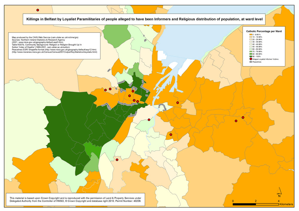
Loyalist - Informers - Belfast
Killings in Belfast by Loyalist paramilitaries of alleged informers, and Religious distribution of population, within Belfast area, at ward level |
.pdf
458kb |
.jpg
135kb |
.jpg
1055kb |
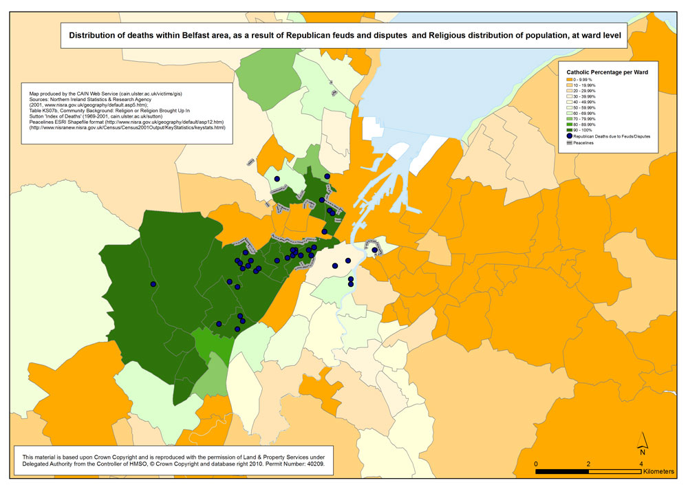
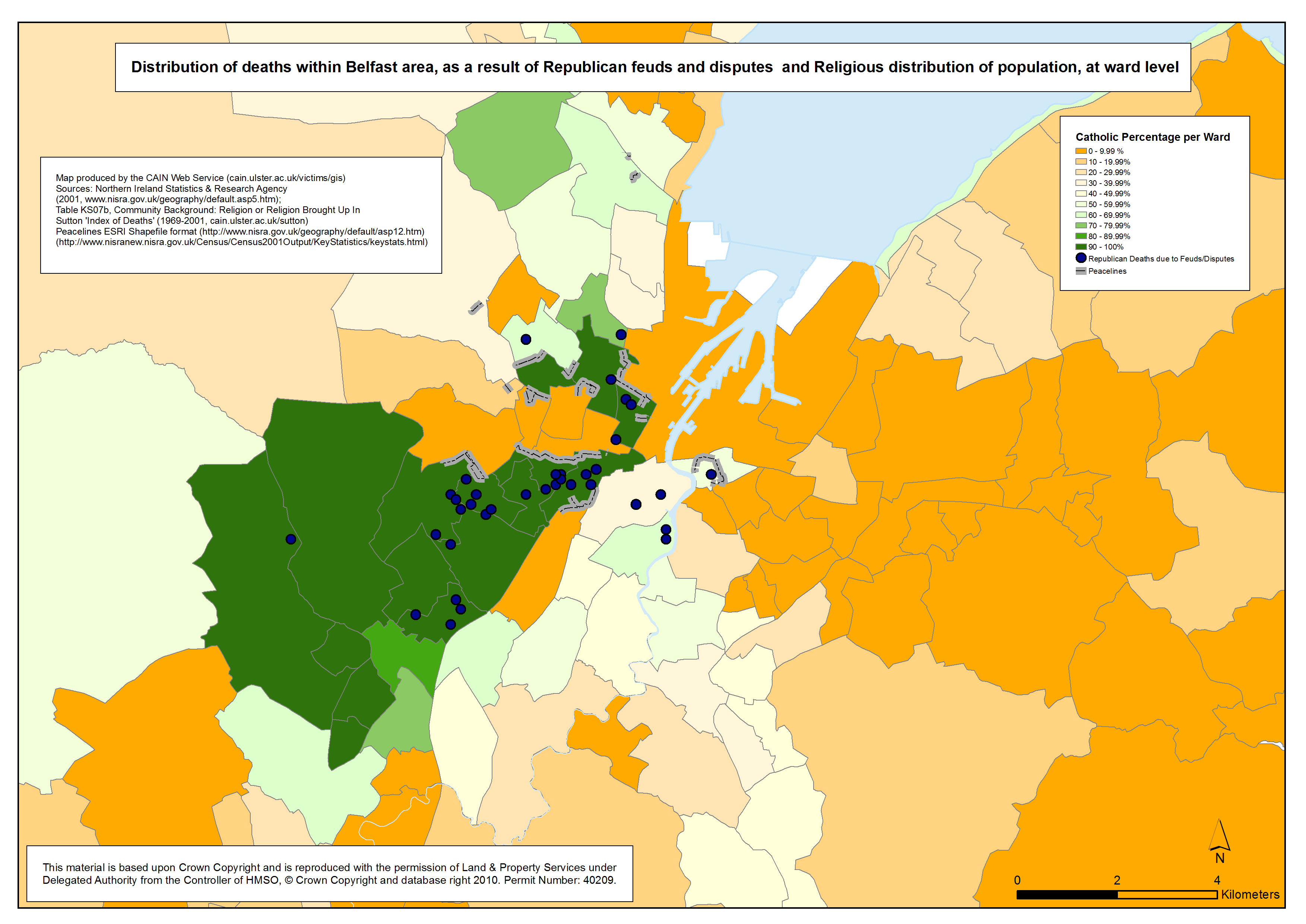
Republican - Feuds - Belfast
Distribution of deaths within Belfast area, as a result of Republican feuds and disputes, and Religious distribution of population, at ward level
|
.pdf
464kb |
.jpg
135kb |
.jpg
1073kb |
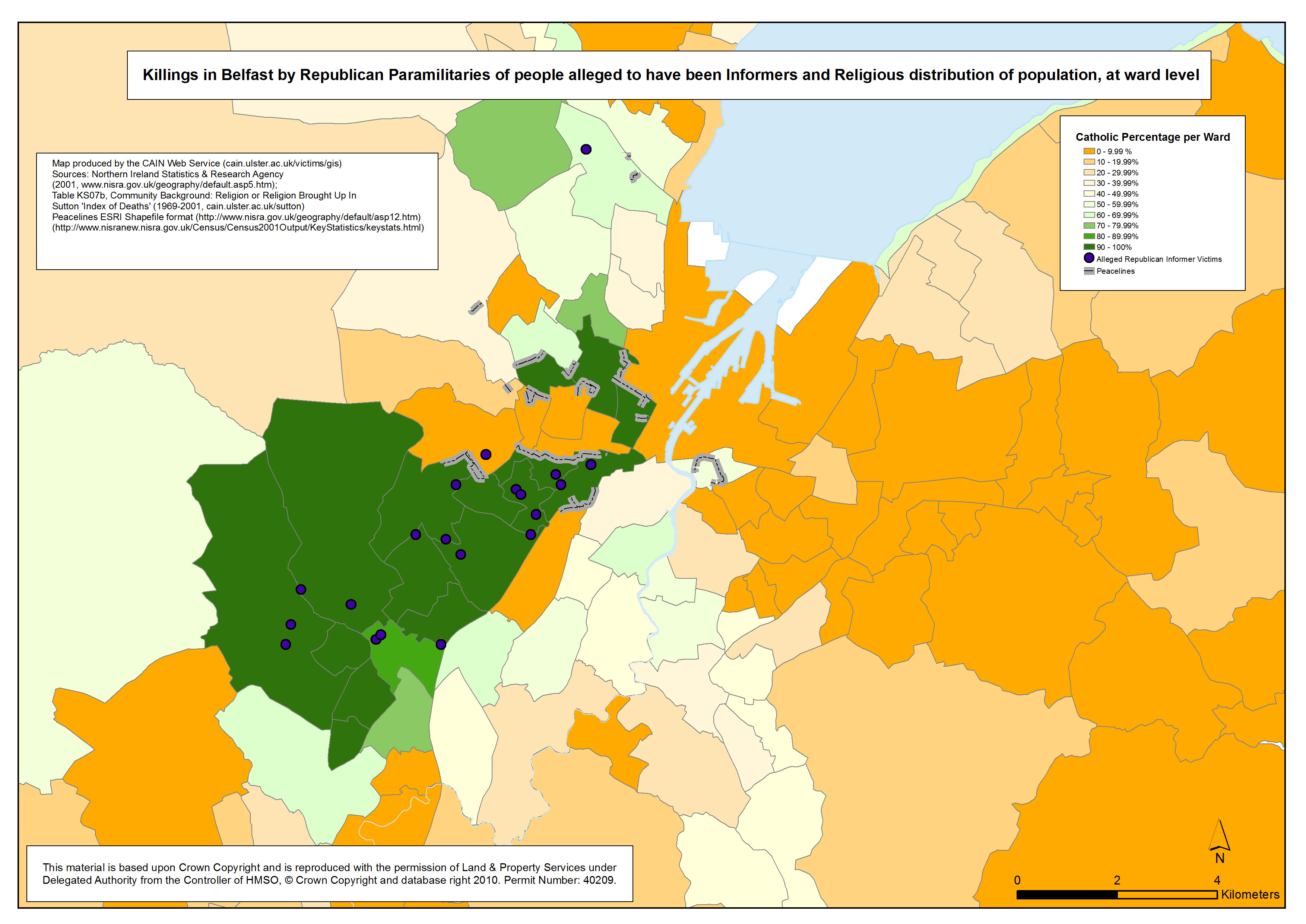
Republican - Informers - Belfast
Killings in Belfast by Republican paramilitaries of alleged informers, and Religious distribution of population, at ward level
|
.pdf
457kb |
.jpg
135kb |
.jpg
1052kb |
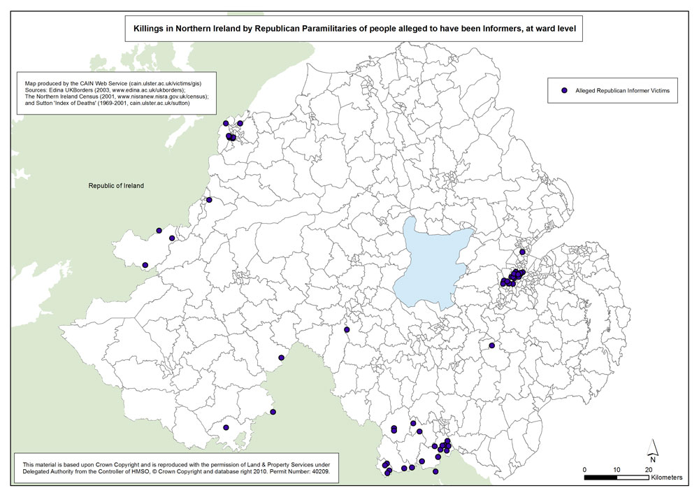
Republican - Informers - Northern Ireland
Killings in Northern Ireland by Republican Paramilitaries of people alleged to have been informers, at ward level |
.pdf
576kb |
.jpg
135kb |
.jpg
1090kb |
| Maps - Locations of deaths of child victims of the conflict, Belfast, Derry and Northern Ireland (3 maps) |
| Title of Map |
File Version |
| PDF |
L-JPG |
H-JPG |
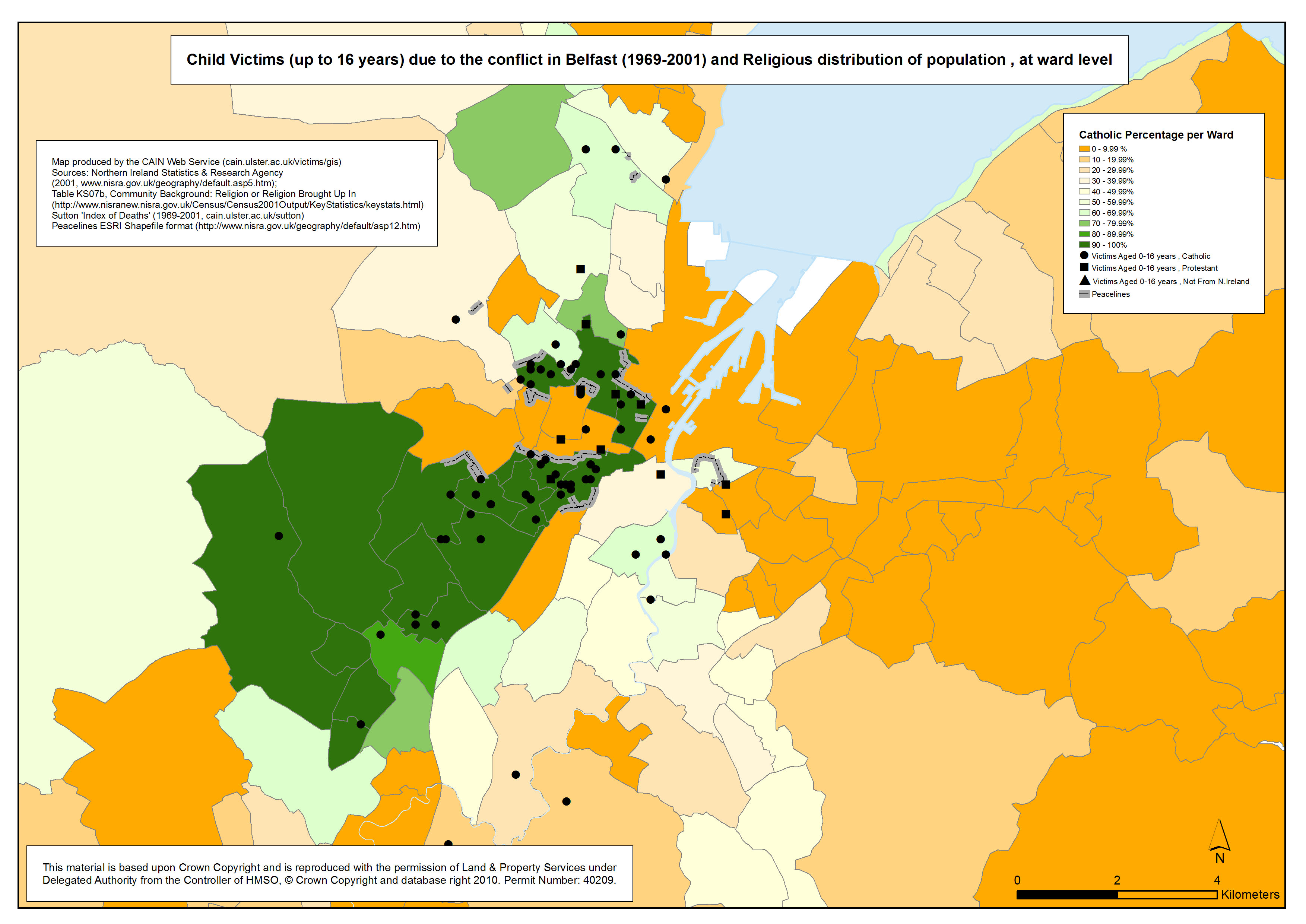
Child deaths - Belfast
Location of child deaths (up to 16 years) due to the conflict in Belfast, and Religious distribution of population, at ward level |
.pdf
467kb |
.jpg
137kb |
.jpg
1078kb |
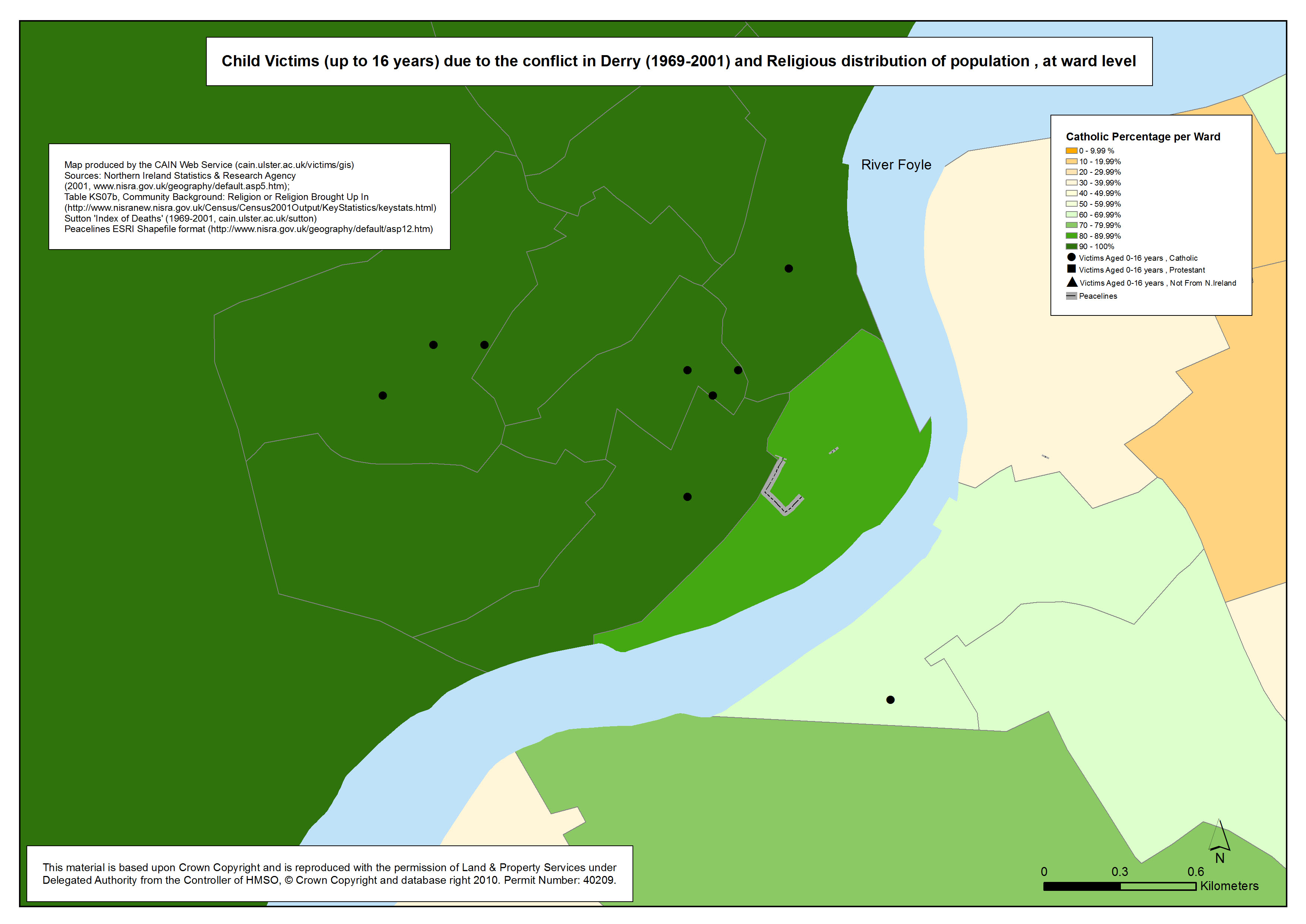
Child deaths - Derry
Location of child deaths (up to 16 years) due to the conflict in Derry, and Religious distribution of population, at ward level |
.pdf
364kb |
.jpg
84kb |
.jpg
773kb |
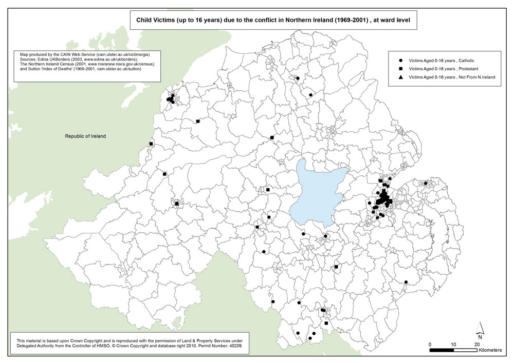
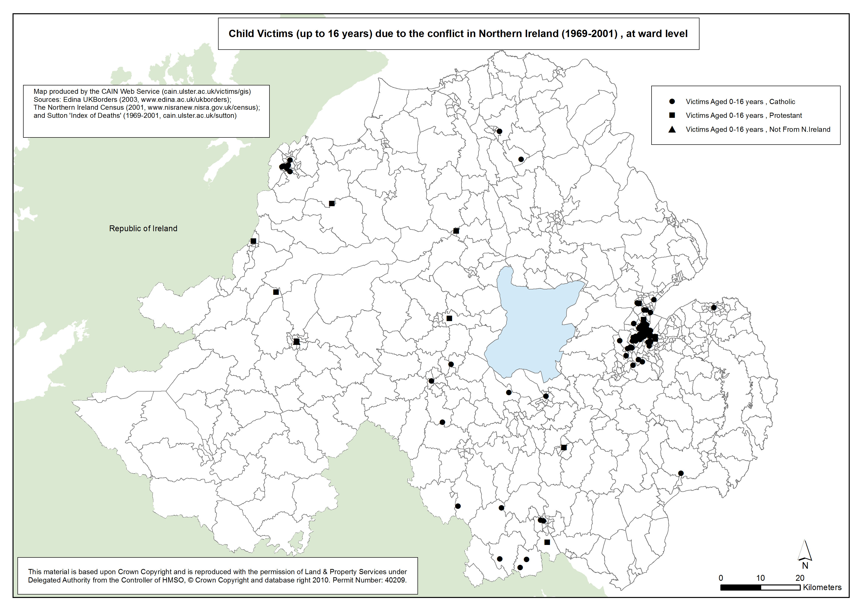
Child deaths - Northern Ireland
Location of child deaths (up to 16 years) due to the conflict in Northern Ireland, and Religious distribution of population, at ward level
|
.pdf
568kb |
.jpg
136kb |
.jpg
1082kb |
| Maps - Location of deaths related to the Northern Ireland conflict, in England, London, Europe, and the Republic of Ireland (4 maps) |
| Title of Map |
File Version |
| PDF |
L-JPG |
H-JPG |
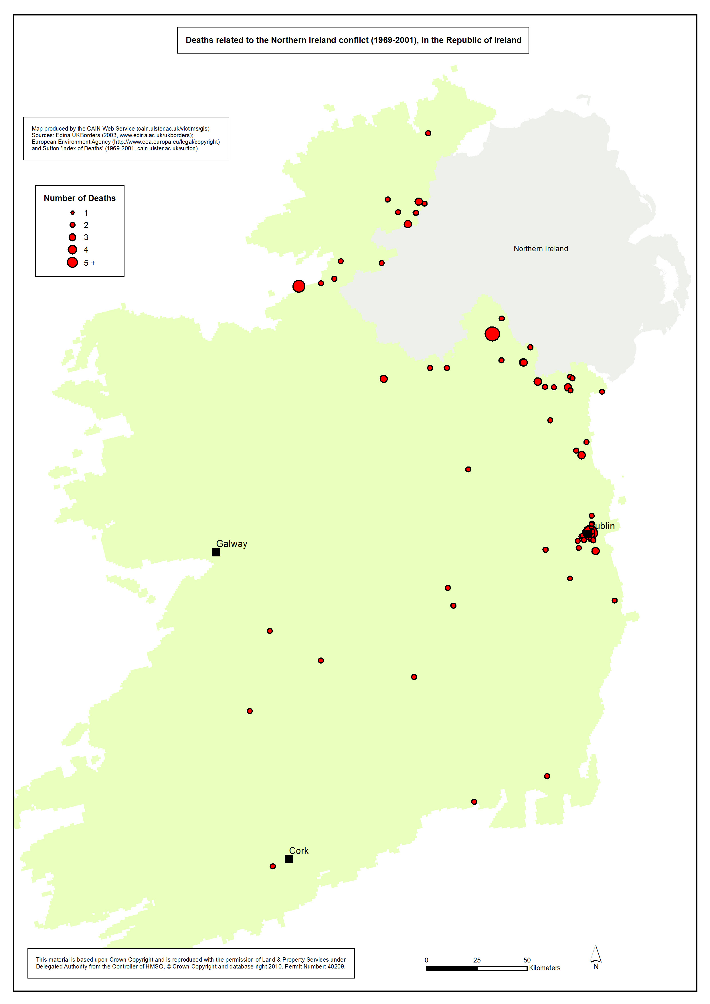
Deaths - Republic of Ireland
Deaths related to the Northern Ireland conflict (1969-2001), in the Republic of Ireland |
.pdf
456kb |
.jpg
107kb |
.jpg
1004kb |
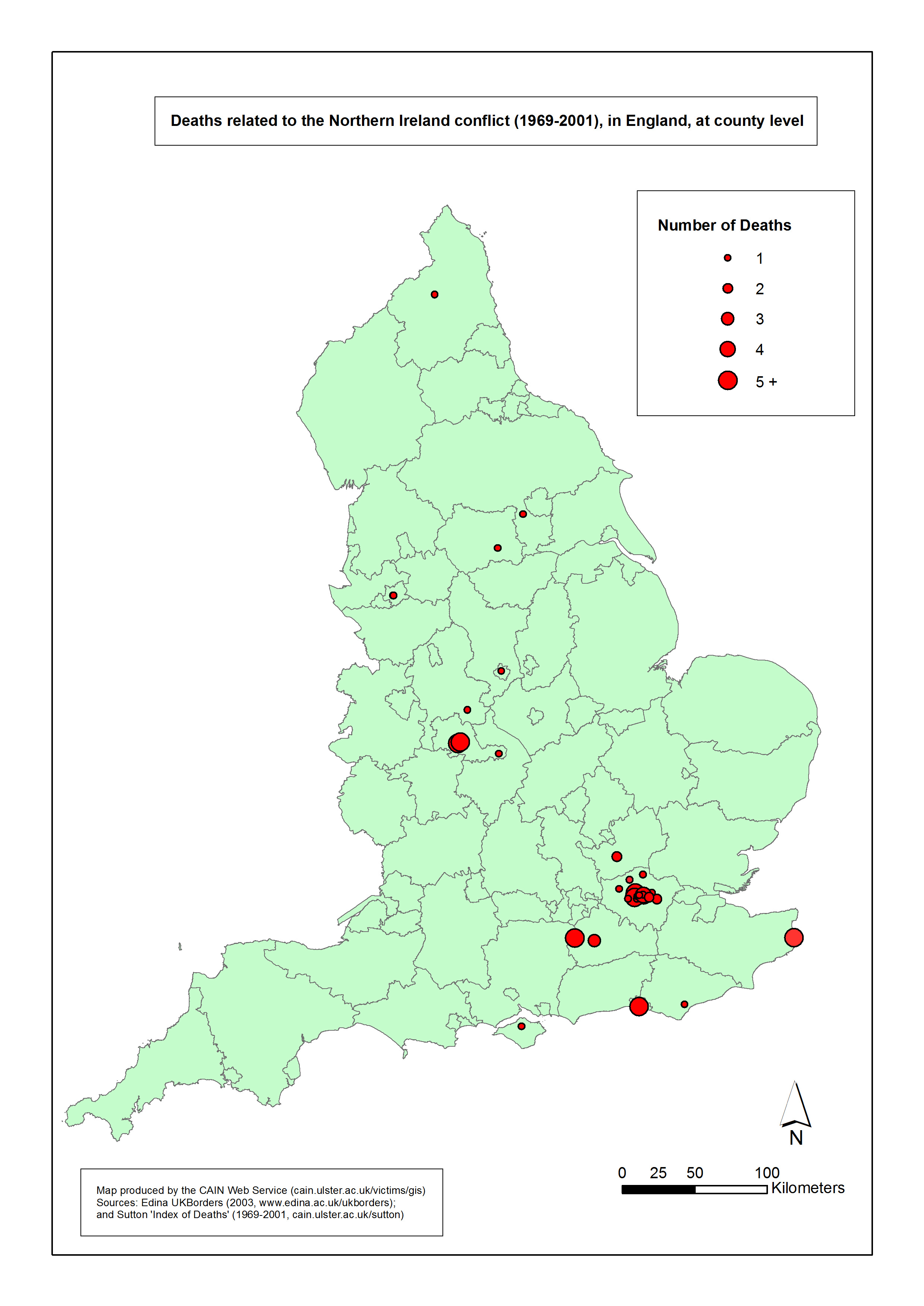
Deaths - England
Deaths related to the Northern Ireland conflict (1969-2001), in England, at county level |
.pdf
353kb |
.jpg
81kb |
.jpg
904kb |
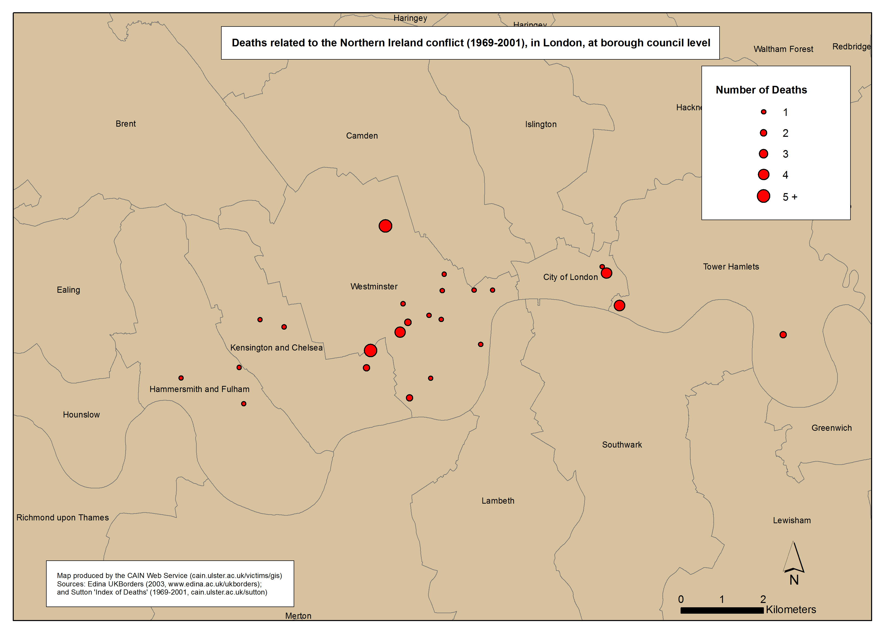
Deaths - London
Deaths related to the Northern Ireland conflict (1969-2001), in London, at borough council level |
.pdf
323kb |
.jpg
76kb |
.jpg
879kb |
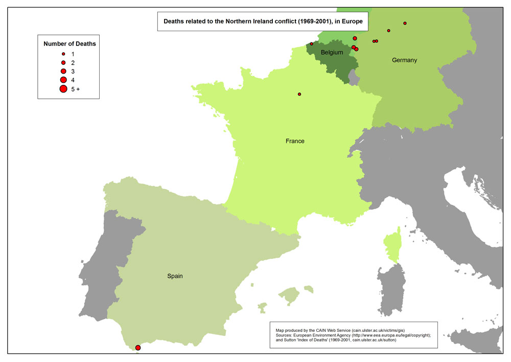
Deaths - Europe
Deaths related to the Northern Ireland conflict (1969-2001), in Europe
|
.pdf
265kb |
.jpg
56kb |
.jpg
641kb |
| Maps - Deaths due to the conflict, close to selected peacelines in Belfast, and distribution of Catholics of adjoining wards (6 maps) |
| Title of Map |
File Version |
| PDF |
L-JPG |
H-JPG |
Deaths - Peaceline - Alliance Avenue
Deaths due to the conflict, in two three-year periods prior to (1988-1990) and after (1992-1994) the establishment of the Alliance Avenue Peaceline (in 1991), and distribution of Catholics of adjoining wards in Belfast (2001) |
.pdf
440kb |
.jpg
132kb |
.jpg
1159kb |
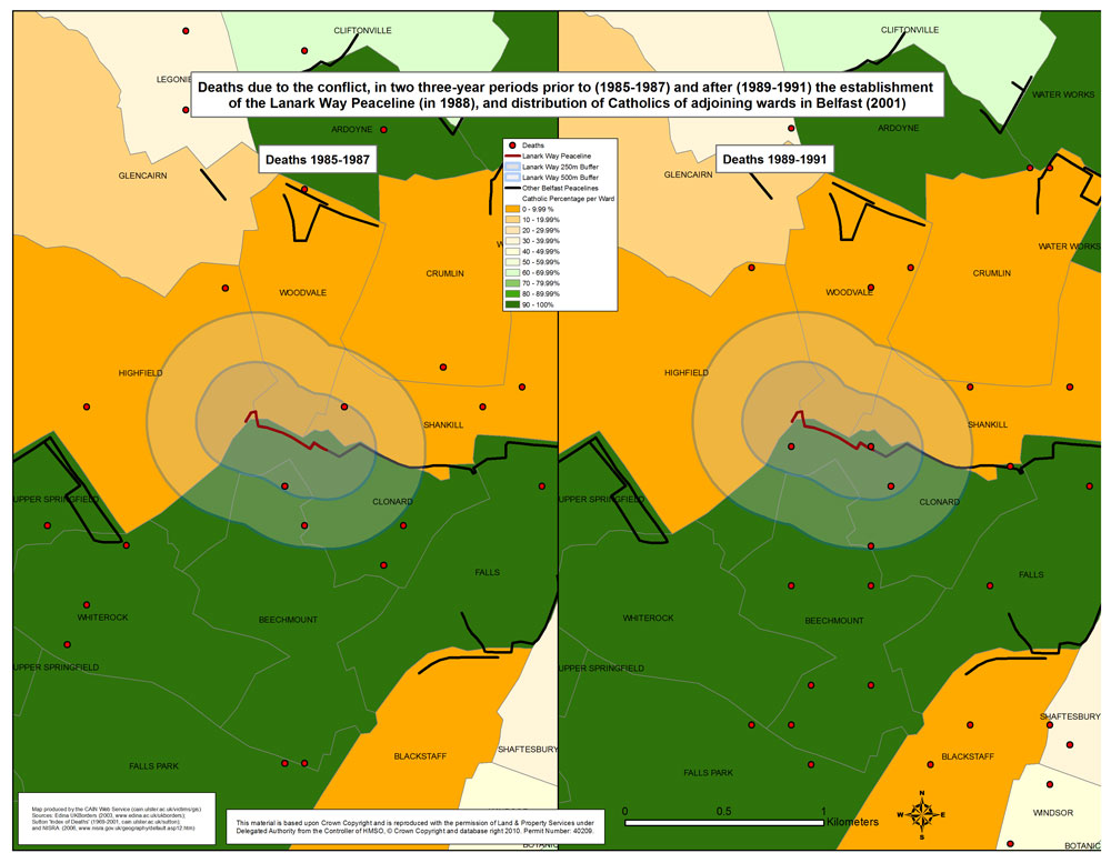
Deaths - Peaceline - Lanark Way
Deaths due to the conflict, in two three-year periods prior to (1985-1987) and after (1989-1991) the establishment of the Lanark Way Peaceline (in 1988), and distribution of Catholics of adjoining wards in Belfast (2001) |
.pdf
453kb |
.jpg
138kb |
.jpg
1224kb |
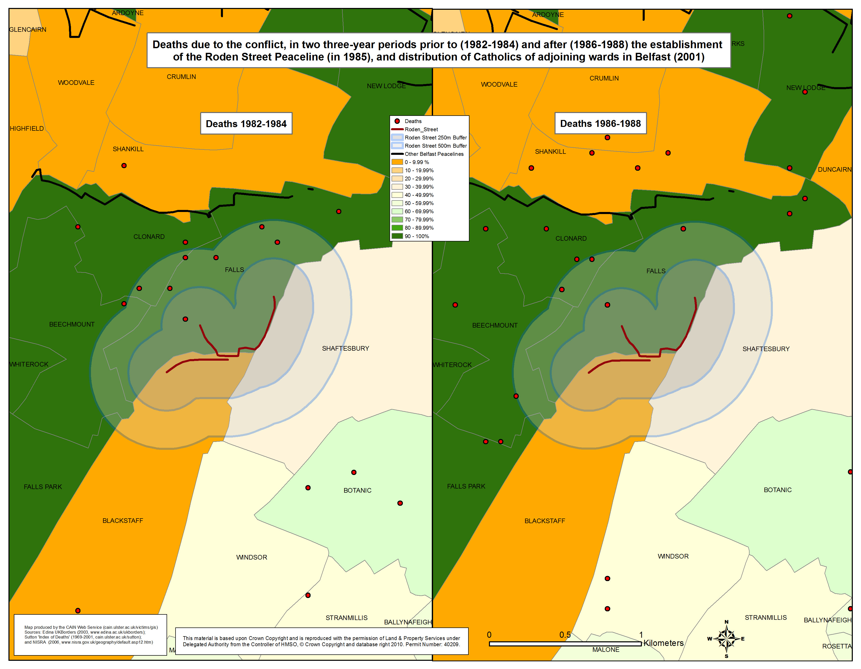
Deaths - Peaceline - Roden Street
Deaths due to the conflict, in two three-year periods prior to (1982-1984) and after (1986-1988) the establishment of the Roden Street Peaceline (in 1985), and distribution of Catholics of adjoining wards in Belfast (2001) |
.pdf
455kb |
.jpg
133kb |
.jpg
1207kb |
Deaths - Peaceline - Squires Hill
Deaths due to the conflict, in two three-year periods prior to (1990-1992) and after (1994-1996) the establishment of the Squires Hill Peaceline (in 1993), and distribution of Catholics of adjoining wards in Belfast (2001)
|
.pdf
392kb |
.jpg
108kb |
.jpg
977kb |
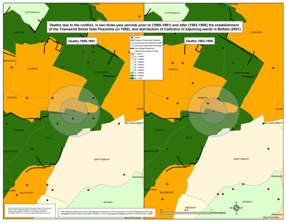
Deaths - Peaceline - Townsend Street Gate
Deaths due to the conflict, in two three-year periods prior to (1989-1991) and after (1993-1995) the establishment of the Townsend Street Gate Peaceline (in 1992), and distribution of Catholics of adjoining wards in Belfast (2001) |
.pdf
457kb |
.jpg
136kb |
.jpg
1203kb |
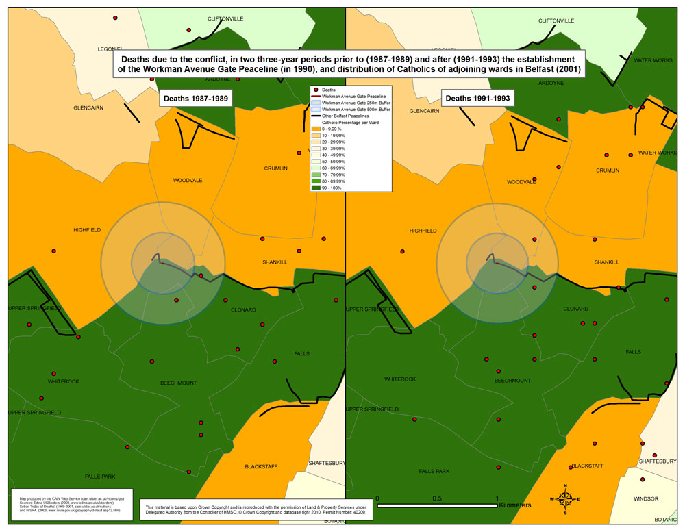
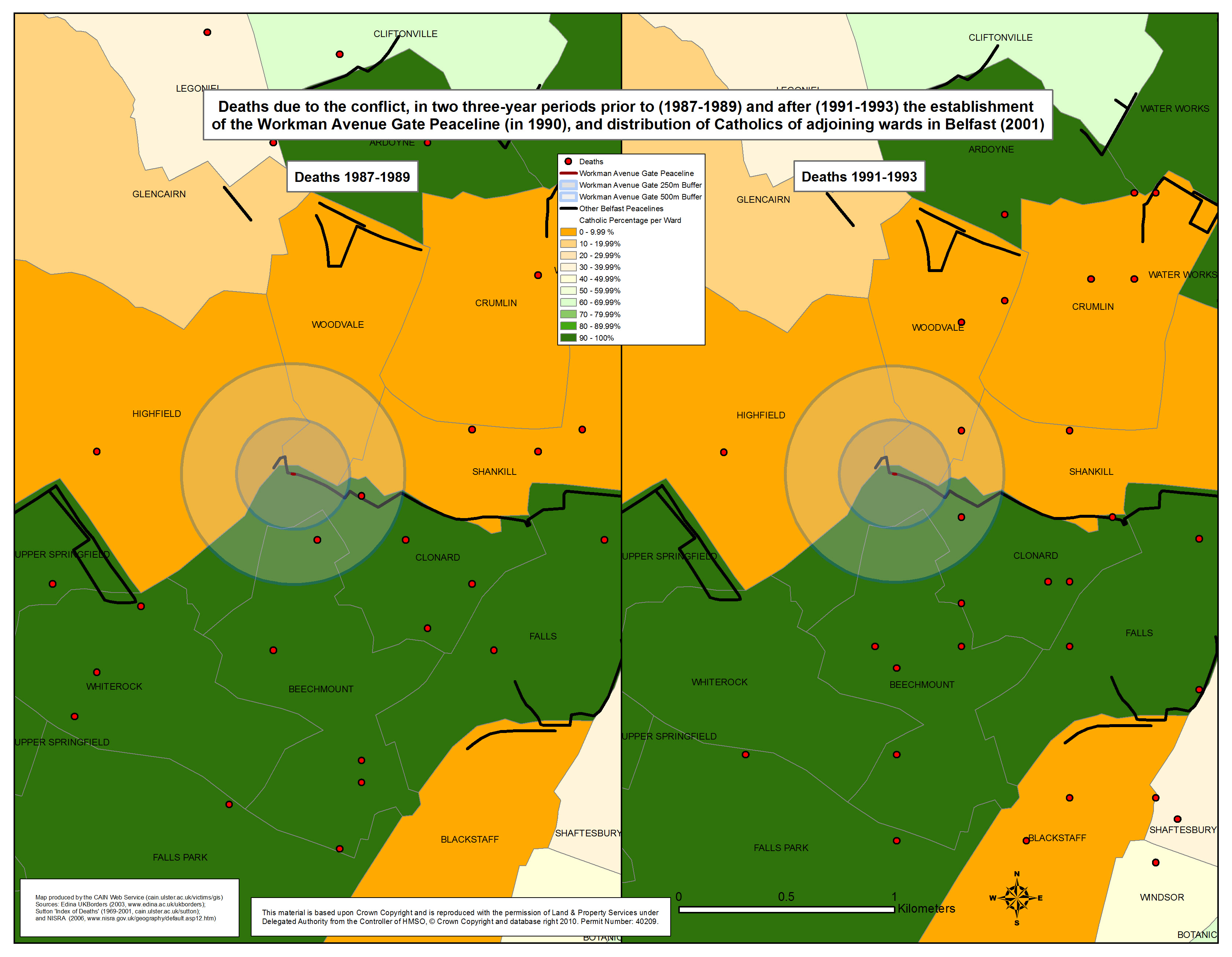
Deaths - Peaceline - Workman Avenue Gate
Deaths due to the conflict, in two three-year periods prior to (1987-1989) and after (1991-1993) the establishment of the Workman Avenue Gate Peaceline (in 1990), and distribution of Catholics of adjoining wards in Belfast (2001) |
.pdf
454kb |
.jpg
139kb |
.jpg
1233kb |
| Maps - Physical memorials related to the conflict, in Belfast, Derry, and Northern Ireland (7 maps) |
| Title of Map |
File Version |
| PDF |
L-JPG |
H-JPG |
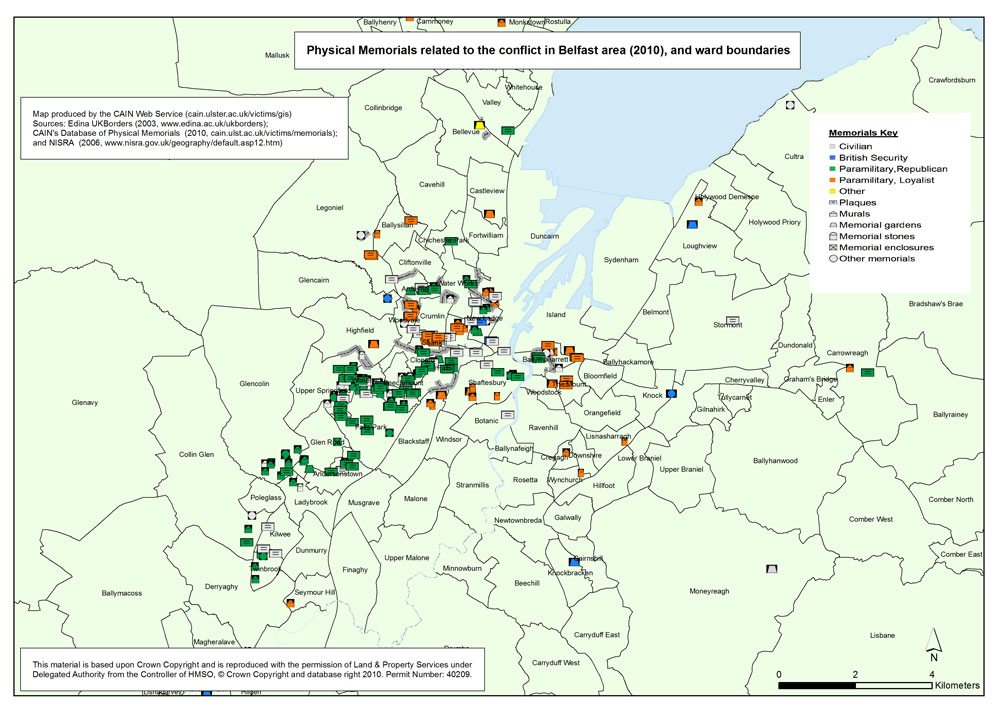
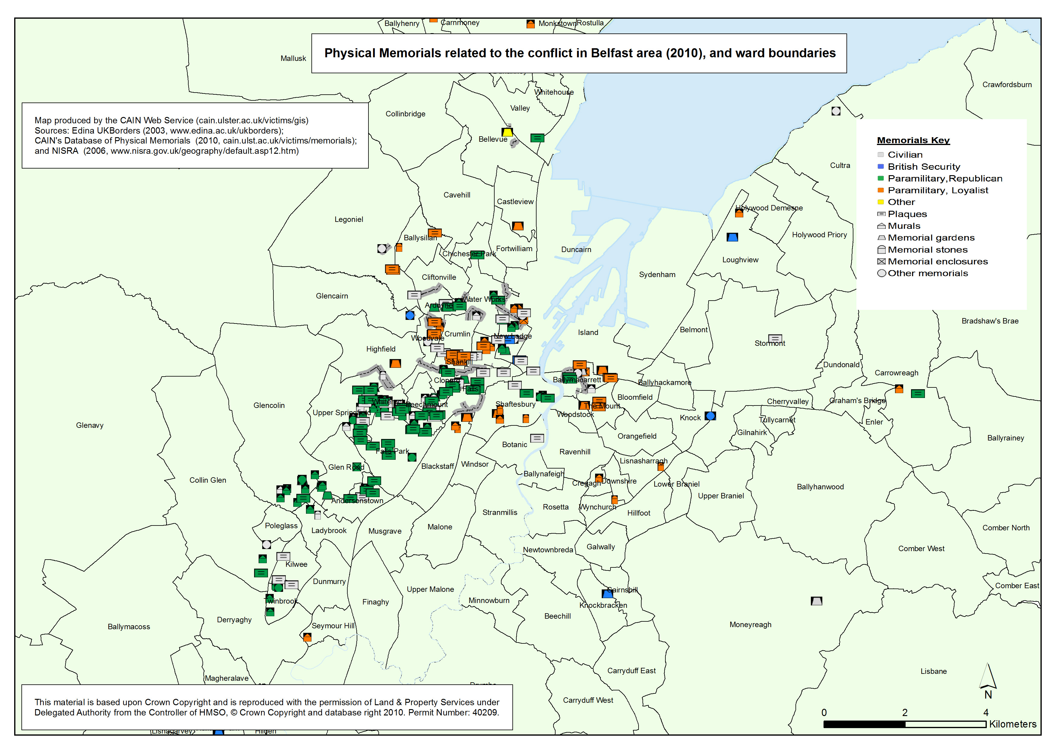
Memorials - Belfast
Physical memorials related to the conflict in Belfast area (2010), and wards boundaries (2001) |
.pdf
632kb |
.jpg
155kb |
.jpg
1465kb |
Memorials - Deprivation (MDM) - Belfast
Physical memorials related to the conflict in Belfast area (2010), with Multiple Deprivation Measure score, at ward level (2001) |
.pdf
517kb |
.jpg
131kb |
.jpg
1263kb |
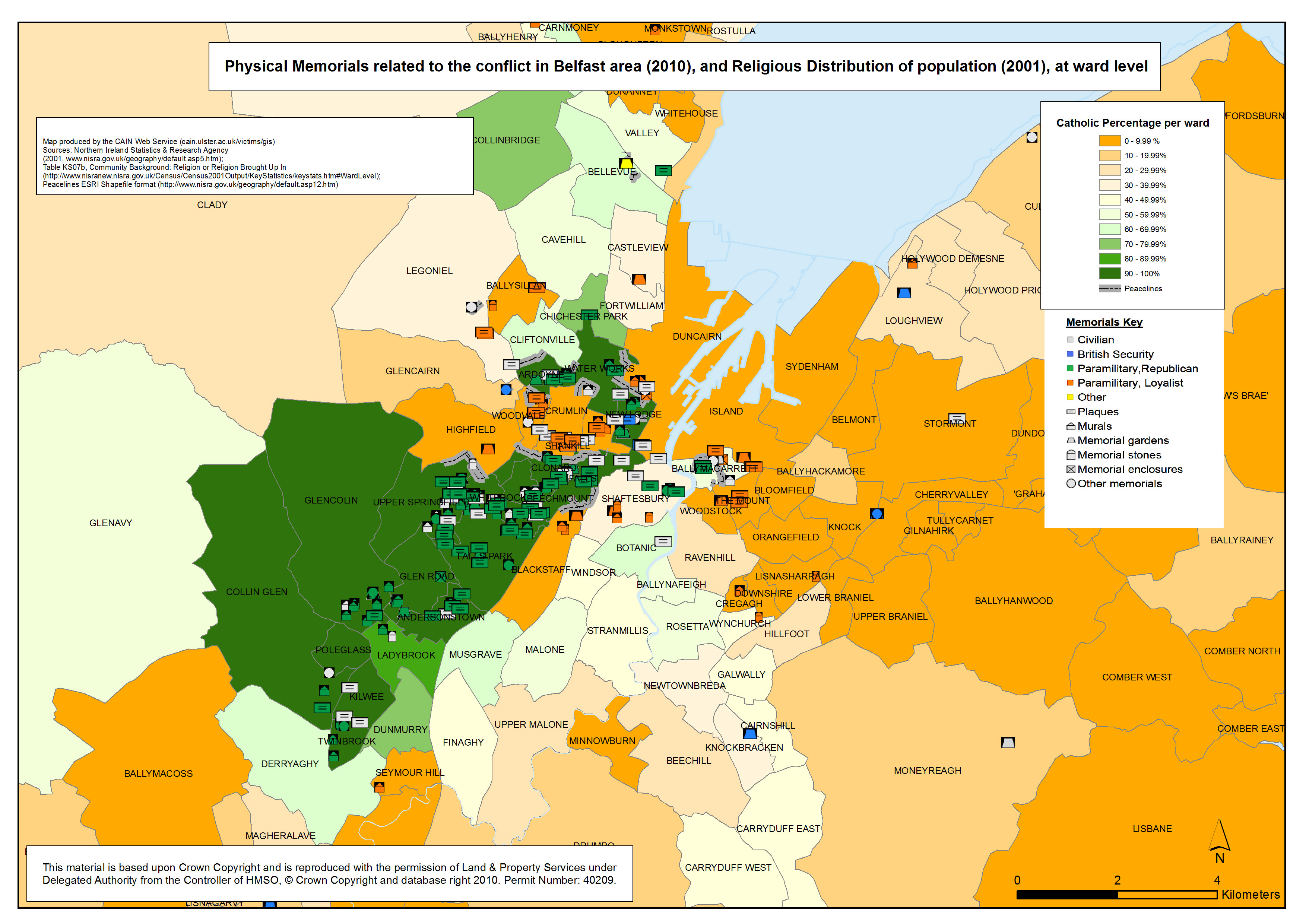
Memorials - Religion - Belfast
Physical memorials related to the conflict in Belfast area (2010), with the distribution of Catholics, at ward level (2001) |
.pdf
583kb |
.jpg
169kb |
.jpg
1618kb |
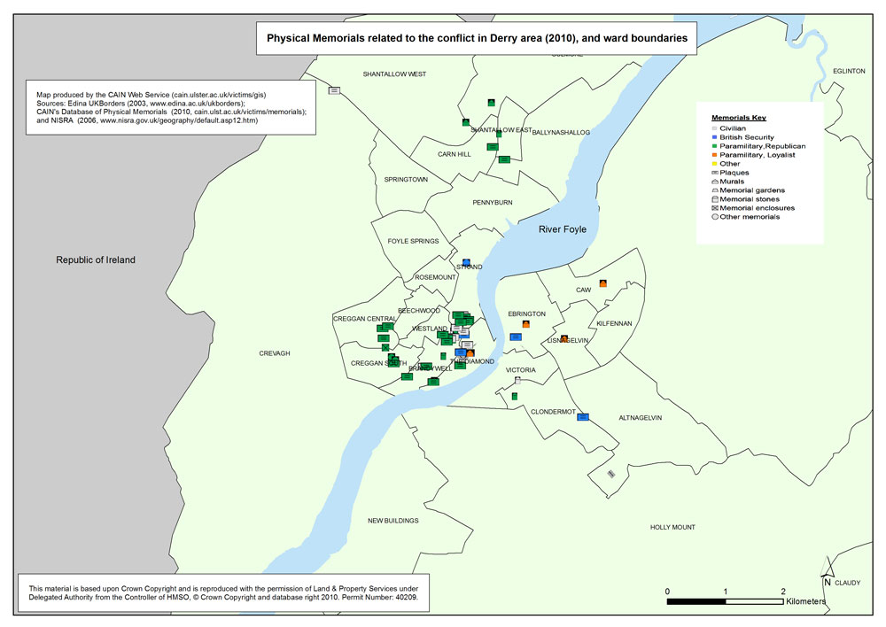
Memorials - Derry
Physical memorials related to the conflict in Derry area (2010), and wards boundaries (2001)
|
.pdf
427kb |
.jpg
96kb |
.jpg
958kb |
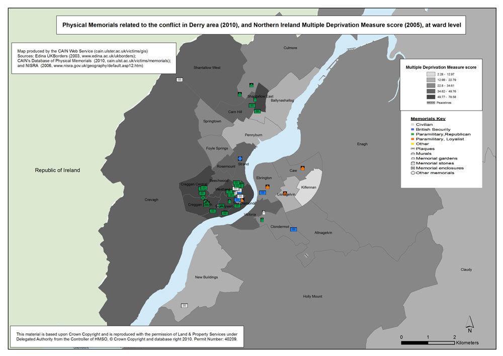
Memorials - Deprivation (MDM) - Derry
Physical memorials related to the conflict in Derry area (2010), with Multiple Deprivation Measure score, at ward level (2001) |
.pdf
380kb |
.jpg
85kb |
.jpg
873kb |
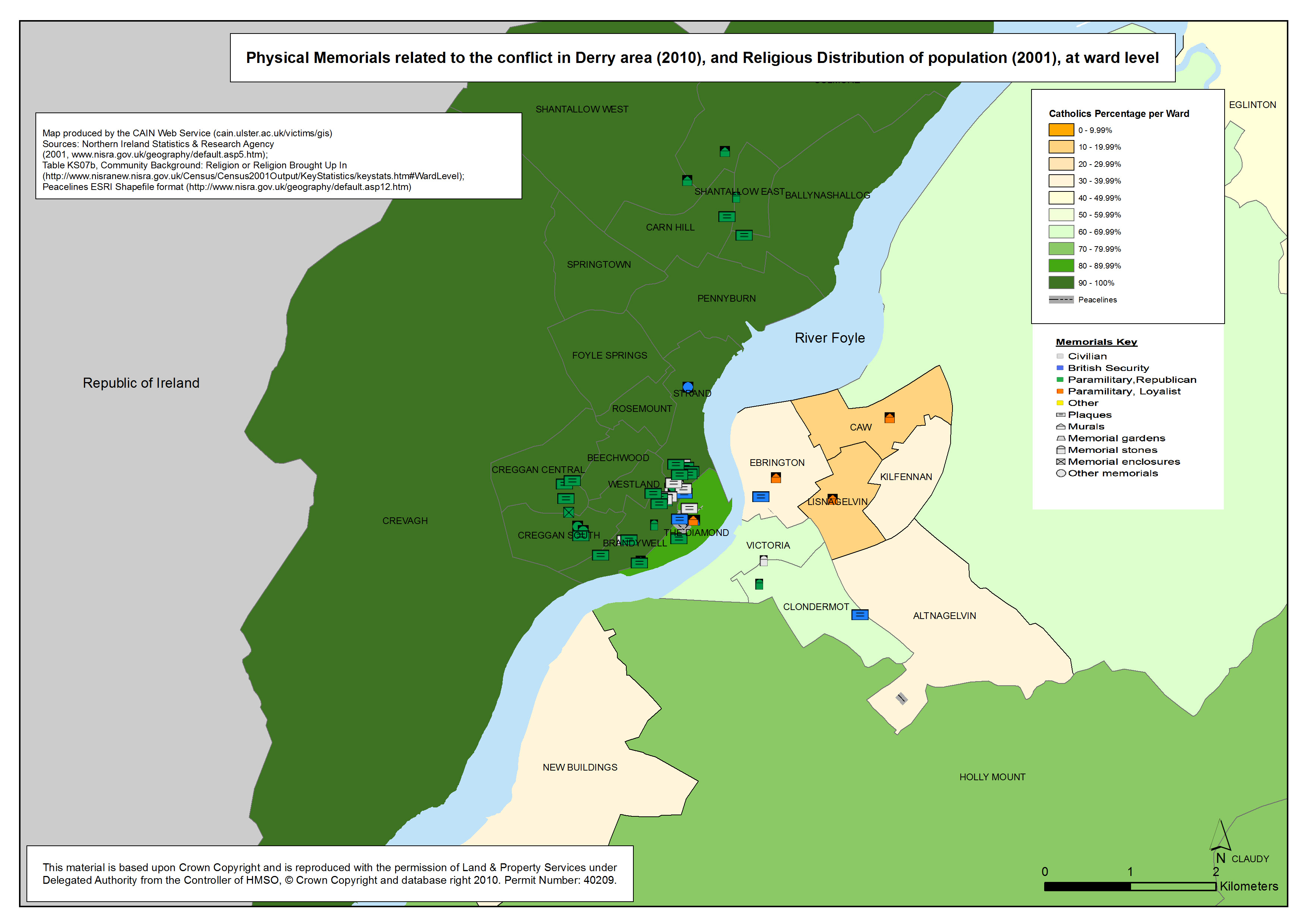
Memorials - Religion - Derry
Physical memorials related to the conflict in Derry area (2010), with the distribution of Catholics, at ward level (2001) |
.pdf
418kb |
.jpg
100kb |
.jpg
1015kb |
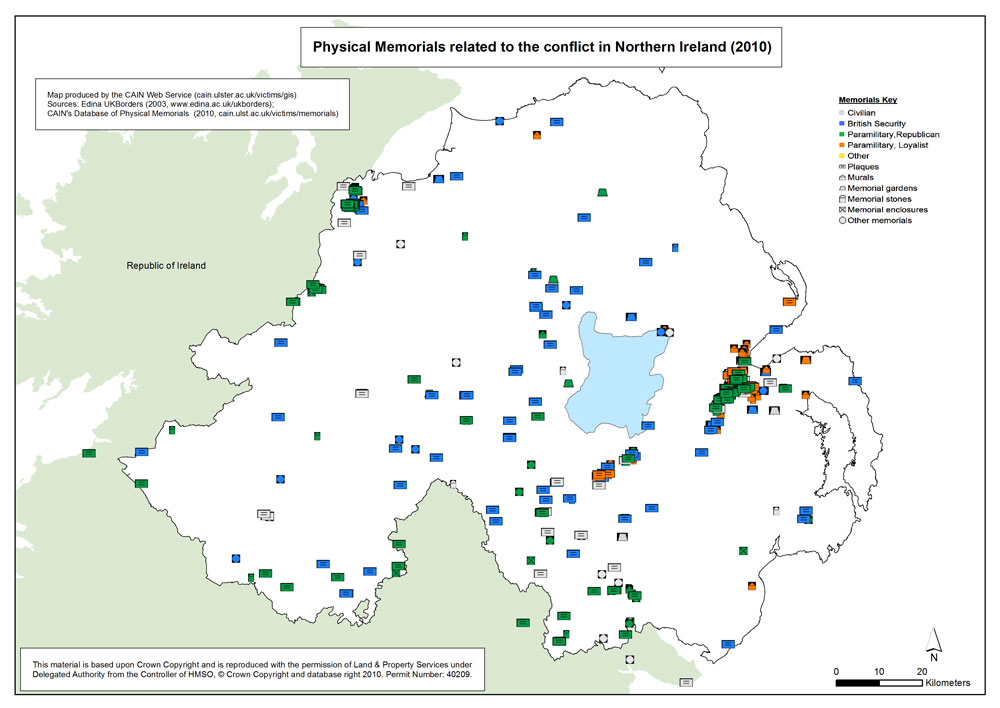
Memorials - NI
Physical memorials related to the conflict in Northern Ireland (2010) |
.pdf
410kb |
.jpg
96kb |
.jpg
873kb |
|
