Visualising the Conflict
Geographic Information Systems (GIS) Maps
Map Set 7:
Killings and Multiple Deprivation Measure score |
| Map Set 7: Killings and Multiple Deprivation Measure score Maps - Introduction |
Maps - Killings (1969-2001), by area (Belfast, Derry), by organisation, with Multiple Deprivation Measure score, at ward level (6 maps)
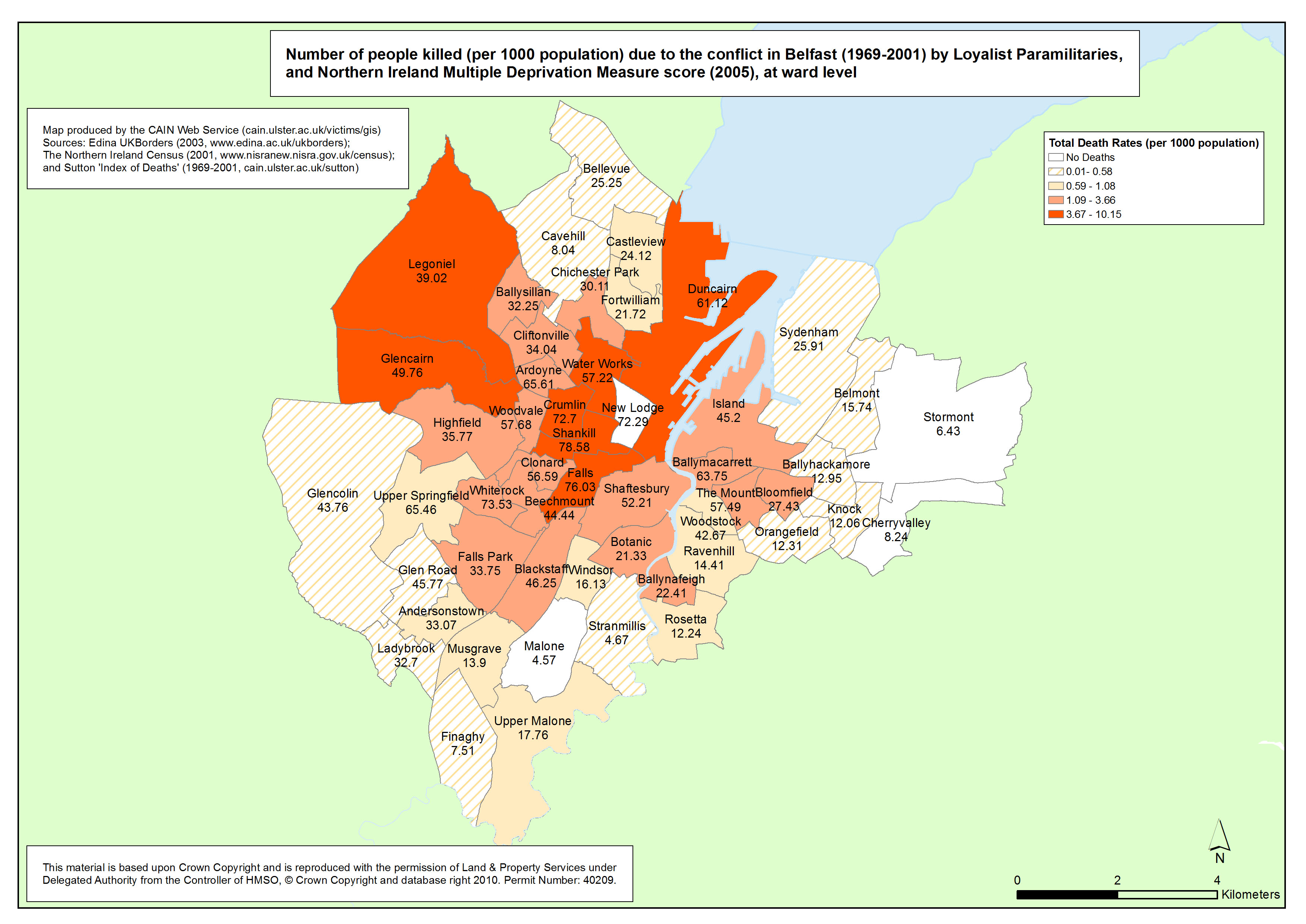
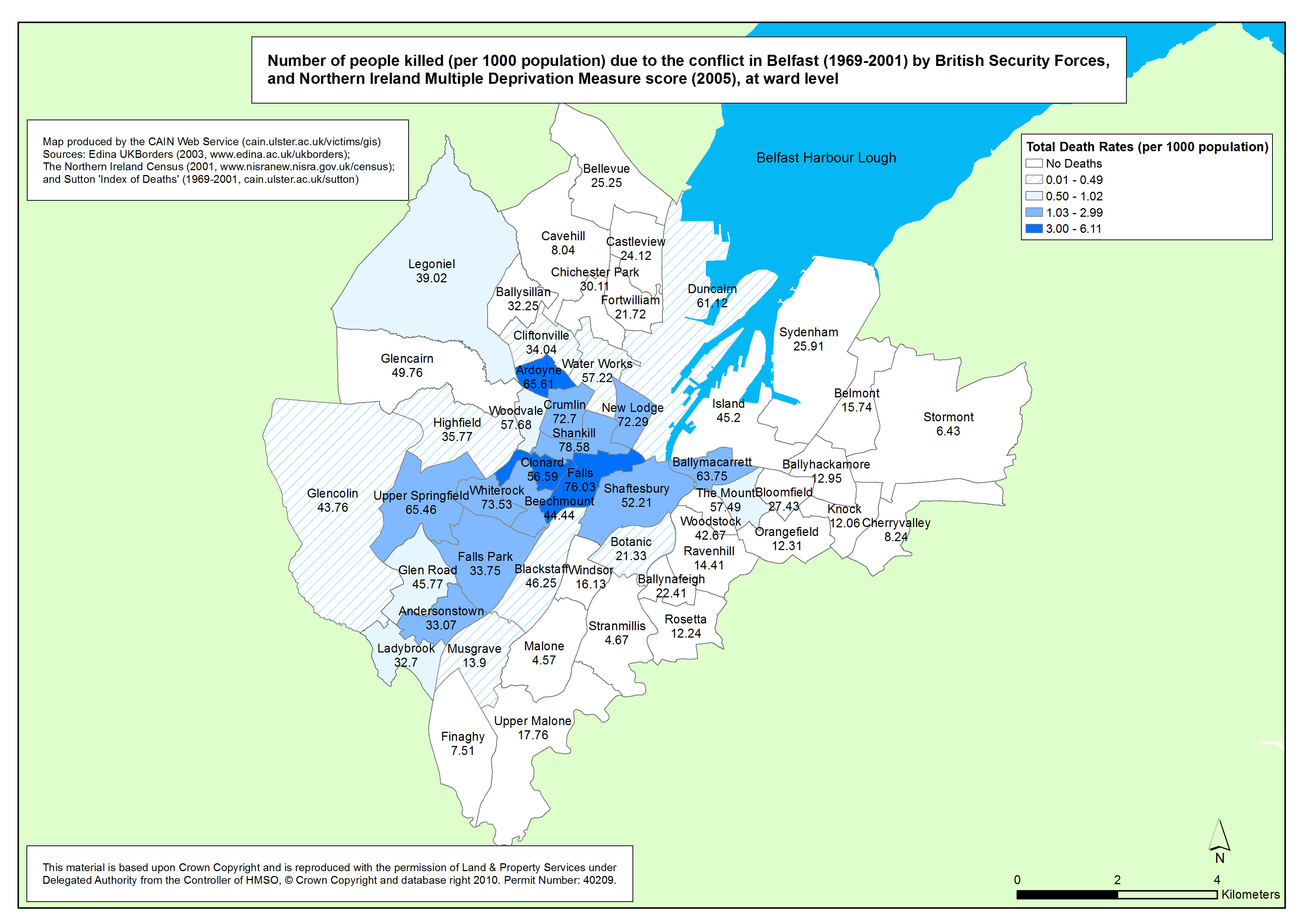
 This set of maps illustrates the death rates per 1000 population in Belfast and Derry, for 3 categories of organisations, due to the conflict in Northern Ireland between 1969 and 2001, as discussed previously and in addition indicates the Northern Ireland Multiple Deprivation Measure (NIMDM) 2005 score for each ward. This set of maps illustrates the death rates per 1000 population in Belfast and Derry, for 3 categories of organisations, due to the conflict in Northern Ireland between 1969 and 2001, as discussed previously and in addition indicates the Northern Ireland Multiple Deprivation Measure (NIMDM) 2005 score for each ward.
The NIMDM is a combination of seven types or 'domains' of deprivation:
- Income Deprivation 25%
- Employment Deprivation 25%
- Health Deprivation and Disability 15%
- Education, Skills and Training Deprivation 15%
- Proximity to Services 10%
- Living Environment 5%
- Crime and Disorder 5%
The NIMDM was downloaded from the Northern Ireland Statistics and Research Agency
(http://www.ninis.nisra.gov.uk/mapxtreme_deprivation2005/datacatalogue.asp?button=ward)
| Maps - Killings (1969-2001), by area (Northern Ireland, Belfast, Derry), by organisation, with Multiple Deprivation Measure score, at ward level (6 maps compiled and drawn by Luke Kelleher) |
| Title of Map |
File Version |
| PDF
| L-JPG
| H-JPG
|
| Belfast |
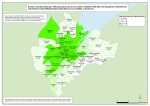
Killings - Belfast - Republican Killings - Ward - MDM
Number of people killed (per 1000 population) due to the conflict in Belfast (1969-2001) by Republican Paramilitaries, with Multiple Deprivation Measure score, at ward level |
.pdf
529kb |
.jpg
176kb |
.jpg
1241kb |
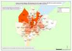 Killings - Belfast - Loyalist Killings - Ward - MDM Killings - Belfast - Loyalist Killings - Ward - MDM
Number of people killed (per 1000 population) due to the conflict in Belfast (1969-2001) by Loyalist Paramilitaries, with Multiple Deprivation Measure score, at ward level |
.pdf
500kb |
.jpg
166kb |
.jpg
1151kb |
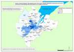 Killings - Belfast - British Security Forces - Ward - MDM Killings - Belfast - British Security Forces - Ward - MDM
Number of people killed (per 1000 population) due to the conflict in Belfast (1969-2001) by British Security Forces, with Multiple Deprivation Measure score, at ward level |
.pdf
516kb |
.jpg
162kb |
.jpg
1137kb |
| Derry |
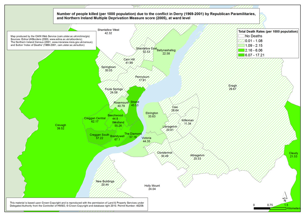
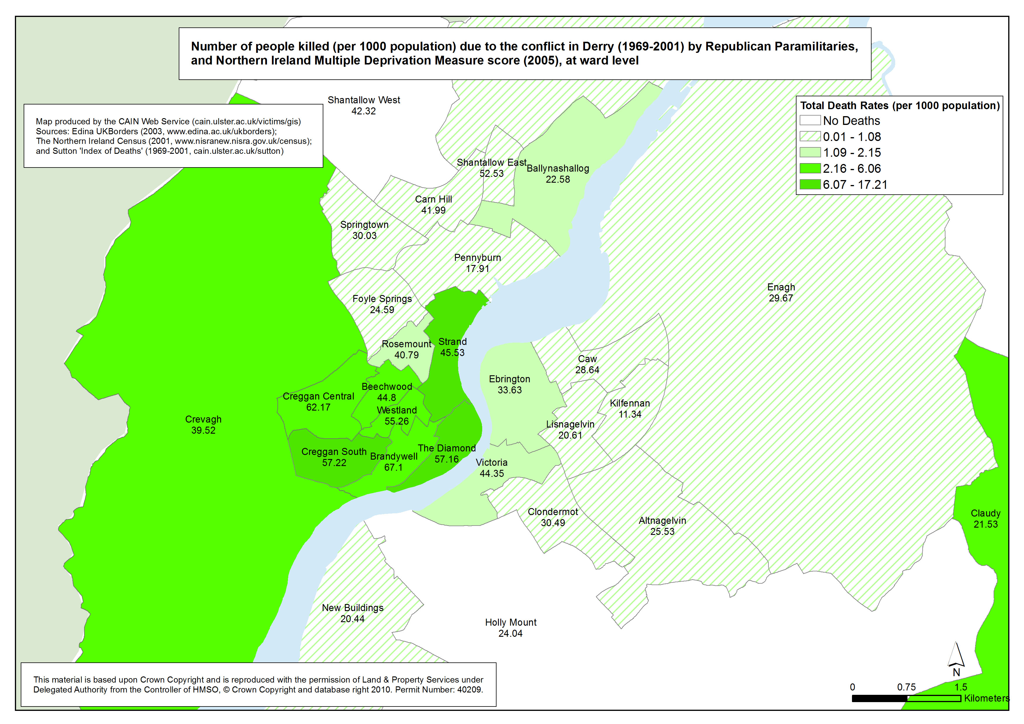
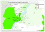 Killings - Derry - Republican Killings - Ward - MDM Killings - Derry - Republican Killings - Ward - MDM
Number of people killed (per 1000 population) due to the conflict in Derry (1969-2001) by Republican Paramilitaries, at ward level |
.pdf
624kb |
.jpg
231kb |
.jpg
1571kb |
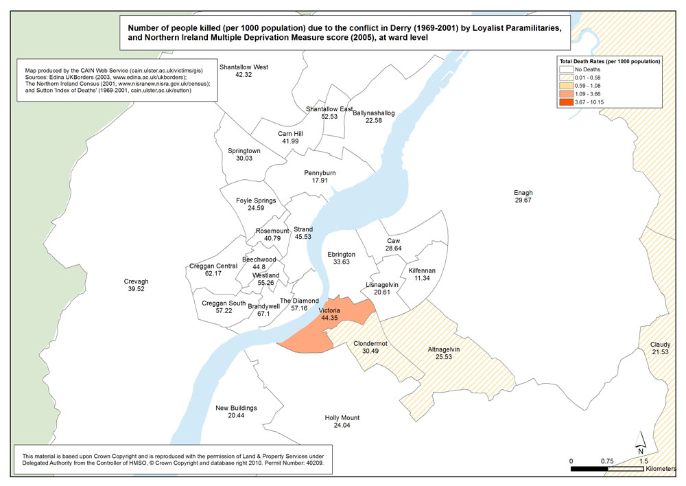
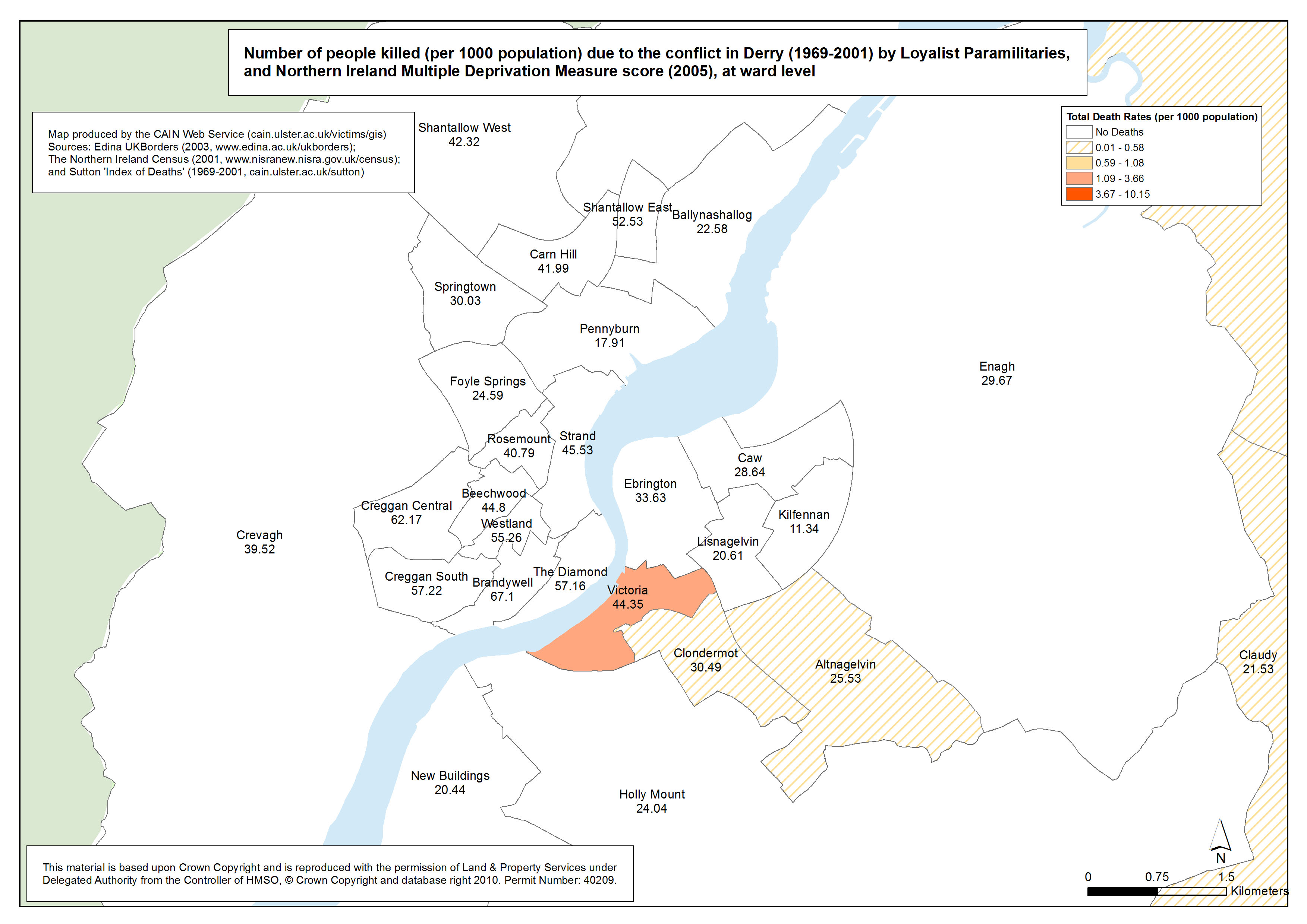
 Killings - Derry - Loyalist Killings - Ward - MDM Killings - Derry - Loyalist Killings - Ward - MDM
Number of people killed (per 1000 population) due to the conflict in Derry (1969-2001) by Loyalist Paramilitaries, at ward level |
.pdf
479kb |
.jpg
145kb |
.jpg
1032kb |
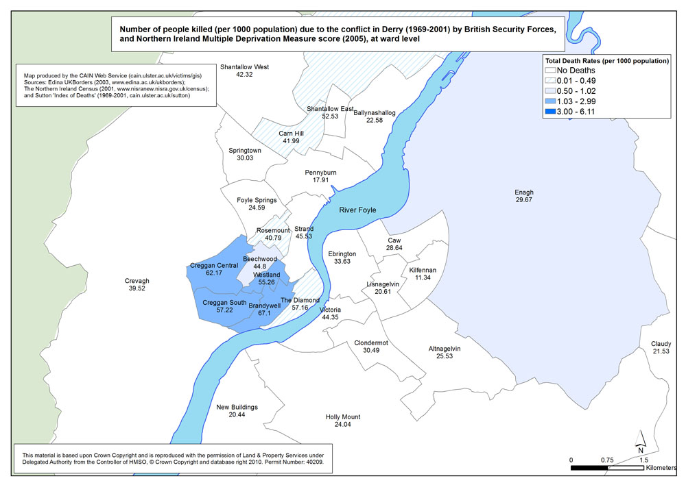
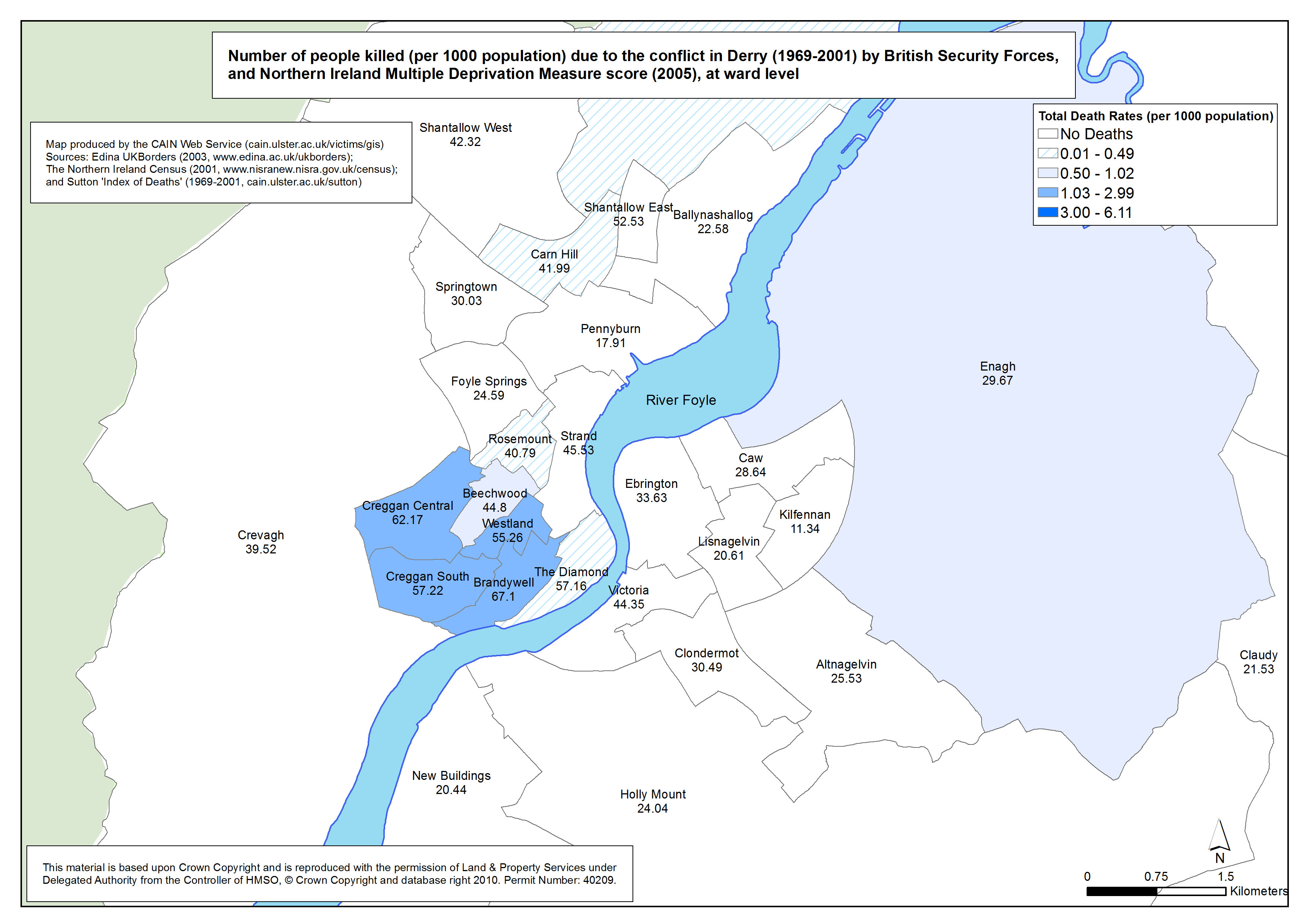
 Killings - Derry - British Security Forces - Ward - MDM Killings - Derry - British Security Forces - Ward - MDM
Number of people killed (per 1000 population) due to the conflict in Derry (1969-2001) by British Security Forces, at ward level |
.pdf
473kb |
.jpg
142kb |
.jpg
994kb |
|
